Filters
Date Range
Extensions
Types
Contacts
Categories
Tag Types
Tag Schemes
|

This map shows all the places conservation elements. Some of the places included exhibit high biodiversity or ecological and cultural value. This map also shows other managed areas from the Protected Areas Database, as well as those that are excluded. Associated input datasets are also included; they relate to biodiversity, special areas, and development. These data are provided by Bureau of Land Management (BLM) "as is" and may contain errors or omissions. The User assumes the entire risk associated with its use of these data and bears all responsibility in determining whether these data are fit for the User's intended use. These data may not have the accuracy, resolution, completeness, timeliness, or other characteristics...
Types: Live Data;
Tags: Anthropology,
Area,
BLM,
Biodiversity,
Bureau of Land Management, All tags...
Connectivity,
Critical,
Current,
DOI,
Designated,
Development,
Excluded,
Footprint,
Future,
Geospatial,
Habitat,
Historic,
Important,
MBR,
MBR 2010,
Managed,
MapServer,
Mojave Basin and Range,
Near,
Protected,
REA,
Rapid Ecoregional Assessment,
River,
Scenic,
Trail,
Wild,
liveData,
service,
society, Fewer tags
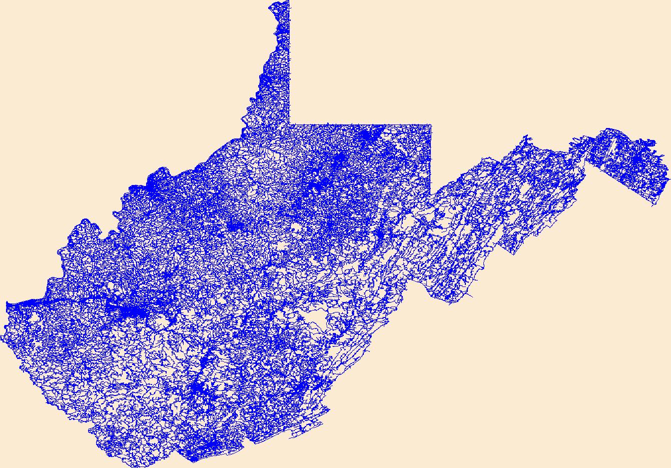
Layers of geospatial data include roads, airports, trails, and railroads.
Tags: Airport Complex,
Airport Point,
Airport Runway,
Airports,
Airstrips, All tags...
Barbour,
Berkeley,
Boone,
Braxton,
Brooke,
Cabell,
Calhoun,
Clay,
Doddridge,
Downloadable Data,
Esri File GeoDatabase 10,
Fayette,
FileGDB,
Geographic names,
Gilmer,
Grant,
Greenbrier,
Hampshire,
Hancock,
Hardy,
Harrison,
Jackson,
Jefferson,
Kanawha,
Lewis,
Lincoln,
Logan,
Marion,
Marshall,
Mason,
McDowell,
Mercer,
Mineral,
Mingo,
Monongalia,
Monroe,
Morgan,
National Transportation Dataset (NTD),
National Transportation Dataset (NTD),
Nicholas,
Ohio,
Pendleton,
Pleasants,
Pocahontas,
Preston,
Putnam,
Railways,
Raleigh,
Randolph,
Ritchie,
Roads,
Roane,
State,
State,
Summers,
Taylor,
Trail,
Trails,
Transportation,
Transportation,
Tucker,
Tyler,
US,
United States,
Upshur,
WV,
Waterway,
Wayne,
Webster,
West Virginia,
Wetzel,
Wirt,
Wood,
Wyoming,
transportation, Fewer tags
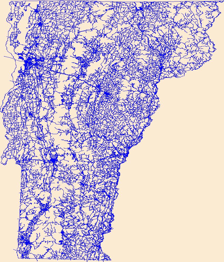
Layers of geospatial data include roads, airports, trails, and railroads.
Tags: Addison,
Airport Complex,
Airport Point,
Airport Runway,
Airports, All tags...
Airstrips,
Bennington,
Caledonia,
Chittenden,
Downloadable Data,
Esri File GeoDatabase 10,
Essex,
FileGDB,
Franklin,
Geographic names,
Grand Isle,
Lamoille,
National Transportation Dataset (NTD),
National Transportation Dataset (NTD),
Orange,
Orleans,
Railways,
Roads,
Rutland,
State,
State,
Trail,
Trails,
Transportation,
Transportation,
US,
United States,
VT,
Vermont,
Washington,
Waterway,
Windham,
Windsor,
transportation, Fewer tags
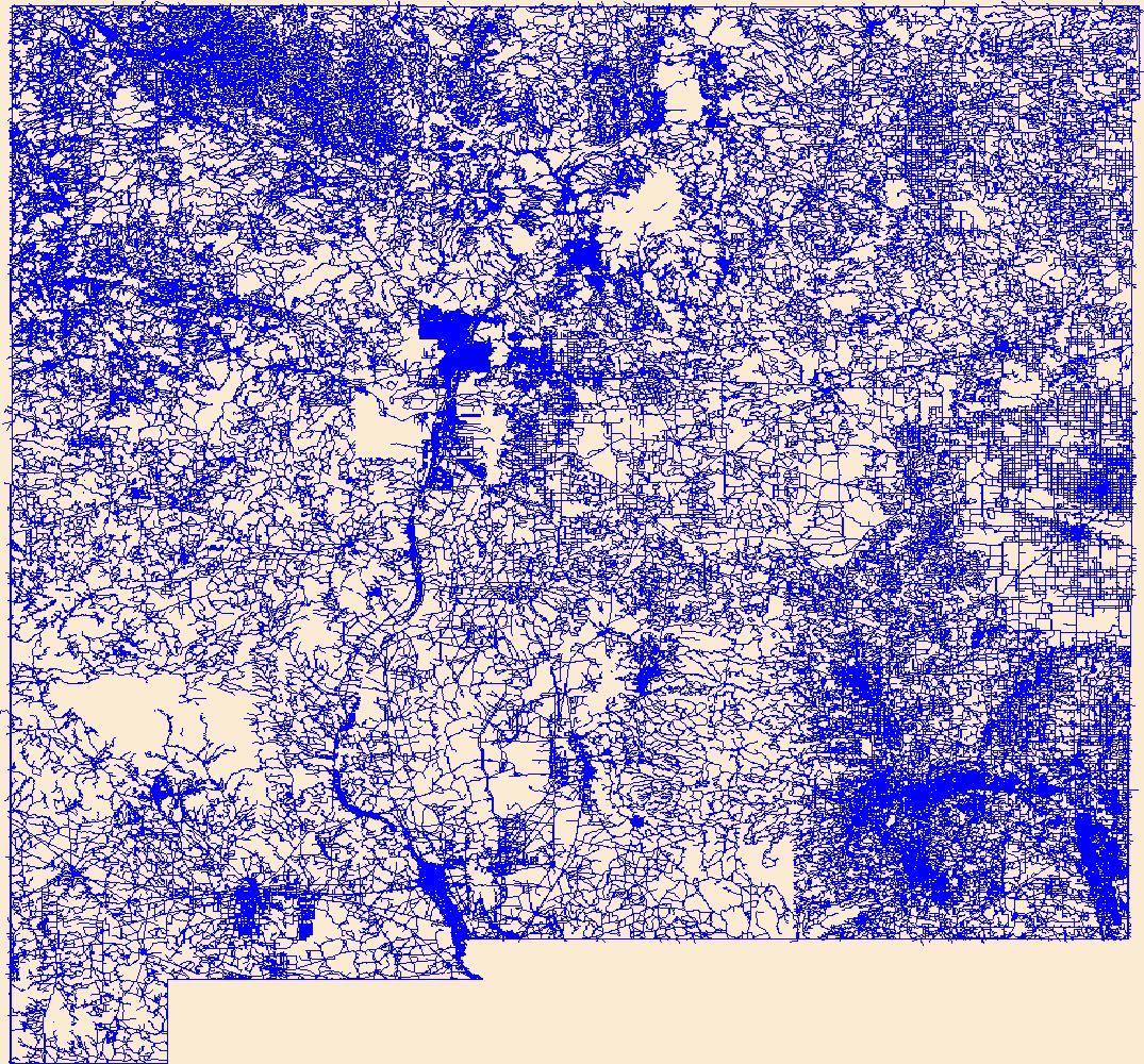
Layers of geospatial data include roads, airports, trails, and railroads.
Tags: Airport Complex,
Airport Point,
Airport Runway,
Airports,
Airstrips, All tags...
Bernalillo,
Catron,
Chaves,
Cibola,
Colfax,
Curry,
De Baca,
Downloadable Data,
Doña Ana,
Eddy,
Esri File GeoDatabase 10,
FileGDB,
Geographic names,
Grant,
Guadalupe,
Harding,
Hidalgo,
Lea,
Lincoln,
Los Alamos,
Luna,
McKinley,
Mora,
NM,
National Transportation Dataset (NTD),
National Transportation Dataset (NTD),
New Mexico,
Otero,
Quay,
Railways,
Rio Arriba,
Roads,
Roosevelt,
San Juan,
San Miguel,
Sandoval,
Santa Fe,
Sierra,
Socorro,
State,
State,
Taos,
Torrance,
Trail,
Trails,
Transportation,
Transportation,
US,
Union,
United States,
Valencia,
Waterway,
transportation, Fewer tags
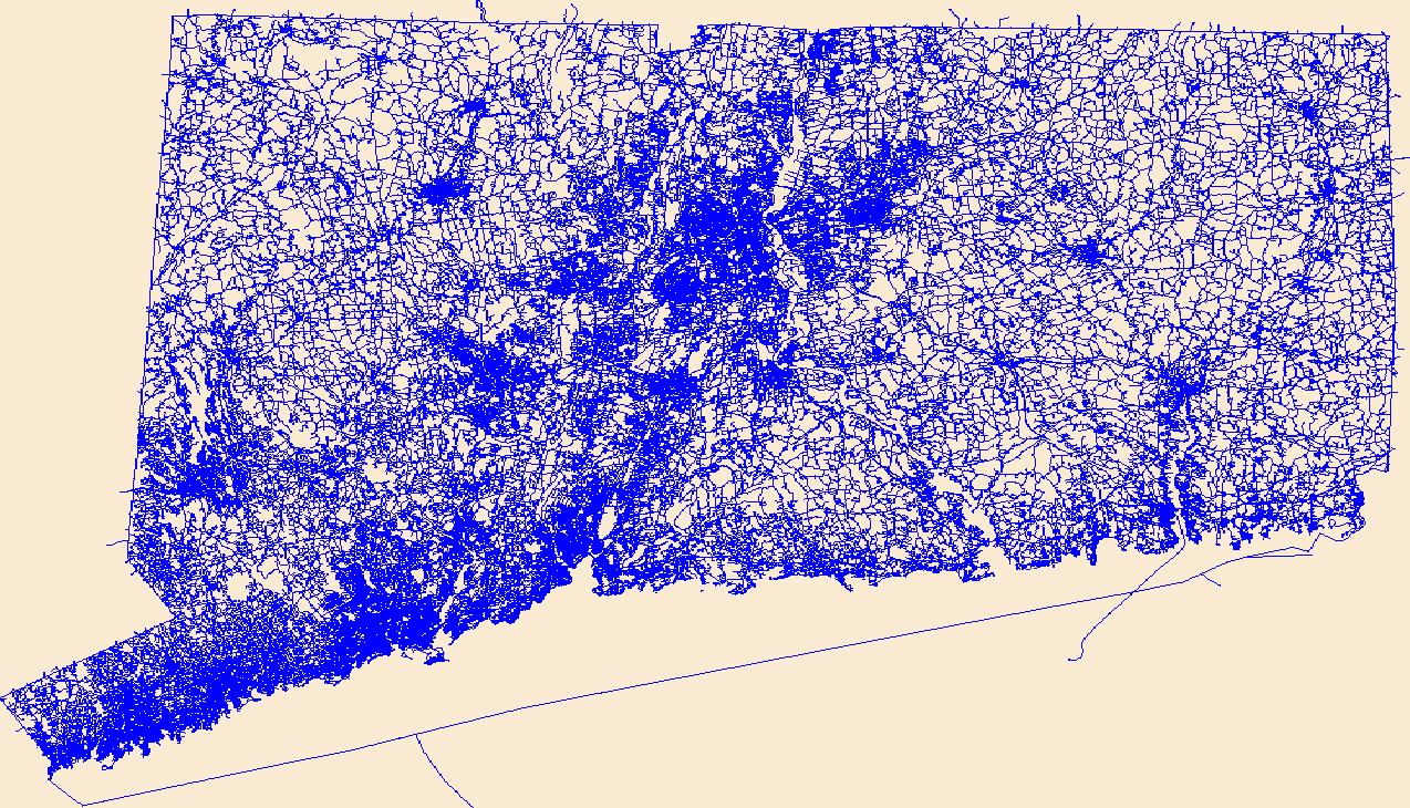
Layers of geospatial data include roads, airports, trails, and railroads.
Tags: Airport Complex,
Airport Point,
Airport Runway,
Airports,
Airstrips, All tags...
CT,
Capitol,
Connecticut,
Downloadable Data,
Esri Shapefile nan,
Geographic names,
Greater Bridgeport,
Lower Connecticut River Valley,
National Transportation Dataset (NTD),
National Transportation Dataset (NTD),
Naugatuck Valley,
Northeastern Connecticut,
Northwest Hills,
Railways,
Roads,
Shapefile,
South Central Connecticut,
Southeastern Connecticut,
State,
State,
Trail,
Trails,
Transportation,
Transportation,
US,
United States,
Waterway,
Western Connecticut,
transportation, Fewer tags

Layers of geospatial data include roads, airports, trails, and railroads.
Tags: Accomack,
Airport Complex,
Airport Point,
Airport Runway,
Airports, All tags...
Airstrips,
Albemarle,
Alexandria,
Alleghany,
Amelia,
Amherst,
Appomattox,
Arlington,
Augusta,
Bath,
Bedford,
Bland,
Botetourt,
Bristol,
Brunswick,
Buchanan,
Buckingham,
Buena Vista,
Campbell,
Caroline,
Carroll,
Charles City,
Charlotte,
Charlottesville,
Chesapeake,
Chesterfield,
Clarke,
Colonial Heights,
Covington,
Craig,
Culpeper,
Cumberland,
Danville,
Dickenson,
Dinwiddie,
Downloadable Data,
Emporia,
Essex,
Fairfax,
Falls Church,
Fauquier,
Floyd,
Fluvanna,
Franklin,
Frederick,
Fredericksburg,
Galax,
GeoPackage,
Geographic names,
Giles,
Gloucester,
Goochland,
Grayson,
Greene,
Greensville,
Halifax,
Hampton,
Hanover,
Harrisonburg,
Henrico,
Henry,
Highland,
Hopewell,
Isle of Wight,
James City,
King George,
King William,
King and Queen,
Lancaster,
Lee,
Lexington,
Loudoun,
Louisa,
Lunenburg,
Lynchburg,
Madison,
Manassas,
Manassas Park,
Martinsville,
Mathews,
Mecklenburg,
Middlesex,
Montgomery,
National Transportation Dataset (NTD),
National Transportation Dataset (NTD),
Nelson,
New Kent,
Newport News,
Norfolk,
Northampton,
Northumberland,
Norton,
Nottoway,
Open Geospatial Consortium GeoPackage 1.2,
Orange,
Page,
Patrick,
Petersburg,
Pittsylvania,
Poquoson,
Portsmouth,
Powhatan,
Prince Edward,
Prince George,
Prince William,
Pulaski,
Radford,
Railways,
Rappahannock,
Richmond,
Roads,
Roanoke,
Rockbridge,
Rockingham,
Russell,
Salem,
Scott,
Shenandoah,
Smyth,
Southampton,
Spotsylvania,
Stafford,
State,
State,
Staunton,
Suffolk,
Surry,
Sussex,
Tazewell,
Trail,
Trails,
Transportation,
Transportation,
US,
United States,
VA,
Virginia,
Virginia Beach,
Warren,
Washington,
Waterway,
Waynesboro,
Westmoreland,
Williamsburg,
Winchester,
Wise,
Wythe,
York,
transportation, Fewer tags

Layers of geospatial data include roads, airports, trails, and railroads.
Tags: Addison,
Airport Complex,
Airport Point,
Airport Runway,
Airports, All tags...
Airstrips,
Bennington,
Caledonia,
Chittenden,
Downloadable Data,
Essex,
Franklin,
GeoPackage,
Geographic names,
Grand Isle,
Lamoille,
National Transportation Dataset (NTD),
National Transportation Dataset (NTD),
Open Geospatial Consortium GeoPackage 1.2,
Orange,
Orleans,
Railways,
Roads,
Rutland,
State,
State,
Trail,
Trails,
Transportation,
Transportation,
US,
United States,
VT,
Vermont,
Washington,
Waterway,
Windham,
Windsor,
transportation, Fewer tags
Layers of geospatial data include roads, airports, trails, and railroads.
Tags: Airport Complex,
Airport Point,
Airport Runway,
Airports,
Airstrips, All tags...
Aitkin,
Anoka,
Becker,
Beltrami,
Benton,
Big Stone,
Blue Earth,
Brown,
Carlton,
Carver,
Cass,
Chippewa,
Chisago,
Clay,
Clearwater,
Cook,
Cottonwood,
Crow Wing,
Dakota,
Dodge,
Douglas,
Downloadable Data,
Faribault,
Fillmore,
Freeborn,
GeoPackage,
Geographic names,
Goodhue,
Grant,
Hennepin,
Houston,
Hubbard,
Isanti,
Itasca,
Jackson,
Kanabec,
Kandiyohi,
Kittson,
Koochiching,
Lac qui Parle,
Lake,
Lake of the Woods,
Le Sueur,
Lincoln,
Lyon,
MN,
Mahnomen,
Marshall,
Martin,
McLeod,
Meeker,
Mille Lacs,
Minnesota,
Morrison,
Mower,
Murray,
National Transportation Dataset (NTD),
National Transportation Dataset (NTD),
Nicollet,
Nobles,
Norman,
Olmsted,
Open Geospatial Consortium GeoPackage 1.2,
Otter Tail,
Pennington,
Pine,
Pipestone,
Polk,
Pope,
Railways,
Ramsey,
Red Lake,
Redwood,
Renville,
Rice,
Roads,
Rock,
Roseau,
Scott,
Sherburne,
Sibley,
St. Louis,
State,
State,
Stearns,
Steele,
Stevens,
Swift,
Todd,
Trail,
Trails,
Transportation,
Transportation,
Traverse,
US,
United States,
Wabasha,
Wadena,
Waseca,
Washington,
Waterway,
Watonwan,
Wilkin,
Winona,
Wright,
Yellow Medicine,
transportation, Fewer tags

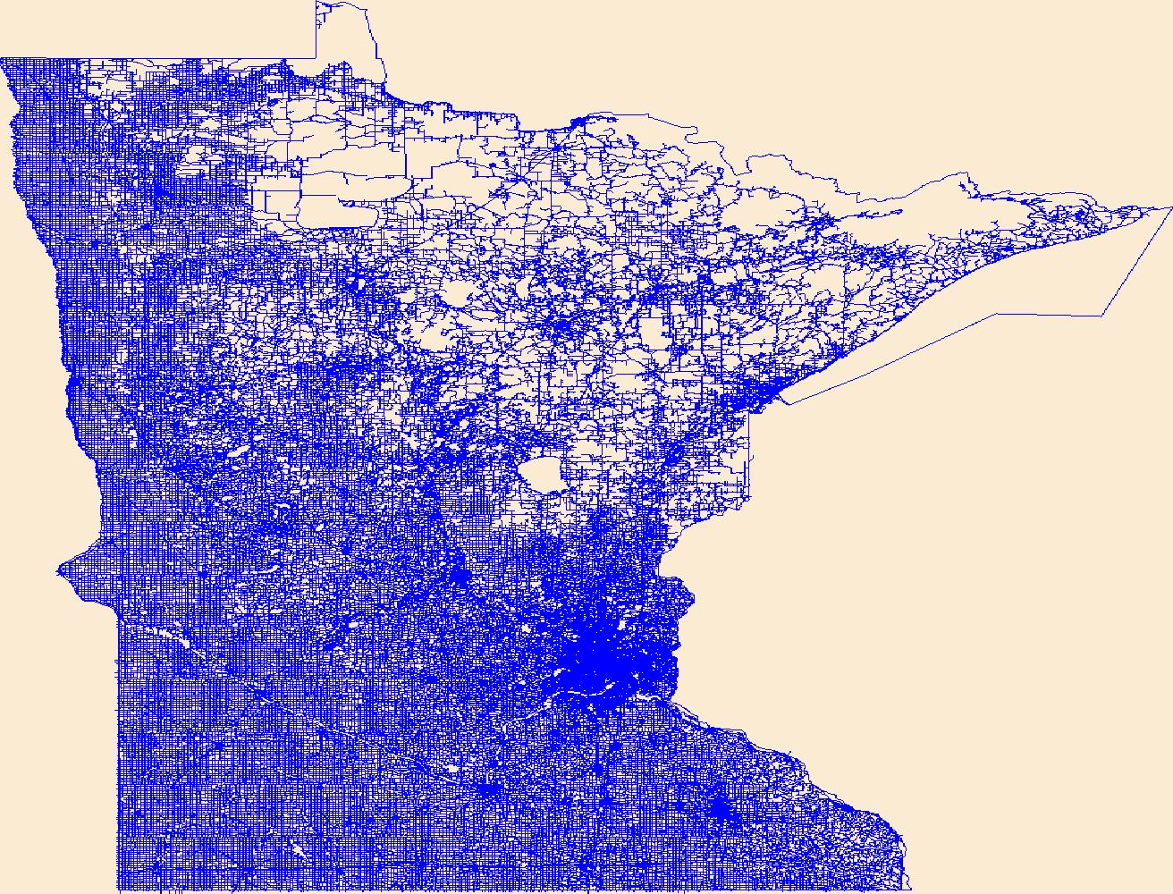
Layers of geospatial data include roads, airports, trails, and railroads.
Tags: Airport Complex,
Airport Point,
Airport Runway,
Airports,
Airstrips, All tags...
Alameda,
Alpine,
Amador,
Butte,
CA,
Calaveras,
California,
Colusa,
Contra Costa,
Del Norte,
Downloadable Data,
El Dorado,
Fresno,
GeoPackage,
Geographic names,
Glenn,
Humboldt,
Imperial,
Inyo,
Kern,
Kings,
Lake,
Lassen,
Los Angeles,
Madera,
Marin,
Mariposa,
Mendocino,
Merced,
Modoc,
Mono,
Monterey,
Napa,
National Transportation Dataset (NTD),
National Transportation Dataset (NTD),
Nevada,
Open Geospatial Consortium GeoPackage 1.2,
Orange,
Placer,
Plumas,
Railways,
Riverside,
Roads,
Sacramento,
San Benito,
San Bernardino,
San Diego,
San Francisco,
San Joaquin,
San Luis Obispo,
San Mateo,
Santa Barbara,
Santa Clara,
Santa Cruz,
Shasta,
Sierra,
Siskiyou,
Solano,
Sonoma,
Stanislaus,
State,
State,
Sutter,
Tehama,
Trail,
Trails,
Transportation,
Transportation,
Trinity,
Tulare,
Tuolumne,
US,
United States,
Ventura,
Waterway,
Yolo,
Yuba,
transportation, Fewer tags
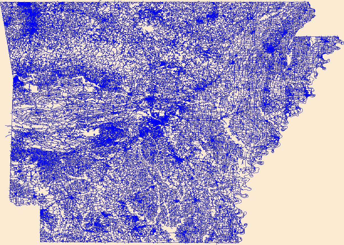
Layers of geospatial data include roads, airports, trails, and railroads.
Tags: AR,
Airport Complex,
Airport Point,
Airport Runway,
Airports, All tags...
Airstrips,
Arkansas,
Arkansas,
Ashley,
Baxter,
Benton,
Boone,
Bradley,
Calhoun,
Carroll,
Chicot,
Clark,
Clay,
Cleburne,
Cleveland,
Columbia,
Conway,
Craighead,
Crawford,
Crittenden,
Cross,
Dallas,
Desha,
Downloadable Data,
Drew,
Faulkner,
Franklin,
Fulton,
Garland,
GeoPackage,
Geographic names,
Grant,
Greene,
Hempstead,
Hot Spring,
Howard,
Independence,
Izard,
Jackson,
Jefferson,
Johnson,
Lafayette,
Lawrence,
Lee,
Lincoln,
Little River,
Logan,
Lonoke,
Madison,
Marion,
Miller,
Mississippi,
Monroe,
Montgomery,
National Transportation Dataset (NTD),
National Transportation Dataset (NTD),
Nevada,
Newton,
Open Geospatial Consortium GeoPackage 1.2,
Ouachita,
Perry,
Phillips,
Pike,
Poinsett,
Polk,
Pope,
Prairie,
Pulaski,
Railways,
Randolph,
Roads,
Saline,
Scott,
Searcy,
Sebastian,
Sevier,
Sharp,
St. Francis,
State,
State,
Stone,
Trail,
Trails,
Transportation,
Transportation,
US,
Union,
United States,
Van Buren,
Washington,
Waterway,
White,
Woodruff,
Yell,
transportation, Fewer tags
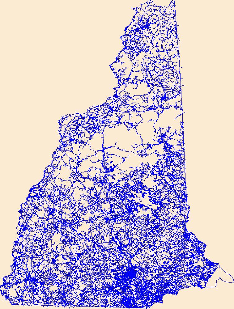
Layers of geospatial data include roads, airports, trails, and railroads.
Tags: Airport Complex,
Airport Point,
Airport Runway,
Airports,
Airstrips, All tags...
Belknap,
Carroll,
Cheshire,
Coos,
Downloadable Data,
GeoPackage,
Geographic names,
Grafton,
Hillsborough,
Merrimack,
NH,
National Transportation Dataset (NTD),
National Transportation Dataset (NTD),
New Hampshire,
Open Geospatial Consortium GeoPackage 1.2,
Railways,
Roads,
Rockingham,
State,
State,
Strafford,
Sullivan,
Trail,
Trails,
Transportation,
Transportation,
US,
United States,
Waterway,
transportation, Fewer tags

This dataset represents roads in the Crown of the Continent Ecosystem (with a 50km buffer). Developed with the most recently available data and represents roads in ~2016. This dataset was developed by the Crown Managers Partnership, as part of a transboundary collaborative management initiative for the Crown of the Continent Ecosystem, based on commonly identified management priorities that are relevant at the landscape scale. The CMP is collaborative group of land managers, scientists, and stakeholder in the CCE. For more information on the CMP and its collaborators, programs, and projects please visit: http://crownmanagers.org/ This dataset has been produced by merging the "National Road Network (NRN) - AB,...
Categories: Data;
Types: Citation,
Downloadable,
Map Service,
OGC WFS Layer,
OGC WMS Layer,
Shapefile;
Tags: Alberta,
B.C,
CCE,
MSDI,
Montana, All tags...
Montana Spatial Data Infrastructure,
The Crown of Continent Ecosystem,
address range,
address ranges,
addresses,
bridge,
bridges,
highway,
railroad,
railroads,
roads,
street,
streets,
trail,
trails,
transportation, Fewer tags

This feature class consists of the trail routes on the Tonto National Forest. It is part of the USFS Southwestern Region Core Data Project. This project is designed to generate and maintain 15 vertically integrated resource data layers which are standardized across the Southwestern Region. A route feature stores the spatial locations (geography) of the trail. These feature classes have an (M) value or measure on their vertices. A route system depicts all trails within or in close proximity to an administrative unit. A trail is a linear feature constructed for the purpose of allowing the free movement of people, stock, or Off Highway Vehicles (OHV). Route measurements and route directions must correspond to those...
Types: Downloadable;
Tags: BLM,
Bureau of Land Management,
DOI,
Facility,
Geospatial, All tags...
MAR 2012,
Madrean Archipelago,
REA,
Rapid Ecoregional Assessment,
bike,
foot trails,
hikers,
hikes,
horse,
recreation,
route,
trail,
trailheads,
transportation, Fewer tags
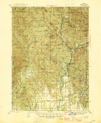
USGS Historical Quadrangle in GeoPDF.
Tags: 15 x 15 minute,
Downloadable Data,
GeoPDF,
GeoTIFF,
Historical Topographic Maps, All tags...
Historical Topographic Maps 15 x 15 Minute Map Series,
Map,
OR,
Trail,
imageryBaseMapsEarthCover, Fewer tags
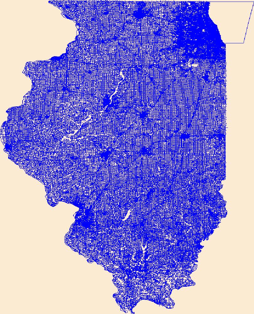
Layers of geospatial data include roads, airports, trails, and railroads.
Tags: Adams,
Airport Complex,
Airport Point,
Airport Runway,
Airports, All tags...
Airstrips,
Alexander,
Bond,
Boone,
Brown,
Bureau,
Calhoun,
Carroll,
Cass,
Champaign,
Christian,
Clark,
Clay,
Clinton,
Coles,
Cook,
Crawford,
Cumberland,
De Witt,
DeKalb,
Douglas,
Downloadable Data,
DuPage,
Edgar,
Edwards,
Effingham,
Esri File GeoDatabase 10,
Fayette,
FileGDB,
Ford,
Franklin,
Fulton,
Gallatin,
Geographic names,
Greene,
Grundy,
Hamilton,
Hancock,
Hardin,
Henderson,
Henry,
IL,
Illinois,
Iroquois,
Jackson,
Jasper,
Jefferson,
Jersey,
Jo Daviess,
Johnson,
Kane,
Kankakee,
Kendall,
Knox,
LaSalle,
Lake,
Lawrence,
Lee,
Livingston,
Logan,
Macon,
Macoupin,
Madison,
Marion,
Marshall,
Mason,
Massac,
McDonough,
McHenry,
McLean,
Menard,
Mercer,
Monroe,
Montgomery,
Morgan,
Moultrie,
National Transportation Dataset (NTD),
National Transportation Dataset (NTD),
Ogle,
Peoria,
Perry,
Piatt,
Pike,
Pope,
Pulaski,
Putnam,
Railways,
Randolph,
Richland,
Roads,
Rock Island,
Saline,
Sangamon,
Schuyler,
Scott,
Shelby,
St. Clair,
Stark,
State,
State,
Stephenson,
Tazewell,
Trail,
Trails,
Transportation,
Transportation,
US,
Union,
United States,
Vermilion,
Wabash,
Warren,
Washington,
Waterway,
Wayne,
White,
Whiteside,
Will,
Williamson,
Winnebago,
Woodford,
transportation, Fewer tags
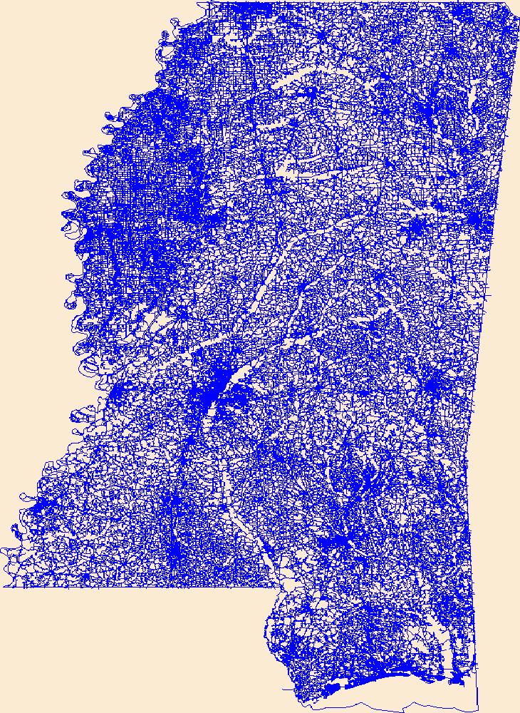
Layers of geospatial data include roads, airports, trails, and railroads.
Tags: Adams,
Airport Complex,
Airport Point,
Airport Runway,
Airports, All tags...
Airstrips,
Alcorn,
Amite,
Attala,
Benton,
Bolivar,
Calhoun,
Carroll,
Chickasaw,
Choctaw,
Claiborne,
Clarke,
Clay,
Coahoma,
Copiah,
Covington,
DeSoto,
Downloadable Data,
Esri Shapefile nan,
Forrest,
Franklin,
Geographic names,
George,
Greene,
Grenada,
Hancock,
Harrison,
Hinds,
Holmes,
Humphreys,
Issaquena,
Itawamba,
Jackson,
Jasper,
Jefferson,
Jefferson Davis,
Jones,
Kemper,
Lafayette,
Lamar,
Lauderdale,
Lawrence,
Leake,
Lee,
Leflore,
Lincoln,
Lowndes,
MS,
Madison,
Marion,
Marshall,
Mississippi,
Monroe,
Montgomery,
National Transportation Dataset (NTD),
National Transportation Dataset (NTD),
Neshoba,
Newton,
Noxubee,
Oktibbeha,
Panola,
Pearl River,
Perry,
Pike,
Pontotoc,
Prentiss,
Quitman,
Railways,
Rankin,
Roads,
Scott,
Shapefile,
Sharkey,
Simpson,
Smith,
State,
State,
Stone,
Sunflower,
Tallahatchie,
Tate,
Tippah,
Tishomingo,
Trail,
Trails,
Transportation,
Transportation,
Tunica,
US,
Union,
United States,
Walthall,
Warren,
Washington,
Waterway,
Wayne,
Webster,
Wilkinson,
Winston,
Yalobusha,
Yazoo,
transportation, Fewer tags

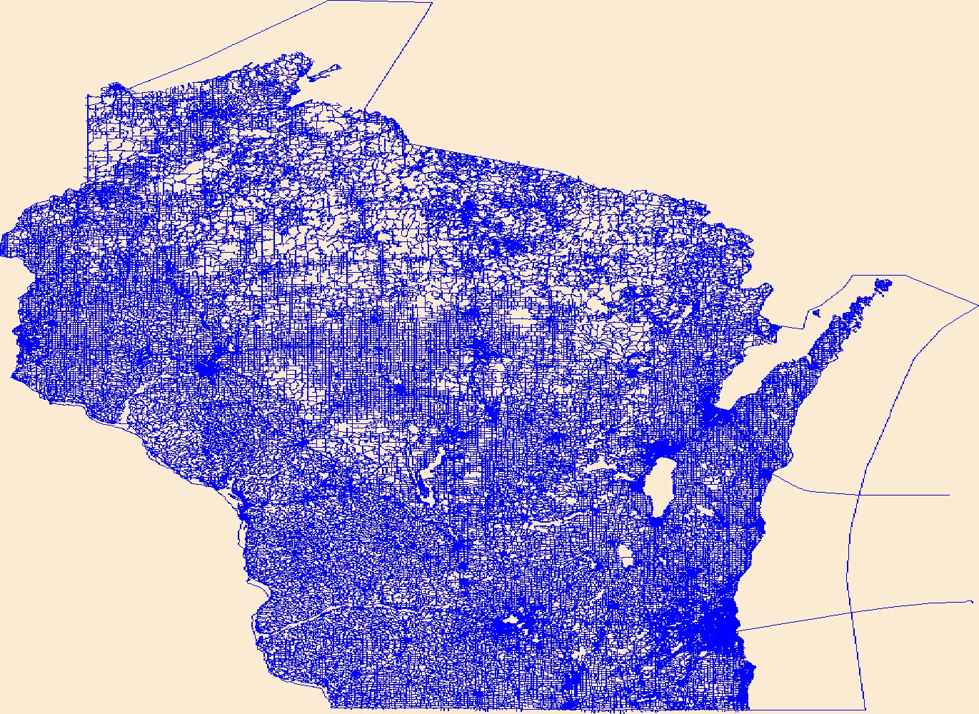
Layers of geospatial data include roads, airports, trails, and railroads.
Tags: Adams,
Airport Complex,
Airport Point,
Airport Runway,
Airports, All tags...
Airstrips,
Ashland,
Barron,
Bayfield,
Brown,
Buffalo,
Burnett,
Calumet,
Chippewa,
Clark,
Columbia,
Crawford,
Dane,
Dodge,
Door,
Douglas,
Downloadable Data,
Dunn,
Eau Claire,
Esri File GeoDatabase 10,
FileGDB,
Florence,
Fond du Lac,
Forest,
Geographic names,
Grant,
Green,
Green Lake,
Iowa,
Iron,
Jackson,
Jefferson,
Juneau,
Kenosha,
Kewaunee,
La Crosse,
Lafayette,
Langlade,
Lincoln,
Manitowoc,
Marathon,
Marinette,
Marquette,
Menominee,
Milwaukee,
Monroe,
National Transportation Dataset (NTD),
National Transportation Dataset (NTD),
Oconto,
Oneida,
Outagamie,
Ozaukee,
Pepin,
Pierce,
Polk,
Portage,
Price,
Racine,
Railways,
Richland,
Roads,
Rock,
Rusk,
Sauk,
Sawyer,
Shawano,
Sheboygan,
St. Croix,
State,
State,
Taylor,
Trail,
Trails,
Transportation,
Transportation,
Trempealeau,
US,
United States,
Vernon,
Vilas,
WI,
Walworth,
Washburn,
Washington,
Waterway,
Waukesha,
Waupaca,
Waushara,
Winnebago,
Wisconsin,
Wood,
transportation, Fewer tags
Layers of geospatial data include roads, airports, trails, and railroads.
Tags: Adams,
Airport Complex,
Airport Point,
Airport Runway,
Airports, All tags...
Airstrips,
Ashland,
Barron,
Bayfield,
Brown,
Buffalo,
Burnett,
Calumet,
Chippewa,
Clark,
Columbia,
Crawford,
Dane,
Dodge,
Door,
Douglas,
Downloadable Data,
Dunn,
Eau Claire,
Esri Shapefile nan,
Florence,
Fond du Lac,
Forest,
Geographic names,
Grant,
Green,
Green Lake,
Iowa,
Iron,
Jackson,
Jefferson,
Juneau,
Kenosha,
Kewaunee,
La Crosse,
Lafayette,
Langlade,
Lincoln,
Manitowoc,
Marathon,
Marinette,
Marquette,
Menominee,
Milwaukee,
Monroe,
National Transportation Dataset (NTD),
National Transportation Dataset (NTD),
Oconto,
Oneida,
Outagamie,
Ozaukee,
Pepin,
Pierce,
Polk,
Portage,
Price,
Racine,
Railways,
Richland,
Roads,
Rock,
Rusk,
Sauk,
Sawyer,
Shapefile,
Shawano,
Sheboygan,
St. Croix,
State,
State,
Taylor,
Trail,
Trails,
Transportation,
Transportation,
Trempealeau,
US,
United States,
Vernon,
Vilas,
WI,
Walworth,
Washburn,
Washington,
Waterway,
Waukesha,
Waupaca,
Waushara,
Winnebago,
Wisconsin,
Wood,
transportation, Fewer tags
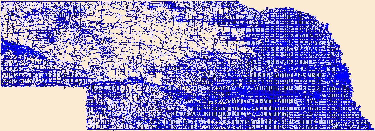
Layers of geospatial data include roads, airports, trails, and railroads.
Tags: Adams,
Airport Complex,
Airport Point,
Airport Runway,
Airports, All tags...
Airstrips,
Antelope,
Arthur,
Banner,
Blaine,
Boone,
Box Butte,
Boyd,
Brown,
Buffalo,
Burt,
Butler,
Cass,
Cedar,
Chase,
Cherry,
Cheyenne,
Clay,
Colfax,
Cuming,
Custer,
Dakota,
Dawes,
Dawson,
Deuel,
Dixon,
Dodge,
Douglas,
Downloadable Data,
Dundy,
Esri File GeoDatabase 10,
FileGDB,
Fillmore,
Franklin,
Frontier,
Furnas,
Gage,
Garden,
Garfield,
Geographic names,
Gosper,
Grant,
Greeley,
Hall,
Hamilton,
Harlan,
Hayes,
Hitchcock,
Holt,
Hooker,
Howard,
Jefferson,
Johnson,
Kearney,
Keith,
Keya Paha,
Kimball,
Knox,
Lancaster,
Lincoln,
Logan,
Loup,
Madison,
McPherson,
Merrick,
Morrill,
NE,
Nance,
National Transportation Dataset (NTD),
National Transportation Dataset (NTD),
Nebraska,
Nemaha,
Nuckolls,
Otoe,
Pawnee,
Perkins,
Phelps,
Pierce,
Platte,
Polk,
Railways,
Red Willow,
Richardson,
Roads,
Rock,
Saline,
Sarpy,
Saunders,
Scotts Bluff,
Seward,
Sheridan,
Sherman,
Sioux,
Stanton,
State,
State,
Thayer,
Thomas,
Thurston,
Trail,
Trails,
Transportation,
Transportation,
US,
United States,
Valley,
Washington,
Waterway,
Wayne,
Webster,
Wheeler,
York,
transportation, Fewer tags
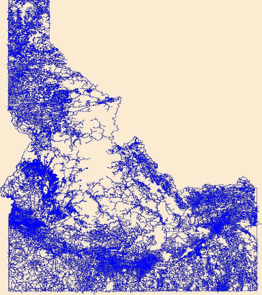
Layers of geospatial data include roads, airports, trails, and railroads.
Tags: Ada,
Adams,
Airport Complex,
Airport Point,
Airport Runway, All tags...
Airports,
Airstrips,
Bannock,
Bear Lake,
Benewah,
Bingham,
Blaine,
Boise,
Bonner,
Bonneville,
Boundary,
Butte,
Camas,
Canyon,
Caribou,
Cassia,
Clark,
Clearwater,
Custer,
Downloadable Data,
Elmore,
Esri File GeoDatabase 10,
FileGDB,
Franklin,
Fremont,
Gem,
Geographic names,
Gooding,
ID,
Idaho,
Idaho,
Jefferson,
Jerome,
Kootenai,
Latah,
Lemhi,
Lewis,
Lincoln,
Madison,
Minidoka,
National Transportation Dataset (NTD),
National Transportation Dataset (NTD),
Nez Perce,
Oneida,
Owyhee,
Payette,
Power,
Railways,
Roads,
Shoshone,
State,
State,
Teton,
Trail,
Trails,
Transportation,
Transportation,
Twin Falls,
US,
United States,
Valley,
Washington,
Waterway,
transportation, Fewer tags
|
|

