Filters: Tags: Port Aransas (X)
36 results (283ms)|
Filters
Date Range
Extensions Types
Contacts Categories Tag Types
|
Winter climate change has the potential to have a large impact on coastal wetlands in the southeastern U.S. Warmer winter temperatures and reductions in the intensity of freeze events would likely lead to mangrove forest range expansion and salt marsh displacement in parts of the U.S. Gulf of Mexico and Atlantic coast. The objective of this research was to better understand some of the ecological implications of mangrove forest migration and salt marsh displacement. The potential ecological effects of mangrove migration are diverse ranging from important biotic impacts (e.g., coastal fisheries, land bird migration; colonial nesting wading birds) to ecosystem stability (e.g., response to sea level rise and drought;...
Winter climate change has the potential to have a large impact on coastal wetlands in the southeastern U.S. Warmer winter temperatures and reductions in the intensity of freeze events would likely lead to mangrove forest range expansion and salt marsh displacement in parts of the U.S. Gulf of Mexico and Atlantic coast. The objective of this research was to better understand some of the ecological implications of mangrove forest migration and salt marsh displacement. The potential ecological effects of mangrove migration are diverse ranging from important biotic impacts (e.g., coastal fisheries, land bird migration; colonial nesting wading birds) to ecosystem stability (e.g., response to sea level rise and drought;...
Changes in tidal marsh area and habitat type in response to sea-level rise were modeled using the Sea Level Affecting Marshes Model (SLAMM 6) that accounts for the dominant processes involved in wetland conversion and shoreline modifications during long-term sea level rise (Park et al. 1989; Successive versions of the model have been used to estimate the impacts of sea level rise on the coasts of the U.S. The model was produced by Warren Pinnacle Consulting, Inc. for the U.S. Fish and Wildlife Service. The SLAMM version 6 technical document can be accessed at http://warrenpinacle.com/prof/SLAMM. SLAMM outputs were converted from raster to vector features. Land cover (wetland) types were generalized to MesoHabitat...
Categories: Data;
Types: ArcGIS REST Map Service,
ArcGIS Service Definition,
Downloadable,
Map Service;
Tags: LiDAR,
Port Aransas,
SLAMM,
Sea Level,
Sea-Level Affecting Marshes Model,
Winter climate change has the potential to have a large impact on coastal wetlands in the southeastern U.S. Warmer winter temperatures and reductions in the intensity of freeze events would likely lead to mangrove forest range expansion and salt marsh displacement in parts of the U.S. Gulf of Mexico and Atlantic coast. The objective of this research was to better understand some of the ecological implications of mangrove forest migration and salt marsh displacement. The potential ecological effects of mangrove migration are diverse ranging from important biotic impacts (e.g., coastal fisheries, land bird migration; colonial nesting wading birds) to ecosystem stability (e.g., response to sea level rise and drought;...
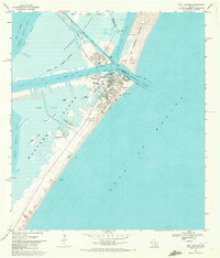
USGS Historical Quadrangle in GeoPDF.
Changes in tidal marsh area and habitat type in response to sea-level rise were modeled using the Sea Level Affecting Marshes Model (SLAMM 6) that accounts for the dominant processes involved in wetland conversion and shoreline modifications during long-term sea level rise (Park et al. 1989; Successive versions of the model have been used to estimate the impacts of sea level rise on the coasts of the U.S. The model was produced by Warren Pinnacle Consulting, Inc. for the U.S. Fish and Wildlife Service. The SLAMM version 6 technical document can be accessed at http://warrenpinacle.com/prof/SLAMM. SLAMM outputs were converted from raster to vector features. Land cover (wetland) types were generalized to MesoHabitat...
Categories: Data;
Types: ArcGIS REST Map Service,
ArcGIS Service Definition,
Downloadable,
Map Service;
Tags: LiDAR,
Port Aransas,
SLAMM,
Sea Level,
Sea-Level Affecting Marshes Model,
Sandy ocean beaches in the United States are popular tourist and recreational destinations and constitute some of the most valuable real estate in the country. The boundary between land and water along the coastline is often the location of concentrated residential and commercial development and is frequently exposed to a range of natural hazards, which include flooding, storm effects, and coastal erosion. In response, the U.S. Geological Survey (USGS) is conducting a national assessment of coastal change hazards. One component of this research effort, the National Assessment of Shoreline Change Project, documents changes in shoreline position as a proxy for coastal change. Shoreline position is an easily understood...
Winter climate change has the potential to have a large impact on coastal wetlands in the southeastern U.S. Warmer winter temperatures and reductions in the intensity of freeze events would likely lead to mangrove forest range expansion and salt marsh displacement in parts of the U.S. Gulf of Mexico and Atlantic coast. The objective of this research was to better understand some of the ecological implications of mangrove forest migration and salt marsh displacement. The potential ecological effects of mangrove migration are diverse ranging from important biotic impacts (e.g., coastal fisheries, land bird migration; colonial nesting wading birds) to ecosystem stability (e.g., response to sea level rise and drought;...
Changes in tidal marsh area and habitat type in response to sea-level rise were modeled using the Sea Level Affecting Marshes Model (SLAMM 6) that accounts for the dominant processes involved in wetland conversion and shoreline modifications during long-term sea level rise (Park et al. 1989; Successive versions of the model have been used to estimate the impacts of sea level rise on the coasts of the U.S. The model was produced by Warren Pinnacle Consulting, Inc. for the U.S. Fish and Wildlife Service. The SLAMM version 6 technical document can be accessed at http://warrenpinacle.com/prof/SLAMM. SLAMM outputs were converted from raster to vector features. Land cover (wetland) types were generalized to MesoHabitat...
Categories: Data;
Types: ArcGIS REST Map Service,
ArcGIS Service Definition,
Downloadable,
Map Service;
Tags: Western Sandpiper,
LiDAR,
Port Aransas,
SLAMM,
Sea Level,
Winter climate change has the potential to have a large impact on coastal wetlands in the southeastern U.S. Warmer winter temperatures and reductions in the intensity of freeze events would likely lead to mangrove forest range expansion and salt marsh displacement in parts of the U.S. Gulf of Mexico and Atlantic coast. The objective of this research was to better understand some of the ecological implications of mangrove forest migration and salt marsh displacement. The potential ecological effects of mangrove migration are diverse ranging from important biotic impacts (e.g., coastal fisheries, land bird migration; colonial nesting wading birds) to ecosystem stability (e.g., response to sea level rise and drought;...
Changes in tidal marsh area and habitat type in response to sea-level rise were modeled using the Sea Level Affecting Marshes Model (SLAMM 6) that accounts for the dominant processes involved in wetland conversion and shoreline modifications during long-term sea level rise (Park et al. 1989; Successive versions of the model have been used to estimate the impacts of sea level rise on the coasts of the U.S. The model was produced by Warren Pinnacle Consulting, Inc. for the U.S. Fish and Wildlife Service. The SLAMM version 6 technical document can be accessed at http://warrenpinacle.com/prof/SLAMM. SLAMM outputs were converted from raster to vector features. Land cover (wetland) types were generalized to MesoHabitat...
Categories: Data;
Types: ArcGIS REST Map Service,
ArcGIS Service Definition,
Downloadable,
Map Service;
Tags: Black Skimmer,
LiDAR,
Port Aransas,
SLAMM,
Sea Level,
Sandy ocean beaches in the United States are popular tourist and recreational destinations and constitute some of the most valuable real estate in the country. The boundary between land and water along the coastline is often the location of concentrated residential and commercial development and is frequently exposed to a range of natural hazards, which include flooding, storm effects, and coastal erosion. In response, the U.S. Geological Survey (USGS) is conducting a national assessment of coastal change hazards. One component of this research effort, the National Assessment of Shoreline Change Project, documents changes in shoreline position as a proxy for coastal change. Shoreline position is an easily understood...
Categories: Data;
Types: Citation,
Downloadable,
Map Service,
OGC WFS Layer,
OGC WMS Layer,
Shapefile;
Tags: Aransas Pass,
Baseline,
Brazos Santiago Pass,
CMGP,
Coastal and Marine Geology Program,
Winter climate change has the potential to have a large impact on coastal wetlands in the southeastern U.S. Warmer winter temperatures and reductions in the intensity of freeze events would likely lead to mangrove forest range expansion and salt marsh displacement in parts of the U.S. Gulf of Mexico and Atlantic coast. The objective of this research was to better understand some of the ecological implications of mangrove forest migration and salt marsh displacement. The potential ecological effects of mangrove migration are diverse ranging from important biotic impacts (e.g., coastal fisheries, land bird migration; colonial nesting wading birds) to ecosystem stability (e.g., response to sea level rise and drought;...
Winter climate change has the potential to have a large impact on coastal wetlands in the southeastern U.S. Warmer winter temperatures and reductions in the intensity of freeze events would likely lead to mangrove forest range expansion and salt marsh displacement in parts of the U.S. Gulf of Mexico and Atlantic coast. The objective of this research was to better understand some of the ecological implications of mangrove forest migration and salt marsh displacement. The potential ecological effects of mangrove migration are diverse ranging from important biotic impacts (e.g., coastal fisheries, land bird migration; colonial nesting wading birds) to ecosystem stability (e.g., response to sea level rise and drought;...
The northern Gulf of Mexico coast spans two major climate gradients and represents an excellent natural laboratory for developing climate-influenced ecological models. In this project, we used these zones of remarkable transition to develop macroclimate-based models for quantifying the regional responses of coastal wetland ecosystems to climate variation. In addition to providing important fish and wildlife habitat and supporting coastal food webs, these coastal wetlands provide many ecosystem goods and services including clean water, stable coastlines, food, recreational opportunities, and stored carbon. Our objective was to examine and forecast the effects of macroclimatic drivers on wetland ecosystem structure...
Categories: Data;
Types: Citation;
Tags: Corpus Christi,
Galveston,
Grand Bay,
Gulf of Mexico,
Laguna Madre,
The Falcon Refinery Superfund Site (hereinafter referred to as “the Site”) is located in San Patricio County near Ingleside, Texas. The Site occupies approximately 104 noncontiguous acres that are divided into the North Site, the South Site, and a barge dock facility. Surface water drainage from the Site enters wetlands along the southeastern section of the property associated with this abandoned refinery. The wetlands connect to the Intracoastal Waterway and Redfish Bay, which connects Corpus Christi Bay to the Gulf of Mexico. In addition to the abandoned refinery, the site currently (June 2024) includes seven large (greater than 50 feet in diameter) aboveground storage tanks that are in the process of being disassembled...
Changes in tidal marsh area and habitat type in response to sea-level rise were modeled using the Sea Level Affecting Marshes Model (SLAMM 6) that accounts for the dominant processes involved in wetland conversion and shoreline modifications during long-term sea level rise (Park et al. 1989; Successive versions of the model have been used to estimate the impacts of sea level rise on the coasts of the U.S. The model was produced by Warren Pinnacle Consulting, Inc. for the U.S. Fish and Wildlife Service. The SLAMM version 6 technical document can be accessed at http://warrenpinacle.com/prof/SLAMM. SLAMM outputs were converted from raster to vector features. Land cover (wetland) types were generalized to MesoHabitat...
Categories: Data;
Types: ArcGIS REST Map Service,
ArcGIS Service Definition,
Downloadable,
Map Service;
Tags: LiDAR,
Port Aransas,
SLAMM,
Sea Level,
Sea-Level Affecting Marshes Model,
Sandy ocean beaches in the United States are popular tourist and recreational destinations and constitute some of the most valuable real estate in the country. The boundary between land and water along the coastline is often the location of concentrated residential and commercial development and is frequently exposed to a range of natural hazards, which include flooding, storm effects, and coastal erosion. In response, the U.S. Geological Survey (USGS) is conducting a national assessment of coastal change hazards. One component of this research effort, the National Assessment of Shoreline Change Project, documents changes in shoreline position as a proxy for coastal change. Shoreline position is an easily understood...
Categories: Data;
Types: Citation,
Downloadable,
Map Service,
OGC WFS Layer,
OGC WMS Layer,
Shapefile;
Tags: Accretion,
Aransas Pass,
Brazos Santiago Pass,
CMGP,
Coastal and Marine Geology Program,
Winter climate change has the potential to have a large impact on coastal wetlands in the southeastern U.S. Warmer winter temperatures and reductions in the intensity of freeze events would likely lead to mangrove forest range expansion and salt marsh displacement in parts of the U.S. Gulf of Mexico and Atlantic coast. The objective of this research was to better understand some of the ecological implications of mangrove forest migration and salt marsh displacement. The potential ecological effects of mangrove migration are diverse ranging from important biotic impacts (e.g., coastal fisheries, land bird migration; colonial nesting wading birds) to ecosystem stability (e.g., response to sea level rise and drought;...
|

|
