Filters: Tags: Boxelder (X)
13 results (9ms)|
Filters
Date Range
Extensions Types Contacts
Categories Tag Types
|
This file (wymt_ffa_2022B_WATSTORE.txt) contains peak-flow input data for PeakFQ for peak-flow frequency analyses for selected streamgages based on data through water year 2022. The file format is called WATSTORE (National Water Data Storage and Retrieval System) available from NWISWeb (http://nwis.waterdata.usgs.gov/usa/nwis/peak).
Types: Map Service,
OGC WFS Layer,
OGC WMS Layer,
OGC WMS Service;
Tags: Boxelder,
Carter County,
Custer County,
Fallon County,
Little Powder,
These data were released prior to the October 1, 2016 effective date for the USGS’s policy dictating the review, approval, and release of scientific data as referenced in USGS Survey Manual Chapter 502.8 Fundamental Science Practices: Review and Approval of Scientific Data for Release. This map shows the USGS (United States Geologic Survey), NWIS (National Water Inventory System) Hydrologic Data Sites for Boxelder County, Utah. The scope and purpose of NWIS is defined on the web site: http://water.usgs.gov/public/pubs/FS/FS-027-98/
These data were released prior to the October 1, 2016 effective date for the USGS’s policy dictating the review, approval, and release of scientific data as referenced in USGS Survey Manual Chapter 502.8 Fundamental Science Practices: Review and Approval of Scientific Data for Release. This map shows specific water-quality items and hydrologic data site information which come from QWDATA (Water Quality) and GWSI (Ground Water Information System). Both QWDATA and GWSI are subsystems of NWIS (National Water Inventory System)of the USGS (United States Geologic Survey). This map is for Boxelder County, Utah. The scope and purpose of NWIS is defined on the web site: http://water.usgs.gov/public/pubs/FS/FS-027-98/

USGS Historical Quadrangle in GeoPDF.
The USGS Wyoming-Montana Water Science Center (WY–MT WSC) completed a report (Sando and McCarthy, 2018) documenting methods for peak-flow frequency analysis following implementation of the Bulletin 17C guidelines (England and others, 2019). The methods are used to provide estimates of peak-flow quantiles for 66.7-, 50-, 42.9-, 20-, 10-, 4-, 2-, 1-, 0.5-, and 0.2-percent annual exceedance probabilities (AEPs) for selected USGS streamgages. This data release presents peak-flow frequency analyses for selected streamgages in Carter, Custer, Fallon, Powder River, and Prairie Counties, and the Powder River Basin, based on data through water year 2022, using methods described by Sando and McCarthy (2018).
Categories: Data;
Types: Map Service,
OGC WFS Layer,
OGC WMS Layer,
OGC WMS Service;
Tags: Boxelder,
Carter County,
Custer County,
Data,
Fallon County,
Executive Summary: Riparian ecosystems are vital components of the semi-arid landscape because woody riparian plants provide resources that are absent in adjacent vegetation types. Historically, flood played a key role in shaping the composition and structure of riparian forests. In recent decades, however, the frequency and magnitude of floods has decreased and the timing of peak discharge has been altered. In addition, wildfire has increased in importance as an agent of disturbance along many streams. We initiated this study to increase our understanding of fire, flood, and drought processes at our Middle Rio Grande study sites and develop tools that managers of other systems can use to project the response of...
Categories: Data;
Types: Map Service,
OGC WFS Layer,
OGC WMS Layer,
OGC WMS Service;
Tags: 2012,
Acer negundo,
Applications and Tools,
Data.gov Desert LCC,
Decision Support,
The USGS Wyoming-Montana Water Science Center (WY–MT WSC) completed a report (Sando and McCarthy, 2018) documenting methods for peak-flow frequency analysis following implementation of the Bulletin 17C guidelines (England and others, 2019). The methods are used to provide estimates of peak-flow quantiles for 66.7-, 50-, 42.9-, 20-, 10-, 4-, 2-, 1-, 0.5-, and 0.2-percent annual exceedance probabilities (AEPs) for selected USGS streamgages. This data release presents peak-flow frequency analyses based on methods described by Sando and McCarthy (2018), for selected streamgages in Carter, Custer, Fallon, Powder River, and Prairie Counties, and the Powder River Basin, based on data through water year 2022.
Types: Map Service,
OGC WFS Layer,
OGC WMS Layer,
OGC WMS Service;
Tags: Boxelder,
Carter County,
Custer County,
Fallon County,
Hydrology,
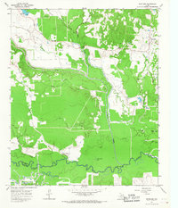
USGS Historical Quadrangle in GeoPDF.
Perennial streams in the Desert LCC support riparian trees such as cottonwood (Populus spp) and box elder (Acer negundo) that are critical components of habitat for riparian obligate birds and other wildlife species (Webb et al. 2007). Trees, snags, and fallen woody debris provide nesting and foraging sites for a variety of riparian animals (Bateman et al. 2008, Smith et al. 2012). Riparian trees require occasional floods to create space suitable for germination and are dependent on accessible groundwater for growth and survival (Lytle and Merritt 2004). Studies along the Middle Rio Grande in New Mexico have shown that rates of woody debris accumulation are also influenced by hydrology because floods physically...
Categories: Data,
Project;
Types: Map Service,
OGC WFS Layer,
OGC WMS Layer,
OGC WMS Service;
Tags: 2012,
Acer negundo,
Applications and Tools,
Decision Support,
Desert Landscape Conservation Cooperative,
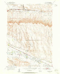
USGS Historical Quadrangle in GeoPDF.

USGS Historical Quadrangle in GeoPDF.
This file (wymt_ffa_2022B.psf) contains specifications to run PeakFQ version 7.4 for peak-flow frequency analyses for selected streamgages based on data through water year 2022.
Types: Map Service,
OGC WFS Layer,
OGC WMS Layer,
OGC WMS Service;
Tags: Boxelder,
Carter County,
Custer County,
Fallon County,
Little Powder,
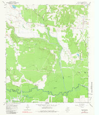
USGS Historical Quadrangle in GeoPDF.
|

|
