Filters: Tags: wild horse (X)
29 results (36ms)|
Filters
Contacts
(Less)
|
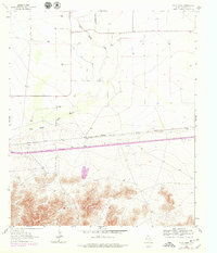
USGS Historical Quadrangle in GeoPDF.
USGS Historical Quadrangle in GeoPDF.
This data set contains imagery from the National Agriculture Imagery Program (NAIP). The NAIP program is administered by USDA FSA and has been established to support two main FSA strategic goals centered on agricultural production. These are, increase stewardship of America's natural resources while enhancing the environment, and to ensure commodities are procured and distributed effectively and efficiently to increase food security. The NAIP program supports these goals by acquiring and providing ortho imagery that has been collected during the agricultural growing season in the U.S. The NAIP ortho imagery is tailored to meet FSA requirements and is a fundamental tool used to support FSA farm and conservation programs....
This data set contains imagery from the National Agriculture Imagery Program (NAIP). The NAIP program is administered by USDA FSA and has been established to support two main FSA strategic goals centered on agricultural production. These are, increase stewardship of America's natural resources while enhancing the environment, and to ensure commodities are procured and distributed effectively and efficiently to increase food security. The NAIP program supports these goals by acquiring and providing ortho imagery that has been collected during the agricultural growing season in the U.S. The NAIP ortho imagery is tailored to meet FSA requirements and is a fundamental tool used to support FSA farm and conservation programs....
In 2006/2007 the Adobetown Herd Management Area (HMA) was rounded up to bring the HMA to its Appropriate Management Level (AML). Given that the HMA is now at AML, a suite of projects have been identified that will improve wildhorse and livestock distribution, rangeland health, and reduce wildhorse movement outside the HMA. The majority of livestock use in this area includes winter sheep, and water development is lacking throughout the HMA. Six miles of pipeline, a number of short pipelines, troughs and supplies for several water wells are proposed. An existing network of pipelines and troughs could be rehabilitated with the purchase and installation of a large solar pump. Four spring developments and small pits...
Categories: Project;
Types: ScienceBase Project;
Tags: Habitat,
habitat conservation project,
livestock,
sagebrush steppe,
water development,
Adult male horse data from Conger and Frisco Herd Management Areas, Utah, USA, between 2017 and 2020
We studied the effect of castrating a proportion of the adult males in a feral horse herd to examine any effect on behavior and social associations, particularly in terms of association with mares (i.e., maintenance of a harem group). We conducted this study between 2017 and 2020 at two Herd Management Areas (HMAs) in western Utah, USA: Conger and Frisco. We conducted demographic observations year round at both HMAs to record group composition and foaling rate. We additionally recorded behavioral observations at Conger HMA.
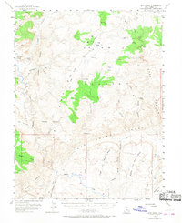
USGS Historical Quadrangle in GeoPDF.
This data set contains imagery from the National Agriculture Imagery Program (NAIP). The NAIP program is administered by USDA FSA and has been established to support two main FSA strategic goals centered on agricultural production. These are increase stewardship of America's natural resources while enhancing the environment, and to ensure commodities are procured and distributed effectively and efficiently to increase food security. The NAIP program supports these goals by acquiring and providing ortho imagery that has been collected during the agricultural growing season in the U.S. The NAIP ortho imagery is tailored to meet FSA requirements and is a fundamental tool used to support FSA farm and conservation programs....
This data set contains imagery from the National Agriculture Imagery Program (NAIP). The NAIP program is administered by USDA FSA and has been established to support two main FSA strategic goals centered on agricultural production. These are, increase stewardship of America's natural resources while enhancing the environment, and to ensure commodities are procured and distributed effectively and efficiently to increase food security. The NAIP program supports these goals by acquiring and providing ortho imagery that has been collected during the agricultural growing season in the U.S. The NAIP ortho imagery is tailored to meet FSA requirements and is a fundamental tool used to support FSA farm and conservation programs....
This data set contains imagery from the National Agriculture Imagery Program (NAIP). The NAIP program is administered by USDA FSA and has been established to support two main FSA strategic goals centered on agricultural production. These are, increase stewardship of America's natural resources while enhancing the environment, and to ensure commodities are procured and distributed effectively and efficiently to increase food security. The NAIP program supports these goals by acquiring and providing ortho imagery that has been collected during the agricultural growing season in the U.S. The NAIP ortho imagery is tailored to meet FSA requirements and is a fundamental tool used to support FSA farm and conservation programs....
This dataset includes locations of burros between 2016 and 2020 from two study areas where burros were located every 2 hours continuously using GPS telemetry collars for Lotek collars, and every 13 hours continuously for Vectronic Aerospace collars. Location data are from adult female burros, not males. Study areas are the Lake Pleasant Herd Management Area in Arizona, USA and the Sinbad Herd Management Area in Utah, USA. Some burro location data from the Lake Pleasant Herd Management Area were collected by the Arizona Game and Fish Department, covering the same time period and methods as USGS-collected data.
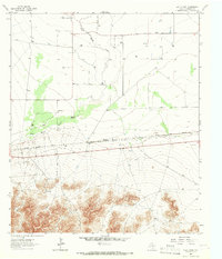
USGS Historical Quadrangle in GeoPDF.
This data set contains imagery from the National Agriculture Imagery Program (NAIP). The NAIP program is administered by USDA FSA and has been established to support two main FSA strategic goals centered on agricultural production. These are, increase stewardship of America's natural resources while enhancing the environment, and to ensure commodities are procured and distributed effectively and efficiently to increase food security. The NAIP program supports these goals by acquiring and providing ortho imagery that has been collected during the agricultural growing season in the U.S. The NAIP ortho imagery is tailored to meet FSA requirements and is a fundamental tool used to support FSA farm and conservation programs....
Data is the allotment area in the Rock Springs Field Office. Digitized on 1:100,000 complete field office coverage, then screen digitized to correct boundary areas.
Categories: Data;
Types: Downloadable;
Tags: BLM,
Bureau of Land Management,
Federal Government,
Rock Springs Field Office,
Wyoming,
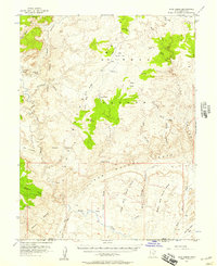
USGS Historical Quadrangle in GeoPDF.
We studied factors affecting separation of feral horse foals from their mothers and foal mortality, including variables such as group changes by the mother and behavior of the foal. We include data on feral horse foals that died or were separated, and their siblings. We conducted this study between 2017 and 2020 at two Herd Management Areas (HMAs) in western Utah, USA: Conger and Frisco. We conducted demographic observations year round at both HMAs to record group composition and foaling rate. We additionally recorded behavioral observations for a subset of foals at Conger HMA annually between March and September. This dataset includes 2 .csv files: Data_foals_dead_separated_siblings.csv - These data contain 52...
Categories: Data;
Tags: Conger Mountain,
Ecology,
Equus,
Frisco Peak,
USGS Science Data Catalog (SDC),
This data set contains imagery from the National Agriculture Imagery Program (NAIP). The NAIP program is administered by USDA FSA and has been established to support two main FSA strategic goals centered on agricultural production. These are, increase stewardship of America's natural resources while enhancing the environment, and to ensure commodities are procured and distributed effectively and efficiently to increase food security. The NAIP program supports these goals by acquiring and providing ortho imagery that has been collected during the agricultural growing season in the U.S. The NAIP ortho imagery is tailored to meet FSA requirements and is a fundamental tool used to support FSA farm and conservation programs....
Data is the allotment area in the Rawlins Field Office. Digitized on 1:100,000 complete field office coverage, then screen digitized to correct boundary areas.
Categories: Data;
Types: Downloadable;
Tags: BLM,
Bureau of Land Management,
Federal Government,
Rawlins Field Office,
Wyoming,
Managers concerned with shrinking habitats and limited resources for wildlife seek effective tools for limiting population growth in some species. Fertility control is one such tool, yet little is known about its impacts on the behavioral ecology of wild, free-roaming animals. We investigated influences of the immunocontraceptive porcine zona pellucida (PZP) on individual and social behavior in bands of feral horses (Equus caballus) in three discrete populations and used 14 hierarchical mixed effect models to gain insight into the influences of PZP treatment on feral horse behavior. A model of body condition was the strongest predictor of feeding, resting, maintenance, and social behaviors, with treated females...
Categories: Publication;
Types: Citation,
Journal Citation;
Tags: Applied Animal Behaviour Science,
Equus caballus,
Fertility control,
Porcine zona pellucida (PZP),
Wild horse,
This data set contains imagery from the National Agriculture Imagery Program (NAIP). The NAIP program is administered by USDA FSA and has been established to support two main FSA strategic goals centered on agricultural production. These are increase stewardship of America's natural resources while enhancing the environment, and to ensure commodities are procured and distributed effectively and efficiently to increase food security. The NAIP program supports these goals by acquiring and providing ortho imagery that has been collected during the agricultural growing season in the U.S. The NAIP ortho imagery is tailored to meet FSA requirements and is a fundamental tool used to support FSA farm and conservation programs....
|

|
