Filters: Tags: volunteer (X) > Types: Citation (X)
6 results (10ms)|
Filters
Date Range
Types Contacts
Categories Tag Types Tag Schemes |
This data set contains imagery from the National Agriculture Imagery Program (NAIP). The NAIP program is administered by USDA FSA and has been established to support two main FSA strategic goals centered on agricultural production. These are increase stewardship of America's natural resources while enhancing the environment, and to ensure commodities are procured and distributed effectively and efficiently to increase food security. The NAIP program supports these goals by acquiring and providing ortho imagery that has been collected during the agricultural growing season in the U.S. The NAIP ortho imagery is tailored to meet FSA requirements and is a fundamental tool used to support FSA farm and conservation programs....
This data set contains imagery from the National Agriculture Imagery Program (NAIP). The NAIP program is administered by USDA FSA and has been established to support two main FSA strategic goals centered on agricultural production. These are increase stewardship of America's natural resources while enhancing the environment, and to ensure commodities are procured and distributed effectively and efficiently to increase food security. The NAIP program supports these goals by acquiring and providing ortho imagery that has been collected during the agricultural growing season in the U.S. The NAIP ortho imagery is tailored to meet FSA requirements and is a fundamental tool used to support FSA farm and conservation programs....
During 2010 to 2013, waterbird mortality surveillance programs used a shared protocol for shoreline walking surveys performed June to November at three areas in northern Lake Michigan. In 2010 and 2012, 1244 total carcasses (0.8 dead bird/km walked) and 2399 total carcasses (1.2 dead birds/km walked), respectively, were detected. Fewer carcasses were detected in 2011 (353 total carcasses, 0.2 dead bird/km walked) and 2013 (451 total carcasses, 0.3 dead bird/km walked). During 3 years, peak detection of carcasses occurred in October and involved primarily migratory diving and fish-eating birds, including long-tailed ducks (Clangula hyemalis; 2010), common loons (Gavia immer; 2012), and red-breasted mergansers (Mergus...
Categories: Data;
Types: Citation,
Map Service,
OGC WFS Layer,
OGC WMS Layer,
OGC WMS Service;
Tags: Clostridium botulinum,
Great Lakes,
USGS Science Data Catalog (SDC),
avian botulism,
surveillance,
This data set contains imagery from the National Agriculture Imagery Program (NAIP). The NAIP program is administered by USDA FSA and has been established to support two main FSA strategic goals centered on agricultural production. These are increase stewardship of America's natural resources while enhancing the environment, and to ensure commodities are procured and distributed effectively and efficiently to increase food security. The NAIP program supports these goals by acquiring and providing ortho imagery that has been collected during the agricultural growing season in the U.S. The NAIP ortho imagery is tailored to meet FSA requirements and is a fundamental tool used to support FSA farm and conservation programs....
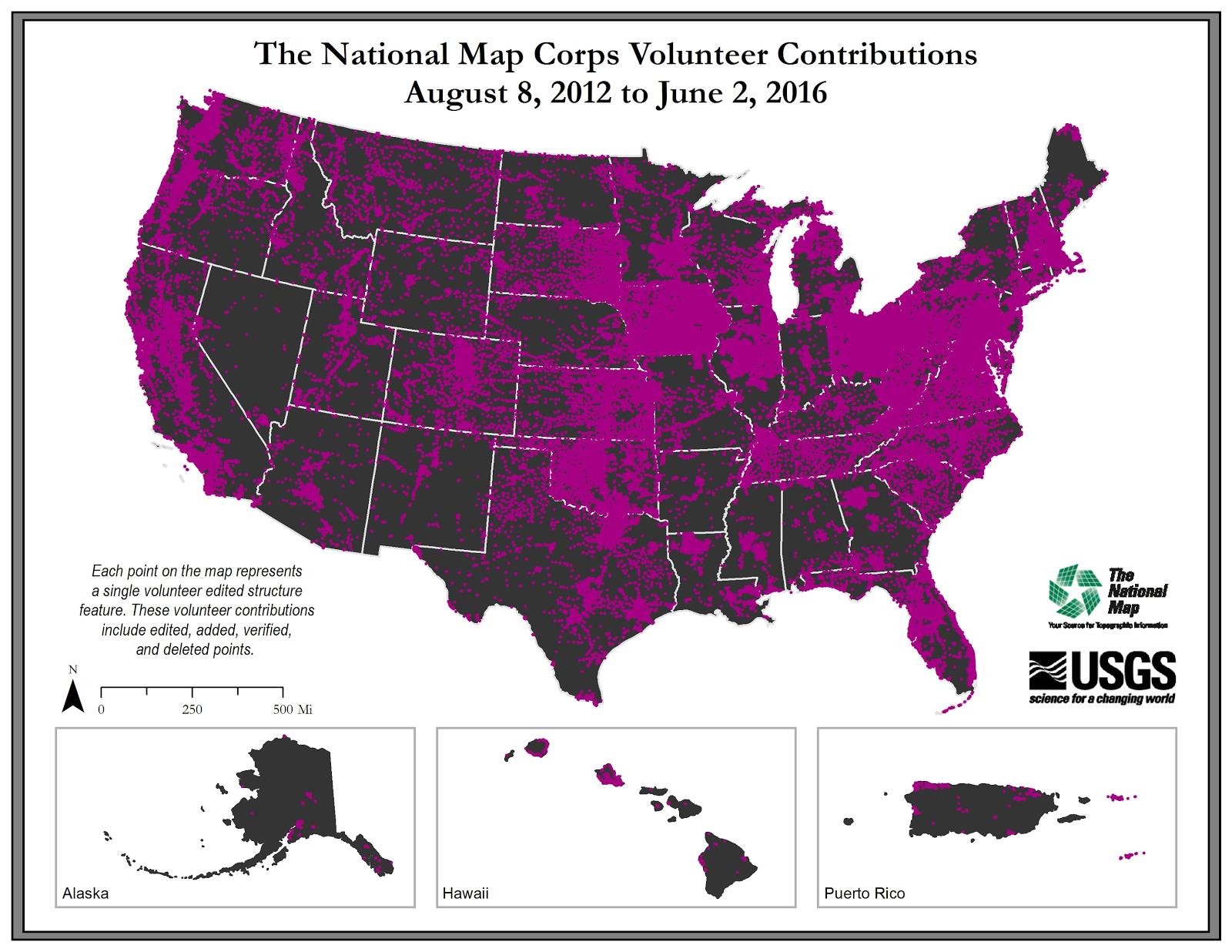
U.S. Geological Survey, Department of the Interior - The annual National Map Corps Volunteered Geographic Information (VGI) structures acquisition plan is to add new structures data and remove or edit obsolete structures data points over the United States. The FY17 acquisition plan allows data contributions by volunteers for all 50 states. Interested parties who wish to become a volunteer data acquisition partner with the USGS in FY17 or in future years should contact a USGS Geospatial Liaison - http://liaisons.usgs.gov/geospatial/documents/TNM_Partnership_User_ContactList.pdf. To find out more about the National Map Corps VGI structures program go to https://my.usgs.gov/confluence/display/nationalmapcorps/Home.
Types: Citation;
Tags: EMS station,
NGDA,
National Geospatial Data Asset,
Real Property Theme,
Structures,
This data set contains imagery from the National Agriculture Imagery Program (NAIP). The NAIP program is administered by USDA FSA and has been established to support two main FSA strategic goals centered on agricultural production. These are increase stewardship of America's natural resources while enhancing the environment, and to ensure commodities are procured and distributed effectively and efficiently to increase food security. The NAIP program supports these goals by acquiring and providing ortho imagery that has been collected during the agricultural growing season in the U.S. The NAIP ortho imagery is tailored to meet FSA requirements and is a fundamental tool used to support FSA farm and conservation programs....
|

|
