Filters: Tags: species range (X)
15 results (67ms)|
Filters
Date Range
Extensions Types
Contacts
Categories Tag Types
|

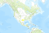
The American crocodile (Crocodylus acutus) ranges from southern Florida through the Caribbean islands, and from Mexico through Central America to Peru. It inhabits brackish and freshwater habitats, preferring mangrove-lined coasts. In October 2002, Wildlife Conservation Society and the University of Florida held a workshop in Gainesville, Florida to establish the current range and conservation priorities for this species. Thirty-nine experts from across the crocodile's range contributed to this effort. This layer represents point locations where crocodiles were present within the last twenty years, as identified by the experts who attended the workshop.

GAP species range data shows a coarse representation of the total areal extent of a species or the geographic limits within which a species can be found (Morrison and Hall 2002). To represent these geographic limits, GAP compiled existing GAP data, where available, and NatureServe data (Patterson et al. 2003, Ridgely et al. 2007, NatureServe 2010) IUCN data (IUCN 2004), where needed. Data provided by GAP in collaboration with Southwest Regional Gap Analysis Project (SWReGAP) and the Southeast Gap Analysis Project (SEGAP) . Bird data provided by NatureServe in collaboration with Robert Ridgely, James Zook, The Nature Conservancy ? Migratory Bird Program, Conservation International ? Center for Applied Biodiversity...
This dataset contains the predicted distributions of 445 terrestrial vertebrate species in Wyoming, created in a GIS modeling process using species habitat assocation rules in combination with species geographic range. Because of the large size of this dataset, it is distributed in two ways (complete, statewide), and tiled into 56 1:100,000-scale quadrangles units which are small enough to be utilized in the PC Arc/Info or ArcView environment.
Categories: Data;
Types: Downloadable;
Tags: Gap Analysis,
Wyoming,
biota,
elevation model,
environment,
These data were compiled for the U.S. Fish and Wildlife Service to assist them with updating the current status of the species Bartram's Stonecrop (Graptopetalum bartramii). Objective(s) of our study were to survey selected sites within the of Bartram's Stonecrop for future management and protection. These data represent summary population counts at selected known sites for the Federally listed Threatened plant species, Bartram's Stonecrop (Graptopetalum bartramii). These data were collected in the southern Arizona portion of the species' range, stratified across Sky Island Mountain ranges from the Rincon Mountains south to the Atascosa Highlands, just north of the Mexican border. Sites were selected to represent...
Categories: Data;
Tags: Adobe Canyon,
Alamo Canyon,
Arizona,
Atascosa Highlands,
Atascosa Mountains,

GAP species range data shows a coarse representation of the total areal extent of a species or the geographic limits within which a species can be found (Morrison and Hall 2002). To represent these geographic limits, GAP compiled existing GAP data, where available, and NatureServe data (Patterson et al. 2003, Ridgely et al. 2007, NatureServe 2010) IUCN data (IUCN 2004), where needed. Data provided by GAP in collaboration with Southwest Regional Gap Analysis Project (SWReGAP) and the Southeast Gap Analysis Project (SEGAP) . Bird data provided by NatureServe in collaboration with Robert Ridgely, James Zook, The Nature Conservancy ? Migratory Bird Program, Conservation International ? Center for Applied Biodiversity...

GAP species range data shows a coarse representation of the total areal extent of a species or the geographic limits within which a species can be found (Morrison and Hall 2002). To represent these geographic limits, GAP compiled existing GAP data, where available, and NatureServe data (Patterson et al. 2003, Ridgely et al. 2007, NatureServe 2010) IUCN data (IUCN 2004), where needed. Data provided by GAP in collaboration with Southwest Regional Gap Analysis Project (SWReGAP) and the Southeast Gap Analysis Project (SEGAP) . Bird data provided by NatureServe in collaboration with Robert Ridgely, James Zook, The Nature Conservancy ? Migratory Bird Program, Conservation International ? Center for Applied Biodiversity...
This individual species distribution is derived from a GIS modeling process using species habitat association rules in combination with species geographic range. There are a total of 445 individual terrestrial vertebrate species distributions generated for Wyoming by the Wyoming Gap Analysis project.
Categories: Data;
Types: Downloadable,
Map Service,
OGC WFS Layer,
OGC WMS Layer,
Shapefile;
Tags: Gap Analysis,
Wyoming,
animal,
biotic,
elevation model,
GAP species range data shows a coarse representation of the total areal extent of a species or the geographic limits within which a species can be found (Morrison and Hall 2002). To represent these geographic limits, GAP compiled existing GAP data, where available, and NatureServe data (Patterson et al. 2003, Ridgely et al. 2007, NatureServe 2010) IUCN data (IUCN 2004), where needed. Data provided by GAP in collaboration with Southwest Regional Gap Analysis Project (SWReGAP) and the Southeast Gap Analysis Project (SEGAP) . Bird data provided by NatureServe in collaboration with Robert Ridgely, James Zook, The Nature Conservancy ? Migratory Bird Program, Conservation International ? Center for Applied Biodiversity...

GAP species range data shows a coarse representation of the total areal extent of a species or the geographic limits within which a species can be found (Morrison and Hall 2002). To represent these geographic limits, GAP compiled existing GAP data, where available, and NatureServe data (Patterson et al. 2003, Ridgely et al. 2007, NatureServe 2010) IUCN data (IUCN 2004), where needed. Data provided by GAP in collaboration with Southwest Regional Gap Analysis Project (SWReGAP) and the Southeast Gap Analysis Project (SEGAP) . Bird data provided by NatureServe in collaboration with Robert Ridgely, James Zook, The Nature Conservancy ? Migratory Bird Program, Conservation International ? Center for Applied Biodiversity...
Species Ranges within 10 milie radius of U.S. Fish and Wildlife Service, Pacific Southwest Region 8
Categories: Data;
Types: ArcGIS REST Map Service,
ArcGIS Service Definition,
Downloadable,
Map Service;
Tags: Endangered species,
Endangered species,
Listed species,
Listed species,
Threatened species,
This is the primary output dataset from the project to access the potential impacts of climate change on vegetation management strategies within Hawaii Volcanoes National Park (HAVO). The key objective of this project was to combine climate projections from the International Pacific Research Center (IPRC) and plant distribution models from Price et al. to produce a series of projected species range maps over the next century. Although the project focused on HAVO, the projected species range maps were created for seven of the main Hawaiian Islands. We stored the model output as rasters (.TIF files); additionally we created multi-panel maps of these rasters that are available separately. In summary, this dataset consists...
Categories: Data;
Types: Citation;
Tags: Hawaii Volcanoes National Park,
Hawaiian Islands,
Pacific Islands CASC,
Plants,
Wildlife and Plants,

GAP species range data shows a coarse representation of the total areal extent of a species or the geographic limits within which a species can be found (Morrison and Hall 2002). To represent these geographic limits, GAP compiled existing GAP data, where available, and NatureServe data (Patterson et al. 2003, Ridgely et al. 2007, NatureServe 2010) IUCN data (IUCN 2004), where needed. Data provided by GAP in collaboration with Southwest Regional Gap Analysis Project (SWReGAP) and the Southeast Gap Analysis Project (SEGAP) . Bird data provided by NatureServe in collaboration with Robert Ridgely, James Zook, The Nature Conservancy ? Migratory Bird Program, Conservation International ? Center for Applied Biodiversity...

GAP species range data shows a coarse representation of the total areal extent of a species or the geographic limits within which a species can be found (Morrison and Hall 2002). To represent these geographic limits, GAP compiled existing GAP data, where available, and NatureServe data (Patterson et al. 2003, Ridgely et al. 2007, NatureServe 2010) IUCN data (IUCN 2004), where needed. Data provided by GAP in collaboration with Southwest Regional Gap Analysis Project (SWReGAP) and the Southeast Gap Analysis Project (SEGAP) . Bird data provided by NatureServe in collaboration with Robert Ridgely, James Zook, The Nature Conservancy ? Migratory Bird Program, Conservation International ? Center for Applied Biodiversity...
GAP species range data show a coarse representation of the total areal extent of a species or the geographic limits within which a species can be found (Morrison and Hall 2002). To represent these geographic limits, GAP compiled existing GAP data, where available, and NatureServe data (Patterson et al. 2003, Ridgely et al. 2007, NatureServe 2010) IUCN data (IUCN 2004), where needed. Data provided by GAP in collaboration with the Northwest Gap Analysis Project (NWGAP), the Southwest Regional Gap Analysis Project (SWReGAP), the Southeast Gap Analysis Project (SEGAP), the Alaska Gap Analysis Project (AKGAP), the Hawaii Gap Analysis Project (HIGAP), the Puerto Rico Gap Analysis Project (PRGAP), and the U.S. Virgin Islands...
Categories: Data;
Types: Map Service,
OGC WFS Layer,
OGC WMS Layer,
OGC WMS Service;
Tags: 12-digit HUCs,
12-digit hydrologic units,
Academics & scientific researchers,
Alabama,
Biodiversity,

GAP species range data shows a coarse representation of the total areal extent of a species or the geographic limits within which a species can be found (Morrison and Hall 2002). To represent these geographic limits, GAP compiled existing GAP data, where available, and NatureServe data (Patterson et al. 2003, Ridgely et al. 2007, NatureServe 2010) IUCN data (IUCN 2004), where needed. Data provided by GAP in collaboration with Southwest Regional Gap Analysis Project (SWReGAP) and the Southeast Gap Analysis Project (SEGAP) . Bird data provided by NatureServe in collaboration with Robert Ridgely, James Zook, The Nature Conservancy ? Migratory Bird Program, Conservation International ? Center for Applied Biodiversity...
|

|
