Filters: Tags: south america (X)
809 results (21ms)|
Filters
Date Range
Extensions Types Contacts
Categories Tag Types
|
This inventory was originally created by Gorum and others (2014) describing the landslides triggered by a sequence of earthquakes, with the largest being the M 6.2 17 km N of Puerto Aisen, Chile earthquake that occurred on 21 April 2007 at 23:45:56 UTC. Care should be taken when comparing with other inventories because different authors use different mapping techniques. This inventory includes landslides triggered by a sequence of earthquakes rather than a single mainshock. Please check the author methods summary and the original data source for more information on these details and to confirm the viability of this inventory for your specific use. With the exception of the data from USGS sources, the inventory...
Categories: Data;
Types: Citation,
Downloadable,
Map Service,
OGC WFS Layer,
OGC WMS Layer,
Shapefile;
Tags: Chile,
EHP,
Earthquake,
Earthquake Hazards Program,
Earthquakes,
A seismic hazard model for South America, based on a smoothed (gridded) seismicity model, a subduction model, a crustal fault model, and a ground motion model, has been produced by the U.S. Geological Survey. These models are combined to account for ground shaking from earthquakes on known faults as well as earthquakes on un-modeled faults. This data set represents the results of calculations of hazard curves for a grid of points with a spacing of 0.1 degrees in latitude and longitude. This particular data set is for peak ground acceleration with a 10 percent probability of exceedance in 50 years.
Categories: Data;
Types: Citation,
Downloadable,
Map Service,
OGC WFS Layer,
OGC WMS Layer,
Shapefile;
Tags: Argentina,
Bolivia,
Brazil,
Chile,
Colombia,

The integrity of Amazon forests are currently threatened by climate change, deforestation, and fire. However, it is unclear how these agents of change interact over large spatial and temporal domains and reducing this uncertainty is important for projecting changes in carbon stocks and species biogeography, and could better inform continental scale conservation programs. With this in mind, aboveground biomass and tree cover data were produced using the dynamic global vegetation model, LPJmL, with 9 different global climate models (using the SRES A2 emissions storyline) and 2 different deforestation scenarios (from Soares et al.). The existing fire module was modified to include 'escaped fire' associated with deforestation,...

The Digital Chart of the World (DCW) is an Environmental Systems Research Institute, Inc. (ESRI) product originally developed for the US Defense Mapping Agency (DMA) using DMA data. The DCW 1993 version at 1:1,000,000 scale was used. The DMA data sources are aeronautical charts, which emphasize landmarks important from flying altitudes. This explains why there is a separate aeronautical theme with all conceivable airports, yet why on some themes small islands and lakes are simply unnamed points. ESRI, in compiling the DCW, also eliminated some detail and made some assumptions for handling tiny polygons and edgematching. Also, note that the completeness of the thematic categories present in each layer will vary....

The integrity of Amazon forests are currently threatened by climate change, deforestation, and fire. However, it is unclear how these agents of change interact over large spatial and temporal domains and reducing this uncertainty is important for projecting changes in carbon stocks and species biogeography, and could better inform continental scale conservation programs. With this in mind, aboveground biomass and tree cover data were produced using the dynamic global vegetation model, LPJmL, with 9 different global climate models (using the SRES A2 emissions storyline) and 2 different deforestation scenarios (from Soares et al.). The existing fire module was modified to include 'escaped fire' associated with deforestation,...

Los otros invertebrados de América del Sur, América Central y el Caribe (other invertebrates).
Las especies invasoras de América del Sur, América Central y el Caribe (invasive species).

Los otros fungis de América del Sur, América Central y el Caribe (other fungi)
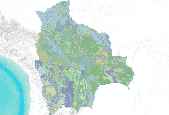
Vegetación de Bolivia 1 : 250 000
A seismic hazard model for South America, based on a smoothed (gridded) seismicity model, a subduction model, a crustal fault model, and a ground motion model, has been produced by the U.S. Geological Survey. These models are combined to account for ground shaking from earthquakes on known faults as well as earthquakes on un-modeled faults. This data set represents the results of calculations of hazard curves for a grid of points with a spacing of 0.1 degrees in latitude and longitude. This particular data set is for horizontal spectral response acceleration for 0.2-second period with a 50 percent probability of exceedance in 50 years.
Categories: Data;
Types: Citation,
Downloadable,
Map Service,
OGC WFS Layer,
OGC WMS Layer,
Shapefile;
Tags: Argentina,
Bolivia,
Brazil,
Chile,
Colombia,

The integrity of Amazon forests are currently threatened by climate change, deforestation, and fire. However, it is unclear how these agents of change interact over large spatial and temporal domains and reducing this uncertainty is important for projecting changes in carbon stocks and species biogeography, and could better inform continental scale conservation programs. With this in mind, aboveground biomass and tree cover data were produced using the dynamic global vegetation model, LPJmL, with 9 different global climate models (using the SRES A2 emissions storyline) and 2 different deforestation scenarios (from Soares et al.). The existing fire module was modified to include 'escaped fire' associated with deforestation,...

The integrity of Amazon forests are currently threatened by climate change, deforestation, and fire. However, it is unclear how these agents of change interact over large spatial and temporal domains and reducing this uncertainty is important for projecting changes in carbon stocks and species biogeography, and could better inform continental scale conservation programs. With this in mind, aboveground biomass and tree cover data were produced using the dynamic global vegetation model, LPJmL, with 9 different global climate models (using the SRES A2 emissions storyline) and 2 different deforestation scenarios (from Soares et al.). The existing fire module was modified to include 'escaped fire' associated with deforestation,...

The integrity of Amazon forests are currently threatened by climate change, deforestation, and fire. However, it is unclear how these agents of change interact over large spatial and temporal domains and reducing this uncertainty is important for projecting changes in carbon stocks and species biogeography, and could better inform continental scale conservation programs. With this in mind, aboveground biomass and tree cover data were produced using the dynamic global vegetation model, LPJmL, with 9 different global climate models (using the SRES A2 emissions storyline) and 2 different deforestation scenarios (from Soares et al.). The existing fire module was modified to include 'escaped fire' associated with deforestation,...

The Digital Chart of the World (DCW) is an Environmental Systems Research Institute, Inc. (ESRI) product originally developed for the US Defense Mapping Agency (DMA) using DMA data. The DCW 1993 version at 1:1,000,000 scale was used. The DMA data sources are aeronautical charts, which emphasize landmarks important from flying altitudes. This explains why there is a separate aeronautical theme with all conceivable airports, yet why on some themes small islands and lakes are simply unnamed points. ESRI, in compiling the DCW, also eliminated some detail and made some assumptions for handling tiny polygons and edgematching. Also, note that the completeness of the thematic categories present in each layer will vary....

The integrity of Amazon forests are currently threatened by climate change, deforestation, and fire. However, it is unclear how these agents of change interact over large spatial and temporal domains and reducing this uncertainty is important for projecting changes in carbon stocks and species biogeography, and could better inform continental scale conservation programs. With this in mind, above ground biomass and tree cover data were produced using the dynamic global vegetation model, LPJmL, with 9 different global climate models (using the SRES A2 emissions storyline) and 2 different deforestation scenarios (from Soares et al.). The existing fire module was modified to include 'escaped fire' associated with deforestation,...

The integrity of Amazon forests are currently threatened by climate change, deforestation, and fire. However, it is unclear how these agents of change interact over large spatial and temporal domains and reducing this uncertainty is important for projecting changes in carbon stocks and species biogeography, and could better inform continental scale conservation programs. With this in mind, above ground biomass and tree cover data were produced using the dynamic global vegetation model, LPJmL, with 9 different global climate models (using the SRES A2 emissions storyline) and 2 different deforestation scenarios (from Soares et al.). The existing fire module was modified to include 'escaped fire' associated with deforestation,...

The integrity of Amazon forests are currently threatened by climate change, deforestation, and fire. However, it is unclear how these agents of change interact over large spatial and temporal domains and reducing this uncertainty is important for projecting changes in carbon stocks and species biogeography, and could better inform continental scale conservation programs. With this in mind, above ground biomass and tree cover data were produced using the dynamic global vegetation model, LPJmL, with 9 different global climate models (using the SRES A2 emissions storyline) and 2 different deforestation scenarios (from Soares et al.). The existing fire module was modified to include 'escaped fire' associated with deforestation,...

The integrity of Amazon forests are currently threatened by climate change, deforestation, and fire. However, it is unclear how these agents of change interact over large spatial and temporal domains and reducing this uncertainty is important for projecting changes in carbon stocks and species biogeography, and could better inform continental scale conservation programs. With this in mind, above ground biomass and tree cover data were produced using the dynamic global vegetation model, LPJmL, with 9 different global climate models (using the SRES A2 emissions storyline) and 2 different deforestation scenarios (from Soares et al.). The existing fire module was modified to include 'escaped fire' associated with deforestation,...
|

|
