Filters: Tags: sage-grouse (X)
80 results (6ms)|
Filters
|
This data set represents a preliminary attempt to define distinct areas of Sage-grouse occupation in North America. The 'boundaries' for subpopulations are not actually boundaries, but lines meant to encircle a specific group of leks. The difference may seem trivial, but it is significant. We did not establish an area associated with each population or subpopulation, and consequently we did not evaluate the associated habitat and/or landscape. This type of analysis would have required a specific assessment of the habitat within and between each of the identified populations and subpopulations. The descriptions of subpopulations are clearly a preliminary attempt to define distinct areas of occupation.
This data set represents SAGE GROUSE brooding use areas in Utah as determined by UDWR field biologists in spring 1999. In May 2006 the dataset was converted from a Critical, High, Substantial and Limited value system to a Crucial/Substantial value system.
We tested the hypothesis that the monoterpenoid levels in the ingesta from various digestive organs of sage grouse are less than that expected from the big sagebrush leaves ingested. Results supported the hypothesis. Dramatic reductions occurred between the gizzard and duodenum. Monoterpenoid levels in the ceca were nil; thus adverse effects of monoterpenoids on ceca microbes would also be nil. Published in Journal of Chemical Ecology, volume 15, issue 3, on pages 961 - 969, in 1989.
Categories: Publication;
Types: Citation,
Journal Citation;
Tags: Artemisia tridentata,
Centrocerus urophasianus,
Journal of Chemical Ecology,
big sagebrush,
digestion,
Models that treat innovations to the price of energy as predetermined with respect to U.S. macroeconomic aggregates are widely used in the literature. For example, it is common to order energy prices first in recursively identified VAR models of the transmission of energy price shocks. Because exactly identifying assumptions are inherently untestable, this approach in practice has required an act of faith in the empirical plausibility of the delay restriction used for identification. An alternative view that would invalidate such models is that energy prices respond instantaneously to macroeconomic news, implying that energy prices should be ordered last in recursively identified VAR models. In this paper, we propose...
Categories: Publication;
Types: Citation;
Tags: Ecology,
Powder River Basin,
Sage-Grouse,
Wyoming,
coal mining,
Habitat and population fragmentation were considered as one of the top factors contributing to the recent U.S. Fish and Wildlife Service decision that listing greater sage-grouse was warranted but currently precluded. This study provides an approach that combines genetic markers and landscape analyses to delineate populations, estimate fragmentation and connectivity in sage-grouse populations, and potentially identify underlying causes that limit connectivity and isolate populations. State and federal agencies are focusing current management actions for greater sage-grouse in core areas containing the highest densities of breeding birds. The core area approach permits limited resources to be applied in regions that...
Categories: Publication;
Types: Citation;
Tags: Birds,
Genetics,
Grasslands and Plains,
Landscapes,
Northwest CASC,
This data set identifies Management Zones to be used in work for the USFWS 2015 Status Review for the greater sage-grouse. Management Zone boundaries in this data set were slightly adjusted from the 2006 WAFWA Management Zone data set. Outer boundaries were adjusted to include all PACs and Populations from the 'GRSG_2015_USFWS_StatusReview_Populations' data set. Management Zone boundaries dividing populations were adjusted to match Population boundaries from the 'GRSG_2015_USFWS_StatusReview_Populations' data set. See the Supplemental Information for more details.
Categories: Data;
Types: ArcGIS REST Map Service,
Map Service;
Tags: GRSG 2015 US FWS Status Review,
Greater Sage-grouse,
Greater sage-grouse,
Management Zones,
Sage-grouse,
Wheat Creek Meadows Wildlife Habitat Area (WCM) is a 1600 acre wildlife habitat area acquired by the BLM through a land exchange in 1988. It lies 15 miles north of Kemmerer, Wyoming on the south end of the Wyoming Range. The property has two perennial streams, Wheat and West Willow Creeks. The main goal for WCM was to provide protection of wildlife habitat and wetlands with special emphasis on maximizing the potential for wildlife species production and diversity. The area provides habitat for many Special Status Species including the sage grouse, white-faced ibis, sage sparrow, sage thrasher, loggerhead shrike, Brewer’s sparrow, pygmy rabbit; and possibly even the Idaho pocket gopher, yellow-billed cuckoo, northern...
Categories: Project;
Types: Map Service,
OGC WFS Layer,
OGC WMS Layer,
OGC WMS Service,
ScienceBase Project;
Tags: Habitat,
avian species,
brewer's sparrow,
habitat conservation project,
pygmy rabbit,
This dataset contains sample collection information for whole genome sequences of Gunnison and Greater Sage-grouse. These data were collected in order to examine patterns of adaptive genetic variation in Greater and Gunnison Sage-grouse. The data is archived in GenBank at the following URL https://www.ncbi.nlm.nih.gov/bioproject/531321.
Conservation planning efforts for sagebrush ecosystems of western North America increasingly focus on enhancing operational resilience though decision-support tools that link spatially explicit variation in soil and plant processes to outcomes of biotic and abiotic disturbances spanning large spatial extents. However, failure to consider higher trophic-level fauna (e.g. wildlife) in these tools can hinder efforts to operationalize resilience owing to spatiotemporal lags between slower reorganization of plant and soil processes following disturbance, and faster behavioral and demographic responses of fauna to disturbance. These spatial products provide additional examples for managers of sagebrush ecosystems and...
October 2017 Update: WY - On October 27, 2017 the WY state director signed maintenance actions for the Wyoming Sage-Grouse ARMPA, Buffalo RMP, Cody RMP, and Worland RMP that changed WY PHMA boundaries, bringing them into consistency with the Wyoming Core Areas (version 4) from the current Governor's executive order 2015-4. The updated PHMA boundaries were also adopted by the Lander RMP.April 2017 Update: UT - The interagency team reconvened in late 2016 to review State of Utah GRSG populations and the BLM’s 2015 and 2016 wildfire data. Of the ten soft triggers and seven hard triggers evaluated, only one population soft trigger and one population hard trigger have been met, both within the Sheeprocks population area...
These data represent an resource selection function (RSF) for translocated sage-grouse in North Dakota during the nesting season. Human enterprise has led to large‐scale changes in landscapes and altered wildlife population distribution and abundance, necessitating efficient and effective conservation strategies for impacted species. Greater sage‐grouse (Centrocercus urophasianus; hereafter sage‐grouse) are a widespread sagebrush (Artemisia spp.) obligate species that has experienced population declines since the mid‐1900s resulting from habitat loss and expansion of anthropogenic features into sagebrush ecosystems. Habitat loss is especially evident in North Dakota, USA, on the northeastern fringe of sage‐grouse’...
Categories: Data;
Types: Downloadable,
GeoTIFF,
Map Service,
Raster;
Tags: North Dakota,
biota,
habitats,
nest,
resource Selection Function,
These data sets represent our preliminary attempt to define distinct areas of Sage-grouse occupation in North America.
Categories: Data;
Types: Downloadable,
Map Service,
OGC WFS Layer,
OGC WMS Layer,
Shapefile;
Tags: Alberta,
California,
Canada,
Centrocercus,
Colorado,
This metadata references the polygonal ARC/INFO GIS cover showing the current and historic distribution of potential habitat, or range, of the Greater Sage-grouse (Centrocercus urophasianus) and Gunnison Sage-grouse (Centrocercus minimus) in Western North America. This data was initially researched and compiled by Dr. Michael A. Schroeder, research biologist for the Washington State Department of Fish and Wildlife. The initial draft of current and historic range data was mapped and submitted to state, federal, or provincial natural resource agencies and other experts for review, comment, and editing. The final product represents the best available science and expert review available at the time of compilation. Definition...
Emerging applications of ecosystem resilience and resistance concepts in sagebrush ecosystems allow managers to better predict and mitigate impacts of wildfire and invasive annual grasses. Soil temperature and moisture strongly influence the kind and amount of vegetation, and consequently, are closely tied to sagebrush ecosystem resilience and resistance (Chambers et al. 2014, 2016). Soil taxonomic temperature and moisture regimes can be used as indicators of resilience and resistance at landscape scales to depict environmental gradients in sagebrush ecosystems that range from cold/cool-moist sites to warm-dry sites. We aggregated soil survey spatial and tabular data to facilitate broad-scale analyses of resilience...
Categories: Data;
Types: Citation;
Tags: Data,
EARTH SCIENCE > LAND SURFACE > LANDSCAPE,
LCC Network Science Catalog,
Resistance and Resilience,
Resistance and Resilience,

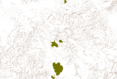
Greater sage-grouse population components derived using an 18-km maximum connection distance. Analysis was conducted using the CONEFOR SENSINODE 2.2 software package and this dataset was developed from lek data obtained from the state wildlife agencies. Components containing < 5 leks have been removed in order to protect the location of single or small groups of leks.
State policies can support renewable energy development by driving markets, providing certainty in the investment market, and incorporating the external benefits of the technologies into cost/benefit calculations. Using statistical analyses and policy design best practices, this paper quantifies the impact of state-level policies on renewable energy development in order to better understand the role of policy on development and inform policy makers on the policy mechanisms that provide maximum benefit. The results include the identification of connections between state policies and renewable energy development, as well as a discussion placing state policy efforts in context with other factors that influence the...
Implementing conservation in the face of unprecedented landscape change requires an understanding of processes and scales that limit wildlife populations. We assessed landscape-level processes influencing sage-grouse (Centrocercus urophasianus), to a migratory population in the Milk River Basin (MRB), northeast Montana, USA, and south-central Saskatchewan, Canada. A regional analysis of leks (e.g., communal breeding sites) documented that populations impacted by the increasing extent of agricultural tillage, roads, and energy development out to spatial scales larger than previously known. Using bird abundance as a novel way to evaluate human impacts revealed relationships that would have been missed had we not incorporated...
Categories: Publication;
Types: Citation;
Tags: Disease,
Population,
Sage-grouse,
conservation,
footprint,
This raster represents a continuous surface of sage-grouse habitat probability values for Nevada and California. These values are derived from modeling the resource selection function (RSF) for the region (see supplemental information in the Open File Report cited below for more details). Higher values indicate a higher probability of quality sage-grouse habitat. NOTE: This file does not include habitat for the Bi-State management area. This dataset is associated with the following Open-File Report; Coates, P.S., Casazza, M.L., Brussee, B.E., Ricca, M.A., Gustafson, K.B., Overton, C.T., Sanchez-Chopitea, E., Kroger, T., Mauch, K., Niell, L., Howe, K., Gardner, S., Espinosa, S., and Delehanty, D.J., 2014, Spatially...
Categories: Data;
Types: ArcGIS REST Map Service,
ArcGIS Service Definition,
Downloadable,
Map Service,
OGC WFS Layer,
OGC WMS Layer,
OGC WMS Service;
Tags: Habitat,
Nevada,
Nevada, Sage-grouse, Habitat,
Sage-grouse,
USA, Great Basin, Nevada,
These data represent an annual resource selection function (RSF) for translocated sage-grouse in North Dakota. Human enterprise has led to large‐scale changes in landscapes and altered wildlife population distribution and abundance, necessitating efficient and effective conservation strategies for impacted species. Greater sage‐grouse (Centrocercus urophasianus; hereafter sage‐grouse) are a widespread sagebrush (Artemisia spp.) obligate species that has experienced population declines since the mid‐1900s resulting from habitat loss and expansion of anthropogenic features into sagebrush ecosystems. Habitat loss is especially evident in North Dakota, USA, on the northeastern fringe of sage‐grouse’ distribution, where...
Categories: Data;
Types: Downloadable,
GeoTIFF,
Map Service,
Raster;
Tags: North Dakota,
Resource Selection Function,
biota,
habitats,
sage-grouse,
The Western Association of Fish and Wildlife Agencies (WAFWA), U.S. Fish and Wildlife Service (FWS) Inter-Landscape Conservation Cooperative (LCC), Greater Sage-Grouse Initiative, and the U.S. Geological Survey (USGS) funded projects to further sage-grouse conservation efforts. The LCC's involved include the Great Northern, The Great Basin, the Plains and Prairie Potholes, and the Southern Rockies. Read more about these projects in the spreadsheet at https://sites.google.com/site/forumsagesteppe/wfwa-lcc
Types: Map Service,
OGC WFS Layer,
OGC WMS Layer,
OGC WMS Service;
Tags: Energy,
FWS/MSU,
MSU,
Oil,
Sage Grouse,
|

|
