Filters: Tags: pinyon (X)
27 results (9ms)|
Filters
Date Range
Extensions (Less) Types (Less) Contacts (Less)
Categories (Less) Tag Types Tag Schemes |

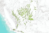
This digital range map represents the range of Colorado pinyon pine (Pinus edulis) in western North America. Data from multiple sources, including existing digitized maps, tabular data, personal communications, USDA Forest Service Inventory and Analysis data, and figures from other publications, were synthesized to create a single digital distribution. The distribution was peer reviewed and iteratively revised based on personal observations of regional authorities.
This dataset presents current and future change agent models and combined future potential for change (PFC) within the pinyon-juniper woodland system Conservation Element.The pinyon-juniper woodland system extent was determined by querying the LANDFIRE existing vegetation dataset for Pinyon-Juniper Woodland and clipping the data to the ecoregion boundary.This dataset presents current and future change agent models and combined future potential for change (PFC). Potential for change (PFC) was determined by calculating the maximum potential for change among all change agents within each 1 km reporting unit. Current and future landscape intactness (LCM_C_FZ and LCM_N_FZ) are based on measures of landscape development...
This data set represent the digital range map of Single-Needle Pinyon Pine (Pinus monophylla) in western North America. Data from multiple sources, including existing digitized maps, tabular data, personal communication, and figures from other publications, were synthesized to create a single digital distribution. The distribution was peer reviewed and iteratively revised based on personal observations of regional authorities.

This dataset represents weighted risks of pinyon mortality based on soil order, texture, climate regime and horizons of salt accumulation. It was developed using STATSGO2 (2002) and the NRCS official soil series descriptions.
This dataset presents current and future change agent models and combined future potential for change (PFC) within the pinyon-juniper woodland system Conservation Element.The pinyon-juniper woodland system extent was determined by querying the LANDFIRE existing vegetation dataset for Pinyon-Juniper Woodland and clipping the data to the ecoregion boundary.This dataset presents current and future change agent models and combined future potential for change (PFC). Potential for change (PFC) was determined by calculating the maximum potential for change among all change agents within each 1 km reporting unit. Current and future landscape intactness (LCM_C_FZ and LCM_N_FZ) are based on measures of landscape development...
This dataset presents current and future change agent models and combined future potential for change (PFC) within the pinyon-juniper woodland system Conservation Element.The pinyon-juniper woodland system extent was determined by querying the LANDFIRE existing vegetation dataset for Pinyon-Juniper Woodland and clipping the data to the ecoregion boundary.This dataset presents current and future change agent models and combined future potential for change (PFC). Potential for change (PFC) was determined by calculating the maximum potential for change among all change agents within each 1 km reporting unit. Current and future landscape intactness (LCM_C_FZ and LCM_N_FZ) are based on measures of landscape development...
Over the last century there has been marked expansion and infilling of pinyon (Pinus spp.)–juniper (Juniperus spp.) woodlands into grassland and shrubland ecosystems across the western United States. Although range expansions in pinyon-juniper populations have been documented with changing climate throughout the Holocene, over the last century, local scale impacts such as livestock grazing, changes in fire regimes, and increasing atmospheric CO2 concentrations are thought to be more recent drivers of pinyon-juniper woodland distribution. Our objective was to examine the role of historical livestock grazing relative to past climate in regulating pinyon (Pinus edulis Engelm.) recruitment and growth over the last...
Pinyon and juniper have been expanding into sagebrush (Artemisia tridentata) ecosystems since settlement of the Great Basin around 1860. Herbaceous understory vegetation is eliminated as stand densities increase and the potential for catastrophic fires increases. Prescribed fire is increasingly used to remove trees and promote recovery of sagebrush ecosystems. We quantified the effects of prescribed fire, vegetation type, and time following fire on soil KCl extractable nitrogen and NaHCO3 extractable phosphorus in a pinyon?juniper woodland and its associated sagebrush ecosystem immediately before and for 4 years after a spring prescribed burn. Potassium chloride extractable NH4+ and total inorganic-N increased immediately...
Categories: Publication;
Types: Citation,
Journal Citation;
Tags: Journal of Arid Environments,
burning,
ecosystem succession,
juniper,
pinyon,
In recent years, the demand has grown for information on how to conserve bat populations in forested ecosystems. Many researchers have responded with studies of bats in forests, but few have studied bat communities in arid-adapted forest types, such as pinyon-juniper woodlands, which are widespread and abundant throughout the west. In this study, I evaluated the relative use and importance of pinyon-juniper woodlands to bats in west-central New Mexico by comparing bats captured in pinyon-juniper woodlands with those captured in ponderosa pine forest. I compared species richness and relative abundance of bats captured in these vegetation types and evaluated the relative importance of each based on its use as reproductive...
Categories: Publication;
Types: Citation,
Journal Citation;
Tags: Forest Ecology and Management,
bats,
habitat,
juniper,
pinyon,
This dataset presents current and future change agent models and combined future potential for change (PFC) within the pinyon-juniper woodland system Conservation Element.The pinyon-juniper woodland system extent was determined by querying the LANDFIRE existing vegetation dataset for Pinyon-Juniper Woodland and clipping the data to the ecoregion boundary.This dataset presents current and future change agent models and combined future potential for change (PFC). Potential for change (PFC) was determined by calculating the maximum potential for change among all change agents within each 1 km reporting unit. Current and future landscape intactness (LCM_C_FZ and LCM_N_FZ) are based on measures of landscape development...
This dataset presents current and future change agent models and combined future potential for change (PFC) within the pinyon-juniper woodland system Conservation Element.The pinyon-juniper woodland system extent was determined by querying the LANDFIRE existing vegetation dataset for Pinyon-Juniper Woodland and clipping the data to the ecoregion boundary.This dataset presents current and future change agent models and combined future potential for change (PFC). Potential for change (PFC) was determined by calculating the maximum potential for change among all change agents within each 1 km reporting unit. Current and future landscape intactness (LCM_C_FZ and LCM_N_FZ) are based on measures of landscape development...
This dataset presents current and future change agent models and combined future potential for change (PFC) within the pinyon-juniper woodland system Conservation Element.The pinyon-juniper woodland system extent was determined by querying the LANDFIRE existing vegetation dataset for Pinyon-Juniper Woodland and clipping the data to the ecoregion boundary.This dataset presents current and future change agent models and combined future potential for change (PFC). Potential for change (PFC) was determined by calculating the maximum potential for change among all change agents within each 1 km reporting unit. Current and future landscape intactness (LCM_C_FZ and LCM_N_FZ) are based on measures of landscape development...
The influence of woody vegetation and biological soil crusts on infiltration capacity is one of the several uncertainties associated with the ecohydrologic effects of woody plant encroachment into arid and semi-arid land systems. The objective of this study was to quantify the effects of Utah juniper (Juniperus osteosperma) and pinyon pine (Pinus edulis) on subcanopy and intercanopy ecohydrologic properties. We measured soil sorptivity, unsaturated hydraulic conductivity [K(h)], soil water content (SWC), and water repellency along radial line transects from under Juniperus and Pinus trees into the centre of the intercanopy space between trees. In the subcanopy, litter mounds, hydrophobic soils, and roots all appear...
Categories: Publication;
Types: Citation,
Journal Citation;
Tags: Ecohydrology,
biological soil crust,
hydrology,
juniper,
pinyon,
This dataset presents current and future change agent models and combined future potential for change (PFC) within the pinyon-juniper woodland system Conservation Element.The pinyon-juniper woodland system extent was determined by querying the LANDFIRE existing vegetation dataset for Pinyon-Juniper Woodland and clipping the data to the ecoregion boundary.This dataset presents current and future change agent models and combined future potential for change (PFC). Potential for change (PFC) was determined by calculating the maximum potential for change among all change agents within each 1 km reporting unit. Current and future landscape intactness (LCM_C_FZ and LCM_N_FZ) are based on measures of landscape development...
This dataset presents current and future change agent models and combined future potential for change (PFC) within the pinyon-juniper woodland system Conservation Element.The pinyon-juniper woodland system extent was determined by querying the LANDFIRE existing vegetation dataset for Pinyon-Juniper Woodland and clipping the data to the ecoregion boundary.This dataset presents current and future change agent models and combined future potential for change (PFC). Potential for change (PFC) was determined by calculating the maximum potential for change among all change agents within each 1 km reporting unit. Current and future landscape intactness (LCM_C_FZ and LCM_N_FZ) are based on measures of landscape development...
In semiarid landscapes, the linkage between runoff and vegetation is a particularly close one. In this paper we report on the results of a long-term and multiple-scale study of interactions between runoff, erosion, and vegetation in a piñon–juniper woodland in New Mexico. We use our results to address three knowledge gaps: (1) the temporal scaling relationships between precipitation and runoff; (2) the effects of spatial scale on runoff and erosion, as influenced by vegetation; and (3) the influence of disturbance on these relationships. On the basis of our results, we tested three assumptions that represent current thinking in these areas (as evidenced, for example, by explicit or implicit assumptions embedded...
Categories: Publication;
Types: Citation,
Journal Citation;
Tags: Ecological Monographs,
banded vegetation,
dryland hydrology,
ecohydrology,
erosion,
This map shows the current and near-term status of terrestrial ecosystems, in addition to the input datasets used for the analysis and distribution modeling that were involved in producing these status datasets. These data are provided by Bureau of Land Management (BLM) "as is" and may contain errors or omissions. The User assumes the entire risk associated with its use of these data and bears all responsibility in determining whether these data are fit for the User's intended use. These data may not have the accuracy, resolution, completeness, timeliness, or other characteristics appropriate for applications that potential users of the data may contemplate. The User is encouraged to carefully consider the content...
Abstract From: ScienceDirect (Pinyon-juniper (PJ) plant communities cover a large area across North America and provide critical habitat for wildlife, biodiversity and ecosystem functions, and rich cultural resources. These communities occur across a variety of environmental gradients, disturbance regimes, structural conditions and species compositions, including three species of juniper and two species of pinyon. PJ communities have experienced substantial changes in recent decades and identifying appropriate management strategies for these diverse communities is a growing challenge. Here, we surveyed the literature and compiled 441 studies to characterize patterns in research on PJ communities through time, across...
Categories: Publication;
Types: Citation;
Tags: Climate,
Forests,
Landscapes,
North Central CASC,
anthropogenic climate change,

This data set represent the digital range map of Arizona singleleaf pinyon pine (Pinus edulis var. fallax) in western North America. Data from multiple sources, including existing digitized maps, tabular data, personal communication, and figures from other publications, were synthesized to create a single digital distribution. The distribution was peer reviewed and iteratively revised based on personal observations of regional authorities.
This dataset presents current and future change agent models and combined future potential for change (PFC) within the pinyon-juniper woodland system Conservation Element.The pinyon-juniper woodland system extent was determined by querying the LANDFIRE existing vegetation dataset for Pinyon-Juniper Woodland and clipping the data to the ecoregion boundary.This dataset presents current and future change agent models and combined future potential for change (PFC). Potential for change (PFC) was determined by calculating the maximum potential for change among all change agents within each 1 km reporting unit. Current and future landscape intactness (LCM_C_FZ and LCM_N_FZ) are based on measures of landscape development...
|

|
