Filters: Tags: gas (X)
170 results (29ms)|
Filters
Date Range
Extensions Types Contacts
Categories
Tag Types
|

This dataset depicts all oil and gas extraction points for countries bordering the Gulf of Mexico and Caribbean Sea and the islands of the Caribbean Sea from the VMAP Level 0 database. VMAP Level 0 is a comprehensive 1:1,000,000 scale vector basemap of the world.
The polygon (vector) shapefiles represent Public Land Survey System (PLSS) sections, or 1-square mile areas of land, with information about Bureau of Land Management (BLM) land and mineral use authorizations for oil and gas. The land areas specified by BLM authorizations vary in size and orientation, and may cross one or more PLSS section boundaries. For spatial consistency, the information was aggregated to the square mile PLSS section boundary. The original source data from BLM Cases Recordation database (LR2000) were specific to the day they were generated (March 6, 2016) and subsequent data pulls will likely be different.
Categories: Data;
Types: Citation,
Downloadable,
Map Service,
OGC WFS Layer,
OGC WMS Layer,
Shapefile;
Tags: Cadastral,
Gas,
Idaho,
Montana,
Nevada,
The U.S. Geological Survey (USGS) has compiled a geodatabase containing mineral-related geospatial data for the People's Republic of China. The data can be used in analyses of the extractive fuel and nonfuel mineral industries and related economic and physical infrastructure integral for the successful operation of the mineral industries within the area of study as well as the movement of mineral products across domestic and global markets. This geodatabase reflects the USGS ongoing commitment to its mission of understanding the nature and distribution of global mineral commodity supply chains by updating and publishing the georeferenced locations of mineral commodity production and processing facilities, mineral...
The Wyoming Energy Resources Information Clearinghouse site is intended to be a clearinghouse of information about Energy in and around the state of Wyoming.
Categories: Data;
Types: Clearinghouse;
Tags: CBM,
CBNG,
Coal,
Coal Bed Methane,
Coal Bed Natural Gas,

This dataset depicts all pipelines for countries bordering the Gulf of Mexico and Caribbean Sea and the islands of the Caribbean Sea from the VMAP Level 0 database. VMAP Level 0 is a comprehensive 1:1,000,000 scale vector basemap of the world.
Log ASCII Standard (LAS) files of select scanned well logs from Idaho Geological Surveys publication DD-3: Historical Oil and Gas Data for Idaho database of exploration wells across the state. Logs curves converted to LAS files may include: Gamma, Caliper (cal), Resistivity, Spontaneous Potential (SP), Bulk Density, Neutron Porosity, and density porosity. Locations of boreholes, attributes, and PDFs of more than 700 Geophysical logs and other data can be downloaded or viewed at no cost via the Idaho Geological Surveys interactive Oil and Gas webmap.
Log ASCII Standard (LAS) files of select scanned well logs from Idaho Geological Surveys publication DD-3: Historical Oil and Gas Data for Idaho database of exploration wells across the state. Logs curves converted to LAS files may include: Gamma, Caliper (cal), Resistivity, Spontaneous Potential (SP), Bulk Density, Neutron Porosity, and density porosity. Locations of boreholes, attributes, and PDFs of more than 700 Geophysical logs and other data can be downloaded or viewed at no cost via the Idaho Geological Surveys interactive Oil and Gas webmap.

These data depict the Mean Estimate of Volume of Undiscovered Liquids in Gas Accumulations in the Marcellus Shale, Appalachian Basin Province. Measured in millions of barrels of total natural gas liquids (MMBNGL) This dataset was compiled from Assessment of Undiscovered Oil and Gas Resources in the Devonian Marcellus Shale, Appalachian Basin Province, 2011. A single Attribute has been chosen for display: NAGLMEAN. Volume of gas below 20 units have been excluded.
Utah Oil and Gas Field Polygons from the Utah Department of Natural Resources, Oil Gas and Mining Division. http://ogm.utah.gov
We examined bird and bat mortality at a new 89-turbine windfarm constructed in an environmentally sensitive area in north-central Iowa. The windfarm became operational in November 2001. It is located in cropland between three Wildlife Management Areas (WMA's) with historically high bird use. In the past, migrant and resident waterfowl, shorebirds, raptors, and songbirds moved between the WMA's through the area now occupied by the windfarm. Studies of bird collision mortality in California and elsewhere raised concerns about the possibility of mortalities in this area. From April 15, 2003 and December 15, 2003 we searched for dead animals under 26 randomly selected turbines. Six 76.2 m by 3.0 m transects were maintained...
One of the first government-sponsored demands for integrated assessment to support decision making in the United States is embodied in the National Environmental Policy Act of 1969 (NEPA). Over the past 25 years, Oak Ridge National Laboratory (ORNL) has supported federal agencies’ in evaluating health and environmental impacts as required by NEPA. Many of ORNL’s efforts have focused on complex, programmatic assessments that break new ground and require and integrate expertise from a wide range of technical disciplines. Examples of ORNL projects that illustrate the use of integrated assessment approaches include environmental documentation for: (1) the Department of the Army’s Chemical Stockpile Disposal Program,...
One of the first government-sponsored demands for integrated assessment to support decision making in the United States is embodied in the National Environmental Policy Act of 1969 (NEPA). Over the past 25 years, Oak Ridge National Laboratory (ORNL) has supported federal agencies’ in evaluating health and environmental impacts as required by NEPA. Many of ORNL’s efforts have focused on complex, programmatic assessments that break new ground and require and integrate expertise from a wide range of technical disciplines. Examples of ORNL projects that illustrate the use of integrated assessment approaches include environmental documentation for: (1) the Department of the Army’s Chemical Stockpile Disposal Program,...
Building energy standards provide control over excessive use of energy in buildings, promoting energy efficiency and mitigating detrimental environment impacts brought by high energy consumption. The central objective of this paper is to develop correlations that will predict building heat gains and cooling energy consumption for commercial buildings in tropical climates. The energy performance index OTTV was first revised to obtain a new performance index, ETTV for commercial buildings. We developed new correlations to investigate the impact ventilation rates and building aspect ratios had on building cooling energy consumption. Comparing estimated and simulated results, we demonstrated good agreement, even for...
From the US Bureau of Mines map publication, "Availability of Federally Owned Minerals for Exploration and Development in the Western United States". The Bureau of Mines inventoried Federal mineral land in Wyoming and assessed the availability of this land for mineral exploration and development as affected by legal status and agency management practices. To illustrate the impact that various Federal land use decisions have on the mineral industry, the USBM also identified and ranked known mineral deposit areas (KMDAs)-i.e., areas having past or present mineral production and /or known mineral resources- and compared these areas spatially with availability of Federal mineral lands. Most Federal minerals, except...
Categories: Data;
Types: Downloadable;
Tags: Federal Government,
Geology,
Mineral Occurrences,
Wyoming,
economy,
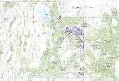
From May to September 2017 measurements of gas and heat emissions were made at Solfatara Plateau Thermal Area, an acid-sulfate, vapor-dominated area in Yellowstone National Park, Wyoming. An eddy covariance system measured half-hourly CO2, H2O and sensible and latent heat fluxes, air temperature and pressure, wind speed and direction and soil moisture. A Multi-GAS instrument measured (0.5 Hz frequency) atmospheric H2O, CO2, SO2 and H2S volumetric mixing ratios, air pressure, temperature and relative humidity and wind speed and direction. Soil temperature at 30 cm depth and CO2 flux were also measured on a grid across a 0.11 km2 area using thermocouple probes and the accumulation chamber method, respectively. The...
Categories: Data;
Tags: Geochemistry,
Multi-GAS,
USGS Science Data Catalog (SDC),
Volcanology,
Yellowstone National Park,
This is the dataset for oil and gas potential as described in Copeland et al. (2009) Mapping Oil and Gas Development Potential in the US Intermountain West and Estimating Impacts to Species, PLoSOne. The dataset should be cited as: Copeland, H., K. Doherty, D. Naugle, A. Pocewicz, J. Kiesecker (2010) Mapping Oil and Gas Development Potential in the US Intermountain West and Estimating Impacts to Species. The projection of this dataset is: US NAD83 Lambert Conformal Conic False easting 0 False northing 0 Central meridian -107.0 Standard parallel 1 33.0 Standard parallel 2 45.0 Latitude of origin 41.0
This data release contains spatial data on the location, number, size and extent of energy-related surface disturbances on the Colorado Plateau of Utah, Colorado, and New Mexico as of 2016. The database includes: 1) polygons of oil and gas pads generated from automated and manual classification of aerial imagery, and 2) polylines of roads derived from the U.S. Census Bureau TIGER/Line Shapefile, supplemented with additional oil and gas access roads digitized from aerial imagery. Pad polygons and road segments are attributed with a "spud year" date based on spud information from the nearest well point. Spudding is the process of beginning to drill a well in the oil and gas industry, and the spud year is a close approximation...
This data set includes arcs, polygons, and polygon labels for geologic and petroleum provinces interpreted and designated by R.M. Pollastro based on numerous literature and map resources.
The data set outlines and describes the general geologic age and type of bedrock of the Former Soviet Union and selected adjacent areas. It also includes shoreline and inland water bodies.
This coverage includes polygons and polygon labels that hold name of tectonic elements from the original tectonic map of Bangladesh.
Categories: Data;
Types: Downloadable,
Map Service,
OGC WFS Layer,
OGC WMS Layer,
Shapefile;
Tags: Bangladesh,
Digital map,
Earth Science,
Economic geology,
Ganges-Brahmaputra Delta, Province 8047,
|

|
