Filters: Tags: cropland (X)
43 results (9ms)|
Filters
Date Range
Extensions Types Contacts
Categories Tag Types
|

All data are provided in 30' latitude-longitude (i.e., 0.5° degree) gridded format in the Geographic projection. A full description of the data development is provided in the Supplementary Information available on the Nature website. Protecting the world’s freshwater resources requires diagnosing threats over a broad range of scales, from global to local. Here we present the first worldwide synthesis to jointly consider human and biodiversity perspectives on water security using a spatial framework that quantifies multiple stressors and accounts for downstream impacts. We find that nearly 80% of the world’s population is exposed to high levels of threat to water security. Massive investment in water technology...
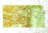
The USDA, NASS Cropland Data Layer (CDL) is a raster, geo-referenced, crop-specific land cover data layer. The 2010 CDL has a ground resolution of 30 meters. The CDL is produced using satellite imagery from the Landsat 5 TM sensor, Landsat 7 ETM+ sensor, and the Indian Remote Sensing RESOURCESAT-1 (IRS-P6) Advanced Wide Field Sensor (AWiFS) collected during the current growing season.Some CDL states used additional satellite imagery and ancillary inputs to supplement and improve the classification. These additional sources can include the United States Geological Survey (USGS) National Elevation Dataset (NED), the USGS National Land Cover Dataset 2001 (NLCD 2001), and the National Aeronautics and Space Administration...
This tabular data set represents the percent of land cover classes from the 2011 Crop land Data Layer compiled for two spatial components of the NHDPlus version 2 data suite (NHDPlusv2) for the conterminous United States; 1) individual reach catchments and 2) reach catchments accumulated upstream through the river network. This dataset can be linked to the NHDPlus version 2 data suite by the unique identifier COMID. The source data is the "2011 Crop Land Data Layer" produced by the United States Department of Agriculture (USDA) National Agricultural Statistics Service (NASS, 2012). Reach catchment information characterizes data at the local scale. Reach catchments accumulated upstream through the river network characterizes...
|

|
