Filters: Tags: cit (X) > partyWithName: Pierre Iachetti (X)
7 results (37ms)|
Filters
Date Range
Tag Schemes |

Conservation Area Name = portfolio sites selected by automation (the SITES algorithm) and expert input The Canadian Rocky Mountains ecoregion (CRM) covers approximately 27.1 million hectares (66.9 million acres) extending across three states and two provinces. The ecoregion extends over a large portion of the Rocky Mountains from southeastern British Columbia and southwestern Alberta to northern Idaho, northwestern Montana and a small part of northeastern Washington. Elevation ranges from 915 m to 3,954 m (3,000 ft to 12,972 ft), with Mt. Robson (BC) being the highest peak in the ecoregion. Geologically, this ecoregion is very complex, containing bedrock of sedimentary, igneous, and metamorphic origin; and is largely...
This work represents a joint effort between Round River Conservation Studies (RRCS), The Nature Conservancy of Canada (NCC), The Nature Conservancy – Alaska (TNC), with assistance from the Coastal Information Team (CIT) Ecosystem Spatial Analysis Planning Team. This effort included a diverse group of researchers from non-governmental and government agencies and represents a collective of researchers and practitioners in the fields of conservation biology, ecology, zoology, Geographical Information Systems (GIS), and land-use planning. To assist the Central Coast Land and Resource Management Planning (Central Coast LRMP) in its decision-making, the Ecosystem Spatial Analysis team was asked to explore a number of...

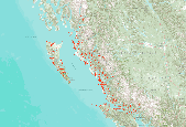
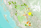
Ecoregional Conservation Assessment for the Coastal Forests and Mountains for British Columbia and Southeast Alaska This dataset represents an assessment of the ecological integrity of all watersheds in the study area based on relative levels of human impacts. This work represents a joint effort between Round River Conservation Studies (RRCS), The Nature Conservancy of Canada (NCC), The Nature Conservancy – Alaska (TNC), with assistance from the Coastal Information Team (CIT) Ecosystem Spatial Analysis Planning Team. This effort included a diverse group of researchers from non-governmental and government agencies and represents a collective of researchers and practitioners in the fields of conservation biology,...
This work represents a joint effort between Round River Conservation Studies (RRCS), The Nature Conservancy of Canada (NCC), The Nature Conservancy – Alaska (TNC), with assistance from the Coastal Information Team (CIT) Ecosystem Spatial Analysis Planning Team. This effort included a diverse group of researchers from non-governmental and government agencies and represents a collective of researchers and practitioners in the fields of conservation biology, ecology, zoology, Geographical Information Systems (GIS), and land-use planning. We sought to develop science-based tools and to assemble regional data necessary to address these sorts of questions, through the development of a Conservation Area Design (CAD)...

This work represents a joint effort between Round River Conservation Studies (RRCS), The Nature Conservancy of Canada (NCC), The Nature Conservancy – Alaska (TNC), with assistance from the Coastal Information Team (CIT) Ecosystem Spatial Analysis Planning Team. This effort included a diverse group of researchers from non-governmental and government agencies and represents a collective of researchers and practitioners in the fields of conservation biology, ecology, zoology, Geographical Information Systems (GIS), and land-use planning. To assist the Central Coast Land and Resource Management Planning (Central Coast LRMP) in its decision-making, the Ecosystem Spatial Analysis team was asked to explore a number of...

The Muskwa-Kechika Management Area (MKMA) is an area of 63,000 km2 (6.3 million hectares)lying in north-eastern British Columbia. This area of the Northern Rockies is one of NorthAmerica’s last remaining large wilderness areas south of the 60th parallel. The MKMA wasestablished through three Land and Resource Management Plans (LRMPs) for the Fort St. Johnand Fort Nelson areas in 1997 and Mackenzie LRMP in 2001. The MK CAD is composed of 7 independent analytical components which provide a suite ofsurrogates for the ecological values and conditions of the study area. These surrogates includemodels to predict diversity across freshwater and terrestrial ecosystems, models of habitatsuitability for freshwater and terrestrial...

This work represents a joint effort between Round River Conservation Studies (RRCS), The Nature Conservancy of Canada (NCC), The Nature Conservancy – Alaska (TNC), with assistance from the Coastal Information Team (CIT) Ecosystem Spatial Analysis Planning Team. This effort included a diverse group of researchers from non-governmental and government agencies and represents a collective of researchers and practitioners in the fields of conservation biology, ecology, zoology, Geographical Information Systems (GIS), and land-use planning. We sought to develop science-based tools and to assemble regional data necessary to address these sorts of questions, through the development of a Conservation Area Design (CAD)...
|

|
