Filters: Tags: chalk (X)
57 results (11ms)|
Filters
Date Range
Types Contacts
Categories Tag Types Tag Schemes |
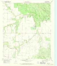
USGS Historical Quadrangle in GeoPDF.
Core Research Center, core R996, from well operated by ANADARKO PRODUCTIONRaw Properties from download, web scrape, MapServer, and Macrostrat API{"Lib Num": "R996", "API Num": "1513521943", "Operator": "ANADARKO PRODUCTION", "Well Name": "A-1 WEGELE", "Field": "WALNUT HILL ", "State": "KS", "County": "NESS", "Type": "SLABBED", "Photos": "T", "Thin Sec": "F", "Analysis": "F", "Latitude": "38.467737", "Longitude": "-99.754204", "coordinates_geohash": "9yc4f4c4y9fm", "Source": "FROM STATE RECORDS", "Security Flag": "NO SPECIAL RESTRICTIONS", "crc_collection_name": "core", "sb_parent_id": "4f4e49dae4b07f02db5e0486", "intervals": [{"Formation": "CHEROKEE", "Age": "PENN", "Min Depth": "4275", "Max Depth": "4311"}, {"Formation":...
Core Research Center, cutting BZ03843, from well operated by AMERADARaw Properties from download, web scrape, MapServer, and Macrostrat API{"Lib Num": "BZ03843", "API Num": "4011305000", "Operator": "AMERADA", "Well Name": "1 RED EAGLE", "Field": "WILDCAT", "State": "SD", "County": "SHANNON", "Thin Sec": "F", "Analysis": "F", "Latitude": "43.074385", "Longitude": "-102.916754", "coordinates_geohash": "9xwv416q3z65", "Source": "FROM STATE RECORDS", "Min": "25", "Max": "3370", "Security Flag": null, "crc_collection_name": "cutting", "sb_parent_id": "4f4e49d8e4b07f02db5df2d2", "intervals": [{"Formation": null, "Age": null, "Min Depth": null, "Max Depth": null}], "crcwc_url": "https://my.usgs.gov/crcwc/cutting/report/4069",...
Categories: Physical Item;
Tags: Late Cretaceous,
Niobrara Formation,
Niobrara Formation,
chalk,
sand,
Core Research Center, cutting BZ01696, from well operated by TEXAS COMPANYRaw Properties from download, web scrape, MapServer, and Macrostrat API{"Lib Num": "BZ01696", "API Num": "2506505129", "Operator": "TEXAS COMPANY", "Well Name": "1 F QUINNELL", "Field": "BIG WALL", "State": "MT", "County": "MUSSELSHELL", "Thin Sec": "F", "Analysis": "F", "Latitude": "46.6124368", "Longitude": "-108.3903882", "coordinates_geohash": "c86cjt890uh8", "Source": "FROM STATE RECORDS", "Min": "2000", "Max": "2965", "Security Flag": null, "crc_collection_name": "cutting", "sb_parent_id": "4f4e49d8e4b07f02db5df2d2", "intervals": [{"Formation": null, "Age": null, "Min Depth": null, "Max Depth": null}], "crcwc_url": "https://my.usgs.gov/crcwc/cutting/report/2110",...
Core Research Center, core D731, from well operated by APACHE CORPORATIONRaw Properties from download, web scrape, MapServer, and Macrostrat API{"Lib Num": "D731", "API Num": "4004720138", "Operator": "APACHE CORPORATION", "Well Name": "4-1 FEDERAL", "Field": "ALUM CREEK", "State": "SD", "County": "FALL RIVER", "Type": "SLABBED", "Photos": "F", "Thin Sec": "T", "Analysis": "T", "Latitude": "43.117808", "Longitude": "-103.997047", "coordinates_geohash": "9xwj33remjvr", "Source": "FROM STATE RECORDS", "Security Flag": "NO SPECIAL RESTRICTIONS", "crc_collection_name": "core", "sb_parent_id": "4f4e49dae4b07f02db5e0486", "intervals": [{"Formation": "LEO", "Age": "PENN", "Min Depth": "3346", "Max Depth": "3386"}], "crcwc_url":...
Categories: Physical Item;
Tags: LEO,
Late Cretaceous,
Niobrara Formation,
Niobrara Formation,
PENN,
Core Research Center, cutting BZ05492, from well operated by ACKMAN-SCHULEINRaw Properties from download, web scrape, MapServer, and Macrostrat API{"Lib Num": "BZ05492", "API Num": "4004720020", "Operator": "ACKMAN-SCHULEIN", "Well Name": "23-13 FED-MARTIN", "Field": "WILDCAT", "State": "SD", "County": "FALL RIVER", "Thin Sec": "F", "Analysis": "F", "Latitude": "43.248051", "Longitude": "-103.972991", "coordinates_geohash": "9xwn4114jtn9", "Source": "FROM STATE RECORDS", "Min": "0", "Max": "2730", "Security Flag": null, "crc_collection_name": "cutting", "sb_parent_id": "4f4e49d8e4b07f02db5df2d2", "intervals": [{"Formation": null, "Age": null, "Min Depth": null, "Max Depth": null}], "crcwc_url": "https://my.usgs.gov/crcwc/cutting/report/5967",...
Categories: Physical Item;
Tags: Late Cretaceous,
Niobrara Formation,
Niobrara Formation,
chalk,
sand,
Core Research Center, cutting BZ00599, from well operated by AMERADARaw Properties from download, web scrape, MapServer, and Macrostrat API{"Lib Num": "BZ00599", "API Num": "2506505169", "Operator": "AMERADA", "Well Name": "1 ED KLOS", "Field": "WAGON BOX", "State": "MT", "County": "MUSSELSHELL", "Thin Sec": "F", "Analysis": "F", "Latitude": "46.6206697", "Longitude": "-108.5132866", "coordinates_geohash": "c86c4xp114sz", "Source": "FROM STATE RECORDS", "Min": "310", "Max": "3274", "Security Flag": null, "crc_collection_name": "cutting", "sb_parent_id": "4f4e49d8e4b07f02db5df2d2", "intervals": [{"Formation": null, "Age": null, "Min Depth": null, "Max Depth": null}], "crcwc_url": "https://my.usgs.gov/crcwc/cutting/report/1036",...
Core Research Center, cutting BZ01789, from well operated by CARDINAL PET - L BARKERRaw Properties from download, web scrape, MapServer, and Macrostrat API{"Lib Num": "BZ01789", "API Num": "2506505387", "Operator": "CARDINAL PET - L BARKER", "Well Name": "15-13 NP", "Field": "WILDCAT MUSSELSHELL", "State": "MT", "County": "MUSSELSHELL", "Thin Sec": "F", "Analysis": "F", "Latitude": "46.7076914", "Longitude": "-108.5658437", "coordinates_geohash": "c86c9wbu02xx", "Source": "FROM STATE RECORDS", "Min": "120", "Max": "3175", "Security Flag": null, "crc_collection_name": "cutting", "sb_parent_id": "4f4e49d8e4b07f02db5df2d2", "intervals": [{"Formation": null, "Age": null, "Min Depth": null, "Max Depth": null}], "crcwc_url":...
This data set contains imagery from the National Agriculture Imagery Program (NAIP). The NAIP program is administered by USDA FSA and has been established to support two main FSA strategic goals centered on agricultural production. These are increase stewardship of America's natural resources while enhancing the environment, and to ensure commodities are procured and distributed effectively and efficiently to increase food security. The NAIP program supports these goals by acquiring and providing ortho imagery that has been collected during the agricultural growing season in the U.S. The NAIP ortho imagery is tailored to meet FSA requirements and is a fundamental tool used to support FSA farm and conservation programs....
Core Research Center, cutting BZ00753, from well operated by MILES JACKSONRaw Properties from download, web scrape, MapServer, and Macrostrat API{"Lib Num": "BZ00753", "API Num": "2506505241", "Operator": "MILES JACKSON", "Well Name": "1 EKERN", "Field": "DEVIL'S POCKET", "State": "MT", "County": "MUSSELSHELL", "Thin Sec": "F", "Analysis": "F", "Latitude": "46.6507224", "Longitude": "-108.938598", "coordinates_geohash": "c8693h924svy", "Source": "FROM STATE RECORDS", "Min": "300", "Max": "4060", "Security Flag": null, "crc_collection_name": "cutting", "sb_parent_id": "4f4e49d8e4b07f02db5df2d2", "intervals": [{"Formation": null, "Age": null, "Min Depth": null, "Max Depth": null}], "crcwc_url": "https://my.usgs.gov/crcwc/cutting/report/781",...
Core Research Center, cutting BZ02632, from well operated by HUSKYRaw Properties from download, web scrape, MapServer, and Macrostrat API{"Lib Num": "BZ02632", "API Num": "2501105148", "Operator": "HUSKY", "Well Name": "1 BUTTE CREEK-GOVT", "Field": "WILDCAT CARTER", "State": "MT", "County": "CARTER", "Thin Sec": "F", "Analysis": "F", "Latitude": "45.2104829", "Longitude": "-104.3367846", "coordinates_geohash": "c8jc1y260sye", "Source": "FROM STATE RECORDS", "Min": "170", "Max": "2590", "Security Flag": null, "crc_collection_name": "cutting", "sb_parent_id": "4f4e49d8e4b07f02db5df2d2", "intervals": [{"Formation": null, "Age": null, "Min Depth": null, "Max Depth": null}], "crcwc_url": "https://my.usgs.gov/crcwc/cutting/report/2882",...
Core Research Center, cutting BZ06395, from well operated by FARMERS UNION CENT EXCRaw Properties from download, web scrape, MapServer, and Macrostrat API{"Lib Num": "BZ06395", "API Num": "2511121045", "Operator": "FARMERS UNION CENT EXC", "Well Name": "12-16 STATE", "Field": "WILDCAT YELLOWSTONE, N", "State": "MT", "County": "YELLOWSTONE", "Thin Sec": "F", "Analysis": "F", "Latitude": "45.7461254", "Longitude": "-108.778432", "coordinates_geohash": "c84shxvfqzf5", "Source": "FROM STATE RECORDS", "Min": "470", "Max": "1360", "Security Flag": null, "crc_collection_name": "cutting", "sb_parent_id": "4f4e49d8e4b07f02db5df2d2", "intervals": [{"Formation": null, "Age": null, "Min Depth": null, "Max Depth": null}], "crcwc_url":...
Core Research Center, cutting HH01178, from well operated by TEXACO EXP & PRODRaw Properties from download, web scrape, MapServer, and Macrostrat API{"Lib Num": "HH01178", "API Num": "2500505007", "Operator": "TEXACO EXP & PROD", "Well Name": "1 DAVIES RANCH", "Field": "WILDCAT", "State": "MT", "County": "BLAINE", "Thin Sec": "F", "Analysis": "F", "Latitude": "48.2951866029", "Longitude": "-109.4030409376", "coordinates_geohash": "c8d4wrz5u7k1", "Source": "FROM STATE RECORDS", "Min": "115", "Max": "2403", "Security Flag": null, "crc_collection_name": "cutting", "sb_parent_id": "4f4e49d8e4b07f02db5df2d2", "intervals": [{"Formation": null, "Age": null, "Min Depth": null, "Max Depth": null}], "crcwc_url": "https://my.usgs.gov/crcwc/cutting/report/51445",...
Core Research Center, cutting BZ01881, from well operated by AMERICAN CLIMAX ET ALRaw Properties from download, web scrape, MapServer, and Macrostrat API{"Lib Num": "BZ01881", "API Num": "2506505298", "Operator": "AMERICAN CLIMAX ET AL", "Well Name": "35-3 HUBER", "Field": "WILDCAT MUSSELSHELL", "State": "MT", "County": "MUSSELSHELL", "Thin Sec": "F", "Analysis": "F", "Latitude": "46.6750585", "Longitude": "-108.5397338", "coordinates_geohash": "c86cd0gvbvs9", "Source": "FROM STATE RECORDS", "Min": "120", "Max": "2860", "Security Flag": null, "crc_collection_name": "cutting", "sb_parent_id": "4f4e49d8e4b07f02db5df2d2", "intervals": [{"Formation": null, "Age": null, "Min Depth": null, "Max Depth": null}], "crcwc_url":...
Core Research Center, cutting BZ01873, from well operated by MULE CREEKRaw Properties from download, web scrape, MapServer, and Macrostrat API{"Lib Num": "BZ01873", "API Num": "2500505010", "Operator": "MULE CREEK", "Well Name": "1 GORDON", "Field": "WILDCAT BLAINE", "State": "MT", "County": "BLAINE", "Thin Sec": "F", "Analysis": "F", "Latitude": "48.360175", "Longitude": "-109.202992", "coordinates_geohash": "c8d7558y3y52", "Source": "FROM STATE RECORDS", "Min": "0", "Max": "3040", "Security Flag": null, "crc_collection_name": "cutting", "sb_parent_id": "4f4e49d8e4b07f02db5df2d2", "intervals": [{"Formation": null, "Age": null, "Min Depth": null, "Max Depth": null}], "crcwc_url": "https://my.usgs.gov/crcwc/cutting/report/2024",...
Core Research Center, cutting BZ01518, from well operated by TEXACORaw Properties from download, web scrape, MapServer, and Macrostrat API{"Lib Num": "BZ01518", "API Num": "2506505171", "Operator": "TEXACO", "Well Name": "3 ZOERB", "Field": "BIG WALL", "State": "MT", "County": "MUSSELSHELL", "Thin Sec": "F", "Analysis": "F", "Latitude": "46.621453", "Longitude": "-108.3757694", "coordinates_geohash": "c86cjz5jts9p", "Source": "FROM STATE RECORDS", "Min": "2500", "Max": "3120", "Security Flag": null, "crc_collection_name": "cutting", "sb_parent_id": "4f4e49d8e4b07f02db5df2d2", "intervals": [{"Formation": null, "Age": null, "Min Depth": null, "Max Depth": null}], "crcwc_url": "https://my.usgs.gov/crcwc/cutting/report/1791",...
This data set contains imagery from the National Agriculture Imagery Program (NAIP). The NAIP program is administered by USDA FSA and has been established to support two main FSA strategic goals centered on agricultural production. These are increase stewardship of America's natural resources while enhancing the environment, and to ensure commodities are procured and distributed effectively and efficiently to increase food security. The NAIP program supports these goals by acquiring and providing ortho imagery that has been collected during the agricultural growing season in the U.S. The NAIP ortho imagery is tailored to meet FSA requirements and is a fundamental tool used to support FSA farm and conservation programs....
This data set contains imagery from the National Agriculture Imagery Program (NAIP). The NAIP program is administered by USDA FSA and has been established to support two main FSA strategic goals centered on agricultural production. These are increase stewardship of America's natural resources while enhancing the environment, and to ensure commodities are procured and distributed effectively and efficiently to increase food security. The NAIP program supports these goals by acquiring and providing ortho imagery that has been collected during the agricultural growing season in the U.S. The NAIP ortho imagery is tailored to meet FSA requirements and is a fundamental tool used to support FSA farm and conservation programs....
This data set contains imagery from the National Agriculture Imagery Program (NAIP). The NAIP program is administered by USDA FSA and has been established to support two main FSA strategic goals centered on agricultural production. These are increase stewardship of America's natural resources while enhancing the environment, and to ensure commodities are procured and distributed effectively and efficiently to increase food security. The NAIP program supports these goals by acquiring and providing ortho imagery that has been collected during the agricultural growing season in the U.S. The NAIP ortho imagery is tailored to meet FSA requirements and is a fundamental tool used to support FSA farm and conservation programs....
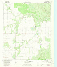
USGS Historical Quadrangle in GeoPDF.
|

|
