Filters: Tags: Zirconium (X)
34 results (36ms)|
Filters
Date Range
Extensions (Less) Types (Less)
Contacts (Less)
Categories (Less) Tag Types
|
The Critical Minerals in Archived Mine Samples Database (CMDB) contains chemistry and geologic information for historic ore and ore-related rock samples from mineral deposits in the United States. In addition, the database contains samples from archetypal deposits from 27 other countries in North America, South America, Asia, Africa and Europe. Samples were obtained from archived ore collections under the U.S. Geological Survey's project titled "Quick Assessment of Rare and Critical Metals in Ore Deposits: A National Assessment" (2008 to 2013) in an effort to begin an assessment of the Nations' previously mined ore deposits for critical minerals. Mineralized and altered rock samples were provided by the Colorado...
Categories: Data;
Types: ArcGIS REST Map Service,
ArcGIS Service Definition,
Downloadable,
Map Service,
OGC WFS Layer,
OGC WMS Layer,
Shapefile;
Tags: Alaska,
Argentina,
Arizona,
Arkansas,
Australia,
This U.S. Geological Survey (USGS) data release provides whole rock major, minor, and trace element geochemical data from the fluorine-rich Mount Emmons-Redwell porphyry molybdenum (Climax-type) deposit (Mt. Emmons-Redwell deposit), located approximately 5.6 km (3.5 mi) northwest of Crested Butte, Colorado. The Mt. Emmons-Redwell deposit partly underlies Redwell Basin on the northwest flank of Mount Emmons in the west-central region of the Colorado Mineral Belt. Mineralization of the Mt. Emmons-Redwell deposit occurs at depth as vein, veinlet, stockwork, and fracture-hosted Climax-type mineralization [308 Mt at 0.32% Mo (Galey, 1978; Guarnera and Anderson, 2007)], and is associated with the Mt. Emmons igneous complex....
Categories: Data;
Types: Downloadable,
Map Service,
OGC WFS Layer,
OGC WMS Layer,
Shapefile;
Tags: <1GB,
Climax-type deposit,
Colorado,
Colorado Mineral Belt,
Crested Butte,
From June to September 2017, the United States Geological Survey (USGS) collected a total of 116 surficial sediment and bedrock samples from abandoned mine wastepiles, ephemeral channels below wastepiles, nearby outcrops, and background areas representative of the undisturbed lithology on the western slope of the northern half of the Oquirrh Mountain Range, approximately 20 miles southwest of Salt Lake City, Utah. The sample locations can be spatially clustered into four groups: the Bates Canyon group in the foothills below Bates Canyon; the Middle Canyon group in Middle Canyon; the Ridgeline group within the Bingham Mining District located at or near the Tooele-Salt Lake County border on the Oquirrh Mountain ridge;...
Categories: Data;
Tags: Bates Canyon,
Bingham Mining District,
Economic Geology,
Environmental Health,
Geochemistry,
The point and polygon layers within this geodatabase present the global distribution of selected mineral resource features (deposits, mines, districts, mineral regions) for 22 minerals or mineral commodities considered critical to the economy and security of the United States as of 2017. These data complement the report by Schulz and others (2017) which provides national and global information on 23 critical minerals - antimony (Sb), barite (barium, Ba), beryllium (Be), cobalt (Co), fluorite or fluorspar (fluorine, F), gallium (Ga), germanium (Ge), graphite (carbon, C), hafnium (Hf), indium (In), lithium (Li), manganese (Mn), niobium (Nb), platinum-group elements (PGE), rare-earth elements (REE), rhenium (Re), selenium...
Categories: Data;
Types: ArcGIS REST Map Service,
ArcGIS Service Definition,
Downloadable,
Map Service;
Tags: Asia,
China,
Korea, Republic of,
USGS PP1802,
USGS Science Data Catalog (SDC),
The U.S. Geological Survey (USGS) has compiled a geodatabase containing mineral-related geospatial data for 19 countries of interest in the Indo-Pacific region (area of study): Bangladesh, Bhutan, Brunei, Burma, Fiji, Malaysia, Mongolia, Nauru, New Caledonia, New Zealand, Papua New Guinea, Philippines, Singapore, Solomon Islands, South Korea (Republic of Korea), Sri Lanka, Taiwan, Timor-Leste, and Vietnam. The data can be used in analyses of the extractive fuel and nonfuel mineral industries integral for the successful operation of the mineral industries within the area of study. This geodatabase reflects the USGS ongoing commitment to its mission of understanding the nature and distribution of global mineral commodity...
Types: Map Service,
OGC WFS Layer,
OGC WMS Layer,
OGC WMS Service;
Tags: Asia,
Bangladesh,
Bhutan,
Brunei,
Burma,
This location is part of the Arizona Mineral Industry Location System (AzMILS), an inventory of mineral occurences, prospects and mine locations in Arizona. LaPaz161 is located in T10N R18W Sec 18 C in the Black Peak - 15 Min quad. This collection consists of various reports, maps, records and related materials acquired by the Arizona Department of Mines and Mineral Resources regarding mining properties in Arizona. Information was obtained by various means, including the property owners, exploration companies, consultants, verbal interviews, field visits, newspapers and publications. Some sections may be redacted for copyright. Please see the access statement.
Re-analyses of sample pulps and bulk rejects from historic USBM rock and heavy-mineral-concentrate samples were conducted by the Alaska Division of Geological & Geophysical Surveys (DGGS) as part of the State of Alaska's Strategic and Critical Minerals Assessment project, which is designed to evaluate Alaska's potential for these resources. The objective of this resource assessment is to expand the state's geochemical database by obtaining and publishing modern, quantitative geochemical analyses for historic USBM samples, where available. Highlights of this re-analysis project include heavy mineral concentrates with up 7,220 ppm Sn, 5,870 ppm Cr, and 17,000 ppm Mn.
This U.S. Geological Survey (USGS) data release provides the descriptions of 11 U.S. sites that include mineral regions, mines, and mineral occurrences that contain enrichments of niobium (Nb). To be included in this data release, a site must have a contained resource and (or) past production of Nb metal greater than 10,000 metric tons, which was the approximate consumption of Nb in the U.S. in 2019 (U.S. Geological Survey, 2020). Sites in this dataset occur in Alaska, Arkansas, Colorado, Nebraska, and Texas. Niobium primarily occurs in oxide minerals of the pyrochlore group, which are most commonly found in carbonatites and alkaline granite-syenite complexes. Globally, the largest Nb deposits occur in Brazil and...
Categories: Data;
Types: ArcGIS REST Map Service,
ArcGIS Service Definition,
Downloadable,
Map Service;
Tags: Alaska,
Arkansas,
BLM,
Bureau of Land Management,
Colorado,
This U.S. Geological Survey (USGS) data release (ver. 1.2, April 2022) contains a set of previously unpublished geochemical data from project studies of primitive areas in central Idaho, including the Clear Creek-Upper Big Deer Creek Area, the Salmon River Breaks and Sawtooth Primitive Areas, and the Gospel-Hump Wilderness Area. The purpose of the USGS Idaho Primitive Area studies, conducted from 1966 to 1984, was to describe the geology, determine petrologic and geochemical characteristics, and evaluate the mineral resource potential of these primitive areas and adjacent study areas. In the case of the Idaho Primitive Area study (Cater and others, 1973), the primitive area covers 1,915 square miles; adjacent...
Categories: Data,
Data Release - Revised;
Types: Downloadable,
Map Service,
OGC WFS Layer,
OGC WMS Layer,
Shapefile;
Tags: Big Deer Creek,
Bitterroot National Forest,
Blaine County,
Boise County,
Boise National Forest,
In response to Executive Order 13817 of December 20, 2017, the U.S. Geological Survey (USGS) coordinated with the Bureau of Land Management (BLM) to identify 36 nonfuel minerals or mineral materials considered critical to the economic and national security of the United States (U.S.) (https://pubs.usgs.gov/of/2018/1021/ofr20181021.pdf). Acquiring information on possible domestic sources of these critical minerals is the rationale for the USGS Earth Mapping Resources Initiative (Earth MRI). The program, which partners the USGS with State Geological Surveys, Federal agencies, and the private sector, aims to collect new geological, geophysical, and topographic (lidar) data in key areas of the U.S. to stimulate mineral...
This data release contains the U.S. salient statistics and world production data extracted from the ZIRCONIUM AND HAFNIUM data sheet of the USGS Mineral Commodity Summaries 2023.
The U.S. Geological Survey (USGS) has compiled a geodatabase containing mineral-related geospatial data for the People's Republic of China. The data can be used in analyses of the extractive fuel and nonfuel mineral industries and related economic and physical infrastructure integral for the successful operation of the mineral industries within the area of study as well as the movement of mineral products across domestic and global markets. This geodatabase reflects the USGS ongoing commitment to its mission of understanding the nature and distribution of global mineral commodity supply chains by updating and publishing the georeferenced locations of mineral commodity production and processing facilities, mineral...
The U.S. Geological Survey (USGS) has undertaken a mineral resources assessment for tungsten for a portion of the Great Basin in parts of western Nevada and east-central California. This data release provides the Great Basin Tungsten Database: the geospatial and geologic data, and results of chemical analyses for 46,955 samples collected in the assessment area, extracted from the USGS National Geochemical Database. These rock records were collected as part of various programs and projects at the USGS and analyzed from 1963 to 2015. The database represents rock records, each comprising one best value chemical determination for each analyzed chemical species, that include skarns, carbonate lithologies (for example,...
Categories: Data;
Types: Downloadable,
Map Service,
OGC WFS Layer,
OGC WMS Layer,
Shapefile;
Tags: California,
GGGSC,
Geology, Geophysics, and Geochemistry Science Center,
Great Basin,
MRP,
The U.S. Geological Survey (USGS) has compiled a geodatabase containing mineral-related geospatial data for 10 countries of interest in Southwest Asia (area of study): Afghanistan, Cambodia, Laos, India, Indonesia, Iran, Nepal, North Korea, Pakistan, and Thailand. The data can be used in analyses of the extractive fuel and nonfuel mineral industries and related economic and physical infrastructure integral for the successful operation of the mineral industries within the area of study as well as the movement of mineral products across domestic and global markets. This geodatabase reflects the USGS ongoing commitment to its mission of understanding the nature and distribution of global mineral commodity supply chains...
This data release contains the U.S. salient statistics and world production data extracted from the ZIRCONIUM AND HAFNIUM data sheet of the USGS Mineral Commodity Summaries 2024.
Compilation of Geospatial Data (GIS) for the Mineral Industries and Related Infrastructure of Africa
This geodatabase reflects the U.S. Geological Survey’s (USGS) ongoing commitment to its mission of understanding the nature and distribution of global mineral commodity supply chains by updating and publishing the georeferenced locations of mineral commodity production and processing facilities, mineral exploration and development sites, and mineral commodity exporting ports in Africa. The geodatabase and geospatial data layers serve to create a new geographic information product in the form of a geospatial portable document format (PDF) map. The geodatabase contains data layers from USGS, foreign governmental, and open-source sources as follows: (1) mineral production and processing facilities, (2) mineral exploration...
This U.S. Geological Survey (USGS) data release provides the descriptions of the only U.S. sites—including mineral regions, mineral occurrences, and mine features—that have reported production and (or) resources of gallium (Ga). The sites in this data release have contained resource and (or) past production of more than 16 metric tons Ga metal, which was the approximate average annual consumption of Ga in the U.S. from 2016 through 2020. This dataset contains the Round Top deposit in Texas and the Apex deposit in Utah. Gallium occurs in many different minerals and rocks where substitution takes place with elements of similar size, such as zinc, or similar charge, such as aluminum. Therefore, Ga is primarily recovered...
Categories: Data;
Types: ArcGIS REST Map Service,
ArcGIS Service Definition,
Downloadable,
Map Service;
Tags: Apex,
BLM,
Bureau of Land Management,
DOI,
Department of the Interior,
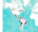
This data set consists of records for over 900 mineral facilities in Latin America and Canada. The mineral facilities include mines, plants, smelters, or refineries of aluminum, cement, coal, copper, diamond, gold, iron and steel, nickel, platinum-group metals, salt, and silver, among others. Records include attributes such as commodity, country, location, company name, facility type and capacity if applicable, and generalized coordinates. The data were compiled from multiple sources, including the 2003 and 2004 USGS Minerals Yearbooks (Latin America and Candada volume), data to be published in the 2005 Minerals Yearbook Latin America and Canada Volume, minerals statistics and information from the USGS minerals...
This data release provides multi-element data for drill core samples from the Mesoproterozoic Nonesuch Formation and Copper Harbor Conglomerate at the Copperwood copper deposit, Michigan, USA. Copper was determined by assay, and sulfur by inductively coupled plasma-optical emission spectrometry (ICP-OES) after aqua regia digestion for most samples. Multi-element whole rock analyses were determined for selected samples. The Copperwood copper deposit is a sediment-hosted stratiform copper deposit in the Presque Isle Syncline of the Upper Peninsula of Michigan. The deposit has a 2018 mineral resource estimate of 42.2 million metric tons (Mt) of measured plus indicated mineral resources in the Lower Copper Bearing Sequence...
Categories: Data;
Tags: Copper Harbor Conglomerate,
Copperwood copper deposit,
Michigan,
NGDB,
National Geochemical Database,

This dataset consists of records for over 1,500 mineral facilities in Africa and the Middle East. The mineral facilities include mines, plants, mills , or refineries of aluminum, cement, coal, copper, diamond, gold, iron and steel, nickel, platinum-group metals, salt, and silver, among others. Records include attributes such as commodity, country, site, company name, plant capacity if applicable, and generalized coordinates. The data were compiled from multiple sources, including the 2004 USGS Minerals Yearbook (Africa and Middle East volume), minerals statistics and information from the USGS minerals information Web site (http://minerals.usgs.gov/minerals/), and data collected by USGS minerals information country...
|

|
