Filters: Tags: Wallops Island (X)
30 results (112ms)|
Filters
Date Range
Extensions Types Contacts
Categories Tag Types Tag Schemes |
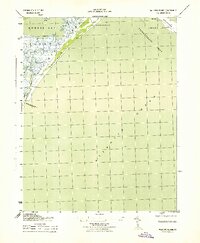
USGS Historical Quadrangle in GeoPDF.
Understanding how sea-level rise will affect coastal landforms and the species and habitats they support is critical for crafting approaches that balance the needs of humans and native species. Given this increasing need to forecast sea-level rise effects on barrier islands in the near and long terms, we are developing Bayesian networks to evaluate and to forecast the cascading effects of sea-level rise on shoreline change, barrier island state, and piping plover habitat availability. We use publicly available data products, such as lidar, orthophotography, and geomorphic feature sets derived from those, to extract metrics of barrier island characteristics at consistent sampling distances. The metrics are then incorporated...
Categories: Data;
Types: Downloadable,
Map Service,
OGC WFS Layer,
OGC WMS Layer,
Shapefile;
Tags: Assawoman Island,
Assawoman Island,
Atlantic Ocean,
Barrier Island,
CMHRP,
Geologic structure and isopach maps were constructed by interpreting over 19,890 trackline kilometers of co-located multichannel boomer, sparker and chirp seismic reflection profiles from the continental shelf of the Delmarva Peninsula, including Maryland and Virginia state waters. In this region, Brothers and others (2020) interpret 12 seismic units and 11 regional unconformities. They interpret the infilled channels as Late Tertiary and Quaternary courses of the Susquehanna, Potomac, Rappahannock, York and James Rivers and tributaries, in addition to a broad drainage system. These regional unconformities form a composite unconformity interpreted as the Quaternary-Tertiary (Q-T) unconformity. A depth to Tertiary...
Categories: Data;
Types: Downloadable,
GeoTIFF,
Map Service,
Raster;
Tags: 32-bit GeoTIFF,
Applied Acoustics S-Boom Source,
Assateague Island,
Assateague Island National Seashore,
Atlantic Ocean,
These data are a qualitatively derived interpretive polygon shapefile defining surficial sediment type and distribution, and geomorphology, for nearly 1,400 square kilometers of sea floor on the inner-continental shelf from Fenwick Island, Maryland to Fisherman’s Island, Virginia, USA. These data are classified according to Barnhardt and others (1998) bottom-type classification system, which was modified to highlight changes in secondary sediment-types such as mud and gravel across this primarily sandy shelf. Most of the geophysical and sample data used to create this interpretive layer were collected as part of the Linking Coastal Processes and Vulnerability: Assateague Island Regional Study project (GS2-2C), supported...
Categories: Data;
Types: Downloadable,
Map Service,
OGC WFS Layer,
OGC WMS Layer,
Shapefile;
Tags: Assateague Island,
Assateague Island National Seashore,
Assawoman Island,
Atlantic Ocean,
Backscatter,
Understanding how sea-level rise will affect coastal landforms and the species and habitats they support is critical for crafting approaches that balance the needs of humans and native species. Given this increasing need to forecast sea-level rise effects on barrier islands in the near and long terms, we are developing Bayesian networks to evaluate and to forecast the cascading effects of sea-level rise on shoreline change, barrier island state, and piping plover habitat availability. We use publicly available data products, such as lidar, orthophotography, and geomorphic feature sets derived from those, to extract metrics of barrier island characteristics at consistent sampling distances. The metrics are then incorporated...
Categories: Data;
Types: Downloadable,
GeoTIFF,
Map Service,
OGC WFS Layer,
OGC WMS Layer,
Raster,
Shapefile;
Tags: Assawoman Island,
Assawoman Island,
Atlantic Ocean,
Barrier Island,
Bayesian Network,
Understanding how sea-level rise will affect coastal landforms and the species and habitats they support is critical for crafting approaches that balance the needs of humans and native species. Given this increasing need to forecast sea-level rise effects on barrier islands in the near and long terms, we are developing Bayesian networks to evaluate and to forecast the cascading effects of sea-level rise on shoreline change, barrier island state, and piping plover habitat availability. We use publicly available data products, such as lidar, orthophotography, and geomorphic feature sets derived from those, to extract metrics of barrier island characteristics at consistent sampling distances. The metrics are then incorporated...
Categories: Data;
Types: Downloadable,
GeoTIFF,
Map Service,
Raster;
Tags: Assawoman Island,
Assawoman Island,
Atlantic Ocean,
CMHRP,
Coastal Habitat,
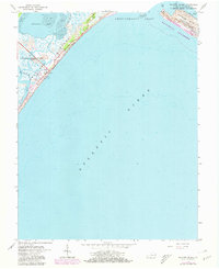
USGS Historical Quadrangle in GeoPDF.
This data release contains coastal wetland synthesis products for the Atlantic-facing Eastern Shore of Virginia (the data release for the Chesapeake Bay-facing portion of the Eastern Shore of Virginia is found here: https://doi.org/10.5066/P997EJYB). Metrics for resiliency, including unvegetated to vegetated ratio (UVVR), marsh elevation, and tidal range are calculated for smaller units delineated from a digital elevation model, providing the spatial variability of physical factors that influence wetland health. The U.S. Geological Survey has been expanding national assessment of coastal change hazards and forecast products to coastal wetlands with the intent of providing federal, state, and local managers with...
The salt marsh complex of Assateague Island National Seashore (ASIS) and Chincoteague Bay was delineated to smaller, conceptual marsh units by geoprocessing of surface elevation data. Flow accumulation based on the relative elevation of each location is used to determine the ridge lines that separate each marsh unit while the surface slope is used to automatically assign each unit a drainage point, where water is expected to drain through. Through scientific efforts initiated with the Hurricane Sandy Science Plan, the U.S. Geological Survey has been expanding national assessment of coastal change hazards and forecast products to coastal wetlands, including the Assateague Island National Seashore and Chincoteague...
Categories: Data;
Types: Downloadable,
Map Service,
OGC WFS Layer,
OGC WMS Layer,
Shapefile;
Tags: Accomack County,
Assateague Island National Seashore,
Assateague State Park,
Atlantic Ocean,
Chincoteague Bay,
Understanding how sea-level rise will affect coastal landforms and the species and habitats they support is critical for crafting approaches that balance the needs of humans and native species. Given this increasing need to forecast sea-level rise effects on barrier islands in the near and long terms, we are developing Bayesian networks to evaluate and to forecast the cascading effects of sea-level rise on shoreline change, barrier island state, and piping plover habitat availability. We use publicly available data products, such as lidar, orthophotography, and geomorphic feature sets derived from those, to extract metrics of barrier island characteristics at consistent sampling distances. The metrics are then incorporated...
Categories: Data;
Types: Downloadable,
Map Service,
OGC WFS Layer,
OGC WMS Layer,
Shapefile;
Tags: Assawoman Island,
Assawoman Island,
Atlantic Ocean,
Barrier Island,
CMHRP,
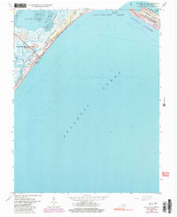
USGS Historical Quadrangle in GeoPDF.
This data release contains coastal wetland synthesis products for the Atlantic-facing Eastern Shore of Virginia (the data release for the Chesapeake Bay-facing portion of the Eastern Shore of Virginia is found here: https://doi.org/10.5066/P997EJYB). Metrics for resiliency, including unvegetated to vegetated ratio (UVVR), marsh elevation, and tidal range are calculated for smaller units delineated from a digital elevation model, providing the spatial variability of physical factors that influence wetland health. The U.S. Geological Survey has been expanding national assessment of coastal change hazards and forecast products to coastal wetlands with the intent of providing federal, state, and local managers with...
Biomass production is positively correlated with mean tidal range in salt marshes along the Atlantic coast of the United States of America. Recent studies support the idea that enhanced stability of the marshes can be attributed to increased vegetative growth due to increased tidal range. This dataset displays the spatial variation of mean tidal range (i.e. Mean Range of Tides, MN) in the Assateague Island National Seashore and Chincoteague Bay based on conceptual marsh units defined by Defne and Ganju (2018). MN was based on the calculated difference in height between mean high water (MHW) and mean low water (MLW) using the VDatum (v3.5) database ( http://vdatum.noaa.gov/ ). Through scientific efforts initiated...
Categories: Data;
Types: Downloadable,
Map Service,
OGC WFS Layer,
OGC WMS Layer,
Shapefile;
Tags: Accomack County,
Assateague Island National Seashore,
Assateague State Park,
Atlantic Ocean,
Chincoteague Bay,
Elevation distribution in the Assateague Island National Seashore (ASIS) salt marsh complex and Chincoteague Bay is given in terms of mean elevation of conceptual marsh units defined by Defne and Ganju (2018). The elevation data is based on the 1-meter resolution Coastal National Elevation Database (CoNED). Through scientific efforts initiated with the Hurricane Sandy Science Plan, the U.S. Geological Survey has been expanding national assessment of coastal change hazards and forecast products to coastal wetlands, including the Assateague Island National Seashore and Chincoteague Bay salt marshes, with the intent of providing Federal, State, and local managers with tools to estimate the vulnerability and ecosystem...
Categories: Data;
Types: Downloadable,
Map Service,
OGC WFS Layer,
OGC WMS Layer,
Shapefile;
Tags: Accomack County,
Assateague Island National Seashore,
Assateague State Park,
Atlantic Ocean,
Chincoteague Bay,
Understanding how sea-level rise will affect coastal landforms and the species and habitats they support is critical for crafting approaches that balance the needs of humans and native species. Given this increasing need to forecast sea-level rise effects on barrier islands in the near and long terms, we are developing Bayesian networks to evaluate and to forecast the cascading effects of sea-level rise on shoreline change, barrier island state, and piping plover habitat availability. We use publicly available data products, such as lidar, orthophotography, and geomorphic feature sets derived from those, to extract metrics of barrier island characteristics at consistent sampling distances. The metrics are then incorporated...
Categories: Data;
Types: Downloadable,
GeoTIFF,
Map Service,
Raster;
Tags: Assawoman Island,
Assawoman Island,
Atlantic Ocean,
Barrier Island,
CMHRP,
Unvegetated to vegetated marsh ratio (UVVR) in the Assateague Island National Seashore and Chincoteague Bay is computed based on conceptual marsh units defined by Defne and Ganju (2018). UVVR was calculated based on U.S. Department of Agriculture National Agriculture Imagery Program (NAIP) 1-meter resolution imagery. Through scientific efforts initiated with the Hurricane Sandy Science Plan, the U.S. Geological Survey has been expanding national assessment of coastal change hazards and forecast products to coastal wetlands, including the Assateague Island National Seashore and Chincoteague Bay salt marshes, with the intent of providing Federal, State, and local managers with tools to estimate the vulnerability and...
Categories: Data;
Types: Downloadable,
Map Service,
OGC WFS Layer,
OGC WMS Layer,
Shapefile;
Tags: Accomack County,
Assateague Island National Seashore,
Assateague State Park,
Atlantic Ocean,
Chincoteague Bay,
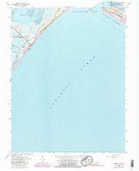
USGS Historical Quadrangle in GeoPDF.
USGS Historical Quadrangle in GeoPDF.
|

|
