Filters: Tags: WOPR (Western Oregon Plan Revision) (X)
18 results (60ms)|
Filters
Contacts
(Less)
|

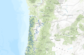
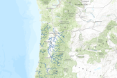
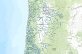
The geographic distribution of stream reaches with potential to support high quality habitat for salmonids has bearing on the actual status of habitats and populations over broad spatial extents. As part of the Coastal Landscape Analysis and Modeling Study (CLAMS), we examined how salmon-habitat potential was distributed relative to current and future (+100 years) landscape characteristics in the Coastal Province of Oregon, USA. The intrinsic potential to provide high-quality rearing habitat was modeled for juvenile coho salmon (Oncorhynchus kisutch) and juvenile steelhead (O. mykiss) based on stream flow, valley constraint, and stream gradient. Â See Supplemental Information for additional detail. BLM: (Bureau...

These data describe areas of suitable habitat believed to be used (currently and historically) by wild, natural, and/or hatchery fish populations. The term "currently" is defined as within the past five reproductive cycles. See the 'USETYPE' field description to differentiate between current and historic distribution. This information is based on extensive surveys, the best professional judgment of ODFW staff biologists and where possible, the professional opinions of staff from other natural resource agencies. Due to natural variations in run size, water conditions, or other environmental factors, some areas displayed may not be used by a species of fish on an annual basis. The Natural Resources Information Management...
Outstanding Natural Areas within Western Oregon. This theme represents the third iteration of the effort to arrive at a preferred approach to the management of the recreation resource. This theme reflects the management approach approved in the Record of Decision.BLM (Bureau of Land Management), WOPR (Western Oregon Plan Revision) ADS (Automated Digitizing System), MOSS (Map Overlay Statistical System) PRMP (Proposed Resource Management Plan) This data is a PRMP release version of the data. The original name of the dataset is:lup_aa_a_ona_poly

This dataset represents Elk Management Areas in Oregon compiled for the U.S Bureau of Land Management's Western Oregon Plan Revision.
This layer shows potential trails within the Western Oregon Plan Revision boundary.BLM (Bureau of Land Management), WOPR (Western Oregon Plan Revision) PRMP: Proposed Resource Management Plan This data is a PRMP release version of the data. The original name of the dataset is:rec_m4c_c_ptrails_arc

The geographic distribution of stream reaches with potential to support high quality habitat for salmonids has bearing on the actual status of habitats and populations over broad spatial extents. As part of the Coastal Landscape Analysis and Modeling Study (CLAMS), we examined how salmon-habitat potential was distributed relative to current and future (+100 years) landscape characteristics in the Coastal Province of Oregon, USA. The intrinsic potential to provide high-quality rearing habitat was modeled for juvenile coho salmon (Oncorhynchus kisutch) and juvenile steelhead (O. mykiss) based on stream flow, valley constraint, and stream gradient. See Supplemental Information for additional detail.<br /><br />BLM:...
These data describe areas of suitable habitat believed to be used (currently and historically) by wild, natural, and/or hatchery fish populations. The term "currently" is defined as within the past five reproductive cycles. See the 'USETYPE' field description to differentiate between current and historic distribution. This information is based on extensive surveys, the best professional judgment of ODFW staff biologists and where possible, the professional opinions of staff from other natural resource agencies. Due to natural variations in run size, water conditions, or other environmental factors, some areas displayed may not be used by a species of fish on an annual basis. The Natural Resources Information Management...

This dataset depicts Marbled Murrelet Habitat within Western Oregon, compiled for the U.S. Bureau of Land Management's Western Oregon Plan Revision project. No additional metadata describing the methods used to determine habitat was available from the BLM.
This layer is line representation of Scenic and Recreational River segments of Wild and Scenic Rivers within Western Oregon.BLM (Bureau of Land Management), WOPR (Western Oregon Plan Revision) PRMP (Proposed Resource Management Plan) This data is a PRMP release version of the data. The original name of the dataset is:lup_aa_a_wsr_arc

The geographic distribution of stream reaches with potential to support high quality habitat for salmonids has bearing on the actual status of habitats and populations over broad spatial extents. As part of the Coastal Landscape Analysis and Modeling Study (CLAMS), we examined how salmon-habitat potential was distributed relative to current and future (+100 years) landscape characteristics in the Coastal Province of Oregon, USA. The intrinsic potential to provide high-quality rearing habitat was modeled for juvenile coho salmon (Oncorhynchus kisutch) and juvenile steelhead (O. mykiss) based on stream flow, valley constraint, and stream gradient. See Supplemental Information for additional detail.<br /><br />BLM...
This layer is polygon representation of Scenic and Recreational River segments of Wild and Scenic Rivers within Western Oregon.BLM (Bureau of Land Management), WOPR (Western Oregon Plan Revision) PRMP (Proposed Resource Management Plan) This data is a PRMP release version of the data. The original name of the dataset is:lup_aa_a_wsr_poly.
These data describe areas of suitable habitat believed to be used (currently and historically) by wild, natural, and/or hatchery fish populations. The term "currently" is defined as within the past five reproductive cycles. See the 'USETYPE' field description to differentiate between current and historic distribution. This information is based on extensive surveys, the best professional judgment of ODFW staff biologists and where possible, the professional opinions of staff from other natural resource agencies. Due to natural variations in run size, water conditions, or other environmental factors, some areas displayed may not be used by a species of fish on an annual basis. The Natural Resources Information Management...

These data describe areas of suitable habitat believed to be used (currently and historically) by wild, natural, and/or hatchery fish populations. The term "currently" is defined as within the past five reproductive cycles. See the 'USETYPE' field description to differentiate between current and historic distribution. This information is based on extensive surveys, the best professional judgment of ODFW staff biologists and where possible, the professional opinions of staff from other natural resource agencies. Due to natural variations in run size, water conditions, or other environmental factors, some areas displayed may not be used by a species of fish on an annual basis. The Natural Resources Information Management...
These data describe areas of suitable habitat believed to be used (currently and historically) by wild, natural, and/or hatchery fish populations. The term "currently" is defined as within the past five reproductive cycles. See the 'USETYPE' field description to differentiate between current and historic distribution. This information is based on extensive surveys, the best professional judgment of ODFW staff biologists and where possible, the professional opinions of staff from other natural resource agencies. Due to natural variations in run size, water conditions, or other environmental factors, some areas displayed may not be used by a species of fish on an annual basis. The Natural Resources Information Management...

These data describe areas of suitable habitat believed to be used (currently and historically) by wild, natural, and/or hatchery fish populations. The term "currently" is defined as within the past five reproductive cycles. See the 'USETYPE' field description to differentiate between current and historic distribution. This information is based on extensive surveys, the best professional judgment of ODFW staff biologists and where possible, the professional opinions of staff from other natural resource agencies. Due to natural variations in run size, water conditions, or other environmental factors, some areas displayed may not be used by a species of fish on an annual basis. The Natural Resources Information Management...

Proposed Areas Of Critical Environmental Concern within Western Oregon as defined for the Proposed Resource Management Plan (PRMP).BLM (Bureau of Land Management), WOPR (Western Oregon Plan Revision) WOPR Theme Group: LUP (Land Use Planning) WOPR Phase: PRMP (Proposed Resource Management Plan) This data is a PRMP release version of the data lup_m4c_c_pacec_poly.
Off-Highway Vehicle (OHV) areas within the Western Oregon Plan Revision (WOPR) area.BLM (Bureau of Land Management), WOPR (Western Oregon Plan Revision) OHV (Off-Highway Vehicle) PRMP (Proposed Resource Management Plan This data is a PRMP release version of the data. The original name of the dataset is:rec_m4c_ohv_poly
Marbled Murrelet Critical Habitat within Western Oregon for the Western Oregon Plan Revision Project (WOPR). This theme depicts lands designated as critical habitat under section 4 of the Endangered Species Act for the marbled murrelet in the states of Washington, Oregon, and California.BLM: (Bureau of Land Management) WOPR: (Western Oregon Plan Revision Project) WLD: (Wildlife) PRMP: (Proposed Resource Management Plan) The CHU (Critical Habitat Units) have been modified for use and analysis for WOPR. This data does not constitute legal description of designated critical habitat for the marbled murrelet. For legal descriptions of murrelet critical habitat, refer to the descriptions contained in the FEDERAL REGISTER...
|

|
