Filters: Tags: WILCOX (X)
367 results (106ms)|
Filters
Date Range
Extensions Types Contacts
Categories Tag Types Tag Schemes |
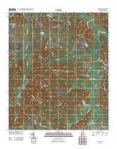
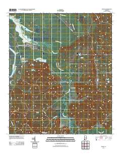
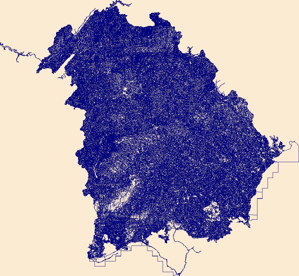
This data set contains imagery from the National Agriculture Imagery Program (NAIP). The NAIP program is administered by USDA FSA and has been established to support two main FSA strategic goals centered on agricultural production. These are, increase stewardship of America's natural resources while enhancing the environment, and to ensure commodities are procured and distributed effectively and efficiently to increase food security. The NAIP program supports these goals by acquiring and providing ortho imagery that has been collected during the agricultural growing season in the U.S. The NAIP ortho imagery is tailored to meet FSA requirements and is a fundamental tool used to support FSA farm and conservation programs....
This data set contains imagery from the National Agriculture Imagery Program (NAIP). The NAIP program is administered by USDA FSA and has been established to support two main FSA strategic goals centered on agricultural production. These are, increase stewardship of America's natural resources while enhancing the environment, and to ensure commodities are procured and distributed effectively and efficiently to increase food security. The NAIP program supports these goals by acquiring and providing ortho imagery that has been collected during the agricultural growing season in the U.S. The NAIP ortho imagery is tailored to meet FSA requirements and is a fundamental tool used to support FSA farm and conservation programs....
This data set contains imagery from the National Agriculture Imagery Program (NAIP). The NAIP program is administered by USDA FSA and has been established to support two main FSA strategic goals centered on agricultural production. These are, increase stewardship of America's natural resources while enhancing the environment, and to ensure commodities are procured and distributed effectively and efficiently to increase food security. The NAIP program supports these goals by acquiring and providing ortho imagery that has been collected during the agricultural growing season in the U.S. The NAIP ortho imagery is tailored to meet FSA requirements and is a fundamental tool used to support FSA farm and conservation programs....
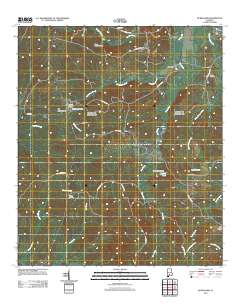
Layered GeoPDF 7.5 Minute Quadrangle Map. Layers of geospatial data include orthoimagery, roads, grids, geographic names, elevation contours, hydrography, and other selected map features.
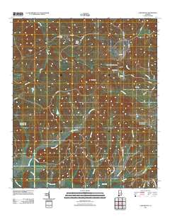
Layered GeoPDF 7.5 Minute Quadrangle Map. Layers of geospatial data include orthoimagery, roads, grids, geographic names, elevation contours, hydrography, and other selected map features.
Layered GeoPDF 7.5 Minute Quadrangle Map. Layers of geospatial data include orthoimagery, roads, grids, geographic names, elevation contours, hydrography, and other selected map features.
Layered GeoPDF 7.5 Minute Quadrangle Map. Layers of geospatial data include orthoimagery, roads, grids, geographic names, elevation contours, hydrography, and other selected map features.
Layered GeoPDF 7.5 Minute Quadrangle Map. Layers of geospatial data include orthoimagery, roads, grids, geographic names, elevation contours, hydrography, and other selected map features.
Layered GeoPDF 7.5 Minute Quadrangle Map. Layers of geospatial data include orthoimagery, roads, grids, geographic names, elevation contours, hydrography, and other selected map features.
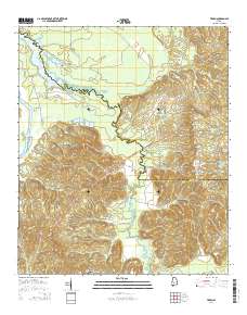
Layered GeoPDF 7.5 Minute Quadrangle Map. Layers of geospatial data include orthoimagery, roads, grids, geographic names, elevation contours, hydrography, and other selected map features.

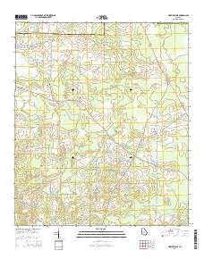
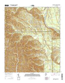
USGS Historical Quadrangle in GeoPDF.
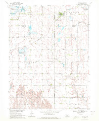
USGS Historical Quadrangle in GeoPDF.
Core Research Center, cutting HH01881, from well operated by PIONEER NATURAL RESOURCESRaw Properties from download, web scrape, MapServer, and Macrostrat API{"Lib Num": "HH01881", "API Num": "4201334323", "Operator": "PIONEER NATURAL RESOURCES", "Well Name": "EDMUND TOM 02 01 PILOT", "Field": "EAGLEVILLE", "State": "TX", "County": "ATASCOSA", "Thin Sec": "F", "Analysis": "F", "Latitude": "28.72015", "Longitude": "-98.2812", "coordinates_geohash": "9v457s3g4018", "Source": "PROVIDED BY DONOR", "Min": "900", "Max": "10690", "Security Flag": "NO SPECIAL RESTRICTIONS", "crc_collection_name": "cutting", "sb_parent_id": "4f4e49d8e4b07f02db5df2d2", "intervals": [{"Formation": "NAVARRO", "Age": "CRETACEOUS", "Min Depth":...
Core Research Center, cutting HH01883, from well operated by PIONEER NATURAL RESOURCESRaw Properties from download, web scrape, MapServer, and Macrostrat API{"Lib Num": "HH01883", "API Num": "4201334322", "Operator": "PIONEER NATURAL RESOURCES", "Well Name": "EDMUND TOM 01 01 P/H", "Field": "EAGLEVILLE", "State": "TX", "County": "ATASCOSA", "Thin Sec": "F", "Analysis": "F", "Latitude": "28.696978", "Longitude": "-98.295219", "coordinates_geohash": "9v4570ps52km", "Source": "PROVIDED BY DONOR", "Min": "10000", "Max": "15620", "Security Flag": "NO SPECIAL RESTRICTIONS", "crc_collection_name": "cutting", "sb_parent_id": "4f4e49d8e4b07f02db5df2d2", "intervals": [{"Formation": "GEORGETOWN", "Age": "CRETACEOUS", "Min...
Core Research Center, cutting HH01913, from well operated by PIONEER NATURAL RESOURCESRaw Properties from download, web scrape, MapServer, and Macrostrat API{"Lib Num": "HH01913", "API Num": "4229735039", "Operator": "PIONEER NATURAL RESOURCES", "Well Name": "H HARLAN BETHUNE 01 02H", "Field": "EAGLEVILLE", "State": "TX", "County": "LIVE OAK", "Thin Sec": "F", "Analysis": "F", "Latitude": "28.59905", "Longitude": "-98.26693", "coordinates_geohash": "9v44eyk1w964", "Source": "PROVIDED BY DONOR", "Min": "2732", "Max": "16670", "Security Flag": "NO SPECIAL RESTRICTIONS", "crc_collection_name": "cutting", "sb_parent_id": "4f4e49d8e4b07f02db5df2d2", "intervals": [{"Formation": "EAGLE FORD", "Age": "CRETACEOUS", "Min...
The National Hydrography Dataset (NHD) is a feature-based database that interconnects and uniquely identifies the stream segments or reaches that make up the nation's surface water drainage system. NHD data was originally developed at 1:100,000-scale and exists at that scale for the whole country. This high-resolution NHD, generally developed at 1:24,000/1:12,000 scale, adds detail to the original 1:100,000-scale NHD. (Data for Alaska, Puerto Rico and the Virgin Islands was developed at high-resolution, not 1:100,000 scale.) Local resolution NHD is being developed where partners and data exist. The NHD contains reach codes for networked features, flow direction, names, and centerline representations for areal water...
The Apparent Wilcox Group thickness maps are contoured from location and top information derived from the Petroleum Information (PI) Wells database. The Wilcox apparent thickness map was constructed by searching for Wilcox and Midway Group tops. Apparent thickness is computed by subtracting Midway top from the Wilcox top. Geographic control is superimposed on the maps from USGS state line, county, elevation and other data files. The veracity of the PI Wells database is being checked by comparison to published cross sections and geologic maps. Interpretation of the depth to Wilcox and apparent thickness maps along with published measured sections and cross sections indicates that portions of Texas, Louisiana, Mississippi...
Categories: Data,
pre-SM502.8;
Types: Downloadable,
Map Service,
OGC WFS Layer,
OGC WMS Layer,
Shapefile;
Tags: 47 = Western Gulf,
48 = East Texas Basin,
49 = Louisiana-Mississippi Salt Basins,
50 = Florida Peninsula,
AL,
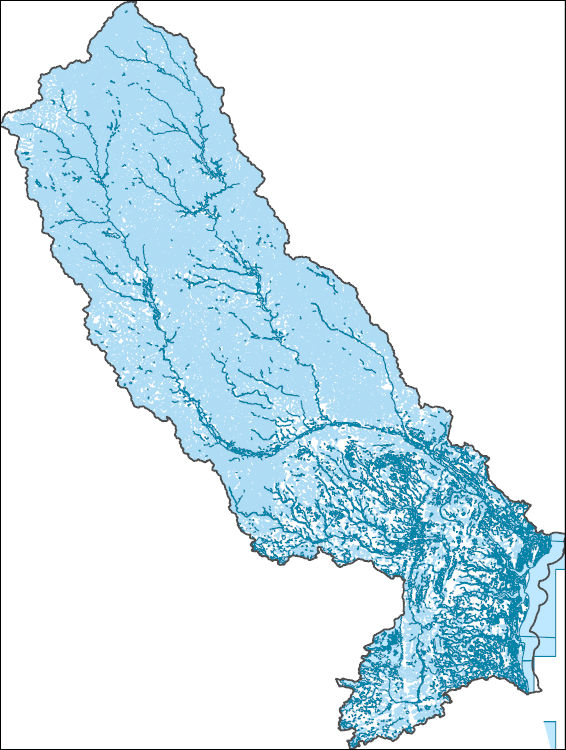
The National Hydrography Dataset (NHD) is a feature-based database that interconnects and uniquely identifies the stream segments or reaches that make up the nation's surface water drainage system. NHD data was originally developed at 1:100,000-scale and exists at that scale for the whole country. This high-resolution NHD, generally developed at 1:24,000/1:12,000 scale, adds detail to the original 1:100,000-scale NHD. (Data for Alaska, Puerto Rico and the Virgin Islands was developed at high-resolution, not 1:100,000 scale.) Local resolution NHD is being developed where partners and data exist. The NHD contains reach codes for networked features, flow direction, names, and centerline representations for areal water...
This data set contains imagery from the National Agriculture Imagery Program (NAIP). The NAIP program is administered by USDA FSA and has been established to support two main FSA strategic goals centered on agricultural production. These are, increase stewardship of America's natural resources while enhancing the environment, and to ensure commodities are procured and distributed effectively and efficiently to increase food security. The NAIP program supports these goals by acquiring and providing ortho imagery that has been collected during the agricultural growing season in the U.S. The NAIP ortho imagery is tailored to meet FSA requirements and is a fundamental tool used to support FSA farm and conservation programs....
This data set contains imagery from the National Agriculture Imagery Program (NAIP). The NAIP program is administered by USDA FSA and has been established to support two main FSA strategic goals centered on agricultural production. These are, increase stewardship of America's natural resources while enhancing the environment, and to ensure commodities are procured and distributed effectively and efficiently to increase food security. The NAIP program supports these goals by acquiring and providing ortho imagery that has been collected during the agricultural growing season in the U.S. The NAIP ortho imagery is tailored to meet FSA requirements and is a fundamental tool used to support FSA farm and conservation programs....
|

|
