Filters: Tags: Shishmaref (X)
12 results (9ms)|
Filters
Date Range
Extensions Types Contacts
Categories Tag Types Tag Schemes |
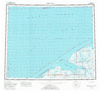
USGS Historical Quadrangle in GeoPDF.
This part of the data release presents orthoimagery spanning the ocean shoreline of Alaska from Icy Cape to Cape Prince of Wales. Aerial images were collected, and data were processed, by Fairbanks Fodar (https://www.fairbanksfodar.com) in Fairbanks, Alaska, for the U.S. Geological Survey. The aerial images, from which the orthoimages were created, were collected in 2016 between August 29 and September 4 and extend from the shoreline to 400-4000 meters inland. The aerial images were collected with precise Global Positioning System (GPS) navigation data from a manned aircraft and were then processed into orthoimages photogrammetrically and using structure-from-motion (SFM) processing methods as described in Nolan...
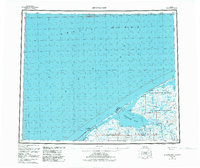
USGS Historical Quadrangle in GeoPDF.
This part of the data release presents a shapefile that includes a spatial index of orthoimagery and elevation data describing the Alaskan coastline from Icy Cape to Cape Prince of Wales. The data products referenced in this index include orthoimagery, digital surface models, and elevation point clouds which were generated from aerial imagery using structure-from-motion methods. Fairbanks Fodar, a contracted mapping service, collected the aerial imagery in 2016 and created all of the data products referenced here. Due to the enormous extent of this dataset, the products are split into separate files with more manageable sizes. Each polygon in this shapefile index provides a geographic outline of a data file’s coverage,...
Categories: Data;
Types: Downloadable,
Map Service,
OGC WFS Layer,
OGC WMS Layer,
Shapefile;
Tags: CMHRP,
Cape Beaufort,
Cape Espenberg,
Cape Krusenstern,
Cape Lewis,
USGS Historical Quadrangle in GeoPDF.
Nearshore bathymetry is a vital link that joins offshore water depths to coastal topography. Seamless water depth information is a critical input parameter for reliable storm surge models, enables the calculation of sediment budgets, and is necessary baseline data for a range of coastal development decisions. Bathymetric data collection capabilities of an active coastal geohazard field program operated by the Alaska Division of Geological & Geophysical Surveys (DGGS) were expanded in 2012. Resultant datasets presented in this report include nearshore bathymetric measurements of critical shallow-water coastal areas in the vicinity of six western Alaska communities: Gambell, Golovin, Hooper Bay, Savoonga, Shishmaref,...
USGS Historical Quadrangle in GeoPDF.
This part of the data release presents digital elevation models (DEMs) spanning the ocean shoreline of Alaska from Icy Cape to Cape Prince of Wales. Aerial images were collected, and data were processed, by Fairbanks Fodar (https://www.fairbanksfodar.com) in Fairbanks, Alaska, for the U.S. Geological Survey. The aerial images, from which the DEMs were created, were collected in 2016 between August 29 and September 4 and extend from the shoreline to 400-4000 meters inland. The aerial images were collected with precise Global Positioning System (GPS) navigation data from a manned aircraft and were then processed into DEMs photogrammetrically using structure-from-motion (SFM) processing methods as described in Nolan...
This part of the data release presents georeferenced elevation point clouds spanning the ocean shoreline of Alaska from Icy Cape to Cape Prince of Wales. Aerial images were collected, and data were processed, by Fairbanks Fodar (https://www.fairbanksfodar.com) in Fairbanks, Alaska, for the U.S. Geological Survey. The aerial images, from which the point clouds were derived, were collected in 2016 between August 29 and September 4 and extend from the shoreline to 400-4000 meters inland. The aerial images were collected with precise Global Positioning System (GPS) navigation data from a manned aircraft and were then processed using structure-from-motion (SFM) methods as described in Nolan and others, 2015 . The included...
Nearshore bathymetry is a vital link that joins offshore water depths to coastal topography. Seamless water depth information is a critical input parameter for reliable storm surge models, enables the calculation of sediment budgets, and is necessary baseline data for a range of coastal development decisions. Bathymetric data collection capabilities of an active coastal geohazard field program operated by the Alaska Division of Geological & Geophysical Surveys (DGGS) were expanded in 2012. Resultant datasets presented in this report include nearshore bathymetric measurements of critical shallow-water coastal areas in the vicinity of six western Alaska communities: Gambell, Golovin, Hooper Bay, Savoonga, Shishmaref,...
USGS Historical Quadrangle in GeoPDF.
USGS Historical Quadrangle in GeoPDF.
|

|
