Filters: Tags: Punta Gorda (X)
24 results (4ms)|
Filters
|
This data set contains imagery from the National Agriculture Imagery Program (NAIP). The NAIP program is administered by USDA FSA and has been established to support two main FSA strategic goals centered on agricultural production. These are, increase stewardship of America's natural resources while enhancing the environment, and to ensure commodities are procured and distributed effectively and efficiently to increase food security. The NAIP program supports these goals by acquiring and providing ortho imagery that has been collected during the agricultural growing season in the U.S. The NAIP ortho imagery is tailored to meet FSA requirements and is a fundamental tool used to support FSA farm and conservation programs....
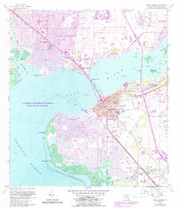
USGS Historical Quadrangle in GeoPDF.
This dataset includes raw, high-resolution seismic-reflection data jointly collected by the U.S. Geological Survey (USGS) and Oregon State University in 2010, between Shelter Cove and Fort Bragg in northern California.
This dataset includes swell-filtered, high-resolution seismic-reflection data jointly collected by the U.S. Geological Survey (USGS) and Oregon State University in 2010, between Fort Bragg and Point Arena in northern California.
|

|
