Filters: Tags: New Mexico (X)
18,195 results (62ms)|
Filters
Date Range
Extensions Types
Contacts
Categories Tag Types
|
This data set includes the relative production scenarios for eight (8) grass species based on linear models from Epstein, et al. (1998). We selected two indicator species for each community: shortgrass prairie: blue grama (Bouteloua gracilis; BOGR) and buffalo grass (Bouteloua dactyloides; BODA); mixedgrass prairie: sideoats grama (Bouteloua curtipendula; BOCU) and little bluestem (Schizachyrium scoparium; SCSC); tallgrass prairie: big bluestem (Andropogon gerardii; ANGE) and Indiangrass (Sorghastrum nutans; SONU); and semiarid grasslands: black grama (Bouteloua eriopoda; BOER) and tobosagrass (Pleuraphis mutica; PLMU). Soil texture (percent by weight) came from the Earth Systems Science Center (2008) which provided...

This map layer shows Indian lands of the United States. For the most part, only areas of 320 acres or more are included; some smaller areas deemed to be important or significant are also included. Federally-administered lands within a reservation are included for continuity; these may or may not be considered part of the reservation and are simply described with their feature type and the administrating Federal agency. Some established Indian lands which are larger than 320 acres are not included in this map layer because their boundaries were not available from the owning or administering agency.
Map containing historical census data from 1900 - 2000 throughout the western United States at the county level. Data includes total population, population density, and percent population change by decade for each county. Population data was obtained from the US Census Bureau and joined to 1:2,000,000 scale National Atlas counties shapefile.
Categories: Data;
Types: Downloadable,
Map Service,
OGC WFS Layer,
OGC WMS Layer,
Shapefile;
Tags: Arizona,
California,
Colorado,
Idaho,
Montana,
The Critical Minerals in Archived Mine Samples Database (CMDB) contains chemistry and geologic information for historic ore and ore-related rock samples from mineral deposits in the United States. In addition, the database contains samples from archetypal deposits from 27 other countries in North America, South America, Asia, Africa and Europe. Samples were obtained from archived ore collections under the U.S. Geological Survey's project titled "Quick Assessment of Rare and Critical Metals in Ore Deposits: A National Assessment" (2008 to 2013) in an effort to begin an assessment of the Nations' previously mined ore deposits for critical minerals. Mineralized and altered rock samples were provided by the Colorado...
Categories: Data;
Types: ArcGIS REST Map Service,
ArcGIS Service Definition,
Downloadable,
Map Service,
OGC WFS Layer,
OGC WMS Layer,
Shapefile;
Tags: Alaska,
Argentina,
Arizona,
Arkansas,
Australia,
The U.S. Geological Survey (USGS) has developed and implemented an algorithm that identifies burned areas in dense time series of Landsat image stacks to produce the Landsat Burned Area Essential Climate Variable (BAECV) products. The algorithm makes use of predictors derived from individual Landsat scenes, lagged reference conditions, and change metrics between the scene and reference conditions. Outputs of the BAECV algorithm consist of pixel-level burn probabilities for each Landsat scene, and annual burn probability, burn classification, and burn date composites. These products were generated for the conterminous United States for 1984 through 2015. These data are also available for download at https://rmgsc.cr.usgs.gov/outgoing/baecv/BAECV_CONUS_v1.1_2017/...
This dataset includes the audio-magnetotelluric (AMT) sounding data collected in 2009 in and near the San Luis Basin, New Mexico. The U.S. Geological Survey conducted a series of multidisciplinary studies, including AMT surveys, in the San Luis Basin to improve understanding of the hydrogeology of the Santa Fe Group and the nature of the sedimentary deposits comprising the principal groundwater aquifers of the Rio Grande rift. The shallow unconfined and the deeper confined Santa Fe Group aquifers in the San Luis Basin are the main sources of municipal water for the region. The population of the San Luis Basin region is growing rapidly and water shortfalls could have serious consequences. Future growth and land management...
Categories: Data;
Types: Downloadable,
Map Service,
OGC WFS Layer,
OGC WMS Layer,
Shapefile;
Tags: AMT,
Cerro,
Cerro De La Olla,
GGGSC,
GPS measurement,
This dataset consists of 102 magnetotelluric (MT) stations collected in 2012-2014 in the Rio Grande Rift and southern Rocky Mountains. The U.S. Geological Survey acquired these data to improve regional conductivity models of the western United States. This work is in support of studies of the effect of lithospheric modification on electrical resistivity structure and tectonic evolution of the western United States.
Categories: Data;
Types: Citation,
Map Service,
OGC WFS Layer,
OGC WMS Layer,
OGC WMS Service;
Tags: Carson National Forest,
Colfax County,
Colorado,
Colorado Plateau,
Dona Ana County,
This data release includes new major and trace element geochemical data acquired by the U.S. Geological Survey (USGS) for igneous rocks in the Cripple Creek district in Colorado. Cripple Creek is among the largest epithermal districts in the world, with more than 800 metric tons (t) Au (>26.4 Moz). The ores are associated spatially, temporally, and genetically with ~34 to 28 Ma alkaline igneous rocks that were emplaced into an 18 km2- diatreme complex and surrounding Proterozoic rocks (Kelley and others, 2020). Igneous rocks associated with Cripple Creek are part of a regionally extensive episode of Oligocene alkaline magmatism that extended southward along the axis of the Rio Grande rift through New Mexico and...
Categories: Data;
Types: Downloadable,
Map Service,
OGC WFS Layer,
OGC WMS Layer,
Shapefile;
Tags: Colorado,
Cripple Creek,
Economic Geology,
Economic geology,
Fire Assay,
The U.S. Geological Survey (USGS) has been engaged in airborne electromagnetics (AEM) since the 1970s, playing a role in the development of early acquisition systems, developing calibration methods, refining standards for data acquisition, improving data processing, modeling, and interpretation methods, and expanding the range of AEM applications. However, USGS AEM survey visibility and data accessibility has not advanced as rapidly as our use of the technique. This data release catalogs AEM surveys in the United States that have contributed to studies under USGS programs including Water, Geologic Mapping, Minerals, Energy, Environmental Health, Ecosystems, Hazards, and Climate. This dataset contains locations for...
Categories: Data;
Types: ArcGIS REST Map Service,
ArcGIS Service Definition,
Downloadable,
Map Service;
Tags: Alabama,
Arizona,
Arkansas,
California,
Colorado,
Layered geospatial PDF Map. Layers of geospatial data include orthoimagery, roads, grids, geographic names, elevation contours, hydrography, and other selected map features.
Layered geospatial PDF Map. Layers of geospatial data include orthoimagery, roads, grids, geographic names, elevation contours, hydrography, and other selected map features.
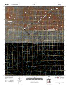
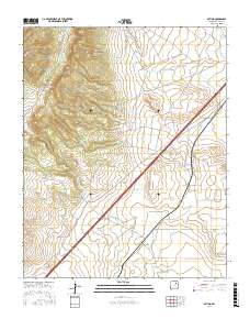
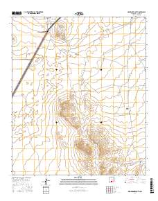
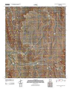
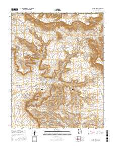
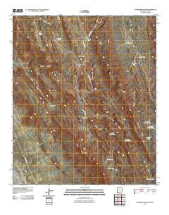
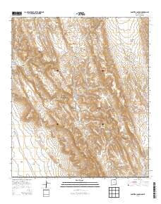
Layered GeoPDF 7.5 Minute Quadrangle Map. Layers of geospatial data include orthoimagery, roads, grids, geographic names, elevation contours, hydrography, and other selected map features.
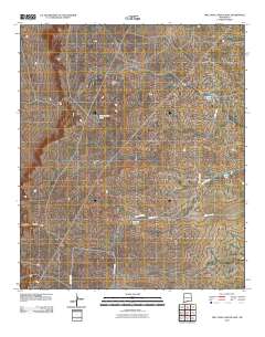
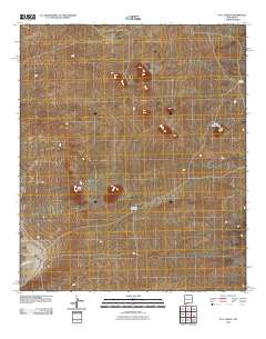
Layered GeoPDF 7.5 Minute Quadrangle Map. Layers of geospatial data include orthoimagery, roads, grids, geographic names, elevation contours, hydrography, and other selected map features.
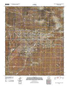
Layered GeoPDF 7.5 Minute Quadrangle Map. Layers of geospatial data include orthoimagery, roads, grids, geographic names, elevation contours, hydrography, and other selected map features.
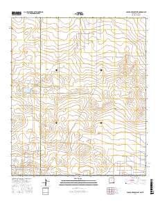
Layered GeoPDF 7.5 Minute Quadrangle Map. Layers of geospatial data include orthoimagery, roads, grids, geographic names, elevation contours, hydrography, and other selected map features.
Layered GeoPDF 7.5 Minute Quadrangle Map. Layers of geospatial data include orthoimagery, roads, grids, geographic names, elevation contours, hydrography, and other selected map features.
Layered geospatial PDF Map. Layers of geospatial data include orthoimagery, roads, grids, geographic names, elevation contours, hydrography, and other selected map features.
Layered geospatial PDF Map. Layers of geospatial data include orthoimagery, roads, grids, geographic names, elevation contours, hydrography, and other selected map features.
Layered GeoPDF 7.5 Minute Quadrangle Map. Layers of geospatial data include orthoimagery, roads, grids, geographic names, elevation contours, hydrography, and other selected map features.
Layered GeoPDF 7.5 Minute Quadrangle Map. Layers of geospatial data include orthoimagery, roads, grids, geographic names, elevation contours, hydrography, and other selected map features.
|

|
