Filters: Tags: Natural Communities (X)
36 results (77ms)|
Filters
Date Range
Contacts
Tag Types Tag Schemes |
This dataset represents current terrestrial intactness values (estimated at the 1km level) within the distribution of Inter-Mountain Dry Shrubland and Grassland. Terrestrial intactness is high in areas where development is low, vegetation intactness is high, and fragmentation is low. Consequently, this dataset serves as a general* indication of habitat quality within the distribution of this conservation element. Estimates of current terrestrial intactness were generated by an EEMS fuzzy logic model that integrates multiple measures of landscape development and vegetation intactness, including agriculture development (from LANDFIRE EVT v1.1), urban development (from LANDFIRE EVT v1.1 and NLCD Impervious Surfaces),...

This dataset represents current terrestrial intactness values (estimated at the 1km level) within the distribution of Californian Warm Temperate Marsh/Seep. Terrestrial intactness is high in areas where development is low, vegetation intactness is high, and fragmentation is low. Consequently, this dataset serves as a general* indication of habitat quality within the distribution of this conservation element. Estimates of current terrestrial intactness were generated by an EEMS fuzzy logic model that integrates multiple measures of landscape development and vegetation intactness, including agriculture development (from LANDFIRE EVT v1.1), urban development (from LANDFIRE EVT v1.1 and NLCD Impervious Surfaces), linear...

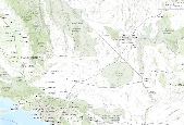
This dataset represents current terrestrial intactness values (estimated at the 1km level) within the distribution of Mojave and Great Basin Upper Bajada and Toeslope. Terrestrial intactness is high in areas where development is low, vegetation intactness is high, and fragmentation is low. Consequently, this dataset serves as a general* indication of habitat quality within the distribution of this conservation element. Estimates of current terrestrial intactness were generated by an EEMS fuzzy logic model that integrates multiple measures of landscape development and vegetation intactness, including agriculture development (from LANDFIRE EVT v1.1), urban development (from LANDFIRE EVT v1.1 and NLCD Impervious Surfaces),...
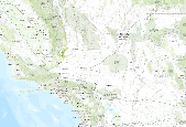
This dataset represents current terrestrial intactness values (estimated at the 1km level) within the distribution of California Annual and Perennial Grassland. Terrestrial intactness is high in areas where development is low, vegetation intactness is high, and fragmentation is low. Consequently, this dataset serves as a general* indication of habitat quality within the distribution of this conservation element. Estimates of current terrestrial intactness were generated by an EEMS fuzzy logic model that integrates multiple measures of landscape development and vegetation intactness, including agriculture development (from LANDFIRE EVT v1.1), urban development (from LANDFIRE EVT v1.1 and NLCD Impervious Surfaces),...
This dataset represents current terrestrial intactness values (estimated at the 1km level) within the distribution of Arid West freshwater emergent marsh. Terrestrial intactness is high in areas where development is low, vegetation intactness is high, and fragmentation is low. Consequently, this dataset serves as a general* indication of habitat quality within the distribution of this conservation element. Estimates of current terrestrial intactness were generated by an EEMS fuzzy logic model that integrates multiple measures of landscape development and vegetation intactness, including agriculture development (from LANDFIRE EVT v1.1), urban development (from LANDFIRE EVT v1.1 and NLCD Impervious Surfaces), linear...

This dataset represents current terrestrial intactness values (estimated at the 1km level) within the distribution of North American Warm Desert Bedrock Cliff and Outcrop. Terrestrial intactness is high in areas where development is low, vegetation intactness is high, and fragmentation is low. Consequently, this dataset serves as a general* indication of habitat quality within the distribution of this conservation element. Estimates of current terrestrial intactness were generated by an EEMS fuzzy logic model that integrates multiple measures of landscape development and vegetation intactness, including agriculture development (from LANDFIRE EVT v1.1), urban development (from LANDFIRE EVT v1.1 and NLCD Impervious...

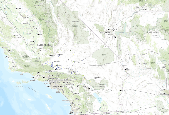
This dataset represents current terrestrial intactness values (estimated at the 1km level) within the distribution of Lower Bajada and Fan Mojavean - Sonoran Desert Scrub. Terrestrial intactness is high in areas where development is low, vegetation intactness is high, and fragmentation is low. Consequently, this dataset serves as a general* indication of habitat quality within the distribution of this conservation element. Estimates of current terrestrial intactness were generated by an EEMS fuzzy logic model that integrates multiple measures of landscape development and vegetation intactness, including agriculture development (from LANDFIRE EVT v1.1), urban development (from LANDFIRE EVT v1.1 and NLCD Impervious...

This dataset represents current terrestrial intactness values (estimated at the 1km level) within the distribution of Intermontane Seral Shrubland. Terrestrial intactness is high in areas where development is low, vegetation intactness is high, and fragmentation is low. Consequently, this dataset serves as a general* indication of habitat quality within the distribution of this conservation element. Estimates of current terrestrial intactness were generated by an EEMS fuzzy logic model that integrates multiple measures of landscape development and vegetation intactness, including agriculture development (from LANDFIRE EVT v1.1), urban development (from LANDFIRE EVT v1.1 and NLCD Impervious Surfaces), linear development...

This dataset represents current terrestrial intactness values (estimated at the 1km level) within the distribution of Shadscale â Saltbush Cool Semi-desert Scrub. Terrestrial intactness is high in areas where development is low, vegetation intactness is high, and fragmentation is low. Consequently, this dataset serves as a general* indication of habitat quality within the distribution of this conservation element. Estimates of current terrestrial intactness were generated by an EEMS fuzzy logic model that integrates multiple measures of landscape development and vegetation intactness, including agriculture development (from LANDFIRE EVT v1.1), urban development (from LANDFIRE EVT v1.1 and NLCD Impervious Surfaces),...

This dataset represents current terrestrial intactness values (estimated at the 1km level) within the distribution of Southwestern North American Riparian/Wash Scrub. Terrestrial intactness is high in areas where development is low, vegetation intactness is high, and fragmentation is low. Consequently, this dataset serves as a general* indication of habitat quality within the distribution of this conservation element. Estimates of current terrestrial intactness were generated by an EEMS fuzzy logic model that integrates multiple measures of landscape development and vegetation intactness, including agriculture development (from LANDFIRE EVT v1.1), urban development (from LANDFIRE EVT v1.1 and NLCD Impervious Surfaces),...
This data represents a vegetation map for New River Gorge National River. It contains nonoverlapping polygons which represent vegetation classes, aquatic features, and cultural features. Vegetation types were classified based on statistical analysis of plot data collected on the ground from 1998 through 2005. Polygons were delineated based on interpretation of digital and hard copy aerial photography flown in 2003.

This dataset represents current terrestrial intactness values (estimated at the 1km level) within the distribution of Californian Mesic Chaparral. Terrestrial intactness is high in areas where development is low, vegetation intactness is high, and fragmentation is low. Consequently, this dataset serves as a general* indication of habitat quality within the distribution of this conservation element. Estimates of current terrestrial intactness were generated by an EEMS fuzzy logic model that integrates multiple measures of landscape development and vegetation intactness, including agriculture development (from LANDFIRE EVT v1.1), urban development (from LANDFIRE EVT v1.1 and NLCD Impervious Surfaces), linear development...

This dataset represents current terrestrial intactness values (estimated at the 1km level) within the distribution of Californian Broadleaf Forest and Woodland. Terrestrial intactness is high in areas where development is low, vegetation intactness is high, and fragmentation is low. Consequently, this dataset serves as a general* indication of habitat quality within the distribution of this conservation element. Estimates of current terrestrial intactness were generated by an EEMS fuzzy logic model that integrates multiple measures of landscape development and vegetation intactness, including agriculture development (from LANDFIRE EVT v1.1), urban development (from LANDFIRE EVT v1.1 and NLCD Impervious Surfaces),...

This dataset represents current terrestrial intactness values (estimated at the 1km level) within the distribution of California Annual Forb/Grass Vegetation. Terrestrial intactness is high in areas where development is low, vegetation intactness is high, and fragmentation is low. Consequently, this dataset serves as a general* indication of habitat quality within the distribution of this conservation element. Estimates of current terrestrial intactness were generated by an EEMS fuzzy logic model that integrates multiple measures of landscape development and vegetation intactness, including agriculture development (from LANDFIRE EVT v1.1), urban development (from LANDFIRE EVT v1.1 and NLCD Impervious Surfaces),...
This data represents a vegetation map for Bluestone National Scenic River. It contains nonoverlapping polygons which represent vegetation classes, aquatic features, and cultural features. Vegetation types were classified based on statistical analysis of plot data collected on the ground from 2003 through 2005. Polygons were delineated based on interpretation of digital and hard copy aerial photography flown in 2003.

This dataset represents current terrestrial intactness values (estimated at the 1km level) within the distribution of Sonoran-Coloradan Semi-Desert Wash Woodland/Scrub. Terrestrial intactness is high in areas where development is low, vegetation intactness is high, and fragmentation is low. Consequently, this dataset serves as a general* indication of habitat quality within the distribution of this conservation element. Estimates of current terrestrial intactness were generated by an EEMS fuzzy logic model that integrates multiple measures of landscape development and vegetation intactness, including agriculture development (from LANDFIRE EVT v1.1), urban development (from LANDFIRE EVT v1.1 and NLCD Impervious Surfaces),...

This dataset represents current terrestrial intactness values (estimated at the 1km level) within the distribution of North American Warm Desert Dunes and Sand Flats. Terrestrial intactness is high in areas where development is low, vegetation intactness is high, and fragmentation is low. Consequently, this dataset serves as a general* indication of habitat quality within the distribution of this conservation element. Estimates of current terrestrial intactness were generated by an EEMS fuzzy logic model that integrates multiple measures of landscape development and vegetation intactness, including agriculture development (from LANDFIRE EVT v1.1), urban development (from LANDFIRE EVT v1.1 and NLCD Impervious Surfaces),...

This dataset represents current terrestrial intactness values (estimated at the 1km level) within the distribution of Central and Great Basin Pinyon - Juniper Woodland. Terrestrial intactness is high in areas where development is low, vegetation intactness is high, and fragmentation is low. Consequently, this dataset serves as a general* indication of habitat quality within the distribution of this conservation element. Estimates of current terrestrial intactness were generated by an EEMS fuzzy logic model that integrates multiple measures of landscape development and vegetation intactness, including agriculture development (from LANDFIRE EVT v1.1), urban development (from LANDFIRE EVT v1.1 and NLCD Impervious Surfaces),...

This dataset represents current terrestrial intactness values (estimated at the 1km level) within the distribution of Californian Pre-montane Chaparral. Terrestrial intactness is high in areas where development is low, vegetation intactness is high, and fragmentation is low. Consequently, this dataset serves as a general* indication of habitat quality within the distribution of this conservation element. Estimates of current terrestrial intactness were generated by an EEMS fuzzy logic model that integrates multiple measures of landscape development and vegetation intactness, including agriculture development (from LANDFIRE EVT v1.1), urban development (from LANDFIRE EVT v1.1 and NLCD Impervious Surfaces), linear...

This dataset represents current terrestrial intactness values (estimated at the 1km level) within the distribution of Madrean Warm Semi-Desert Wash Woodland/Scrub. Terrestrial intactness is high in areas where development is low, vegetation intactness is high, and fragmentation is low. Consequently, this dataset serves as a general* indication of habitat quality within the distribution of this conservation element. Estimates of current terrestrial intactness were generated by an EEMS fuzzy logic model that integrates multiple measures of landscape development and vegetation intactness, including agriculture development (from LANDFIRE EVT v1.1), urban development (from LANDFIRE EVT v1.1 and NLCD Impervious Surfaces),...
|

|
