Filters: Tags: MOUNT SHASTA (X)
14 results (15ms)|
Filters
Date Range
Extensions Types Contacts
Categories Tag Types Tag Schemes |
This data set contains imagery from the National Agriculture Imagery Program (NAIP). The NAIP program is administered by USDA FSA and has been established to support two main FSA strategic goals centered on agricultural production. These are, increase stewardship of America's natural resources while enhancing the environment, and to ensure commodities are procured and distributed effectively and efficiently to increase food security. The NAIP program supports these goals by acquiring and providing ortho imagery that has been collected during the agricultural growing season in the U.S. The NAIP ortho imagery is tailored to meet FSA requirements and is a fundamental tool used to support FSA farm and conservation programs....
This data set contains imagery from the National Agriculture Imagery Program (NAIP). The NAIP program is administered by USDA FSA and has been established to support two main FSA strategic goals centered on agricultural production. These are, increase stewardship of America's natural resources while enhancing the environment, and to ensure commodities are procured and distributed effectively and efficiently to increase food security. The NAIP program supports these goals by acquiring and providing ortho imagery that has been collected during the agricultural growing season in the U.S. The NAIP ortho imagery is tailored to meet FSA requirements and is a fundamental tool used to support FSA farm and conservation programs....
The Siskiyou mule deer herd migrates from winter ranges primarily north and east of Mount Shasta (i.e., Day Bench, Lake Shastina, Montague, Mount Dome, Mount Hebron, Sheep-Mahogany Mountain, Tionesta, and Wild Horse Mountain) to sprawling summer ranges scattered between the Mount Shasta Wilderness in the west and the Burnt Lava Flow Geological Area in the east. A small percentage of the herd are residents, residing largely within winter ranges across the central and northeast areas of the herd’s annual distribution. The total population size of the Siskiyou herd is unknown, but adult deer densities averaged 6.01 deer per km2 on summer ranges in 2017 and 5.16 deer per km2 on winter ranges in 2019 (Wittmer and others,...
Categories: Data;
Types: Downloadable,
Map Service,
OGC WFS Layer,
OGC WMS Layer,
Shapefile;
Tags: California,
Mount Shasta,
United States,
animal behavior,
biota,
This data set contains imagery from the National Agriculture Imagery Program (NAIP). The NAIP program is administered by USDA FSA and has been established to support two main FSA strategic goals centered on agricultural production. These are, increase stewardship of America's natural resources while enhancing the environment, and to ensure commodities are procured and distributed effectively and efficiently to increase food security. The NAIP program supports these goals by acquiring and providing ortho imagery that has been collected during the agricultural growing season in the U.S. The NAIP ortho imagery is tailored to meet FSA requirements and is a fundamental tool used to support FSA farm and conservation programs....
This data set contains imagery from the National Agriculture Imagery Program (NAIP). The NAIP program is administered by USDA FSA and has been established to support two main FSA strategic goals centered on agricultural production. These are, increase stewardship of America's natural resources while enhancing the environment, and to ensure commodities are procured and distributed effectively and efficiently to increase food security. The NAIP program supports these goals by acquiring and providing ortho imagery that has been collected during the agricultural growing season in the U.S. The NAIP ortho imagery is tailored to meet FSA requirements and is a fundamental tool used to support FSA farm and conservation programs....
Temperature measurements, isotopic contents, and dissolved constituents are presented for springs at Mount Shasta to understand slightly thermal springs in the Shasta Valley based on the characteristics of non-thermal springs. Non-thermal springs on Mount Shasta are generally cooler than mean annual air temperatures for their elevation. The specific conductance of non-thermal springs increases linearly with discharge temperature. Springs at higher and intermediate elevations on Mount Shasta have fairly limited circulation paths, whereas low-elevation springs have longer paths because of their higher-elevation recharge. Springs in the Shasta Valley are warmer than air temperatures for their elevation and contain...
Categories: Publication;
Types: Citation;
Tags: Mount Shasta,
Stable iso,
geothermal systems,
springs
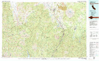
USGS Historical Quadrangle in GeoPDF.
The Siskiyou mule deer herd migrates from winter ranges primarily north and east of Mount Shasta (i.e., Day Bench, Lake Shastina, Montague, Mount Dome, Mount Hebron, Sheep-Mahogany Mountain, Tionesta, and Wild Horse Mountain) to sprawling summer ranges scattered between the Mount Shasta Wilderness in the west and the Burnt Lava Flow Geological Area in the east. A small percentage of the herd are residents, residing largely within winter ranges across the central and northeast areas of the herd’s annual distribution. The total population size of the Siskiyou herd is unknown, but adult deer densities averaged 6.01 deer per km2 on summer ranges in 2017 and 5.16 deer per km2 on winter ranges in 2019 (Wittmer and others,...
Categories: Data;
Types: Downloadable,
Map Service,
OGC WFS Layer,
OGC WMS Layer,
Shapefile;
Tags: California,
Mount Shasta,
United States,
animal behavior,
biota,
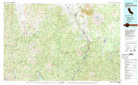
Visible/near-infrared (VNIR) and mid-infrared (MIR) spectral library composed of twenty natural tephra samples from ten volcanic sources that span a range of compositions and components. The bulk, glass, and mineral phase compositions of each sample have been measured and VNIR and MIR spectra from four size fractions of each sample were collected. The VNIR spectral library has been expanded (ed. 2) to twenty-two samples.
The Siskiyou mule deer herd migrates from winter ranges primarily north and east of Mount Shasta (i.e., Day Bench, Lake Shastina, Montague, Mount Dome, Mount Hebron, Sheep-Mahogany Mountain, Tionesta, and Wild Horse Mountain) to sprawling summer ranges scattered between the Mount Shasta Wilderness in the west and the Burnt Lava Flow Geological Area in the east. A small percentage of the herd are residents, residing largely within winter ranges across the central and northeast areas of the herd’s annual distribution. The total population size of the Siskiyou herd is unknown, but adult deer densities averaged 6.01 deer per km2 on summer ranges in 2017 and 5.16 deer per km2 on winter ranges in 2019 (Wittmer and others,...
Categories: Data;
Types: Downloadable,
Map Service,
OGC WFS Layer,
OGC WMS Layer,
Shapefile;
Tags: California,
Mount Shasta,
United States,
animal behavior,
biota,
The California volcano locations, threat rank and hazard zones data release contains two shapefiles for download or use as a web map service. The California Volcanic Center Locations shapefile was created to provide a generalized location of volcano hazard sources. The California Volcano Hazard Zones shapefile was created from previously published hazard zone reports. Specific details about each file can be found in the metadata included with each file and the read-me document for this data release. Together, these files were used to define California Volcano Hazards for the GIS analysis that supports conclusions in the California's exposure to volcano hazards report. Geologists produce hazard zone maps to convey...
Categories: Data;
Types: ArcGIS REST Map Service,
ArcGIS Service Definition,
Downloadable,
Map Service;
Tags: Alpine County,
Ash,
Ballistic,
Butte County,
California,
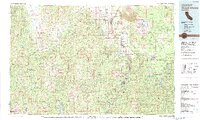
USGS Historical Quadrangle in GeoPDF.
|

|
