Filters: Tags: LAWLER (X)
26 results (6ms)|
Filters
Date Range
Types Contacts
Tag Types Tag Schemes |
This data set contains imagery from the National Agriculture Imagery Program (NAIP). The NAIP program is administered by USDA FSA and has been established to support two main FSA strategic goals centered on agricultural production. These are, increase stewardship of America's natural resources while enhancing the environment, and to ensure commodities are procured and distributed effectively and efficiently to increase food security. The NAIP program supports these goals by acquiring and providing ortho imagery that has been collected during the agricultural growing season in the U.S. The NAIP ortho imagery is tailored to meet FSA requirements and is a fundamental tool used to support FSA farm and conservation programs....

Lawler and colleagues assessed the potential effects of 30 coupled atmosphere–ocean general circulation model (AOGCM) future-climate simulations on the geographic ranges of 2954 species of birds, mammals, and amphibians in the Western Hemisphere. Eighty percent of the climate projections based on a relatively low greenhouse-gas emissions scenario result in the local loss of at least 10% of the vertebrate fauna over much of North and South America.
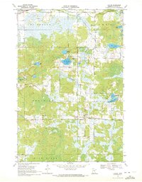
USGS Historical Quadrangle in GeoPDF.
This data set contains imagery from the National Agriculture Imagery Program (NAIP). The NAIP program is administered by USDA FSA and has been established to support two main FSA strategic goals centered on agricultural production. These are, increase stewardship of America's natural resources while enhancing the environment, and to ensure commodities are procured and distributed effectively and efficiently to increase food security. The NAIP program supports these goals by acquiring and providing ortho imagery that has been collected during the agricultural growing season in the U.S. The NAIP ortho imagery is tailored to meet FSA requirements and is a fundamental tool used to support FSA farm and conservation programs....

Lawler and colleagues assessed the potential effects of 30 coupled atmosphere–ocean general circulation model (AOGCM) future-climate simulations on the geographic ranges of 2954 species of birds, mammals, and amphibians in the Western Hemisphere. Eighty percent of the climate projections based on a relatively low greenhouse-gas emissions scenario result in the local loss of at least 10% of the vertebrate fauna over much of North and South America.

Lawler and colleagues assessed the potential effects of 30 coupled atmosphere–ocean general circulation model (AOGCM) future-climate simulations on the geographic ranges of 2954 species of birds, mammals, and amphibians in the Western Hemisphere. Eighty percent of the climate projections based on a relatively low greenhouse-gas emissions scenario result in the local loss of at least 10% of the vertebrate fauna over much of North and South America.

Lawler and colleagues assessed the potential effects of 30 coupled atmosphere–ocean general circulation model (AOGCM) future-climate simulations on the geographic ranges of 2954 species of birds, mammals, and amphibians in the Western Hemisphere. Eighty percent of the climate projections based on a relatively low greenhouse-gas emissions scenario result in the local loss of at least 10% of the vertebrate fauna over much of North and South America.
This data set contains imagery from the National Agriculture Imagery Program (NAIP). The NAIP program is administered by USDA FSA and has been established to support two main FSA strategic goals centered on agricultural production. These are, increase stewardship of America's natural resources while enhancing the environment, and to ensure commodities are procured and distributed effectively and efficiently to increase food security. The NAIP program supports these goals by acquiring and providing ortho imagery that has been collected during the agricultural growing season in the U.S. The NAIP ortho imagery is tailored to meet FSA requirements and is a fundamental tool used to support FSA farm and conservation programs....

Lawler and colleagues assessed the potential effects of 30 coupled atmosphere–ocean general circulation model (AOGCM) future-climate simulations on the geographic ranges of 2954 species of birds, mammals, and amphibians in the Western Hemisphere. Eighty percent of the climate projections based on a relatively low greenhouse-gas emissions scenario result in the local loss of at least 10% of the vertebrate fauna over much of North and South America.
This data set contains imagery from the National Agriculture Imagery Program (NAIP). The NAIP program is administered by USDA FSA and has been established to support two main FSA strategic goals centered on agricultural production. These are, increase stewardship of America's natural resources while enhancing the environment, and to ensure commodities are procured and distributed effectively and efficiently to increase food security. The NAIP program supports these goals by acquiring and providing ortho imagery that has been collected during the agricultural growing season in the U.S. The NAIP ortho imagery is tailored to meet FSA requirements and is a fundamental tool used to support FSA farm and conservation programs....
This data set contains imagery from the National Agriculture Imagery Program (NAIP). The NAIP program is administered by USDA FSA and has been established to support two main FSA strategic goals centered on agricultural production. These are, increase stewardship of America's natural resources while enhancing the environment, and to ensure commodities are procured and distributed effectively and efficiently to increase food security. The NAIP program supports these goals by acquiring and providing ortho imagery that has been collected during the agricultural growing season in the U.S. The NAIP ortho imagery is tailored to meet FSA requirements and is a fundamental tool used to support FSA farm and conservation programs....

Lawler and colleagues assessed the potential effects of 30 coupled atmosphere–ocean general circulation model (AOGCM) future-climate simulations on the geographic ranges of 2954 species of birds, mammals, and amphibians in the Western Hemisphere. Eighty percent of the climate projections based on a relatively low greenhouse-gas emissions scenario result in the local loss of at least 10% of the vertebrate fauna over much of North and South America.

Lawler and colleagues assessed the potential effects of 30 coupled atmosphere–ocean general circulation model (AOGCM) future-climate simulations on the geographic ranges of 2954 species of birds, mammals, and amphibians in the Western Hemisphere. Eighty percent of the climate projections based on a relatively low greenhouse-gas emissions scenario result in the local loss of at least 10% of the vertebrate fauna over much of North and South America.

Lawler and colleagues assessed the potential effects of 30 coupled atmosphere–ocean general circulation model (AOGCM) future-climate simulations on the geographic ranges of 2954 species of birds, mammals, and amphibians in the Western Hemisphere. Eighty percent of the climate projections based on a relatively low greenhouse-gas emissions scenario result in the local loss of at least 10% of the vertebrate fauna over much of North and South America.
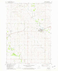
USGS Historical Quadrangle in GeoPDF.
This data set contains imagery from the National Agriculture Imagery Program (NAIP). The NAIP program is administered by USDA FSA and has been established to support two main FSA strategic goals centered on agricultural production. These are, increase stewardship of America's natural resources while enhancing the environment, and to ensure commodities are procured and distributed effectively and efficiently to increase food security. The NAIP program supports these goals by acquiring and providing ortho imagery that has been collected during the agricultural growing season in the U.S. The NAIP ortho imagery is tailored to meet FSA requirements and is a fundamental tool used to support FSA farm and conservation programs....
|

|
