Filters
Date Range
Contacts
Tag Types
Tag Schemes
|

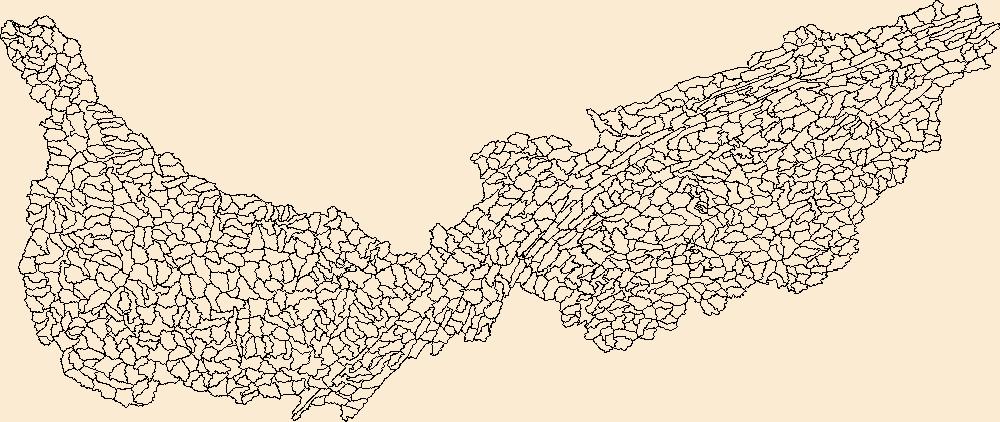
The Watershed Boundary Dataset (WBD) is a comprehensive aggregated collection of hydrologic unit data consistent with the national criteria for delineation and resolution. It defines the areal extent of surface water drainage to a point except in coastal or lake front areas where there could be multiple outlets as stated by the "Federal Standards and Procedures for the National Watershed Boundary Dataset (WBD)" "Standard" (https://pubs.usgs.gov/tm/11/a3/). Watershed boundaries are determined solely upon science-based hydrologic principles, not favoring any administrative boundaries or special projects, nor particular program or agency. This dataset represents the hydrologic unit boundaries to the 12-digit (6th level)...
Tags: 10-digit,
12-digit,
14-digit,
16-digit,
2-digit, All tags...
4-digit,
6-digit,
8-digit,
Adair,
Adams,
Aitkin,
Alexander,
Allamakee,
Anoka,
Appanoose,
Ashland,
Audrain,
Audubon,
Ballard,
Barron,
Basin,
Bayfield,
Becker,
Beltrami,
Benton,
Berrien,
Big Stone,
Black Hawk,
Blue Earth,
Bollinger,
Bond,
Boone,
Bremer,
Brookings,
Brown,
Buchanan,
Buena Vista,
Buffalo,
Bureau,
Burnett,
Butler,
Calhoun,
Callaway,
Cape Girardeau,
Carlton,
Carroll,
Carver,
Cass,
Cedar,
Cerro Gordo,
Champaign,
Chickasaw,
Chippewa,
Chisago,
Christian,
Clark,
Clarke,
Clay,
Clayton,
Clearwater,
Clinton,
Codington,
Coles,
Columbia,
Cook,
Cottonwood,
Crawford,
Crow Wing,
Dakota,
Dallas,
Dane,
Davis,
Day,
De Witt,
DeKalb,
Delaware,
Dent,
Des Moines,
Deuel,
Dickinson,
Dodge,
Douglas,
Downloadable Data,
DuPage,
Dubuque,
Dunn,
Eau Claire,
Effingham,
Elkhart,
Emmet,
Faribault,
Fayette,
Fillmore,
Floyd,
Fond du Lac,
Ford,
Forest,
Franklin,
Freeborn,
Fulton,
Gasconade,
GeoPackage,
Gogebic,
Goodhue,
Grant,
Green,
Green Lake,
Greene,
Grundy,
Guthrie,
HU-2,
HU-2 Region,
HU2_07,
HUC,
Hamilton,
Hancock,
Hardin,
Henderson,
Hennepin,
Henry,
Houston,
Howard,
Hubbard,
Humboldt,
Hydrography,
Hydrologic Unit Code,
Hydrologic Units,
IA,
IL,
IN,
Illinois,
Indiana,
Iowa,
Iowa,
Iron,
Iroquois,
Isanti,
Itasca,
Jackson,
Jasper,
Jefferson,
Jersey,
Jo Daviess,
Johnson,
Jones,
Juneau,
KY,
Kanabec,
Kandiyohi,
Kane,
Kankakee,
Kendall,
Kenosha,
Kentucky,
Keokuk,
Knox,
Kosciusko,
Kossuth,
La Crosse,
LaPorte,
LaSalle,
Lac qui Parle,
Lafayette,
Lake,
Langlade,
Le Sueur,
Lee,
Lewis,
Lincoln,
Linn,
Livingston,
Logan,
Louisa,
Lucas,
Lyon,
MI,
MN,
MO,
Macon,
Macoupin,
Madison,
Mahaska,
Marathon,
Maries,
Marion,
Marquette,
Marshall,
Martin,
Mason,
McDonough,
McHenry,
McLean,
McLeod,
Meeker,
Menard,
Mercer,
Michigan,
Mille Lacs,
Milwaukee,
Minnesota,
Mississippi,
Missouri,
Mitchell,
Monroe,
Montgomery,
Morgan,
Morrison,
Moultrie,
Mower,
Murray,
Muscatine,
ND,
National Watershed Boundary Dataset (WBD),
National Watershed Boundary Dataset (WBD),
Newton,
Nicollet,
Nobles,
North Dakota,
Ogle,
Olmsted,
Oneida,
Open Geospatial Consortium GeoPackage 1.2,
Osage,
Otter Tail,
Palo Alto,
Peoria,
Pepin,
Perry,
Phelps,
Piatt,
Pierce,
Pike,
Pine,
Pipestone,
Pocahontas,
Polk,
Pope,
Portage,
Porter,
Poweshiek,
Price,
Pulaski,
Putnam,
Racine,
Ralls,
Ramsey,
Randolph,
Redwood,
Region,
Renville,
Reynolds,
Rice,
Richland,
Roberts,
Rock,
Rock Island,
Rusk,
SD,
Sac,
Sangamon,
Sauk,
Sawyer,
Schuyler,
Scotland,
Scott,
Shawano,
Shelby,
Sherburne,
Sibley,
South Dakota,
St. Charles,
St. Clair,
St. Croix,
St. Francois,
St. Joseph,
St. Louis,
Stark,
Starke,
Ste. Genevieve,
Stearns,
Steele,
Stephenson,
Stevens,
Story,
Sub-basin,
Sub-region,
Subwatershed,
Swift,
Tama,
Taylor,
Tazewell,
Texas,
Todd,
Traverse,
Trempealeau,
US,
Union,
United States,
Van Buren,
Vermilion,
Vernon,
Vilas,
WBD,
WI,
Wabasha,
Wadena,
Walworth,
Wapello,
Warren,
Waseca,
Washburn,
Washington,
Watershed,
Watershed Boundary Dataset,
Watonwan,
Waukesha,
Waushara,
Wayne,
Webster,
White,
Whiteside,
Will,
Williamson,
Winnebago,
Winneshiek,
Winona,
Wisconsin,
Wood,
Woodford,
Worth,
Wright,
Yellow Medicine,
inlandWaters, Fewer tags

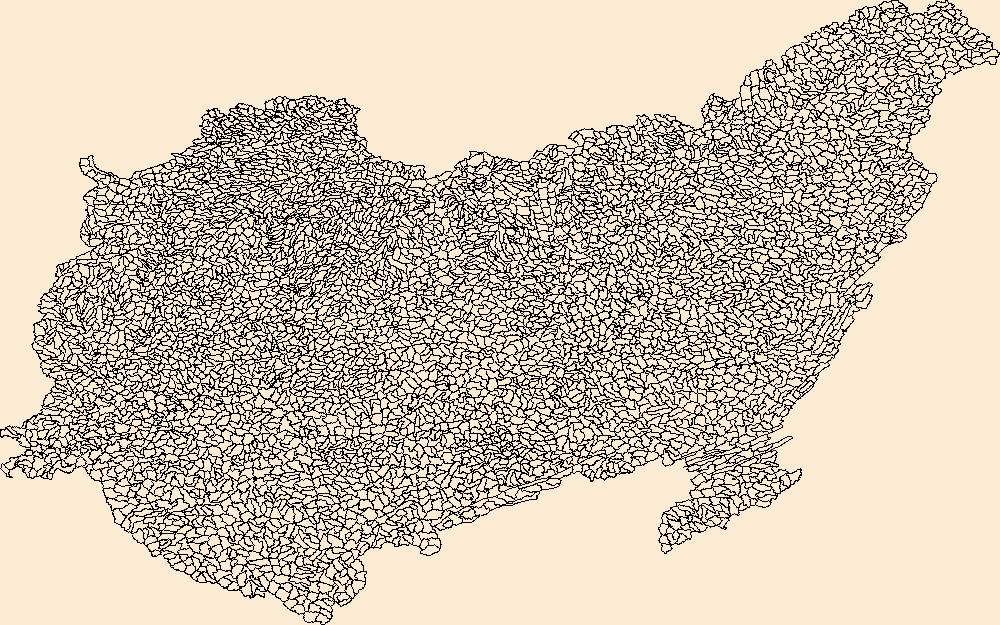
The Watershed Boundary Dataset (WBD) is a comprehensive aggregated collection of hydrologic unit data consistent with the national criteria for delineation and resolution. It defines the areal extent of surface water drainage to a point except in coastal or lake front areas where there could be multiple outlets as stated by the "Federal Standards and Procedures for the National Watershed Boundary Dataset (WBD)" "Standard" (https://pubs.usgs.gov/tm/11/a3/). Watershed boundaries are determined solely upon science-based hydrologic principles, not favoring any administrative boundaries or special projects, nor particular program or agency. This dataset represents the hydrologic unit boundaries to the 12-digit (6th level)...
Tags: 10-digit,
12-digit,
14-digit,
16-digit,
2-digit, All tags...
4-digit,
6-digit,
8-digit,
AL,
Alabama,
Alcorn,
Anderson,
Ashe,
Avery,
Basin,
Bedford,
Bell,
Benton,
Bland,
Bledsoe,
Blount,
Bradley,
Bristol,
Buchanan,
Buncombe,
Caldwell,
Calloway,
Campbell,
Cannon,
Carroll,
Carter,
Catoosa,
Cherokee,
Chester,
Claiborne,
Clay,
Cocke,
Coffee,
Colbert,
Cullman,
Cumberland,
Dade,
DeKalb,
Decatur,
Dickenson,
Dickson,
Downloadable Data,
Etowah,
Fannin,
Fentress,
Franklin,
GA,
GeoPackage,
Georgia,
Giles,
Gilmer,
Graham,
Grainger,
Graves,
Grayson,
Greene,
Greenville,
Grundy,
HU-2,
HU-2 Region,
HU2_06,
HUC,
Habersham,
Hamblen,
Hamilton,
Hancock,
Hardin,
Harlan,
Hawkins,
Haywood,
Henderson,
Henry,
Hickman,
Houston,
Humphreys,
Hydrography,
Hydrologic Unit Code,
Hydrologic Units,
Itawamba,
Jackson,
Jefferson,
Johnson,
KY,
Kentucky,
Knox,
Lauderdale,
Lawrence,
Lee,
Letcher,
Lewis,
Limestone,
Lincoln,
Livingston,
Loudon,
Lumpkin,
Lyon,
MS,
Macon,
Madison,
Marion,
Marshall,
Maury,
McCracken,
McDowell,
McMinn,
McNairy,
Meigs,
Mississippi,
Mitchell,
Monroe,
Moore,
Morgan,
NC,
National Watershed Boundary Dataset (WBD),
National Watershed Boundary Dataset (WBD),
North Carolina,
Norton,
Open Geospatial Consortium GeoPackage 1.2,
Perry,
Pickens,
Polk,
Prentiss,
Putnam,
Rabun,
Region,
Rhea,
Roane,
Russell,
Rutherford,
SC,
Scott,
Sequatchie,
Sevier,
Smyth,
South Carolina,
Stewart,
Sub-basin,
Sub-region,
Subwatershed,
Sullivan,
Swain,
TN,
Tazewell,
Tennessee,
Tishomingo,
Towns,
Transylvania,
Trigg,
US,
Unicoi,
Union,
United States,
VA,
Van Buren,
Virginia,
WBD,
WV,
Walker,
Washington,
Watauga,
Watershed,
Watershed Boundary Dataset,
Wayne,
West Virginia,
White,
Whitfield,
Williamson,
Winston,
Wise,
Wythe,
Yancey,
inlandWaters, Fewer tags

The Watershed Boundary Dataset (WBD) is a comprehensive aggregated collection of hydrologic unit data consistent with the national criteria for delineation and resolution. It defines the areal extent of surface water drainage to a point except in coastal or lake front areas where there could be multiple outlets as stated by the "Federal Standards and Procedures for the National Watershed Boundary Dataset (WBD)" "Standard" (https://pubs.usgs.gov/tm/11/a3/). Watershed boundaries are determined solely upon science-based hydrologic principles, not favoring any administrative boundaries or special projects, nor particular program or agency. This dataset represents the hydrologic unit boundaries to the 12-digit (6th level)...
Tags: 10-digit,
12-digit,
14-digit,
16-digit,
2-digit, All tags...
4-digit,
6-digit,
8-digit,
AL,
Alabama,
Alcorn,
Anderson,
Ashe,
Avery,
Basin,
Bedford,
Bell,
Benton,
Bland,
Bledsoe,
Blount,
Bradley,
Bristol,
Buchanan,
Buncombe,
Caldwell,
Calloway,
Campbell,
Cannon,
Carroll,
Carter,
Catoosa,
Cherokee,
Chester,
Claiborne,
Clay,
Cocke,
Coffee,
Colbert,
Cullman,
Cumberland,
Dade,
DeKalb,
Decatur,
Dickenson,
Dickson,
Downloadable Data,
Esri Shapefile nan,
Etowah,
Fannin,
Fentress,
Franklin,
GA,
Georgia,
Giles,
Gilmer,
Graham,
Grainger,
Graves,
Grayson,
Greene,
Greenville,
Grundy,
HU-2,
HU-2 Region,
HU2_06,
HUC,
Habersham,
Hamblen,
Hamilton,
Hancock,
Hardin,
Harlan,
Hawkins,
Haywood,
Henderson,
Henry,
Hickman,
Houston,
Humphreys,
Hydrography,
Hydrologic Unit Code,
Hydrologic Units,
Itawamba,
Jackson,
Jefferson,
Johnson,
KY,
Kentucky,
Knox,
Lauderdale,
Lawrence,
Lee,
Letcher,
Lewis,
Limestone,
Lincoln,
Livingston,
Loudon,
Lumpkin,
Lyon,
MS,
Macon,
Madison,
Marion,
Marshall,
Maury,
McCracken,
McDowell,
McMinn,
McNairy,
Meigs,
Mississippi,
Mitchell,
Monroe,
Moore,
Morgan,
NC,
National Watershed Boundary Dataset (WBD),
National Watershed Boundary Dataset (WBD),
North Carolina,
Norton,
Perry,
Pickens,
Polk,
Prentiss,
Putnam,
Rabun,
Region,
Rhea,
Roane,
Russell,
Rutherford,
SC,
Scott,
Sequatchie,
Sevier,
Shapefile,
Smyth,
South Carolina,
Stewart,
Sub-basin,
Sub-region,
Subwatershed,
Sullivan,
Swain,
TN,
Tazewell,
Tennessee,
Tishomingo,
Towns,
Transylvania,
Trigg,
US,
Unicoi,
Union,
United States,
VA,
Van Buren,
Virginia,
WBD,
WV,
Walker,
Washington,
Watauga,
Watershed,
Watershed Boundary Dataset,
Wayne,
West Virginia,
White,
Whitfield,
Williamson,
Winston,
Wise,
Wythe,
Yancey,
inlandWaters, Fewer tags
The Watershed Boundary Dataset (WBD) is a comprehensive aggregated collection of hydrologic unit data consistent with the national criteria for delineation and resolution. It defines the areal extent of surface water drainage to a point except in coastal or lake front areas where there could be multiple outlets as stated by the "Federal Standards and Procedures for the National Watershed Boundary Dataset (WBD)" "Standard" (https://pubs.usgs.gov/tm/11/a3/). Watershed boundaries are determined solely upon science-based hydrologic principles, not favoring any administrative boundaries or special projects, nor particular program or agency. This dataset represents the hydrologic unit boundaries to the 12-digit (6th level)...
Tags: 10-digit,
12-digit,
14-digit,
16-digit,
2-digit, All tags...
4-digit,
6-digit,
8-digit,
AL,
Alabama,
Alcorn,
Anderson,
Ashe,
Avery,
Basin,
Bedford,
Bell,
Benton,
Bland,
Bledsoe,
Blount,
Bradley,
Bristol,
Buchanan,
Buncombe,
Caldwell,
Calloway,
Campbell,
Cannon,
Carroll,
Carter,
Catoosa,
Cherokee,
Chester,
Claiborne,
Clay,
Cocke,
Coffee,
Colbert,
Cullman,
Cumberland,
Dade,
DeKalb,
Decatur,
Dickenson,
Dickson,
Downloadable Data,
Esri File GeoDatabase 10,
Etowah,
Fannin,
Fentress,
FileGDB,
Franklin,
GA,
Georgia,
Giles,
Gilmer,
Graham,
Grainger,
Graves,
Grayson,
Greene,
Greenville,
Grundy,
HU-2,
HU-2 Region,
HU2_06,
HUC,
Habersham,
Hamblen,
Hamilton,
Hancock,
Hardin,
Harlan,
Hawkins,
Haywood,
Henderson,
Henry,
Hickman,
Houston,
Humphreys,
Hydrography,
Hydrologic Unit Code,
Hydrologic Units,
Itawamba,
Jackson,
Jefferson,
Johnson,
KY,
Kentucky,
Knox,
Lauderdale,
Lawrence,
Lee,
Letcher,
Lewis,
Limestone,
Lincoln,
Livingston,
Loudon,
Lumpkin,
Lyon,
MS,
Macon,
Madison,
Marion,
Marshall,
Maury,
McCracken,
McDowell,
McMinn,
McNairy,
Meigs,
Mississippi,
Mitchell,
Monroe,
Moore,
Morgan,
NC,
National Watershed Boundary Dataset (WBD),
National Watershed Boundary Dataset (WBD),
North Carolina,
Norton,
Perry,
Pickens,
Polk,
Prentiss,
Putnam,
Rabun,
Region,
Rhea,
Roane,
Russell,
Rutherford,
SC,
Scott,
Sequatchie,
Sevier,
Smyth,
South Carolina,
Stewart,
Sub-basin,
Sub-region,
Subwatershed,
Sullivan,
Swain,
TN,
Tazewell,
Tennessee,
Tishomingo,
Towns,
Transylvania,
Trigg,
US,
Unicoi,
Union,
United States,
VA,
Van Buren,
Virginia,
WBD,
WV,
Walker,
Washington,
Watauga,
Watershed,
Watershed Boundary Dataset,
Wayne,
West Virginia,
White,
Whitfield,
Williamson,
Winston,
Wise,
Wythe,
Yancey,
inlandWaters, Fewer tags

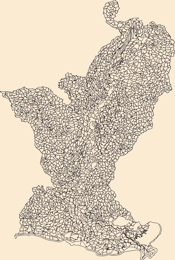
The Watershed Boundary Dataset (WBD) is a comprehensive aggregated collection of hydrologic unit data consistent with the national criteria for delineation and resolution. It defines the areal extent of surface water drainage to a point except in coastal or lake front areas where there could be multiple outlets as stated by the "Federal Standards and Procedures for the National Watershed Boundary Dataset (WBD)" "Standard" (https://pubs.usgs.gov/tm/11/a3/). Watershed boundaries are determined solely upon science-based hydrologic principles, not favoring any administrative boundaries or special projects, nor particular program or agency. This dataset represents the hydrologic unit boundaries to the 12-digit (6th level)...
Tags: 10-digit,
12-digit,
14-digit,
16-digit,
2-digit, All tags...
4-digit,
6-digit,
8-digit,
AR,
Acadia,
Adams,
Alcorn,
Alexander,
Allen,
Amite,
Arkansas,
Arkansas,
Ascension,
Ashley,
Assumption,
Attala,
Avoyelles,
Ballard,
Basin,
Beauregard,
Benton,
Bienville,
Bolivar,
Bollinger,
Bradley,
Butler,
Calcasieu,
Caldwell,
Calhoun,
Calloway,
Cameron,
Cape Girardeau,
Carlisle,
Carroll,
Catahoula,
Chester,
Chickasaw,
Chicot,
Choctaw,
Claiborne,
Clark,
Clay,
Cleveland,
Coahoma,
Columbia,
Concordia,
Copiah,
Craighead,
Crittenden,
Crockett,
Cross,
Dallas,
DeSoto,
Desha,
Downloadable Data,
Drew,
Dunklin,
Dyer,
East Baton Rouge,
East Carroll,
East Feliciana,
Esri Shapefile nan,
Evangeline,
Faulkner,
Fayette,
Franklin,
Fulton,
Garland,
Gibson,
Grant,
Graves,
Greene,
Grenada,
HU-2,
HU-2 Region,
HU2_08,
HUC,
Hardeman,
Harrison,
Haywood,
Hempstead,
Henderson,
Henry,
Hickman,
Hinds,
Holmes,
Hot Spring,
Howard,
Humphreys,
Hydrography,
Hydrologic Unit Code,
Hydrologic Units,
IL,
Iberia,
Iberville,
Illinois,
Iron,
Issaquena,
Jackson,
Jefferson,
Jefferson Davis,
KY,
Kentucky,
LA,
LaSalle,
Lafayette,
Lafourche,
Lake,
Lauderdale,
Lawrence,
Leake,
Lee,
Leflore,
Lincoln,
Livingston,
Lonoke,
Louisiana,
MO,
MS,
Madison,
Marshall,
McCracken,
McNairy,
Mississippi,
Mississippi,
Missouri,
Monroe,
Montgomery,
Morehouse,
Natchitoches,
National Watershed Boundary Dataset (WBD),
National Watershed Boundary Dataset (WBD),
Nevada,
New Madrid,
Obion,
Oktibbeha,
Orleans,
Ouachita,
Panola,
Pemiscot,
Perry,
Phillips,
Pike,
Plaquemines,
Poinsett,
Pointe Coupee,
Polk,
Pontotoc,
Prairie,
Prentiss,
Pulaski,
Quitman,
Randolph,
Rapides,
Region,
Reynolds,
Richland,
Saline,
Scott,
Shapefile,
Sharkey,
Shelby,
St. Bernard,
St. Charles,
St. Francis,
St. Francois,
St. Helena,
St. James,
St. John the Baptist,
St. Landry,
St. Martin,
St. Mary,
St. Tammany,
Ste. Genevieve,
Stoddard,
Sub-basin,
Sub-region,
Subwatershed,
Sunflower,
TN,
Tallahatchie,
Tangipahoa,
Tate,
Tennessee,
Tensas,
Terrebonne,
Tippah,
Tipton,
Tunica,
US,
Union,
United States,
Vermilion,
Vernon,
WBD,
Warren,
Washington,
Watershed,
Watershed Boundary Dataset,
Wayne,
Weakley,
Webster,
West Baton Rouge,
West Carroll,
West Feliciana,
White,
Wilkinson,
Winn,
Woodruff,
Yalobusha,
Yazoo,
Yell,
inlandWaters, Fewer tags

The Watershed Boundary Dataset (WBD) is a comprehensive aggregated collection of hydrologic unit data consistent with the national criteria for delineation and resolution. It defines the areal extent of surface water drainage to a point except in coastal or lake front areas where there could be multiple outlets as stated by the "Federal Standards and Procedures for the National Watershed Boundary Dataset (WBD)" "Standard" (https://pubs.usgs.gov/tm/11/a3/). Watershed boundaries are determined solely upon science-based hydrologic principles, not favoring any administrative boundaries or special projects, nor particular program or agency. This dataset represents the hydrologic unit boundaries to the 12-digit (6th level)...
Tags: 10-digit,
12-digit,
14-digit,
16-digit,
2-digit, All tags...
4-digit,
6-digit,
8-digit,
Adair,
Adams,
Alexander,
Allegany,
Alleghany,
Allegheny,
Allen,
Anderson,
Armstrong,
Ashe,
Ashland,
Ashtabula,
Athens,
Auglaize,
Ballard,
Barbour,
Barren,
Bartholomew,
Basin,
Bath,
Beaver,
Bedford,
Bell,
Belmont,
Benton,
Blackford,
Blair,
Bland,
Bledsoe,
Boone,
Bourbon,
Boyd,
Boyle,
Bracken,
Braxton,
Breathitt,
Breckinridge,
Brooke,
Brown,
Buchanan,
Bullitt,
Butler,
Cabell,
Caldwell,
Calhoun,
Cambria,
Cameron,
Campbell,
Cannon,
Carroll,
Carter,
Casey,
Cass,
Cattaraugus,
Champaign,
Chautauqua,
Cheatham,
Christian,
Claiborne,
Clarion,
Clark,
Clay,
Clearfield,
Clermont,
Clinton,
Coffee,
Coles,
Columbiana,
Coshocton,
Craig,
Crawford,
Crittenden,
Cumberland,
Darke,
Davidson,
Daviess,
DeKalb,
Dearborn,
Decatur,
Delaware,
Dickenson,
Dickson,
Doddridge,
Douglas,
Downloadable Data,
Dubois,
Edgar,
Edmonson,
Edwards,
Effingham,
Elk,
Elliott,
Erie,
Estill,
Fairfield,
Fayette,
Fentress,
Fleming,
Floyd,
Ford,
Forest,
Fountain,
Franklin,
Fulton,
Galax,
Gallatin,
Gallia,
Garrard,
Garrett,
Geauga,
GeoPackage,
Gibson,
Giles,
Gilmer,
Grant,
Grayson,
Green,
Greenbrier,
Greene,
Greenup,
Grundy,
Guernsey,
HU-2,
HU-2 Region,
HU2_05,
HUC,
Hamilton,
Hancock,
Hardin,
Harlan,
Harrison,
Hart,
Henderson,
Hendricks,
Henry,
Hickman,
Highland,
Hocking,
Holmes,
Hopkins,
Houston,
Howard,
Humphreys,
Huntington,
Hydrography,
Hydrologic Unit Code,
Hydrologic Units,
IL,
IN,
Illinois,
Indiana,
Indiana,
Iroquois,
Jackson,
Jasper,
Jay,
Jefferson,
Jennings,
Jessamine,
Johnson,
KY,
Kanawha,
Kenton,
Kentucky,
Knott,
Knox,
Kosciusko,
Larue,
Laurel,
Lawrence,
Lee,
Leslie,
Letcher,
Lewis,
Licking,
Lincoln,
Livingston,
Logan,
Lyon,
MD,
Macon,
Madison,
Magoffin,
Mahoning,
Marion,
Marshall,
Martin,
Maryland,
Mason,
Massac,
McCracken,
McCreary,
McDowell,
McKean,
McLean,
Meade,
Medina,
Meigs,
Menifee,
Mercer,
Metcalfe,
Miami,
Mingo,
Monongalia,
Monroe,
Montgomery,
Morgan,
Morrow,
Moultrie,
Muhlenberg,
Muskingum,
NC,
NY,
National Watershed Boundary Dataset (WBD),
National Watershed Boundary Dataset (WBD),
Nelson,
New York,
Nicholas,
Noble,
North Carolina,
OH,
Ohio,
Ohio,
Oldham,
Open Geospatial Consortium GeoPackage 1.2,
Orange,
Overton,
Owen,
Owsley,
PA,
Parke,
Patrick,
Pendleton,
Pennsylvania,
Perry,
Pickaway,
Pickett,
Pike,
Pleasants,
Pocahontas,
Pope,
Portage,
Posey,
Potter,
Powell,
Preble,
Preston,
Pulaski,
Putnam,
Radford,
Raleigh,
Randolph,
Region,
Richland,
Ripley,
Ritchie,
Roane,
Robertson,
Rockcastle,
Ross,
Rowan,
Rush,
Russell,
Rutherford,
Saline,
Scioto,
Scott,
Sequatchie,
Shelby,
Simpson,
Smith,
Smyth,
Somerset,
Spencer,
Stark,
Starke,
Stewart,
Sub-basin,
Sub-region,
Subwatershed,
Sullivan,
Summers,
Summit,
Sumner,
Surry,
Switzerland,
TN,
Taylor,
Tazewell,
Tennessee,
Tippecanoe,
Tipton,
Todd,
Trigg,
Trimble,
Trousdale,
Trumbull,
Tucker,
Tuscarawas,
Tyler,
US,
Union,
United States,
Upshur,
VA,
Van Buren,
Vanderburgh,
Venango,
Vermilion,
Vermillion,
Vigo,
Vinton,
Virginia,
WBD,
WV,
Wabash,
Warren,
Warrick,
Washington,
Watauga,
Watershed,
Watershed Boundary Dataset,
Wayne,
Webster,
Wells,
West Virginia,
Westmoreland,
Wetzel,
White,
Whitley,
Wilkes,
Williamson,
Wilson,
Wirt,
Wise,
Wolfe,
Wood,
Woodford,
Wyandot,
Wyoming,
Wythe,
inlandWaters, Fewer tags

The Watershed Boundary Dataset (WBD) is a comprehensive aggregated collection of hydrologic unit data consistent with the national criteria for delineation and resolution. It defines the areal extent of surface water drainage to a point except in coastal or lake front areas where there could be multiple outlets as stated by the "Federal Standards and Procedures for the National Watershed Boundary Dataset (WBD)" "Standard" (https://pubs.usgs.gov/tm/11/a3/). Watershed boundaries are determined solely upon science-based hydrologic principles, not favoring any administrative boundaries or special projects, nor particular program or agency. This dataset represents the hydrologic unit boundaries to the 12-digit (6th level)...
Tags: 10-digit,
12-digit,
14-digit,
16-digit,
2-digit, All tags...
4-digit,
6-digit,
8-digit,
Adair,
Adams,
Alexander,
Allegany,
Alleghany,
Allegheny,
Allen,
Anderson,
Armstrong,
Ashe,
Ashland,
Ashtabula,
Athens,
Auglaize,
Ballard,
Barbour,
Barren,
Bartholomew,
Basin,
Bath,
Beaver,
Bedford,
Bell,
Belmont,
Benton,
Blackford,
Blair,
Bland,
Bledsoe,
Boone,
Bourbon,
Boyd,
Boyle,
Bracken,
Braxton,
Breathitt,
Breckinridge,
Brooke,
Brown,
Buchanan,
Bullitt,
Butler,
Cabell,
Caldwell,
Calhoun,
Cambria,
Cameron,
Campbell,
Cannon,
Carroll,
Carter,
Casey,
Cass,
Cattaraugus,
Champaign,
Chautauqua,
Cheatham,
Christian,
Claiborne,
Clarion,
Clark,
Clay,
Clearfield,
Clermont,
Clinton,
Coffee,
Coles,
Columbiana,
Coshocton,
Craig,
Crawford,
Crittenden,
Cumberland,
Darke,
Davidson,
Daviess,
DeKalb,
Dearborn,
Decatur,
Delaware,
Dickenson,
Dickson,
Doddridge,
Douglas,
Downloadable Data,
Dubois,
Edgar,
Edmonson,
Edwards,
Effingham,
Elk,
Elliott,
Erie,
Esri Shapefile nan,
Estill,
Fairfield,
Fayette,
Fentress,
Fleming,
Floyd,
Ford,
Forest,
Fountain,
Franklin,
Fulton,
Galax,
Gallatin,
Gallia,
Garrard,
Garrett,
Geauga,
Gibson,
Giles,
Gilmer,
Grant,
Grayson,
Green,
Greenbrier,
Greene,
Greenup,
Grundy,
Guernsey,
HU-2,
HU-2 Region,
HU2_05,
HUC,
Hamilton,
Hancock,
Hardin,
Harlan,
Harrison,
Hart,
Henderson,
Hendricks,
Henry,
Hickman,
Highland,
Hocking,
Holmes,
Hopkins,
Houston,
Howard,
Humphreys,
Huntington,
Hydrography,
Hydrologic Unit Code,
Hydrologic Units,
IL,
IN,
Illinois,
Indiana,
Indiana,
Iroquois,
Jackson,
Jasper,
Jay,
Jefferson,
Jennings,
Jessamine,
Johnson,
KY,
Kanawha,
Kenton,
Kentucky,
Knott,
Knox,
Kosciusko,
Larue,
Laurel,
Lawrence,
Lee,
Leslie,
Letcher,
Lewis,
Licking,
Lincoln,
Livingston,
Logan,
Lyon,
MD,
Macon,
Madison,
Magoffin,
Mahoning,
Marion,
Marshall,
Martin,
Maryland,
Mason,
Massac,
McCracken,
McCreary,
McDowell,
McKean,
McLean,
Meade,
Medina,
Meigs,
Menifee,
Mercer,
Metcalfe,
Miami,
Mingo,
Monongalia,
Monroe,
Montgomery,
Morgan,
Morrow,
Moultrie,
Muhlenberg,
Muskingum,
NC,
NY,
National Watershed Boundary Dataset (WBD),
National Watershed Boundary Dataset (WBD),
Nelson,
New York,
Nicholas,
Noble,
North Carolina,
OH,
Ohio,
Ohio,
Oldham,
Orange,
Overton,
Owen,
Owsley,
PA,
Parke,
Patrick,
Pendleton,
Pennsylvania,
Perry,
Pickaway,
Pickett,
Pike,
Pleasants,
Pocahontas,
Pope,
Portage,
Posey,
Potter,
Powell,
Preble,
Preston,
Pulaski,
Putnam,
Radford,
Raleigh,
Randolph,
Region,
Richland,
Ripley,
Ritchie,
Roane,
Robertson,
Rockcastle,
Ross,
Rowan,
Rush,
Russell,
Rutherford,
Saline,
Scioto,
Scott,
Sequatchie,
Shapefile,
Shelby,
Simpson,
Smith,
Smyth,
Somerset,
Spencer,
Stark,
Starke,
Stewart,
Sub-basin,
Sub-region,
Subwatershed,
Sullivan,
Summers,
Summit,
Sumner,
Surry,
Switzerland,
TN,
Taylor,
Tazewell,
Tennessee,
Tippecanoe,
Tipton,
Todd,
Trigg,
Trimble,
Trousdale,
Trumbull,
Tucker,
Tuscarawas,
Tyler,
US,
Union,
United States,
Upshur,
VA,
Van Buren,
Vanderburgh,
Venango,
Vermilion,
Vermillion,
Vigo,
Vinton,
Virginia,
WBD,
WV,
Wabash,
Warren,
Warrick,
Washington,
Watauga,
Watershed,
Watershed Boundary Dataset,
Wayne,
Webster,
Wells,
West Virginia,
Westmoreland,
Wetzel,
White,
Whitley,
Wilkes,
Williamson,
Wilson,
Wirt,
Wise,
Wolfe,
Wood,
Woodford,
Wyandot,
Wyoming,
Wythe,
inlandWaters, Fewer tags
The Watershed Boundary Dataset (WBD) is a comprehensive aggregated collection of hydrologic unit data consistent with the national criteria for delineation and resolution. It defines the areal extent of surface water drainage to a point except in coastal or lake front areas where there could be multiple outlets as stated by the "Federal Standards and Procedures for the National Watershed Boundary Dataset (WBD)" "Standard" (https://pubs.usgs.gov/tm/11/a3/). Watershed boundaries are determined solely upon science-based hydrologic principles, not favoring any administrative boundaries or special projects, nor particular program or agency. This dataset represents the hydrologic unit boundaries to the 12-digit (6th level)...
Tags: 10-digit,
12-digit,
14-digit,
16-digit,
2-digit, All tags...
4-digit,
6-digit,
8-digit,
Adair,
Adams,
Alexander,
Allegany,
Alleghany,
Allegheny,
Allen,
Anderson,
Armstrong,
Ashe,
Ashland,
Ashtabula,
Athens,
Auglaize,
Ballard,
Barbour,
Barren,
Bartholomew,
Basin,
Bath,
Beaver,
Bedford,
Bell,
Belmont,
Benton,
Blackford,
Blair,
Bland,
Bledsoe,
Boone,
Bourbon,
Boyd,
Boyle,
Bracken,
Braxton,
Breathitt,
Breckinridge,
Brooke,
Brown,
Buchanan,
Bullitt,
Butler,
Cabell,
Caldwell,
Calhoun,
Cambria,
Cameron,
Campbell,
Cannon,
Carroll,
Carter,
Casey,
Cass,
Cattaraugus,
Champaign,
Chautauqua,
Cheatham,
Christian,
Claiborne,
Clarion,
Clark,
Clay,
Clearfield,
Clermont,
Clinton,
Coffee,
Coles,
Columbiana,
Coshocton,
Craig,
Crawford,
Crittenden,
Cumberland,
Darke,
Davidson,
Daviess,
DeKalb,
Dearborn,
Decatur,
Delaware,
Dickenson,
Dickson,
Doddridge,
Douglas,
Downloadable Data,
Dubois,
Edgar,
Edmonson,
Edwards,
Effingham,
Elk,
Elliott,
Erie,
Esri File GeoDatabase 10,
Estill,
Fairfield,
Fayette,
Fentress,
FileGDB,
Fleming,
Floyd,
Ford,
Forest,
Fountain,
Franklin,
Fulton,
Galax,
Gallatin,
Gallia,
Garrard,
Garrett,
Geauga,
Gibson,
Giles,
Gilmer,
Grant,
Grayson,
Green,
Greenbrier,
Greene,
Greenup,
Grundy,
Guernsey,
HU-2,
HU-2 Region,
HU2_05,
HUC,
Hamilton,
Hancock,
Hardin,
Harlan,
Harrison,
Hart,
Henderson,
Hendricks,
Henry,
Hickman,
Highland,
Hocking,
Holmes,
Hopkins,
Houston,
Howard,
Humphreys,
Huntington,
Hydrography,
Hydrologic Unit Code,
Hydrologic Units,
IL,
IN,
Illinois,
Indiana,
Indiana,
Iroquois,
Jackson,
Jasper,
Jay,
Jefferson,
Jennings,
Jessamine,
Johnson,
KY,
Kanawha,
Kenton,
Kentucky,
Knott,
Knox,
Kosciusko,
Larue,
Laurel,
Lawrence,
Lee,
Leslie,
Letcher,
Lewis,
Licking,
Lincoln,
Livingston,
Logan,
Lyon,
MD,
Macon,
Madison,
Magoffin,
Mahoning,
Marion,
Marshall,
Martin,
Maryland,
Mason,
Massac,
McCracken,
McCreary,
McDowell,
McKean,
McLean,
Meade,
Medina,
Meigs,
Menifee,
Mercer,
Metcalfe,
Miami,
Mingo,
Monongalia,
Monroe,
Montgomery,
Morgan,
Morrow,
Moultrie,
Muhlenberg,
Muskingum,
NC,
NY,
National Watershed Boundary Dataset (WBD),
National Watershed Boundary Dataset (WBD),
Nelson,
New York,
Nicholas,
Noble,
North Carolina,
OH,
Ohio,
Ohio,
Oldham,
Orange,
Overton,
Owen,
Owsley,
PA,
Parke,
Patrick,
Pendleton,
Pennsylvania,
Perry,
Pickaway,
Pickett,
Pike,
Pleasants,
Pocahontas,
Pope,
Portage,
Posey,
Potter,
Powell,
Preble,
Preston,
Pulaski,
Putnam,
Radford,
Raleigh,
Randolph,
Region,
Richland,
Ripley,
Ritchie,
Roane,
Robertson,
Rockcastle,
Ross,
Rowan,
Rush,
Russell,
Rutherford,
Saline,
Scioto,
Scott,
Sequatchie,
Shelby,
Simpson,
Smith,
Smyth,
Somerset,
Spencer,
Stark,
Starke,
Stewart,
Sub-basin,
Sub-region,
Subwatershed,
Sullivan,
Summers,
Summit,
Sumner,
Surry,
Switzerland,
TN,
Taylor,
Tazewell,
Tennessee,
Tippecanoe,
Tipton,
Todd,
Trigg,
Trimble,
Trousdale,
Trumbull,
Tucker,
Tuscarawas,
Tyler,
US,
Union,
United States,
Upshur,
VA,
Van Buren,
Vanderburgh,
Venango,
Vermilion,
Vermillion,
Vigo,
Vinton,
Virginia,
WBD,
WV,
Wabash,
Warren,
Warrick,
Washington,
Watauga,
Watershed,
Watershed Boundary Dataset,
Wayne,
Webster,
Wells,
West Virginia,
Westmoreland,
Wetzel,
White,
Whitley,
Wilkes,
Williamson,
Wilson,
Wirt,
Wise,
Wolfe,
Wood,
Woodford,
Wyandot,
Wyoming,
Wythe,
inlandWaters, Fewer tags
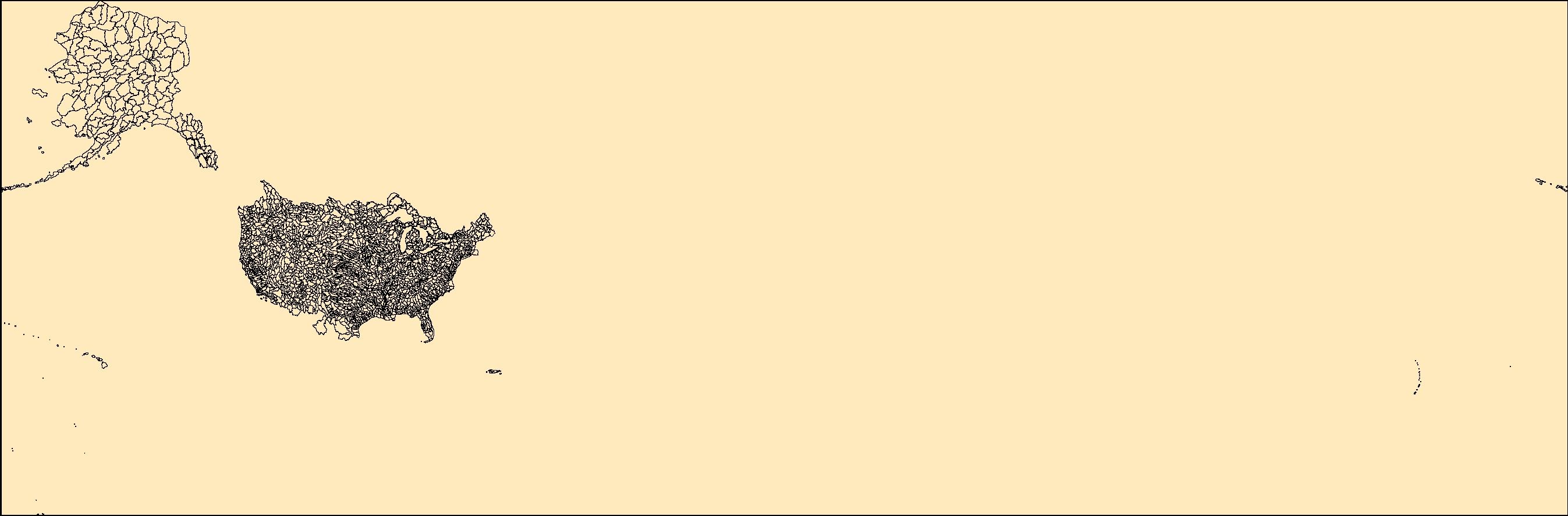
The Watershed Boundary Dataset (WBD) is a comprehensive aggregated collection of hydrologic unit data consistent with the national criteria for delineation and resolution. It defines the areal extent of surface water drainage to a point except in coastal or lake front areas where there could be multiple outlets as stated by the "Federal Standards and Procedures for the National Watershed Boundary Dataset (WBD)" "Standard" (https://pubs.usgs.gov/tm/11/a3/). Watershed boundaries are determined solely upon science-based hydrologic principles, not favoring any administrative boundaries or special projects, nor particular program or agency. This dataset represents the hydrologic unit boundaries to the 12-digit (6th level)...
Tags: 10-digit,
12-digit,
14-digit,
16-digit,
2-digit, All tags...
4-digit,
6-digit,
8-digit,
AK,
AL,
AR,
AS,
AZ,
Alabama,
Alaska,
American Samoa,
Arizona,
Arkansas,
Basin,
CA,
CO,
CT,
California,
Colorado,
Connecticut,
DC,
DE,
Delaware,
District of Columbia,
Downloadable Data,
Esri File GeoDatabase 10,
FL,
FileGDB,
Florida,
GA,
GU,
Georgia,
Guam,
HI,
HUC,
Hawaii,
Hydrography,
Hydrologic Unit Code,
Hydrologic Units,
IA,
ID,
IL,
IN,
Idaho,
Illinois,
Indiana,
Iowa,
KS,
KY,
Kansas,
Kentucky,
LA,
Louisiana,
MA,
MD,
ME,
MI,
MN,
MO,
MP,
MS,
MT,
Maine,
Maryland,
Massachusetts,
Michigan,
Minnesota,
Mississippi,
Missouri,
Montana,
NC,
ND,
NE,
NH,
NJ,
NM,
NV,
NY,
National,
National,
National Watershed Boundary Dataset (WBD),
National Watershed Boundary Dataset (WBD),
Nebraska,
Nevada,
New Hampshire,
New Jersey,
New Mexico,
New York,
North Carolina,
North Dakota,
Northern Mariana Islands,
OH,
OK,
OR,
Ohio,
Oklahoma,
Oregon,
PA,
PR,
Pennsylvania,
Puerto Rico,
RI,
Region,
Rhode Island,
SC,
SD,
South Carolina,
South Dakota,
Sub-basin,
Sub-region,
Subwatershed,
TN,
TX,
Tennessee,
Texas,
US,
UT,
United States,
Utah,
VA,
VI,
VT,
Vermont,
Virgin Islands,
Virginia,
WA,
WBD,
WI,
WV,
WY,
Washington,
Watershed,
Watershed Boundary Dataset,
West Virginia,
Wisconsin,
Wyoming,
inlandWaters, Fewer tags

The Watershed Boundary Dataset (WBD) is a comprehensive aggregated collection of hydrologic unit data consistent with the national criteria for delineation and resolution. It defines the areal extent of surface water drainage to a point except in coastal or lake front areas where there could be multiple outlets as stated by the "Federal Standards and Procedures for the National Watershed Boundary Dataset (WBD)" "Standard" (https://pubs.usgs.gov/tm/11/a3/). Watershed boundaries are determined solely upon science-based hydrologic principles, not favoring any administrative boundaries or special projects, nor particular program or agency. This dataset represents the hydrologic unit boundaries to the 12-digit (6th level)...
Tags: 10-digit,
12-digit,
14-digit,
16-digit,
2-digit, All tags...
4-digit,
6-digit,
8-digit,
AR,
Acadia,
Adams,
Alcorn,
Alexander,
Allen,
Amite,
Arkansas,
Arkansas,
Ascension,
Ashley,
Assumption,
Attala,
Avoyelles,
Ballard,
Basin,
Beauregard,
Benton,
Bienville,
Bolivar,
Bollinger,
Bradley,
Butler,
Calcasieu,
Caldwell,
Calhoun,
Calloway,
Cameron,
Cape Girardeau,
Carlisle,
Carroll,
Catahoula,
Chester,
Chickasaw,
Chicot,
Choctaw,
Claiborne,
Clark,
Clay,
Cleveland,
Coahoma,
Columbia,
Concordia,
Copiah,
Craighead,
Crittenden,
Crockett,
Cross,
Dallas,
DeSoto,
Desha,
Downloadable Data,
Drew,
Dunklin,
Dyer,
East Baton Rouge,
East Carroll,
East Feliciana,
Evangeline,
Faulkner,
Fayette,
Franklin,
Fulton,
Garland,
GeoPackage,
Gibson,
Grant,
Graves,
Greene,
Grenada,
HU-2,
HU-2 Region,
HU2_08,
HUC,
Hardeman,
Harrison,
Haywood,
Hempstead,
Henderson,
Henry,
Hickman,
Hinds,
Holmes,
Hot Spring,
Howard,
Humphreys,
Hydrography,
Hydrologic Unit Code,
Hydrologic Units,
IL,
Iberia,
Iberville,
Illinois,
Iron,
Issaquena,
Jackson,
Jefferson,
Jefferson Davis,
KY,
Kentucky,
LA,
LaSalle,
Lafayette,
Lafourche,
Lake,
Lauderdale,
Lawrence,
Leake,
Lee,
Leflore,
Lincoln,
Livingston,
Lonoke,
Louisiana,
MO,
MS,
Madison,
Marshall,
McCracken,
McNairy,
Mississippi,
Mississippi,
Missouri,
Monroe,
Montgomery,
Morehouse,
Natchitoches,
National Watershed Boundary Dataset (WBD),
National Watershed Boundary Dataset (WBD),
Nevada,
New Madrid,
Obion,
Oktibbeha,
Open Geospatial Consortium GeoPackage 1.2,
Orleans,
Ouachita,
Panola,
Pemiscot,
Perry,
Phillips,
Pike,
Plaquemines,
Poinsett,
Pointe Coupee,
Polk,
Pontotoc,
Prairie,
Prentiss,
Pulaski,
Quitman,
Randolph,
Rapides,
Region,
Reynolds,
Richland,
Saline,
Scott,
Sharkey,
Shelby,
St. Bernard,
St. Charles,
St. Francis,
St. Francois,
St. Helena,
St. James,
St. John the Baptist,
St. Landry,
St. Martin,
St. Mary,
St. Tammany,
Ste. Genevieve,
Stoddard,
Sub-basin,
Sub-region,
Subwatershed,
Sunflower,
TN,
Tallahatchie,
Tangipahoa,
Tate,
Tennessee,
Tensas,
Terrebonne,
Tippah,
Tipton,
Tunica,
US,
Union,
United States,
Vermilion,
Vernon,
WBD,
Warren,
Washington,
Watershed,
Watershed Boundary Dataset,
Wayne,
Weakley,
Webster,
West Baton Rouge,
West Carroll,
West Feliciana,
White,
Wilkinson,
Winn,
Woodruff,
Yalobusha,
Yazoo,
Yell,
inlandWaters, Fewer tags

The Watershed Boundary Dataset (WBD) is a comprehensive aggregated collection of hydrologic unit data consistent with the national criteria for delineation and resolution. It defines the areal extent of surface water drainage to a point except in coastal or lake front areas where there could be multiple outlets as stated by the "Federal Standards and Procedures for the National Watershed Boundary Dataset (WBD)" "Standard" (https://pubs.usgs.gov/tm/11/a3/). Watershed boundaries are determined solely upon science-based hydrologic principles, not favoring any administrative boundaries or special projects, nor particular program or agency. This dataset represents the hydrologic unit boundaries to the 12-digit (6th level)...
Tags: 10-digit,
12-digit,
14-digit,
16-digit,
2-digit, All tags...
4-digit,
6-digit,
8-digit,
AK,
AL,
AR,
AS,
AZ,
Alabama,
Alaska,
American Samoa,
Arizona,
Arkansas,
Basin,
CA,
CO,
CT,
California,
Colorado,
Connecticut,
DC,
DE,
Delaware,
District of Columbia,
Downloadable Data,
FL,
Florida,
GA,
GU,
GeoPackage,
Georgia,
Guam,
HI,
HUC,
Hawaii,
Hydrography,
Hydrologic Unit Code,
Hydrologic Units,
IA,
ID,
IL,
IN,
Idaho,
Illinois,
Indiana,
Iowa,
KS,
KY,
Kansas,
Kentucky,
LA,
Louisiana,
MA,
MD,
ME,
MI,
MN,
MO,
MP,
MS,
MT,
Maine,
Maryland,
Massachusetts,
Michigan,
Minnesota,
Mississippi,
Missouri,
Montana,
NC,
ND,
NE,
NH,
NJ,
NM,
NV,
NY,
National,
National,
National Watershed Boundary Dataset (WBD),
National Watershed Boundary Dataset (WBD),
Nebraska,
Nevada,
New Hampshire,
New Jersey,
New Mexico,
New York,
North Carolina,
North Dakota,
Northern Mariana Islands,
OH,
OK,
OR,
Ohio,
Oklahoma,
Open Geospatial Consortium GeoPackage 1.2,
Oregon,
PA,
PR,
Pennsylvania,
Puerto Rico,
RI,
Region,
Rhode Island,
SC,
SD,
South Carolina,
South Dakota,
Sub-basin,
Sub-region,
Subwatershed,
TN,
TX,
Tennessee,
Texas,
US,
UT,
United States,
Utah,
VA,
VI,
VT,
Vermont,
Virgin Islands,
Virginia,
WA,
WBD,
WI,
WV,
WY,
Washington,
Watershed,
Watershed Boundary Dataset,
West Virginia,
Wisconsin,
Wyoming,
inlandWaters, Fewer tags

The Watershed Boundary Dataset (WBD) is a comprehensive aggregated collection of hydrologic unit data consistent with the national criteria for delineation and resolution. It defines the areal extent of surface water drainage to a point except in coastal or lake front areas where there could be multiple outlets as stated by the "Federal Standards and Procedures for the National Watershed Boundary Dataset (WBD)" "Standard" (https://pubs.usgs.gov/tm/11/a3/). Watershed boundaries are determined solely upon science-based hydrologic principles, not favoring any administrative boundaries or special projects, nor particular program or agency. This dataset represents the hydrologic unit boundaries to the 12-digit (6th level)...
Tags: 10-digit,
12-digit,
14-digit,
16-digit,
2-digit, All tags...
4-digit,
6-digit,
8-digit,
Adair,
Adams,
Aitkin,
Alexander,
Allamakee,
Anoka,
Appanoose,
Ashland,
Audrain,
Audubon,
Ballard,
Barron,
Basin,
Bayfield,
Becker,
Beltrami,
Benton,
Berrien,
Big Stone,
Black Hawk,
Blue Earth,
Bollinger,
Bond,
Boone,
Bremer,
Brookings,
Brown,
Buchanan,
Buena Vista,
Buffalo,
Bureau,
Burnett,
Butler,
Calhoun,
Callaway,
Cape Girardeau,
Carlton,
Carroll,
Carver,
Cass,
Cedar,
Cerro Gordo,
Champaign,
Chickasaw,
Chippewa,
Chisago,
Christian,
Clark,
Clarke,
Clay,
Clayton,
Clearwater,
Clinton,
Codington,
Coles,
Columbia,
Cook,
Cottonwood,
Crawford,
Crow Wing,
Dakota,
Dallas,
Dane,
Davis,
Day,
De Witt,
DeKalb,
Delaware,
Dent,
Des Moines,
Deuel,
Dickinson,
Dodge,
Douglas,
Downloadable Data,
DuPage,
Dubuque,
Dunn,
Eau Claire,
Effingham,
Elkhart,
Emmet,
Esri File GeoDatabase 10,
Faribault,
Fayette,
FileGDB,
Fillmore,
Floyd,
Fond du Lac,
Ford,
Forest,
Franklin,
Freeborn,
Fulton,
Gasconade,
Gogebic,
Goodhue,
Grant,
Green,
Green Lake,
Greene,
Grundy,
Guthrie,
HU-2,
HU-2 Region,
HU2_07,
HUC,
Hamilton,
Hancock,
Hardin,
Henderson,
Hennepin,
Henry,
Houston,
Howard,
Hubbard,
Humboldt,
Hydrography,
Hydrologic Unit Code,
Hydrologic Units,
IA,
IL,
IN,
Illinois,
Indiana,
Iowa,
Iowa,
Iron,
Iroquois,
Isanti,
Itasca,
Jackson,
Jasper,
Jefferson,
Jersey,
Jo Daviess,
Johnson,
Jones,
Juneau,
KY,
Kanabec,
Kandiyohi,
Kane,
Kankakee,
Kendall,
Kenosha,
Kentucky,
Keokuk,
Knox,
Kosciusko,
Kossuth,
La Crosse,
LaPorte,
LaSalle,
Lac qui Parle,
Lafayette,
Lake,
Langlade,
Le Sueur,
Lee,
Lewis,
Lincoln,
Linn,
Livingston,
Logan,
Louisa,
Lucas,
Lyon,
MI,
MN,
MO,
Macon,
Macoupin,
Madison,
Mahaska,
Marathon,
Maries,
Marion,
Marquette,
Marshall,
Martin,
Mason,
McDonough,
McHenry,
McLean,
McLeod,
Meeker,
Menard,
Mercer,
Michigan,
Mille Lacs,
Milwaukee,
Minnesota,
Mississippi,
Missouri,
Mitchell,
Monroe,
Montgomery,
Morgan,
Morrison,
Moultrie,
Mower,
Murray,
Muscatine,
ND,
National Watershed Boundary Dataset (WBD),
National Watershed Boundary Dataset (WBD),
Newton,
Nicollet,
Nobles,
North Dakota,
Ogle,
Olmsted,
Oneida,
Osage,
Otter Tail,
Palo Alto,
Peoria,
Pepin,
Perry,
Phelps,
Piatt,
Pierce,
Pike,
Pine,
Pipestone,
Pocahontas,
Polk,
Pope,
Portage,
Porter,
Poweshiek,
Price,
Pulaski,
Putnam,
Racine,
Ralls,
Ramsey,
Randolph,
Redwood,
Region,
Renville,
Reynolds,
Rice,
Richland,
Roberts,
Rock,
Rock Island,
Rusk,
SD,
Sac,
Sangamon,
Sauk,
Sawyer,
Schuyler,
Scotland,
Scott,
Shawano,
Shelby,
Sherburne,
Sibley,
South Dakota,
St. Charles,
St. Clair,
St. Croix,
St. Francois,
St. Joseph,
St. Louis,
Stark,
Starke,
Ste. Genevieve,
Stearns,
Steele,
Stephenson,
Stevens,
Story,
Sub-basin,
Sub-region,
Subwatershed,
Swift,
Tama,
Taylor,
Tazewell,
Texas,
Todd,
Traverse,
Trempealeau,
US,
Union,
United States,
Van Buren,
Vermilion,
Vernon,
Vilas,
WBD,
WI,
Wabasha,
Wadena,
Walworth,
Wapello,
Warren,
Waseca,
Washburn,
Washington,
Watershed,
Watershed Boundary Dataset,
Watonwan,
Waukesha,
Waushara,
Wayne,
Webster,
White,
Whiteside,
Will,
Williamson,
Winnebago,
Winneshiek,
Winona,
Wisconsin,
Wood,
Woodford,
Worth,
Wright,
Yellow Medicine,
inlandWaters, Fewer tags
The Watershed Boundary Dataset (WBD) is a comprehensive aggregated collection of hydrologic unit data consistent with the national criteria for delineation and resolution. It defines the areal extent of surface water drainage to a point except in coastal or lake front areas where there could be multiple outlets as stated by the "Federal Standards and Procedures for the National Watershed Boundary Dataset (WBD)" "Standard" (https://pubs.usgs.gov/tm/11/a3/). Watershed boundaries are determined solely upon science-based hydrologic principles, not favoring any administrative boundaries or special projects, nor particular program or agency. This dataset represents the hydrologic unit boundaries to the 12-digit (6th level)...
Tags: 10-digit,
12-digit,
14-digit,
16-digit,
2-digit, All tags...
4-digit,
6-digit,
8-digit,
AR,
Acadia,
Adams,
Alcorn,
Alexander,
Allen,
Amite,
Arkansas,
Arkansas,
Ascension,
Ashley,
Assumption,
Attala,
Avoyelles,
Ballard,
Basin,
Beauregard,
Benton,
Bienville,
Bolivar,
Bollinger,
Bradley,
Butler,
Calcasieu,
Caldwell,
Calhoun,
Calloway,
Cameron,
Cape Girardeau,
Carlisle,
Carroll,
Catahoula,
Chester,
Chickasaw,
Chicot,
Choctaw,
Claiborne,
Clark,
Clay,
Cleveland,
Coahoma,
Columbia,
Concordia,
Copiah,
Craighead,
Crittenden,
Crockett,
Cross,
Dallas,
DeSoto,
Desha,
Downloadable Data,
Drew,
Dunklin,
Dyer,
East Baton Rouge,
East Carroll,
East Feliciana,
Esri File GeoDatabase 10,
Evangeline,
Faulkner,
Fayette,
FileGDB,
Franklin,
Fulton,
Garland,
Gibson,
Grant,
Graves,
Greene,
Grenada,
HU-2,
HU-2 Region,
HU2_08,
HUC,
Hardeman,
Harrison,
Haywood,
Hempstead,
Henderson,
Henry,
Hickman,
Hinds,
Holmes,
Hot Spring,
Howard,
Humphreys,
Hydrography,
Hydrologic Unit Code,
Hydrologic Units,
IL,
Iberia,
Iberville,
Illinois,
Iron,
Issaquena,
Jackson,
Jefferson,
Jefferson Davis,
KY,
Kentucky,
LA,
LaSalle,
Lafayette,
Lafourche,
Lake,
Lauderdale,
Lawrence,
Leake,
Lee,
Leflore,
Lincoln,
Livingston,
Lonoke,
Louisiana,
MO,
MS,
Madison,
Marshall,
McCracken,
McNairy,
Mississippi,
Mississippi,
Missouri,
Monroe,
Montgomery,
Morehouse,
Natchitoches,
National Watershed Boundary Dataset (WBD),
National Watershed Boundary Dataset (WBD),
Nevada,
New Madrid,
Obion,
Oktibbeha,
Orleans,
Ouachita,
Panola,
Pemiscot,
Perry,
Phillips,
Pike,
Plaquemines,
Poinsett,
Pointe Coupee,
Polk,
Pontotoc,
Prairie,
Prentiss,
Pulaski,
Quitman,
Randolph,
Rapides,
Region,
Reynolds,
Richland,
Saline,
Scott,
Sharkey,
Shelby,
St. Bernard,
St. Charles,
St. Francis,
St. Francois,
St. Helena,
St. James,
St. John the Baptist,
St. Landry,
St. Martin,
St. Mary,
St. Tammany,
Ste. Genevieve,
Stoddard,
Sub-basin,
Sub-region,
Subwatershed,
Sunflower,
TN,
Tallahatchie,
Tangipahoa,
Tate,
Tennessee,
Tensas,
Terrebonne,
Tippah,
Tipton,
Tunica,
US,
Union,
United States,
Vermilion,
Vernon,
WBD,
Warren,
Washington,
Watershed,
Watershed Boundary Dataset,
Wayne,
Weakley,
Webster,
West Baton Rouge,
West Carroll,
West Feliciana,
White,
Wilkinson,
Winn,
Woodruff,
Yalobusha,
Yazoo,
Yell,
inlandWaters, Fewer tags
The Watershed Boundary Dataset (WBD) is a comprehensive aggregated collection of hydrologic unit data consistent with the national criteria for delineation and resolution. It defines the areal extent of surface water drainage to a point except in coastal or lake front areas where there could be multiple outlets as stated by the "Federal Standards and Procedures for the National Watershed Boundary Dataset (WBD)" "Standard" (https://pubs.usgs.gov/tm/11/a3/). Watershed boundaries are determined solely upon science-based hydrologic principles, not favoring any administrative boundaries or special projects, nor particular program or agency. This dataset represents the hydrologic unit boundaries to the 12-digit (6th level)...
Tags: 10-digit,
12-digit,
14-digit,
16-digit,
2-digit, All tags...
4-digit,
6-digit,
8-digit,
Adair,
Adams,
Aitkin,
Alexander,
Allamakee,
Anoka,
Appanoose,
Ashland,
Audrain,
Audubon,
Ballard,
Barron,
Basin,
Bayfield,
Becker,
Beltrami,
Benton,
Berrien,
Big Stone,
Black Hawk,
Blue Earth,
Bollinger,
Bond,
Boone,
Bremer,
Brookings,
Brown,
Buchanan,
Buena Vista,
Buffalo,
Bureau,
Burnett,
Butler,
Calhoun,
Callaway,
Cape Girardeau,
Carlton,
Carroll,
Carver,
Cass,
Cedar,
Cerro Gordo,
Champaign,
Chickasaw,
Chippewa,
Chisago,
Christian,
Clark,
Clarke,
Clay,
Clayton,
Clearwater,
Clinton,
Codington,
Coles,
Columbia,
Cook,
Cottonwood,
Crawford,
Crow Wing,
Dakota,
Dallas,
Dane,
Davis,
Day,
De Witt,
DeKalb,
Delaware,
Dent,
Des Moines,
Deuel,
Dickinson,
Dodge,
Douglas,
Downloadable Data,
DuPage,
Dubuque,
Dunn,
Eau Claire,
Effingham,
Elkhart,
Emmet,
Esri Shapefile nan,
Faribault,
Fayette,
Fillmore,
Floyd,
Fond du Lac,
Ford,
Forest,
Franklin,
Freeborn,
Fulton,
Gasconade,
Gogebic,
Goodhue,
Grant,
Green,
Green Lake,
Greene,
Grundy,
Guthrie,
HU-2,
HU-2 Region,
HU2_07,
HUC,
Hamilton,
Hancock,
Hardin,
Henderson,
Hennepin,
Henry,
Houston,
Howard,
Hubbard,
Humboldt,
Hydrography,
Hydrologic Unit Code,
Hydrologic Units,
IA,
IL,
IN,
Illinois,
Indiana,
Iowa,
Iowa,
Iron,
Iroquois,
Isanti,
Itasca,
Jackson,
Jasper,
Jefferson,
Jersey,
Jo Daviess,
Johnson,
Jones,
Juneau,
KY,
Kanabec,
Kandiyohi,
Kane,
Kankakee,
Kendall,
Kenosha,
Kentucky,
Keokuk,
Knox,
Kosciusko,
Kossuth,
La Crosse,
LaPorte,
LaSalle,
Lac qui Parle,
Lafayette,
Lake,
Langlade,
Le Sueur,
Lee,
Lewis,
Lincoln,
Linn,
Livingston,
Logan,
Louisa,
Lucas,
Lyon,
MI,
MN,
MO,
Macon,
Macoupin,
Madison,
Mahaska,
Marathon,
Maries,
Marion,
Marquette,
Marshall,
Martin,
Mason,
McDonough,
McHenry,
McLean,
McLeod,
Meeker,
Menard,
Mercer,
Michigan,
Mille Lacs,
Milwaukee,
Minnesota,
Mississippi,
Missouri,
Mitchell,
Monroe,
Montgomery,
Morgan,
Morrison,
Moultrie,
Mower,
Murray,
Muscatine,
ND,
National Watershed Boundary Dataset (WBD),
National Watershed Boundary Dataset (WBD),
Newton,
Nicollet,
Nobles,
North Dakota,
Ogle,
Olmsted,
Oneida,
Osage,
Otter Tail,
Palo Alto,
Peoria,
Pepin,
Perry,
Phelps,
Piatt,
Pierce,
Pike,
Pine,
Pipestone,
Pocahontas,
Polk,
Pope,
Portage,
Porter,
Poweshiek,
Price,
Pulaski,
Putnam,
Racine,
Ralls,
Ramsey,
Randolph,
Redwood,
Region,
Renville,
Reynolds,
Rice,
Richland,
Roberts,
Rock,
Rock Island,
Rusk,
SD,
Sac,
Sangamon,
Sauk,
Sawyer,
Schuyler,
Scotland,
Scott,
Shapefile,
Shawano,
Shelby,
Sherburne,
Sibley,
South Dakota,
St. Charles,
St. Clair,
St. Croix,
St. Francois,
St. Joseph,
St. Louis,
Stark,
Starke,
Ste. Genevieve,
Stearns,
Steele,
Stephenson,
Stevens,
Story,
Sub-basin,
Sub-region,
Subwatershed,
Swift,
Tama,
Taylor,
Tazewell,
Texas,
Todd,
Traverse,
Trempealeau,
US,
Union,
United States,
Van Buren,
Vermilion,
Vernon,
Vilas,
WBD,
WI,
Wabasha,
Wadena,
Walworth,
Wapello,
Warren,
Waseca,
Washburn,
Washington,
Watershed,
Watershed Boundary Dataset,
Watonwan,
Waukesha,
Waushara,
Wayne,
Webster,
White,
Whiteside,
Will,
Williamson,
Winnebago,
Winneshiek,
Winona,
Wisconsin,
Wood,
Woodford,
Worth,
Wright,
Yellow Medicine,
inlandWaters, Fewer tags
|
|

