Filters: Tags: Great Bend (X)
57 results (32ms)|
Filters
Date Range
Extensions Types Contacts
Categories Tag Types
|

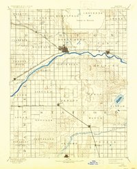
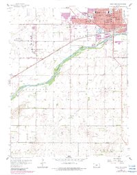
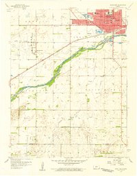
USGS Historical Quadrangle in GeoPDF.
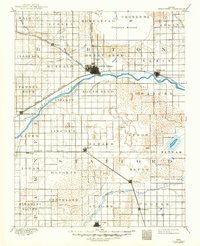
USGS Historical Quadrangle in GeoPDF.
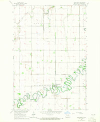
USGS Historical Quadrangle in GeoPDF.

USGS Historical Quadrangle in GeoPDF.
This data set contains imagery from the National Agriculture Imagery Program (NAIP). The NAIP program is administered by USDA FSA and has been established to support two main FSA strategic goals centered on agricultural production. These are, increase stewardship of America's natural resources while enhancing the environment, and to ensure commodities are procured and distributed effectively and efficiently to increase food security. The NAIP program supports these goals by acquiring and providing ortho imagery that has been collected during the agricultural growing season in the U.S. The NAIP ortho imagery is tailored to meet FSA requirements and is a fundamental tool used to support FSA farm and conservation programs....
This data set contains imagery from the National Agriculture Imagery Program (NAIP). The NAIP program is administered by USDA FSA and has been established to support two main FSA strategic goals centered on agricultural production. These are, increase stewardship of America's natural resources while enhancing the environment, and to ensure commodities are procured and distributed effectively and efficiently to increase food security. The NAIP program supports these goals by acquiring and providing ortho imagery that has been collected during the agricultural growing season in the U.S. The NAIP ortho imagery is tailored to meet FSA requirements and is a fundamental tool used to support FSA farm and conservation programs....
High-resolution geophysical mapping of Lake Powell in the Glen Canyon National Recreation Area in Utah and Arizona was conducted between October 8 and November 15, 2017, as part of a collaborative effort between the U.S. Geological Survey and the Bureau of Reclamation to provide high-quality data needed to reassess the area-capacity tables for the Lake Powell reservoir. Seismic data collected during this survey can help to define the rates of deposition within the San Juan and Colorado Rivers, which are the main inflows to Lake Powell. These new data are intended to improve water budget management decisions that affect the natural and recreational resources of the reservoir. Multibeam echosounder bathymetry and...
Categories: Data;
Types: Downloadable,
Map Service,
OGC WFS Layer,
OGC WMS Layer,
Shapefile;
Tags: AML Minos X,
Antelope Canyon,
BOR,
Bullfrog,
Bullfrog Bay,
USGS Historical Quadrangle in GeoPDF.
This data set contains imagery from the National Agriculture Imagery Program (NAIP). The NAIP program is administered by USDA FSA and has been established to support two main FSA strategic goals centered on agricultural production. These are, increase stewardship of America's natural resources while enhancing the environment, and to ensure commodities are procured and distributed effectively and efficiently to increase food security. The NAIP program supports these goals by acquiring and providing ortho imagery that has been collected during the agricultural growing season in the U.S. The NAIP ortho imagery is tailored to meet FSA requirements and is a fundamental tool used to support FSA farm and conservation programs....
This data set contains imagery from the National Agriculture Imagery Program (NAIP). The NAIP program is administered by USDA FSA and has been established to support two main FSA strategic goals centered on agricultural production. These are increase stewardship of America's natural resources while enhancing the environment, and to ensure commodities are procured and distributed effectively and efficiently to increase food security. The NAIP program supports these goals by acquiring and providing ortho imagery that has been collected during the agricultural growing season in the U.S. The NAIP ortho imagery is tailored to meet FSA requirements and is a fundamental tool used to support FSA farm and conservation programs....
This data set contains imagery from the National Agriculture Imagery Program (NAIP). The NAIP program is administered by USDA FSA and has been established to support two main FSA strategic goals centered on agricultural production. These are, increase stewardship of America's natural resources while enhancing the environment, and to ensure commodities are procured and distributed effectively and efficiently to increase food security. The NAIP program supports these goals by acquiring and providing ortho imagery that has been collected during the agricultural growing season in the U.S. The NAIP ortho imagery is tailored to meet FSA requirements and is a fundamental tool used to support FSA farm and conservation programs....
High-resolution geophysical mapping of Lake Powell in the Glen Canyon National Recreation Area in Utah and Arizona was conducted between October 8 and November 15, 2017, as part of a collaborative effort between the U.S. Geological Survey and the Bureau of Reclamation to provide high-quality data needed to reassess the area-capacity tables for the Lake Powell reservoir. Seismic data collected during this survey can help to define the rates of deposition within the San Juan and Colorado Rivers, which are the main inflows to Lake Powell. These new data are intended to improve water budget management decisions that affect the natural and recreational resources of the reservoir. Multibeam echosounder bathymetry and...
Categories: Data;
Types: Downloadable,
Map Service,
OGC WFS Layer,
OGC WMS Layer,
Shapefile;
Tags: Antelope Canyon,
BOR,
Bullfrog,
Bullfrog Bay,
Bureau of Reclamation,
High-resolution geophysical mapping of Lake Powell in the Glen Canyon National Recreation Area in Utah and Arizona was conducted between October 8 and November 15, 2017, as part of a collaborative effort between the U.S. Geological Survey and the Bureau of Reclamation to provide high-quality data needed to reassess the area-capacity tables for the Lake Powell reservoir. Seismic data collected during this survey can help to define the rates of deposition within the San Juan and Colorado Rivers, which are the main inflows to Lake Powell. These new data are intended to improve water budget management decisions that affect the natural and recreational resources of the reservoir. Multibeam echosounder bathymetry and...
High-resolution geophysical mapping of Lake Powell in the Glen Canyon National Recreation Area in Utah and Arizona was conducted between October 8 and November 15, 2017, as part of a collaborative effort between the U.S. Geological Survey and the Bureau of Reclamation to provide high-quality data needed to reassess the area-capacity tables for the Lake Powell reservoir. Seismic data collected during this survey can help to define the rates of deposition within the San Juan and Colorado Rivers, which are the main inflows to Lake Powell. These new data are intended to improve water budget management decisions that affect the natural and recreational resources of the reservoir. Multibeam echosounder bathymetry and...
Categories: Data;
Types: ArcGIS REST Map Service,
ArcGIS Service Definition,
Downloadable,
Map Service;
Tags: Antelope Canyon,
BOR,
Bullfrog,
Bullfrog Bay,
Bureau of Reclamation,
High-resolution geophysical mapping of Lake Powell in the Glen Canyon National Recreation Area in Utah and Arizona was conducted between October 8 and November 15, 2017, as part of a collaborative effort between the U.S. Geological Survey and the Bureau of Reclamation to provide high-quality data needed to reassess the area-capacity tables for the Lake Powell reservoir. Seismic data collected during this survey can help to define the rates of deposition within the San Juan and Colorado Rivers, which are the main inflows to Lake Powell. These new data are intended to improve water budget management decisions that affect the natural and recreational resources of the reservoir. Multibeam echosounder bathymetry and...
Categories: Data;
Types: Downloadable,
Map Service,
OGC WFS Layer,
OGC WMS Layer,
Shapefile;
Tags: Antelope Canyon,
BOR,
Bullfrog,
Bullfrog Bay,
Bureau of Reclamation,
USGS Historical Quadrangle in GeoPDF.
USGS Historical Quadrangle in GeoPDF.
|

|
