Filters: Tags: GOLDEN (X)
76 results (42ms)|
Filters
Date Range
Extensions Types Contacts
Categories Tag Types
|
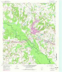
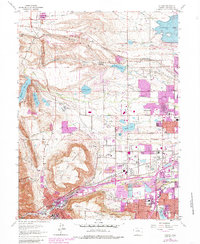
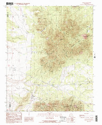
USGS Historical Quadrangle in GeoPDF.
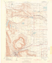
USGS Historical Quadrangle in GeoPDF.
ADMMR map collection: Linda / Golden Mine Sample Map; 38 x 19 in.
Categories: Data;
Tags: Arizona,
Dataset,
Dushey Canyon metallic mineral dist.,
Gladden - 15 Min,
Gold, Lode,
This data set contains imagery from the National Agriculture Imagery Program (NAIP). The NAIP program is administered by USDA FSA and has been established to support two main FSA strategic goals centered on agricultural production. These are increase stewardship of America's natural resources while enhancing the environment, and to ensure commodities are procured and distributed effectively and efficiently to increase food security. The NAIP program supports these goals by acquiring and providing ortho imagery that has been collected during the agricultural growing season in the U.S. The NAIP ortho imagery is tailored to meet FSA requirements and is a fundamental tool used to support FSA farm and conservation programs....
This data set contains imagery from the National Agriculture Imagery Program (NAIP). The NAIP program is administered by USDA FSA and has been established to support two main FSA strategic goals centered on agricultural production. These are, increase stewardship of America's natural resources while enhancing the environment, and to ensure commodities are procured and distributed effectively and efficiently to increase food security. The NAIP program supports these goals by acquiring and providing ortho imagery that has been collected during the agricultural growing season in the U.S. The NAIP ortho imagery is tailored to meet FSA requirements and is a fundamental tool used to support FSA farm and conservation programs....
This data set contains imagery from the National Agriculture Imagery Program (NAIP). The NAIP program is administered by USDA FSA and has been established to support two main FSA strategic goals centered on agricultural production. These are increase stewardship of America's natural resources while enhancing the environment, and to ensure commodities are procured and distributed effectively and efficiently to increase food security. The NAIP program supports these goals by acquiring and providing ortho imagery that has been collected during the agricultural growing season in the U.S. The NAIP ortho imagery is tailored to meet FSA requirements and is a fundamental tool used to support FSA farm and conservation programs....
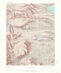
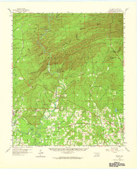
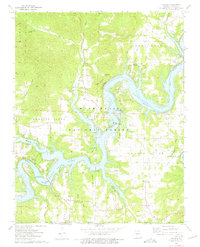
USGS Historical Quadrangle in GeoPDF.
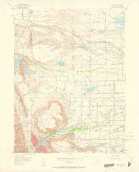
USGS Historical Quadrangle in GeoPDF.
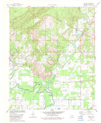
USGS Historical Quadrangle in GeoPDF.
USGS Historical Quadrangle in GeoPDF.
USGS Historical Quadrangle in GeoPDF.
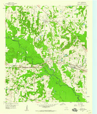
USGS Historical Quadrangle in GeoPDF.
USGS Historical Quadrangle in GeoPDF.
This data set contains imagery from the National Agriculture Imagery Program (NAIP). The NAIP program is administered by USDA FSA and has been established to support two main FSA strategic goals centered on agricultural production. These are, increase stewardship of America's natural resources while enhancing the environment, and to ensure commodities are procured and distributed effectively and efficiently to increase food security. The NAIP program supports these goals by acquiring and providing ortho imagery that has been collected during the agricultural growing season in the U.S. The NAIP ortho imagery is tailored to meet FSA requirements and is a fundamental tool used to support FSA farm and conservation programs....
This data set contains imagery from the National Agriculture Imagery Program (NAIP). The NAIP program is administered by USDA FSA and has been established to support two main FSA strategic goals centered on agricultural production. These are increase stewardship of America's natural resources while enhancing the environment, and to ensure commodities are procured and distributed effectively and efficiently to increase food security. The NAIP program supports these goals by acquiring and providing ortho imagery that has been collected during the agricultural growing season in the U.S. The NAIP ortho imagery is tailored to meet FSA requirements and is a fundamental tool used to support FSA farm and conservation programs....
This data release comprises a georeferenced raster layer depicting the estimated susceptibility to intense rainfall-induced landslides in Puerto Rico, which is a supplement to: Hughes, K.S., and Schulz, W.H., 2020, Map depicting susceptibility to landslides triggered by intense rainfall, Puerto Rico: U.S. Geological Survey Open-File Report 2020–1022, 91 p., 1 plate, scale 1:150,000, https://doi.org/10.3133/ofr20201022. Users of this layer are strongly encouraged to read the text herein and available with Open-File Report 2020-1022. DEVELOPMENT OF THE LANDSLIDE SUSCEPTIBILITY MAP Landslides commonly occur in Puerto Rico during or soon after intense rainfall and present significant hazards to the built environment...
Categories: Data;
Types: Downloadable,
GeoTIFF,
Map Service,
Raster;
Tags: GHSC,
Geomorphology,
Golden,
Puerto Rico,
USGS,
This page houses model results used in the U.S. National Seismic Hazard Model, 2023. We include results from four geodetic deformation models (Pollitz, Zeng, Shen, Evans), post-seismic relaxation ("ghost transient") calculation (Hearn), and creep calculation (Johnson/Murray). Geologic deformation model results are available in Hatem et al. (2022a). An overview of all model procedures and comparisons is available at: Pollitz, F.F., E. L. Evans, E. H. Field, A. E. Hatem, E. H. Hearn, K. M. Johnson, J. R. Murray, P. M. Powers, Z.-K. Shen, C. Wespestad, and Y. Zeng (2022). Western U.S. Deformation models for the 2023 update to the U.S. National Seismic Hazard Model, Seismol. Res. Lett. doi: 10.1785/0220220143 Individual,...
USGS Historical Quadrangle in GeoPDF.
This data set contains imagery from the National Agriculture Imagery Program (NAIP). The NAIP program is administered by USDA FSA and has been established to support two main FSA strategic goals centered on agricultural production. These are, increase stewardship of America's natural resources while enhancing the environment, and to ensure commodities are procured and distributed effectively and efficiently to increase food security. The NAIP program supports these goals by acquiring and providing ortho imagery that has been collected during the agricultural growing season in the U.S. The NAIP ortho imagery is tailored to meet FSA requirements and is a fundamental tool used to support FSA farm and conservation programs....
This location is part of the Arizona Mineral Industry Location System (AzMILS), an inventory of mineral occurences, prospects and mine locations in Arizona. Maricopa295 is located in T6N R10W Sec 23 NW in the Gladden - 15 Min quad. This collection consists of various reports, maps, records and related materials acquired by the Arizona Department of Mines and Mineral Resources regarding mining properties in Arizona. Information was obtained by various means, including the property owners, exploration companies, consultants, verbal interviews, field visits, newspapers and publications. Some sections may be redacted for copyright. Please see the access statement.
|

|
