Filters: Tags: Fish Distribution (X)
15 results (11ms)|
Filters
Date Range
Extensions (Less) Types (Less)
Contacts (Less)
Categories (Less) Tag Types
|

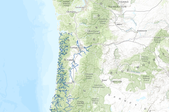
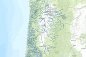
These data describe areas of suitable habitat believed to be used (currently and historically) by wild, natural, and/or hatchery fish populations. The term "currently" is defined as within the past five reproductive cycles. See the 'USETYPE' field description to differentiate between current and historic distribution. This information is based on extensive surveys, the best professional judgment of ODFW staff biologists and where possible, the professional opinions of staff from other natural resource agencies. Due to natural variations in run size, water conditions, or other environmental factors, some areas displayed may not be used by a species of fish on an annual basis. The Natural Resources Information Management...
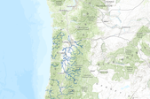
Fish distribution in Umpqua National Forest. The cover was built at two locations and by two people. Cottage Grove prepared the Cottage Grove district fish distribution and the Supervisors office prepared the fish distribution for Tiller, North Umpqua, and Diamond Lake districts. The SO then merged the two layers together. The fish distribution layer was developed using the existing stream layer, then identifying those streams and stream breaks for each fish species. The streams that don't have any fish distribution were deleted fom the layer. Arcview was the program used to create the layer utilizing heads-up digitizing to identify the breaks. This cover was built at a map scale of 1:24000.
These GIS data contain stream reaches that were identified as habitat areas for the Lower Columbia River Chinook Salmon (CKLCR) and Upper Willamette River Chinook Salmon (CKUWR) Evolutionarily Significant Unit (ESU).WOPR: (Western Oregon Plan Revision) PRMP: (Proposed Resource Management Plan) Chinook Salmon Columbia River Willamete River CHART: (Critical Habitat Analytical Review Teams) PCE: (Primary Constituent Elements) This data is a PRMP release version of the data fsh_aa_a_chinnok_chart_arc. These data were used in the critical habitat analysis conducted by National Marine Fisheries Service's Critical Habitat Analytical Review Teams. The analysis was conducted as part of the rule making process for critical...
These data describe areas of suitable habitat believed to be used (currently and historically) by wild, natural, and/or hatchery fish populations. The term "currently" is defined as within the past five reproductive cycles. See the 'USETYPE' field description to differentiate between current and historic distribution. This information is based on extensive surveys, the best professional judgment of ODFW staff biologists and where possible, the professional opinions of staff from other natural resource agencies. Due to natural variations in run size, water conditions, or other environmental factors, some areas displayed may not be used by a species of fish on an annual basis. The Natural Resources Information Management...
These data are the primary data used to estimate rainbow trout abundance and survival in the Colorado River, Glen and Grand Canyons. Refer to the analyses as per the associated journal manuscript (see Larger Work Citation). Prey availability, feeding efficiency, and competition reduce somatic growth and cause the collapse of a fish population" Nighttime boat electrofishing was used to sample rainbow trout four times per year in April, July, September, and January, from April 2012 through September 2016. A total of five reaches were sampled between Glen Canyon Dam (river kilometer [rkm] 0) to below the confluence with the Little Colorado River (located at rkm 130). Reaches ranged from two to six km in length. A total...
Known observations and distribution of Pacific Lamprey for Oregon, Washington, and Idaho from the Columbia River Fish and Wildlife Conservation Office managed database on behalf of the PLCI. Observation data includes points for Lampetra species when information provided. Current as of December 2020. Older datasets can be found in the archived data folder. Files available for download: Service Definition file (if downloaded files need to be extracted to then open in desktop programs) Zipped ESRI File Geodatabase, Zipped Shapefiles Layer files for ArcMap and ArcGIS Pro Google Earth kmz files Metadata Online interactive map with these datasets are available: AGOL: DataBasin: https://databasin.org/datasets/a243fb1346ca4258b6388c5f7a90aee4
Categories: Data;
Types: ArcGIS REST Map Service,
ArcGIS Service Definition,
Citation,
Downloadable,
Map Service;
Tags: Anadromous Fish,
Anadromous Fish,
Aquatic Species,
Aquatic Species,
Biota,
Abstract (from http://www.tandfonline.com/doi/abs/10.1080/00028487.2012.734892#.VDw7ExYXNyg): Predicting the distribution of native stream fishes is fundamental to the management and conservation of many species. Modeling species distributions often consists of quantifying relationships between species occurrence and abundance data at known locations with environmental data at those locations. However, it is well documented that native stream fish distributions can be altered as a result of asymmetric interactions between dominant exotic and subordinate native species. For example, the naturalized exotic Brown Trout Salmo trutta has been identified as a threat to native Brook Trout Salvelinus fontinalis in the eastern...
Categories: Publication;
Types: Citation;
Tags: Co-occurence,
Fish,
Fish Distribution,
National CASC,
Rivers, Streams and Lakes,
These GIS data contain stream reaches that were identified as habitat areas for the Pacific Coho Salmon Evolutionarily Significant Unit (ESU).WOPR (Western Oregon Plan Revision) PRMP (Proposed Resource Management Plan) Coho Salmon Pacific Ocean CHART (Critical Habitat Analytical Review Teams) PCE (Primary Constituent Elements) This data is a PRMP release version of the data fsh_aa_a_coho_chart_arc. These data were used in the critical habitat analysis conducted by National Marine Fisheries Service's Critical Habitat Analytical Review Teams. The analysis was conducted as part of the rule making process for critical habitat. Critical habitat for Pacific Coho salmon is defined in National Marine Fisheries Service's...
These GIS data contain stream reaches that were identified as habitat areas for the Lower Columbia River Steelhead (STLCR), Middle Columbia River Steelhead (STMCR), and Upper Willamette River Steelhead (STUWR) Evolutionarily Significant Unit (ESU).WOPR: (Western Oregon Plan Revision) PRMP: (Proposed Resource Management Plan) Steelhead Columbia River Willamete River CHART (Critical Habitat Analytical Review Teams) PCE (Primary Constituent Elements) ESU (Evolutionarily Significant Units) This data is a PRMP release version of the data fsh_aa_a_steelhead_chart_arc. These data were used in the critical habitat analysis conducted by National Marine Fisheries Service's Critical Habitat Analytical Review Teams. The analysis...
Alteration of natural flow regimes by river regulation affects fish distribution and assemblage structure, but causative pathways are not always direct and may go unrecognized. The Colorado River population of the endangered Colorado pikeminnow, Ptychocheilus lucius, suffers from low rates of recruitment and reduced carrying capacity. We hypothesized that availability of prey fish for this large-bodied native piscivore may, in part, be limited by reduced standing crops of periphyton and macroinvertebrates resulting from accumulation of fine sediment in the riverbed. We stratified the 373-km-long study area into 11 strata and sampled various physical and biological parameters in runs and riffles of three randomly...
Categories: Publication;
Types: Citation,
Journal Citation;
Tags: Colorado River,
Colorado pikeminnow,
Ecological Applications,
Ptychocheilus lucius,
benthic macroinvertebrates,
These data describe areas of suitable habitat believed to be used (currently and historically) by wild, natural, and/or hatchery fish populations. The term "currently" is defined as within the past five reproductive cycles. See the 'USETYPE' field description to differentiate between current and historic distribution. This information is based on extensive surveys, the best professional judgment of ODFW staff biologists and where possible, the professional opinions of staff from other natural resource agencies. Due to natural variations in run size, water conditions, or other environmental factors, some areas displayed may not be used by a species of fish on an annual basis. The Natural Resources Information Management...

These data describe areas of suitable habitat believed to be used (currently and historically) by wild, natural, and/or hatchery fish populations. The term "currently" is defined as within the past five reproductive cycles. See the 'USETYPE' field description to differentiate between current and historic distribution. This information is based on extensive surveys, the best professional judgment of ODFW staff biologists and where possible, the professional opinions of staff from other natural resource agencies. Due to natural variations in run size, water conditions, or other environmental factors, some areas displayed may not be used by a species of fish on an annual basis. The Natural Resources Information Management...
These GIS data contain stream reaches that were identified as habitat areas for the Columbia River Chum Salmon (CMCOL) Evolutionarily Significant Unit (ESU).WOPR (Western Oregon Plan Revision) PRMP (Proposed Resource Management Plan) Chum Salmon Columbia River CHART (Critical Habitat Analytical Review Teams) PCE (Primary Constituent Elements) This data is a PRMP release version of the data fsh_aa_a_chum_chart_arc. These data were used in the critical habitat analysis conducted by National Marine Fisheries Service's Critical Habitat Analytical Review Teams. The analysis was conducted as part of the rule making process for critical habitat. Critical habitat for CMCOL salmon is defined in National Marine Fisheries...
These data describe areas of suitable habitat believed to be used (currently and historically) by wild, natural, and/or hatchery fish populations. The term "currently" is defined as within the past five reproductive cycles. See the 'USETYPE' field description to differentiate between current and historic distribution. This information is based on extensive surveys, the best professional judgment of ODFW staff biologists and where possible, the professional opinions of staff from other natural resource agencies. Due to natural variations in run size, water conditions, or other environmental factors, some areas displayed may not be used by a species of fish on an annual basis. The Natural Resources Information Management...

These data describe areas of suitable habitat believed to be used (currently and historically) by wild, natural, and/or hatchery fish populations. The term "currently" is defined as within the past five reproductive cycles. See the 'USETYPE' field description to differentiate between current and historic distribution. This information is based on extensive surveys, the best professional judgment of ODFW staff biologists and where possible, the professional opinions of staff from other natural resource agencies. Due to natural variations in run size, water conditions, or other environmental factors, some areas displayed may not be used by a species of fish on an annual basis. The Natural Resources Information Management...
|

|
