Filters: Tags: Evapotranspiration (X)
531 results (6ms)|
Filters
|
This dataset is a Basin Characterization Model (BCM) output using the GFDL A2 Scenario for average Spring (March, April, May) snowpack, 2070-2099, clipped to the DRECP 12 km buffered boundary. Snowpack: Amount of snow accumulated per month summed annually, or if divided by 12 average monthly snowpack. This is calculated as prior month's snowpack plus snowfall minus sublimation and snow melt. The California Basin Characterization Model (BCM) climate dataset provides historical and projected climate surfaces for the state at a 270 meter resolution. The historical data is based on 4 kilometer PRISM data, and the projected climate surfaces are based on the A2 and B1 scenarios of the PCM and GFDL GCMs. The BCM approach...

This dataset is a Basin Characterization Model (BCM) output using the PCM A2 Scenario for average Winter (December, January, February) snowpack, in northern Sierra Nevada California, for 2010-2039. Snowpack: Amount of snow accumulated per month summed annually, or if divided by 12 average monthly snowpack. This is calculated as prior month's snowpack plus snowfall minus sublimation and snow melt. The California Basin Characterization Model (BCM) climate dataset provides historical and projected climate surfaces for the state at a 270 meter resolution. The historical data is based on 4 kilometer PRISM data, and the projected climate surfaces are based on the A2 and B1 scenarios of the PCM and GFDL GCMs. The BCM...

This dataset is a Basin Characterization Model (BCM) output using the PCM A2 Scenario for average Winter (December, January, February) snowpack, in central Sierra Nevada California, for 2070-2099. Snowpack: Amount of snow accumulated per month summed annually, or if divided by 12 average monthly snowpack. This is calculated as prior month's snowpack plus snowfall minus sublimation and snow melt. The California Basin Characterization Model (BCM) climate dataset provides historical and projected climate surfaces for the state at a 270 meter resolution. The historical data is based on 4 kilometer PRISM data, and the projected climate surfaces are based on the A2 and B1 scenarios of the PCM and GFDL GCMs. The BCM...

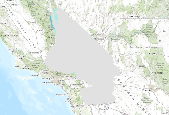
This dataset is a Basin Characterization Model (BCM) output using the GFDL A2 Scenario for Climatic Water Deficit (CWD) in northern Sierra Nevada California, for 2070-2099. The term climatic water deficit defined by Stephenson (1998) is quantified as the amount of water by which potential evapotranspiration (PET) exceeds actual evapotranspiration (AET). This term effectively integrates the combined effects of solar radiation, evapotranspiration, and air temperature on watershed conditions given available soil moisture derived from precipitation. Climatic water deficit can be thought of as the amount of additional water that would have evaporated or transpired had it been present in the soils given the temperature...

This dataset is a historic average Winter (December, January, February) snowpack, in central Sierra Nevada California, for 1971-2000, from the California Basin Characterization Model (BCM) Snowpack: Amount of snow accumulated per month summed annually, or if divided by 12 average monthly snowpack. This is calculated as prior month's snowpack plus snowfall minus sublimation and snow melt. The California Basin Characterization Model (BCM) climate dataset provides historical and projected climate surfaces for the state at a 270 meter resolution. The historical data is based on 4 kilometer PRISM data, and the projected climate surfaces are based on the A2 and B1 scenarios of the PCM and GFDL GCMs. The BCM approach...
This file includes satellite sensor-derived data on evapotranspiration, vegetation response (normalized difference vegetation index), and snow and weather-station data used to derive weekly growing degree units and total precipitation used in analyses described in the paper, "Challenges in complementing data from ground-based sensors with satellite-derived products to measure ecological changes in relation to climate – lessons from temperate wetland-upland landscapes."

This dataset represents Climatic Water Deficit (CWD) change, from Basin Characterization Model (BCM) output using the PCM A2 Scenario in southern Sierra Nevada California, for 2010-2039. The data was processed using historic CWD (1979-2000) and CWD (2010-2039) to calculate change. The term climatic water deficit defined by Stephenson (1998) is quantified as the amount of water by which potential evapotranspiration (PET) exceeds actual evapotranspiration (AET). This term effectively integrates the combined effects of solar radiation, evapotranspiration, and air temperature on watershed conditions given available soil moisture derived from precipitation. Climatic water deficit can be thought of as the amount of...

This dataset is a Basin Characterization Model (BCM) output using the PCM A2 Scenario for annual runoff, 2010-2039, clipped to the DRECP 12 km buffered boundary. Runoff: Amount of water that becomes stream flow, summed annually. Modeled as amount of water that exceeds total soil storage and rejected recharge. The California Basin Characterization Model (BCM) climate dataset provides historical and projected climate surfaces for the state at a 270 meter resolution. The historical data is based on 4 kilometer PRISM data, and the projected climate surfaces are based on the A2 and B1 scenarios of the PCM and GFDL GCMs. The BCM approach uses a regional water balance model based on high resolution downscaled precipitation...
The data set consists of evapotranspiration measurements made at the USGS Dead River forested wetland climate station beginning November 21, 2009 and ending February 29, 2016. Annual ET rates corrected to a near-surface energy-budget varied from 1448 mm (2012) to 1614 mm (2010). The eddy-covariance method was used, with high-frequency sensors installed above the forest canopy to measure sensible and latent heat fluxes. Ancillary meteorological data are also included in the data set: net radiation, soil temperature and moisture, air temperature, relative humidity, wind speed and direction, rainfall, and ground-water levels. Data were collected at 30-minute resolution, with evapotranspiration corrected to the near-surface...
Types: Citation;
Tags: Evapotranspiration,
Florida,
Hillsborough,
forested wetland,
latent heat flux,
The data set consists of monthly sums of 30-minute evapotranspiration measurements made at the USGS Starkey pasture climate station beginning May 1, 2003 and ending April 30, 2016. Annual evapotranspiration rates corrected to a near-surface energy-budget for the 12 calendar years of record at this site (2004-2015) varied from 718 millimeters (2007) to 903 millimeters (2010). The eddy-covariance method was used, with high-frequency sensors installed above the pasture to measure sensible and latent heat fluxes. Ancillary meteorological data are also included in the data set: rainfall and ground-water levels. Data were collected at 30-minute resolution, with evapotranspiration corrected to the near-surface energy-budget...
Categories: Data;
Types: Citation;
Tags: Florida,
Pasco County,
evapotranspiration,
latent heat flux,
net radiation,
These data were compiled to understand the effects of riparian vegetation health on local abundance and species diversity of land birds. The primary objective of our study was to to determine the effects of riparian restoration on birds in the Colorado River delta. These tabular data represent vegetation indices and evapotranspiration (ET) data at varying spatial scales that correspond to avian use circles of 100 to 2000 meters. Three vegetation reflectance indices (VIs): NDVI, EVI, and EVI2 were obtained from Landsat imagery with a biweekly temporal frequency, and covering the entire period of bird surveys (2002-2020). The Normalized Difference Vegetation Index (NDVI) and Enhanced Vegetation Index (EVI) and two-band...
Annual actual evapotranspiration (ETa) rates in 55 basins in Florida and parts of Alabama and Georgia were evaluated for 2000–17 using the Operational Simplified Surface Energy Balance (SSEBop) model at about a one-square kilometer resolution (Sepúlveda, 2021). SSEBop ETa rates were bias corrected on the basis of ETa rates computed from weather observations at 24 micrometeorological evapotranspiration flux (MEF) stations, stratified by land-use type and referred to as mETa rates. Uncorrected and bias-corrected SSEBop ETa rates were evaluated by comparison with independent estimates based on a crop-coefficient method for generalized land-use types (luETa) and a water-balance method for each basin (wbETa). Average...
Categories: Data;
Tags: Climatology,
Florida,
Hydrology,
Meteorology,
USGS Science Data Catalog (SDC),
Project Summary Climate change is projected to have substantial impacts on Pacific Northwest water resources and ecosystems. Recognizing this, resource managers have expressed growing interest in incorporating climate change information into long-range planning. The availability of hydrologic scenarios to support climate change adaptation and long-range planning, however, has been limited until very recently to a relatively small number of selected case studies. More comprehensive resources needed to support regional planning have been lacking. Furthermore, ecosystem studies at the landscape scale need consistent climate change information and databases over large geographic areas. Products using a common set of...
Understanding how different crops use water over time is essential for planning and managing water allocation, water rights, and agricultural production. The main objective of this paper is to characterize the spatiotemporal dynamics of crop water use in the Central Valley of California using Landsat-based annual actual evapotranspiration (ETa) from 2008-2018 derived from the Operational Simplified Surface Energy Balance (SSEBop) model. Crop water use for ten crops are characterized at multiple scales. The Mann-Kendall trend analysis revealed a significant increase in area cultivated with almonds and their water use, with an annual rate of change of 16,327 hectares in area and 13,488 ha-m in water use. Conversely,...
The Russian River Watershed (RRW) covers about 1,300 square miles (without Santa Rosa Plain) of urban, agricultural, and forested lands in northern Sonoma County and southern Mendocino County, California. Communities in the RRW depend on a combination of Russian River water and groundwater to meet their water-supply demands. Water is used primarily for agricultural irrigation, municipal and private wells supply, and commercial uses - such as for wineries and recreation. Annual rainfall in the RRW is highly variable, making it prone to droughts and flooding from atmospheric river events. In order to better understand surface-water and groundwater issues, the USGS is creating a Coupled Ground-Water and Surface-Water...
Categories: Data;
Types: Downloadable,
Map Service,
OGC WFS Layer,
OGC WMS Layer,
Shapefile;
Tags: California,
Hydrology,
Russian River,
USGS Science Data Catalog (SDC),
United States,

These data were released prior to the October 1, 2016 effective date for the USGS’s policy dictating the review, approval, and release of scientific data as referenced in USGS Survey Manual Chapter 502.8 Fundamental Science Practices: Review and Approval of Scientific Data for Release. This digital geospatial data set is a compilation of reference points representing springs in California that were used for the regional ground-water potential map by Bedinger and Harrill (2004). The regional ground-water potential map was developed to assess potential interbasin flow in the Death Valley regional ground-water flow system (DVRFS), a 100,000-square-kilometer region of southern Nevada and California. To obtain an adequate...

These data were released prior to the October 1, 2016 effective date for the USGS’s policy dictating the review, approval, and release of scientific data as referenced in USGS Survey Manual Chapter 502.8 Fundamental Science Practices: Review and Approval of Scientific Data for Release. This digital data set represents the Death Valley regional ground-water flow system (DVRFS) study area which encompasses approximately 100,000-square kilometers in Nevada and California and is bounded by latitudes 35-degrees north and 38-degrees 15-minutes north and by longitudes 115-degrees west and 118-degrees west. The study area boundary encompasses the DVRFS model domain which is the area simulated by a transient ground-water...

These data were released prior to the October 1, 2016 effective date for the USGS’s policy dictating the review, approval, and release of scientific data as referenced in USGS Survey Manual Chapter 502.8 Fundamental Science Practices: Review and Approval of Scientific Data for Release. The data in this release are associated with the U.S. Geological Survey Open-File Report: Snyder, D.T., Risley, J.C., and Haynes, J.V., 2012, Hydrological information products for the Off-Project Water Program of the Klamath Basin Restoration Agreement: U.S. Geological Survey Open-File Report 2012–1199, 20 p., https://pubs.usgs.gov/of/2012/1199

The shapefile associated with this metadata file represents the spatial distribution of mean annual water-budget components, in inches, for the Island of Oahu, Hawaii. The water-budget components in the shapefile were computed by a water-budget model for a scenario representative of average climate conditions (1978–2007 rainfall) and 2010 land cover, as described in USGS Scientific Investigations Report (SIR) 2015-5010. The model was developed for estimating groundwater recharge and other water-budget components for each subarea of the model. The model subareas were generated using Esri ArcGIS software by intersecting (merging) multiple spatial data sets that characterize the spatial distribution of rainfall, fog...
These data were released prior to the October 1, 2016 effective date for the USGS’s policy dictating the review, approval, and release of scientific data as referenced in USGS Survey Manual Chapter 502.8 Fundamental Science Practices: Review and Approval of Scientific Data for Release. The digital data set provides locations and general descriptions of sites instrumented to collect micrometeorological data from which mean annual ET rates were computed. Sites are located in Ash Meadows and Oasis Valley, Nevada. Data were collected December 1993 through present.
|

|
