Filters: Tags: Dakota (X)
771 results (17ms)|
Filters
Date Range
Types Contacts
Categories Tag Types
|
Core Research Center, core B414, from well operated by TENNECO OILRaw Properties from download, web scrape, MapServer, and Macrostrat API{"Lib Num": "B414", "API Num": "4904520653", "Operator": "TENNECO OIL", "Well Name": "6 MOHAWK FEDERAL B", "Field": "COYOTE CREEK SO", "State": "WY", "County": "WESTON", "Type": "SLABBED", "Photos": "T", "Thin Sec": "T", "Analysis": "T", "Latitude": "44.1074", "Longitude": "-104.99281", "coordinates_geohash": "9xv6fvd84pq9", "Source": "FROM STATE RECORDS", "Security Flag": "NO SPECIAL RESTRICTIONS", "crc_collection_name": "core", "sb_parent_id": "4f4e49dae4b07f02db5e0486", "intervals": [{"Formation": "DAKOTA", "Age": "CRET", "Min Depth": "6812", "Max Depth": "6856"}], "crcwc_url":...
Core Research Center, core D497, from well operated by CELSIUS ENERGYRaw Properties from download, web scrape, MapServer, and Macrostrat API{"Lib Num": "D497", "API Num": "4904120714", "Operator": "CELSIUS ENERGY", "Well Name": "10 BUTCHER KNIFE SPRINGS", "Field": "BUTCHER KNIFE SPRINGS", "State": "WY", "County": "UINTA", "Type": "SLABBED", "Photos": "F", "Thin Sec": "F", "Analysis": "F", "Latitude": "41.23732", "Longitude": "-110.08026", "coordinates_geohash": "9x3dx540b18g", "Source": "FROM STATE RECORDS", "Security Flag": "NO SPECIAL RESTRICTIONS", "crc_collection_name": "core", "sb_parent_id": "4f4e49dae4b07f02db5e0486", "intervals": [{"Formation": "DAKOTA", "Age": "CRET", "Min Depth": "12856", "Max Depth":...
Categories: Physical Item;
Tags: Bridger Formation,
CRET,
DAKOTA,
Middle part, Bridger Formation,
middle Eocene
Core Research Center, core S476, from well operated by AMERADA HESS CORPRaw Properties from download, web scrape, MapServer, and Macrostrat API{"Lib Num": "S476", "API Num": "4902506130", "Operator": "AMERADA HESS CORP", "Well Name": "3 UNIT", "Field": "SAGE SPRING CREEK", "State": "WY", "County": "NATRONA", "Type": "FULL", "Photos": "F", "Thin Sec": "F", "Analysis": "F", "Latitude": "43.1533", "Longitude": "-106.14453", "coordinates_geohash": "9xst2xgfjnjv", "Source": "FROM STATE RECORDS", "Security Flag": "NO SPECIAL RESTRICTIONS", "crc_collection_name": "core", "sb_parent_id": "4f4e49dae4b07f02db5e0486", "intervals": [{"Formation": "DAKOTA", "Age": "CRET", "Min Depth": "7115", "Max Depth": "7181"}], "crcwc_url":...
Categories: Physical Item;
Tags: CRET,
DAKOTA,
Lance Formation,
Lance Formation; Meeteetse Formation,
Upper Cretaceous
Core Research Center, core R847, from well operated by TRICENTRAL RESOURCESRaw Properties from download, web scrape, MapServer, and Macrostrat API{"Lib Num": "R847", "API Num": "0512310776", "Operator": "TRICENTRAL RESOURCES", "Well Name": "ELLER 2-14", "Field": "SPRUCE", "State": "CO", "County": "WELD", "Type": "FULL", "Photos": "F", "Thin Sec": "F", "Analysis": "F", "Latitude": "40.685817", "Longitude": "-103.616488", "coordinates_geohash": "9xnr6nsu0cfx", "Source": "FROM STATE RECORDS", "Security Flag": "NO SPECIAL RESTRICTIONS", "crc_collection_name": "core", "sb_parent_id": "4f4e49dae4b07f02db5e0486", "intervals": [{"Formation": "DAKOTA", "Age": "CRETACEOUS", "Min Depth": "5710", "Max Depth": "5738"}], "crcwc_url":...
Categories: Physical Item;
Tags: CRETACEOUS,
DAKOTA,
Oligocene,
White River Fm or Group,
White River Formation,
Core Research Center, core C358, from well operated by MOBIL OILRaw Properties from download, web scrape, MapServer, and Macrostrat API{"Lib Num": "C358", "API Num": "4904509070", "Operator": "MOBIL OIL", "Well Name": "F-22-3-P KRAUSE", "Field": "COYOTE CREEK", "State": "WY", "County": "WESTON", "Type": "SLABBED", "Photos": "F", "Thin Sec": "F", "Analysis": "F", "Latitude": "44.1715", "Longitude": "-105.01152", "coordinates_geohash": "9xv763hvwhrk", "Source": "FROM STATE RECORDS", "Security Flag": "NO SPECIAL RESTRICTIONS", "crc_collection_name": "core", "sb_parent_id": "4f4e49dae4b07f02db5e0486", "intervals": [{"Formation": "DAKOTA", "Age": "CRET", "Min Depth": "6510", "Max Depth": "6595"}], "crcwc_url": "https://my.usgs.gov/crcwc/core/report/10369",...
Core Research Center, core T391, from well operated by NORTH AMERICAN RESRaw Properties from download, web scrape, MapServer, and Macrostrat API{"Lib Num": "T391", "API Num": "0504506760", "Operator": "NORTH AMERICAN RES", "Well Name": "32-20 CEDAR BENCH UNIT", "Field": "CEDAR BENCH UNIT", "State": "CO", "County": "GARFIELD", "Type": "FULL", "Photos": "F", "Thin Sec": "F", "Analysis": "F", "Latitude": "39.520105", "Longitude": "-108.574731", "coordinates_geohash": "9x4bc66m33s9", "Source": "FROM STATE RECORDS", "Security Flag": "NO SPECIAL RESTRICTIONS", "crc_collection_name": "core", "sb_parent_id": "4f4e49dae4b07f02db5e0486", "intervals": [{"Formation": "DAKOTA", "Age": "CRET", "Min Depth": "7801", "Max Depth":...
Categories: Physical Item;
Tags: CRET,
DAKOTA,
Tertiary,
Wasatch Formation and Ohio Creek Formation,
Wasatch Formation; Ohio Creek Formation,
Core Research Center, core D268, from well operated by MOBIL OILRaw Properties from download, web scrape, MapServer, and Macrostrat API{"Lib Num": "D268", "API Num": "4900505509", "Operator": "MOBIL OIL", "Well Name": "F-11-9-P HALVERSON", "Field": "HALVERSON", "State": "WY", "County": "CAMPBELL", "Type": "SLABBED", "Photos": "F", "Thin Sec": "F", "Analysis": "F", "Latitude": "44.24765", "Longitude": "-105.16098", "coordinates_geohash": "9xv5xp015xcc", "Source": "FROM STATE RECORDS", "Security Flag": "NO SPECIAL RESTRICTIONS", "crc_collection_name": "core", "sb_parent_id": "4f4e49dae4b07f02db5e0486", "intervals": [{"Formation": "DAKOTA", "Age": "CRET", "Min Depth": "6936", "Max Depth": "6946"}], "crcwc_url": "https://my.usgs.gov/crcwc/core/report/11009",...
Core Research Center, core T422, from well operated by MITCHELL ENERGYRaw Properties from download, web scrape, MapServer, and Macrostrat API{"Lib Num": "T422", "API Num": "0510309104", "Operator": "MITCHELL ENERGY", "Well Name": "1-11-2-104 FEDERAL", "Field": "HELL'S HOLE", "State": "CO", "County": "RIO BLANCO", "Type": "THICK SLAB", "Photos": "T", "Thin Sec": "F", "Analysis": "F", "Latitude": "39.894087", "Longitude": "-109.028818", "coordinates_geohash": "9x46yyrxukuf", "Source": "FROM STATE RECORDS", "Security Flag": "NO SPECIAL RESTRICTIONS", "crc_collection_name": "core", "sb_parent_id": "4f4e49dae4b07f02db5e0486", "intervals": [{"Formation": "DAKOTA", "Age": "CRET", "Min Depth": "6832", "Max Depth": "6893"}],...
Categories: Physical Item;
Tags: CRET,
DAKOTA,
Holocene and Pleistocene,
Mass movements, slides,slumps, and flows
Core Research Center, core E739, from well operated by HILLIARD O & G INCRaw Properties from download, web scrape, MapServer, and Macrostrat API{"Lib Num": "E739", "API Num": "0512307614", "Operator": "HILLIARD O & G INC", "Well Name": "1 AMOCO UPRR", "Field": "QWILDCAT", "State": "CO", "County": "WELD", "Type": "SLABBED", "Photos": "T", "Thin Sec": "T", "Analysis": "T", "Latitude": "40.77037", "Longitude": "-104.798546", "coordinates_geohash": "9xjrzq008gu6", "Source": "FROM STATE RECORDS", "Security Flag": "NO SPECIAL RESTRICTIONS", "crc_collection_name": "core", "sb_parent_id": "4f4e49dae4b07f02db5e0486", "intervals": [{"Formation": "DAKOTA", "Age": "CRET", "Min Depth": "8364", "Max Depth": "8406"}, {"Formation":...
Categories: Physical Item;
Tags: CRET,
CRETACEOUS,
Calabrian - Middle Pleistocene,
DAKOTA,
FORELLE /LM/,
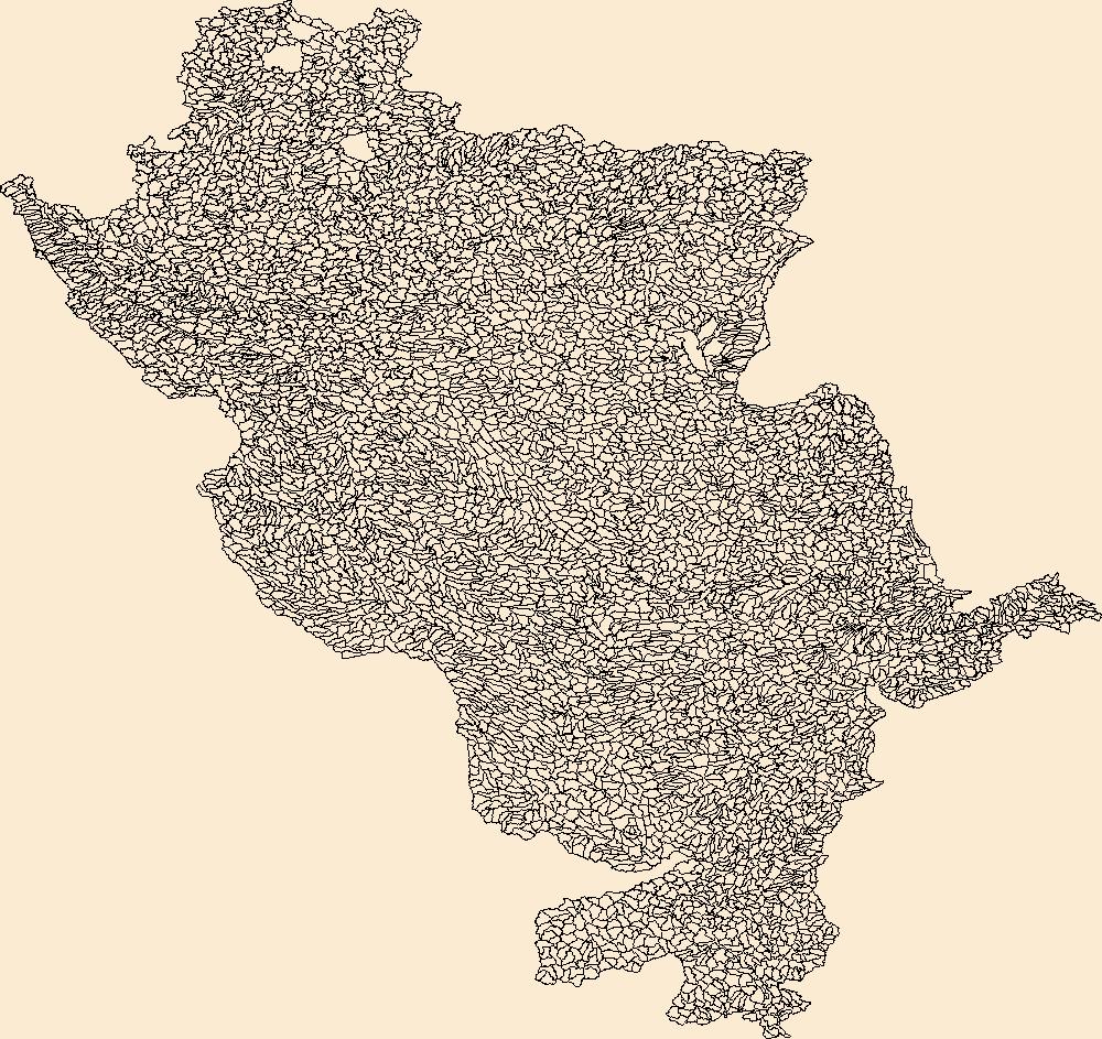
The Watershed Boundary Dataset (WBD) is a comprehensive aggregated collection of hydrologic unit data consistent with the national criteria for delineation and resolution. It defines the areal extent of surface water drainage to a point except in coastal or lake front areas where there could be multiple outlets as stated by the "Federal Standards and Procedures for the National Watershed Boundary Dataset (WBD)" "Standard" (https://pubs.usgs.gov/tm/11/a3/). Watershed boundaries are determined solely upon science-based hydrologic principles, not favoring any administrative boundaries or special projects, nor particular program or agency. This dataset represents the hydrologic unit boundaries to the 12-digit (6th level)...

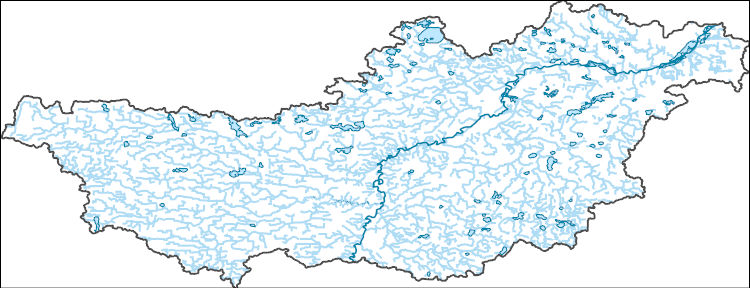
The National Hydrography Dataset (NHD) is a feature-based database that interconnects and uniquely identifies the stream segments or reaches that make up the nation's surface water drainage system. NHD data was originally developed at 1:100,000-scale and exists at that scale for the whole country. This high-resolution NHD, generally developed at 1:24,000/1:12,000 scale, adds detail to the original 1:100,000-scale NHD. (Data for Alaska, Puerto Rico and the Virgin Islands was developed at high-resolution, not 1:100,000 scale.) Local resolution NHD is being developed where partners and data exist. The NHD contains reach codes for networked features, flow direction, names, and centerline representations for areal water...
The National Hydrography Dataset (NHD) is a feature-based database that interconnects and uniquely identifies the stream segments or reaches that make up the nation's surface water drainage system. NHD data was originally developed at 1:100,000-scale and exists at that scale for the whole country. This high-resolution NHD, generally developed at 1:24,000/1:12,000 scale, adds detail to the original 1:100,000-scale NHD. (Data for Alaska, Puerto Rico and the Virgin Islands was developed at high-resolution, not 1:100,000 scale.) Local resolution NHD is being developed where partners and data exist. The NHD contains reach codes for networked features, flow direction, names, and centerline representations for areal water...
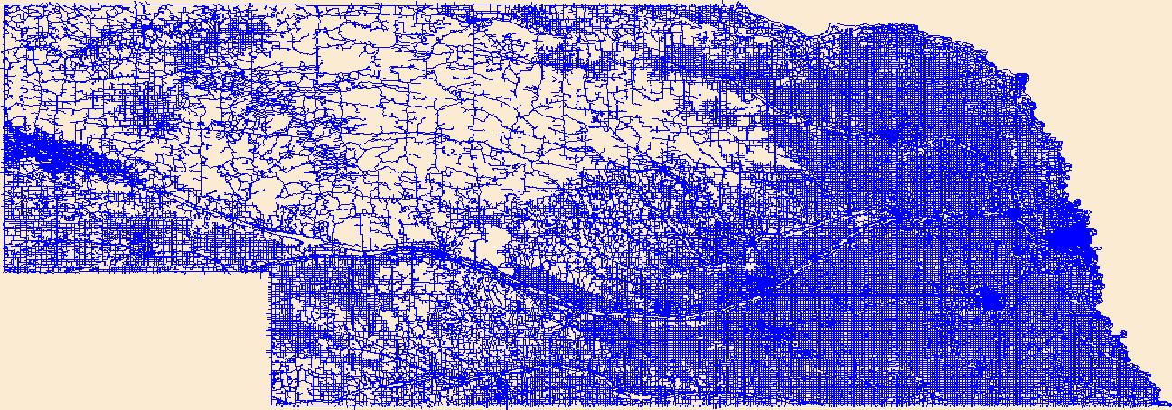
Layers of geospatial data include roads, airports, trails, and railroads.
The National Hydrography Dataset (NHD) is a feature-based database that interconnects and uniquely identifies the stream segments or reaches that make up the nation's surface water drainage system. NHD data was originally developed at 1:100,000-scale and exists at that scale for the whole country. This high-resolution NHD, generally developed at 1:24,000/1:12,000 scale, adds detail to the original 1:100,000-scale NHD. (Data for Alaska, Puerto Rico and the Virgin Islands was developed at high-resolution, not 1:100,000 scale.) Local resolution NHD is being developed where partners and data exist. The NHD contains reach codes for networked features, flow direction, names, and centerline representations for areal water...
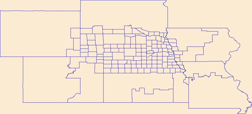
Geospatial data is comprised of government boundaries.
The Geographic Names Information System (GNIS) is the Federal standard for geographic nomenclature. The U.S. Geological Survey developed the GNIS for the U.S. Board on Geographic Names, a Federal inter-agency body chartered by public law to maintain uniform feature name usage throughout the Government and to promulgate standard names to the public. The GNIS is the official repository of domestic geographic names data; the official vehicle for geographic names use by all departments of the Federal Government; and the source for applying geographic names to Federal electronic and printed products of all types.
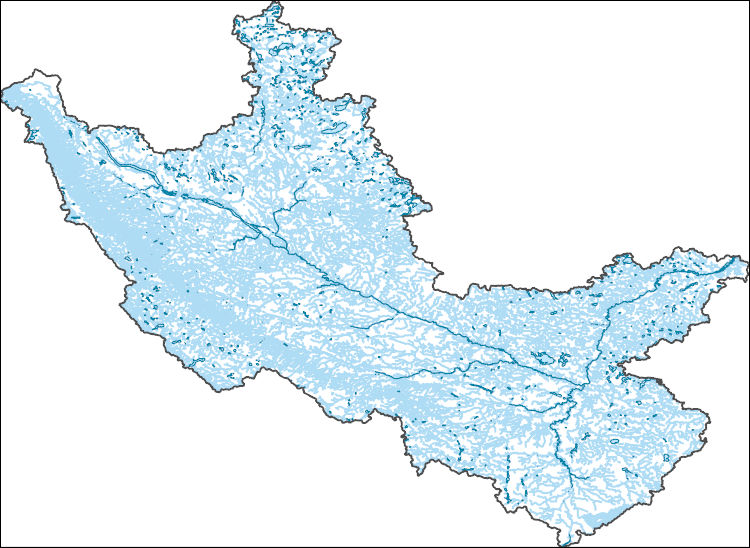
The National Hydrography Dataset (NHD) is a feature-based database that interconnects and uniquely identifies the stream segments or reaches that make up the nation's surface water drainage system. NHD data was originally developed at 1:100,000-scale and exists at that scale for the whole country. This high-resolution NHD, generally developed at 1:24,000/1:12,000 scale, adds detail to the original 1:100,000-scale NHD. (Data for Alaska, Puerto Rico and the Virgin Islands was developed at high-resolution, not 1:100,000 scale.) Local resolution NHD is being developed where partners and data exist. The NHD contains reach codes for networked features, flow direction, names, and centerline representations for areal water...
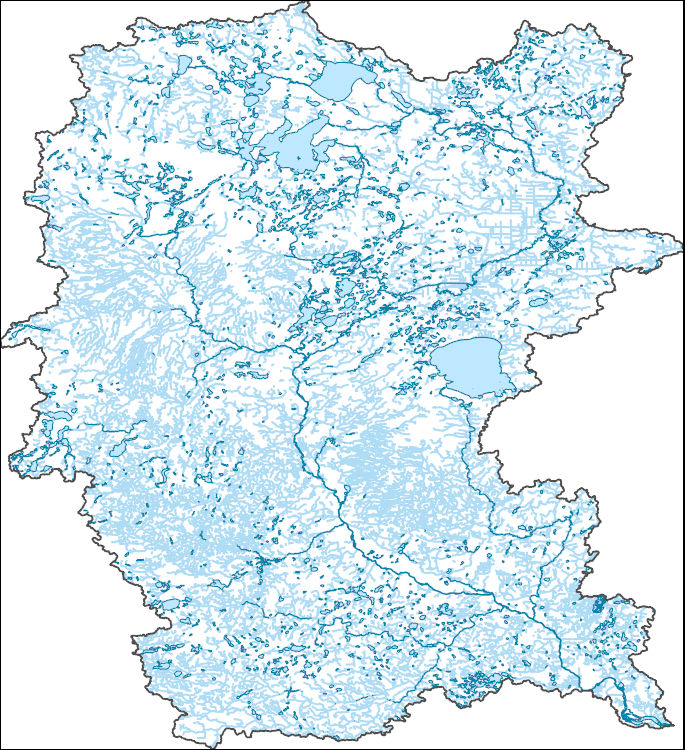
The National Hydrography Dataset (NHD) is a feature-based database that interconnects and uniquely identifies the stream segments or reaches that make up the nation's surface water drainage system. NHD data was originally developed at 1:100,000-scale and exists at that scale for the whole country. This high-resolution NHD, generally developed at 1:24,000/1:12,000 scale, adds detail to the original 1:100,000-scale NHD. (Data for Alaska, Puerto Rico and the Virgin Islands was developed at high-resolution, not 1:100,000 scale.) Local resolution NHD is being developed where partners and data exist. The NHD contains reach codes for networked features, flow direction, names, and centerline representations for areal water...

The National Hydrography Dataset (NHD) is a feature-based database that interconnects and uniquely identifies the stream segments or reaches that make up the nation's surface water drainage system. NHD data was originally developed at 1:100,000-scale and exists at that scale for the whole country. This high-resolution NHD, generally developed at 1:24,000/1:12,000 scale, adds detail to the original 1:100,000-scale NHD. (Data for Alaska, Puerto Rico and the Virgin Islands was developed at high-resolution, not 1:100,000 scale.) Local resolution NHD is being developed where partners and data exist. The NHD contains reach codes for networked features, flow direction, names, and centerline representations for areal water...

The National Hydrography Dataset (NHD) is a feature-based database that interconnects and uniquely identifies the stream segments or reaches that make up the nation's surface water drainage system. NHD data was originally developed at 1:100,000-scale and exists at that scale for the whole country. This high-resolution NHD, generally developed at 1:24,000/1:12,000 scale, adds detail to the original 1:100,000-scale NHD. (Data for Alaska, Puerto Rico and the Virgin Islands was developed at high-resolution, not 1:100,000 scale.) Local resolution NHD is being developed where partners and data exist. The NHD contains reach codes for networked features, flow direction, names, and centerline representations for areal water...
|

|
