Filters
Date Range
Types
Contacts
Categories
Tag Types
Tag Schemes
|
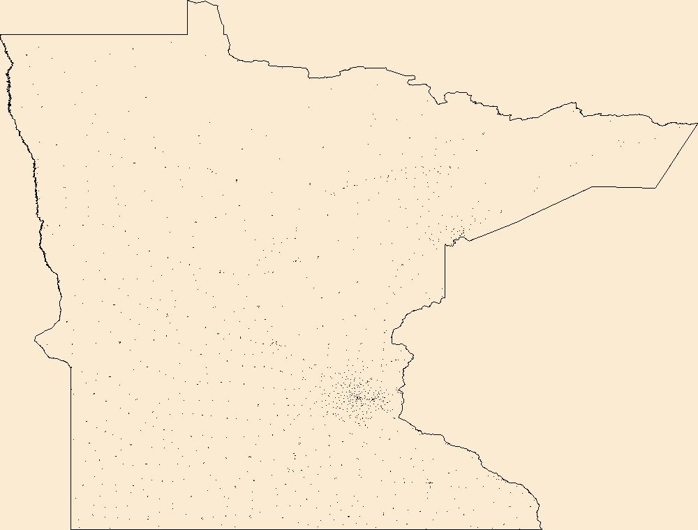
Geospatial data includes structures and other selected map features.
Tags: Aitkin,
Anoka,
Becker,
Beltrami,
Benton, All tags...
Big Stone,
Blue Earth,
Brown,
Campground,
Carlton,
Carver,
Cass,
Chippewa,
Chisago,
Clay,
Clearwater,
College / University,
Cook,
Cottonwood,
Courthouse,
Crow Wing,
Dakota,
Dodge,
Douglas,
Downloadable Data,
Faribault,
Fillmore,
Fire Station/ EMS Station,
Freeborn,
GeoPackage,
Goodhue,
Grant,
Hennepin,
Hospital/Medical Center,
Houston,
Hubbard,
Information Center,
Isanti,
Itasca,
Jackson,
Kanabec,
Kandiyohi,
Kittson,
Koochiching,
Lac qui Parle,
Lake,
Lake of the Woods,
Law Enforcement,
Le Sueur,
Lincoln,
Lyon,
MN,
Mahnomen,
Marshall,
Martin,
McLeod,
Meeker,
Mille Lacs,
Minnesota,
Morrison,
Mower,
Murray,
National Structures Dataset (NSD),
National Structures Dataset (NSD),
Nicollet,
Nobles,
Norman,
Olmsted,
Open Geospatial Consortium GeoPackage 1.2,
Otter Tail,
Pennington,
Pine,
Pipestone,
Polk,
Pope,
Post Office,
Prison/ Correctional Facility,
Ramsey,
Red Lake,
Redwood,
Renville,
Rice,
Rock,
Roseau,
School,
School:Elementary,
School:High School,
School:Middle School,
Scott,
Sherburne,
Sibley,
St. Louis,
State,
State,
State Capitol,
Stearns,
Steele,
Stevens,
Structures,
Swift,
Technical School,
Todd,
Town Hall,
Trade School,
Trailhead,
Traverse,
US,
United States,
Visitor Center,
Wabasha,
Wadena,
Waseca,
Washington,
Watonwan,
Wilkin,
Winona,
Wright,
Yellow Medicine,
structure, Fewer tags
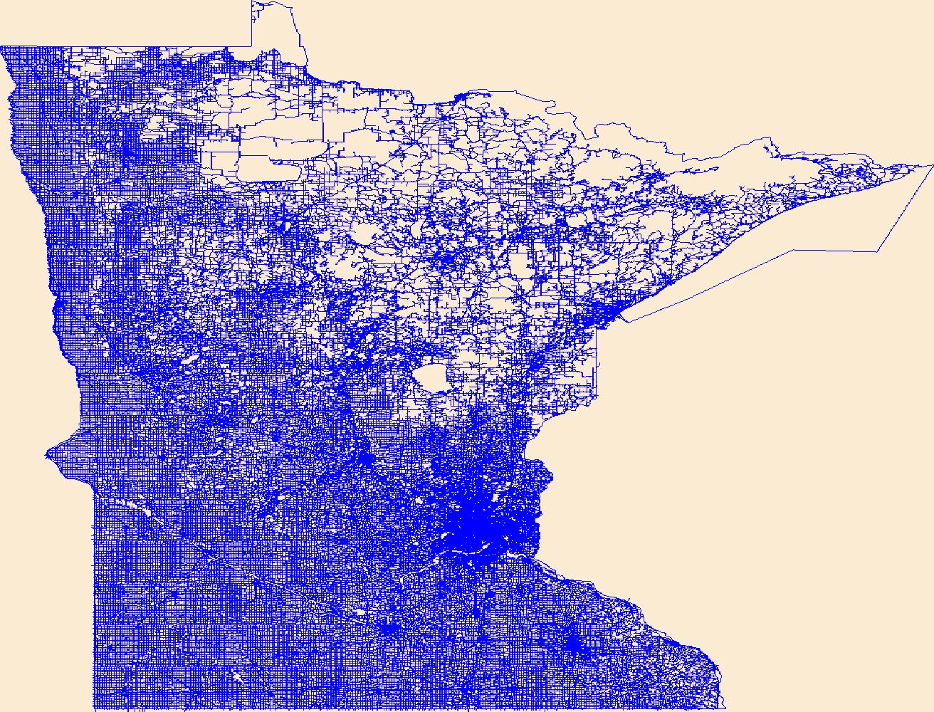
Layers of geospatial data include roads, airports, trails, and railroads.
Tags: Airport Complex,
Airport Point,
Airport Runway,
Airports,
Airstrips, All tags...
Aitkin,
Anoka,
Becker,
Beltrami,
Benton,
Big Stone,
Blue Earth,
Brown,
Carlton,
Carver,
Cass,
Chippewa,
Chisago,
Clay,
Clearwater,
Cook,
Cottonwood,
Crow Wing,
Dakota,
Dodge,
Douglas,
Downloadable Data,
Faribault,
Fillmore,
Freeborn,
GeoPackage,
Geographic names,
Goodhue,
Grant,
Hennepin,
Houston,
Hubbard,
Isanti,
Itasca,
Jackson,
Kanabec,
Kandiyohi,
Kittson,
Koochiching,
Lac qui Parle,
Lake,
Lake of the Woods,
Le Sueur,
Lincoln,
Lyon,
MN,
Mahnomen,
Marshall,
Martin,
McLeod,
Meeker,
Mille Lacs,
Minnesota,
Morrison,
Mower,
Murray,
National Transportation Dataset (NTD),
National Transportation Dataset (NTD),
Nicollet,
Nobles,
Norman,
Olmsted,
Open Geospatial Consortium GeoPackage 1.2,
Otter Tail,
Pennington,
Pine,
Pipestone,
Polk,
Pope,
Railways,
Ramsey,
Red Lake,
Redwood,
Renville,
Rice,
Roads,
Rock,
Roseau,
Scott,
Sherburne,
Sibley,
St. Louis,
State,
State,
Stearns,
Steele,
Stevens,
Swift,
Todd,
Trail,
Trails,
Transportation,
Transportation,
Traverse,
US,
United States,
Wabasha,
Wadena,
Waseca,
Washington,
Waterway,
Watonwan,
Wilkin,
Winona,
Wright,
Yellow Medicine,
transportation, Fewer tags

The Geographic Names Information System (GNIS) is the Federal standard for geographic nomenclature. The U.S. Geological Survey developed the GNIS for the U.S. Board on Geographic Names, a Federal inter-agency body chartered by public law to maintain uniform feature name usage throughout the Government and to promulgate standard names to the public. The GNIS is the official repository of domestic geographic names data; the official vehicle for geographic names use by all departments of the Federal Government; and the source for applying geographic names to Federal electronic and printed products of all types.
Tags: Adams,
Alexander,
Antarctica,
Antarctica,
BGN, All tags...
Board on Geographic Names,
Bond,
Boone,
Borough,
Brown,
Bureau,
Calhoun,
Carroll,
Cass,
Census Area,
Champaign,
Christian,
Clark,
Clay,
Clinton,
Coles,
Commonwealth,
Cook,
County,
Crawford,
Cumberland,
De Witt,
DeKalb,
District,
Douglas,
Downloadable Data,
DuPage,
Edgar,
Edwards,
Effingham,
Fayette,
Feature class,
Feature coordinates,
Feature county,
Feature description,
Feature designation,
Feature history,
Feature indentification,
Feature name,
Feature state,
Ford,
Franklin,
Fulton,
GNIS,
Gallatin,
Geographic Names,
Geographic Names Federal Codes,
Geographic Names Information System,
Geographic feature,
Geographic name,
Geographical feature,
Geographical name,
Greene,
Grundy,
Hamilton,
Hancock,
Hardin,
Henderson,
Henry,
IL,
Illinois,
Iroquois,
Jackson,
Jasper,
Jefferson,
Jersey,
Jo Daviess,
Johnson,
Kane,
Kankakee,
Kendall,
Knox,
LaSalle,
Lake,
Lawrence,
Lee,
Livingston,
Logan,
Macon,
Macoupin,
Madison,
Marion,
Marshall,
Mason,
Massac,
McDonough,
McHenry,
McLean,
Menard,
Mercer,
Monroe,
Montgomery,
Morgan,
Moultrie,
Municipio,
National Geographic Names Information System (GNIS),
National Geographic Names Information System (GNIS),
Official feature name,
Ogle,
Outlying Area,
Parish,
Peoria,
Perry,
Piatt,
Pike,
Place name,
Pope,
Populated Place,
Pulaski,
Putnam,
Randolph,
Richland,
Rock Island,
Saline,
Sangamon,
Schuyler,
Scott,
Shelby,
St. Clair,
Stark,
State,
Stephenson,
TXT (pipes),
Tazewell,
Territories,
Territory,
Topographic Map,
U.S. Board on Geographic Names,
U.S. Geological Survey,
US,
USA,
USBGN,
USGS,
UTF-8 Pipe Delimited Text File nan,
Union,
United States,
United States,
United States,
Variant name,
Vermilion,
Wabash,
Warren,
Washington,
Wayne,
White,
Whiteside,
Will,
Williamson,
Winnebago,
Woodford,
antarctic,
database,
economy,
environment,
feature,
gazetteer,
geographic,
geographic names,
geographical,
geography,
geospatial,
imageryBaseMapsEarthCover,
inlandWaters,
location,
map,
name,
place,
placename,
society,
structure,
topographic map,
toponymy, Fewer tags
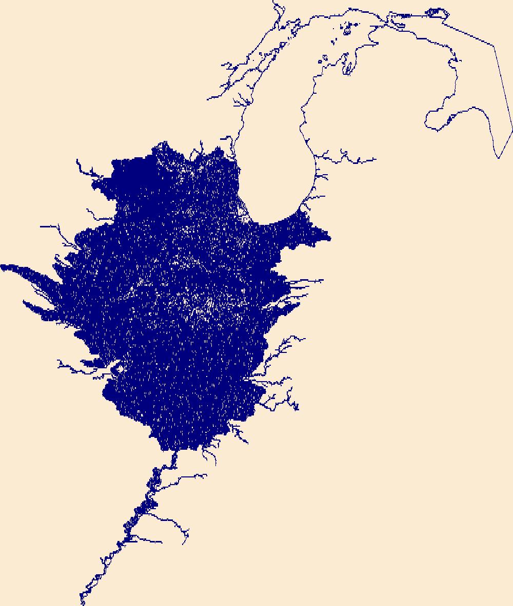
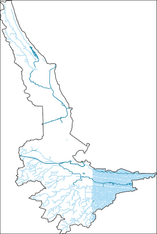
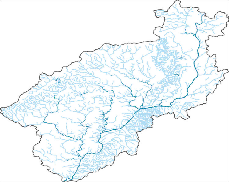
The National Hydrography Dataset (NHD) is a feature-based database that interconnects and uniquely identifies the stream segments or reaches that make up the nation's surface water drainage system. NHD data was originally developed at 1:100,000-scale and exists at that scale for the whole country. This high-resolution NHD, generally developed at 1:24,000/1:12,000 scale, adds detail to the original 1:100,000-scale NHD. (Data for Alaska, Puerto Rico and the Virgin Islands was developed at high-resolution, not 1:100,000 scale.) Local resolution NHD is being developed where partners and data exist. The NHD contains reach codes for networked features, flow direction, names, and centerline representations for areal water...
Tags: Administrative watershed units,
Administrative watershed units,
Alger,
Area of Complex Channels,
Area to be submerged, All tags...
Ashland,
Baraga,
Basin,
Basin,
Bay/Inlet,
Bayfield,
Boundaries,
Boundary,
Bridge,
Canal/Ditch,
Chippewa,
Coastline,
Connector,
Cook,
Dam/Weir,
Douglas,
Downloadable Data,
Drainage areas for surface water,
Drainageway,
Esri Shapefile nan,
Estuary,
Flow direction network,
Flume,
ForeShore,
Gaging Station,
Gate,
Gogebic,
HU-4,
HU-4 Subregion,
HU10,
HU12,
HU14,
HU16,
HU2,
HU4,
HU4_0418,
HU6,
HU8,
HUC,
Hazard Zone,
Houghton,
Hydrographic,
Hydrography,
Hydrography,
Hydrography,
Hydrologic Unit Code,
Hydrologic Units,
Ice mass,
Inundation Area,
Iron,
Keweenaw,
Lake,
Levee,
Line,
Lock Chamber,
Luce,
MI,
MN,
Marquette,
Marsh,
Michigan,
Minnesota,
National Hydrography Dataset (NHD),
National Hydrography Dataset (NHD) Best Resolution,
National Hydrography Dataset (NHD) Best Resolution,
Nonearthen Shore,
Ontonagon,
Orthoimage,
Playa,
Point,
PointEvent,
Pond,
Rapids,
Rapids,
Reach,
Reach code,
Reef,
Region,
Reservoir,
Rock,
Sea/Ocean,
Shapefile,
Sink/Rise,
Sounding Datum Line,
Special Use Zone,
Special Use Zone Limit,
Spillway,
St. Louis,
Stream,
Stream/River,
Sub-basin,
Sub-region,
Subbasin,
Submerged Stream,
Subregion,
Subwatershed,
Surface water systems,
Swamp,
Topographic,
Tunnel,
US,
Underground Conduit,
United States,
WBD,
WBD,
WI,
Wall,
Wash,
Water Intake Outflow,
Waterfall,
Watershed,
Watershed Boundaries,
Watershed Boundary Dataset,
Watershed Boundary Dataset,
Well,
Wisconsin,
artificial path,
boundaries,
dams,
drainage systems and characteristics,
inlandWaters,
lakes,
ngda,
rivers, Fewer tags
The National Hydrography Dataset (NHD) is a feature-based database that interconnects and uniquely identifies the stream segments or reaches that make up the nation's surface water drainage system. NHD data was originally developed at 1:100,000-scale and exists at that scale for the whole country. This high-resolution NHD, generally developed at 1:24,000/1:12,000 scale, adds detail to the original 1:100,000-scale NHD. (Data for Alaska, Puerto Rico and the Virgin Islands was developed at high-resolution, not 1:100,000 scale.) Local resolution NHD is being developed where partners and data exist. The NHD contains reach codes for networked features, flow direction, names, and centerline representations for areal water...
Tags: Adams,
Administrative watershed units,
Administrative watershed units,
Alexander,
Area of Complex Channels, All tags...
Area to be submerged,
Basin,
Basin,
Bay/Inlet,
Bond,
Boone,
Boundaries,
Boundary,
Bridge,
Brown,
Bureau,
Calhoun,
Canal/Ditch,
Carroll,
Cass,
Champaign,
Christian,
Clark,
Clay,
Clinton,
Coastline,
Coles,
Connector,
Cook,
Crawford,
Cumberland,
Dam/Weir,
De Witt,
DeKalb,
Douglas,
Downloadable Data,
Drainage areas for surface water,
Drainageway,
DuPage,
Edgar,
Edwards,
Effingham,
Estuary,
Fayette,
Flow direction network,
Flume,
Ford,
ForeShore,
Franklin,
Fulton,
Gaging Station,
Gallatin,
Gate,
GeoPackage,
Greene,
Grundy,
HU10,
HU12,
HU14,
HU16,
HU2,
HU4,
HU6,
HU8,
HUC,
Hamilton,
Hancock,
Hardin,
Hazard Zone,
Henderson,
Henry,
Hydrographic,
Hydrography,
Hydrography,
Hydrography,
Hydrologic Unit Code,
Hydrologic Units,
IL,
Ice mass,
Illinois,
Inundation Area,
Iroquois,
Jackson,
Jasper,
Jefferson,
Jersey,
Jo Daviess,
Johnson,
Kane,
Kankakee,
Kendall,
Knox,
LaSalle,
Lake,
Lawrence,
Lee,
Levee,
Line,
Livingston,
Lock Chamber,
Logan,
Macon,
Macoupin,
Madison,
Marion,
Marsh,
Marshall,
Mason,
Massac,
McDonough,
McHenry,
McLean,
Menard,
Mercer,
Monroe,
Montgomery,
Morgan,
Moultrie,
National Hydrography Dataset (NHD),
National Hydrography Dataset (NHD) Best Resolution,
National Hydrography Dataset (NHD) Best Resolution,
Nonearthen Shore,
Ogle,
Open Geospatial Consortium GeoPackage 1.2,
Orthoimage,
Peoria,
Perry,
Piatt,
Pike,
Playa,
Point,
PointEvent,
Pond,
Pope,
Pulaski,
Putnam,
Randolph,
Rapids,
Rapids,
Reach,
Reach code,
Reef,
Region,
Reservoir,
Richland,
Rock,
Rock Island,
Saline,
Sangamon,
Schuyler,
Scott,
Sea/Ocean,
Shelby,
Sink/Rise,
Sounding Datum Line,
Special Use Zone,
Special Use Zone Limit,
Spillway,
St. Clair,
Stark,
State,
State,
State_Illinois,
Stephenson,
Stream,
Stream/River,
Sub-basin,
Sub-region,
Subbasin,
Submerged Stream,
Subregion,
Subwatershed,
Surface water systems,
Swamp,
Tazewell,
Topographic,
Tunnel,
US,
Underground Conduit,
Union,
United States,
Vermilion,
WBD,
WBD,
Wabash,
Wall,
Warren,
Wash,
Washington,
Water Intake Outflow,
Waterfall,
Watershed,
Watershed Boundaries,
Watershed Boundary Dataset,
Watershed Boundary Dataset,
Wayne,
Well,
White,
Whiteside,
Will,
Williamson,
Winnebago,
Woodford,
artificial path,
boundaries,
dams,
drainage systems and characteristics,
inlandWaters,
lakes,
ngda,
rivers, Fewer tags
These vector contour lines are derived from the 3D Elevation Program using automated and semi-automated processes. They were created to support 1:24,000-scale CONUS and Hawaii, 1:25,000-scale Alaska, and 1:20,000-scale Puerto Rico / US Virgin Island topographic map products, but are also published in this GIS vector format. Contour intervals are assigned by 7.5-minute quadrangle, so this vector dataset is not visually seamless across quadrangle boundaries. The vector lines have elevation attributes (in feet above mean sea level on NAVD88), but this dataset does not carry line symbols or annotation.
Tags: 1 x 1 degree,
1X1,
Ashland,
Bayfield,
Cook, All tags...
Downloadable Data,
Elevation,
Elevation Terrestrial,
GeoPackage,
Gogebic,
Lake,
MI,
MN,
Michigan,
Minnesota,
National Elevation Dataset (NED),
National Elevation Dataset (NED) 1/3 arc-second - Contours,
National Elevation Dataset (NED) 1/3 arc-second - Contours,
Ontonagon,
Open Geospatial Consortium GeoPackage 1.2,
US,
United States,
WI,
Wisconsin,
elevation,
ngda, Fewer tags
The National Hydrography Dataset (NHD) is a feature-based database that interconnects and uniquely identifies the stream segments or reaches that make up the nation's surface water drainage system. NHD data was originally developed at 1:100,000-scale and exists at that scale for the whole country. This high-resolution NHD, generally developed at 1:24,000/1:12,000 scale, adds detail to the original 1:100,000-scale NHD. (Data for Alaska, Puerto Rico and the Virgin Islands was developed at high-resolution, not 1:100,000 scale.) Local resolution NHD is being developed where partners and data exist. The NHD contains reach codes for networked features, flow direction, names, and centerline representations for areal water...
Tags: Administrative watershed units,
Administrative watershed units,
Aitkin,
Anoka,
Area of Complex Channels, All tags...
Area to be submerged,
Basin,
Basin,
Bay/Inlet,
Becker,
Beltrami,
Benton,
Big Stone,
Blue Earth,
Boundaries,
Boundary,
Bridge,
Brown,
Canal/Ditch,
Carlton,
Carver,
Cass,
Chippewa,
Chisago,
Clay,
Clearwater,
Coastline,
Connector,
Cook,
Cottonwood,
Crow Wing,
Dakota,
Dam/Weir,
Dodge,
Douglas,
Downloadable Data,
Drainage areas for surface water,
Drainageway,
Esri File GeoDatabase 10,
Estuary,
Faribault,
FileGDB,
Fillmore,
Flow direction network,
Flume,
ForeShore,
Freeborn,
Gaging Station,
Gate,
Goodhue,
Grant,
HU10,
HU12,
HU14,
HU16,
HU2,
HU4,
HU6,
HU8,
HUC,
Hazard Zone,
Hennepin,
Houston,
Hubbard,
Hydrographic,
Hydrography,
Hydrography,
Hydrography,
Hydrologic Unit Code,
Hydrologic Units,
Ice mass,
Inundation Area,
Isanti,
Itasca,
Jackson,
Kanabec,
Kandiyohi,
Kittson,
Koochiching,
Lac qui Parle,
Lake,
Lake of the Woods,
Le Sueur,
Levee,
Lincoln,
Line,
Lock Chamber,
Lyon,
MN,
Mahnomen,
Marsh,
Marshall,
Martin,
McLeod,
Meeker,
Mille Lacs,
Minnesota,
Morrison,
Mower,
Murray,
National Hydrography Dataset (NHD),
National Hydrography Dataset (NHD) Best Resolution,
National Hydrography Dataset (NHD) Best Resolution,
Nicollet,
Nobles,
Nonearthen Shore,
Norman,
Olmsted,
Orthoimage,
Otter Tail,
Pennington,
Pine,
Pipestone,
Playa,
Point,
PointEvent,
Polk,
Pond,
Pope,
Ramsey,
Rapids,
Rapids,
Reach,
Reach code,
Red Lake,
Redwood,
Reef,
Region,
Renville,
Reservoir,
Rice,
Rock,
Rock,
Roseau,
Scott,
Sea/Ocean,
Sherburne,
Sibley,
Sink/Rise,
Sounding Datum Line,
Special Use Zone,
Special Use Zone Limit,
Spillway,
St. Louis,
State,
State,
State_Minnesota,
Stearns,
Steele,
Stevens,
Stream,
Stream/River,
Sub-basin,
Sub-region,
Subbasin,
Submerged Stream,
Subregion,
Subwatershed,
Surface water systems,
Swamp,
Swift,
Todd,
Topographic,
Traverse,
Tunnel,
US,
Underground Conduit,
United States,
WBD,
WBD,
Wabasha,
Wadena,
Wall,
Waseca,
Wash,
Washington,
Water Intake Outflow,
Waterfall,
Watershed,
Watershed Boundaries,
Watershed Boundary Dataset,
Watershed Boundary Dataset,
Watonwan,
Well,
Wilkin,
Winona,
Wright,
Yellow Medicine,
artificial path,
boundaries,
dams,
drainage systems and characteristics,
inlandWaters,
lakes,
ngda,
rivers, Fewer tags
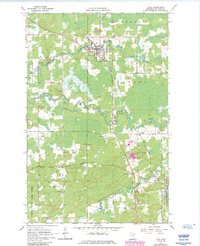
USGS Historical Quadrangle in GeoPDF.
Tags: 7.5 x 7.5 minute,
Cook,
Downloadable Data,
GeoPDF,
GeoTIFF, All tags...
Historical Topographic Maps,
Historical Topographic Maps 7.5 x 7.5 Minute Map Series,
MN,
Map,
imageryBaseMapsEarthCover, Fewer tags
The National Hydrography Dataset (NHD) is a feature-based database that interconnects and uniquely identifies the stream segments or reaches that make up the nation's surface water drainage system. NHD data was originally developed at 1:100,000-scale and exists at that scale for the whole country. This high-resolution NHD, generally developed at 1:24,000/1:12,000 scale, adds detail to the original 1:100,000-scale NHD. (Data for Alaska, Puerto Rico and the Virgin Islands was developed at high-resolution, not 1:100,000 scale.) Local resolution NHD is being developed where partners and data exist. The NHD contains reach codes for networked features, flow direction, names, and centerline representations for areal water...
Tags: Administrative watershed units,
Administrative watershed units,
Area of Complex Channels,
Area to be submerged,
Basin, All tags...
Basin,
Bay/Inlet,
Berrien,
Boundaries,
Boundary,
Bridge,
Canal/Ditch,
Coastline,
Connector,
Cook,
Dam/Weir,
Downloadable Data,
Drainage areas for surface water,
Drainageway,
Esri File GeoDatabase 10,
Estuary,
FileGDB,
Flow direction network,
Flume,
ForeShore,
Gaging Station,
Gate,
HU-8,
HU-8 Subbasin,
HU10,
HU12,
HU14,
HU16,
HU2,
HU4,
HU6,
HU8,
HU8_04040001,
HUC,
Hazard Zone,
Hydrographic,
Hydrography,
Hydrography,
Hydrography,
Hydrologic Unit Code,
Hydrologic Units,
IL,
IN,
Ice mass,
Illinois,
Indiana,
Inundation Area,
LaPorte,
Lake,
Levee,
Line,
Lock Chamber,
MI,
Marsh,
Michigan,
National Hydrography Dataset (NHD),
National Hydrography Dataset (NHD) Best Resolution,
National Hydrography Dataset (NHD) Best Resolution,
Nonearthen Shore,
Orthoimage,
Playa,
Point,
PointEvent,
Pond,
Porter,
Rapids,
Rapids,
Reach,
Reach code,
Reef,
Region,
Reservoir,
Rock,
Sea/Ocean,
Sink/Rise,
Sounding Datum Line,
Special Use Zone,
Special Use Zone Limit,
Spillway,
St. Joseph,
Stream,
Stream/River,
Sub-basin,
Sub-region,
Subbasin,
Submerged Stream,
Subregion,
Subwatershed,
Surface water systems,
Swamp,
Topographic,
Tunnel,
US,
Underground Conduit,
United States,
WBD,
WBD,
Wall,
Wash,
Water Intake Outflow,
Waterfall,
Watershed,
Watershed Boundaries,
Watershed Boundary Dataset,
Watershed Boundary Dataset,
Well,
artificial path,
boundaries,
dams,
drainage systems and characteristics,
inlandWaters,
lakes,
ngda,
rivers, Fewer tags
The National Hydrography Dataset (NHD) is a feature-based database that interconnects and uniquely identifies the stream segments or reaches that make up the nation's surface water drainage system. NHD data was originally developed at 1:100,000-scale and exists at that scale for the whole country. This high-resolution NHD, generally developed at 1:24,000/1:12,000 scale, adds detail to the original 1:100,000-scale NHD. (Data for Alaska, Puerto Rico and the Virgin Islands was developed at high-resolution, not 1:100,000 scale.) Local resolution NHD is being developed where partners and data exist. The NHD contains reach codes for networked features, flow direction, names, and centerline representations for areal water...
Tags: Administrative watershed units,
Administrative watershed units,
Area of Complex Channels,
Area to be submerged,
Basin, All tags...
Basin,
Bay/Inlet,
Boundaries,
Boundary,
Bridge,
Canal/Ditch,
Coastline,
Connector,
Cook,
Dam/Weir,
Downloadable Data,
Drainage areas for surface water,
Drainageway,
Esri File GeoDatabase 10,
Estuary,
FileGDB,
Flow direction network,
Flume,
ForeShore,
Gaging Station,
Gate,
HU-8,
HU-8 Subbasin,
HU10,
HU12,
HU14,
HU16,
HU2,
HU4,
HU6,
HU8,
HU8_07120003,
HUC,
Hazard Zone,
Hydrographic,
Hydrography,
Hydrography,
Hydrography,
Hydrologic Unit Code,
Hydrologic Units,
IL,
IN,
Ice mass,
Illinois,
Indiana,
Inundation Area,
Lake,
Levee,
Line,
Lock Chamber,
Marsh,
National Hydrography Dataset (NHD),
National Hydrography Dataset (NHD) Best Resolution,
National Hydrography Dataset (NHD) Best Resolution,
Nonearthen Shore,
Orthoimage,
Playa,
Point,
PointEvent,
Pond,
Rapids,
Rapids,
Reach,
Reach code,
Reef,
Region,
Reservoir,
Rock,
Sea/Ocean,
Sink/Rise,
Sounding Datum Line,
Special Use Zone,
Special Use Zone Limit,
Spillway,
Stream,
Stream/River,
Sub-basin,
Sub-region,
Subbasin,
Submerged Stream,
Subregion,
Subwatershed,
Surface water systems,
Swamp,
Topographic,
Tunnel,
US,
Underground Conduit,
United States,
WBD,
WBD,
Wall,
Wash,
Water Intake Outflow,
Waterfall,
Watershed,
Watershed Boundaries,
Watershed Boundary Dataset,
Watershed Boundary Dataset,
Well,
Will,
artificial path,
boundaries,
dams,
drainage systems and characteristics,
inlandWaters,
lakes,
ngda,
rivers, Fewer tags
The National Hydrography Dataset (NHD) is a feature-based database that interconnects and uniquely identifies the stream segments or reaches that make up the nation's surface water drainage system. NHD data was originally developed at 1:100,000-scale and exists at that scale for the whole country. This high-resolution NHD, generally developed at 1:24,000/1:12,000 scale, adds detail to the original 1:100,000-scale NHD. (Data for Alaska, Puerto Rico and the Virgin Islands was developed at high-resolution, not 1:100,000 scale.) Local resolution NHD is being developed where partners and data exist. The NHD contains reach codes for networked features, flow direction, names, and centerline representations for areal water...
Tags: Administrative watershed units,
Administrative watershed units,
Area of Complex Channels,
Area to be submerged,
Basin, All tags...
Basin,
Bay/Inlet,
Boundaries,
Boundary,
Bridge,
Canal/Ditch,
Coastline,
Connector,
Cook,
Dam/Weir,
DeKalb,
Downloadable Data,
Drainage areas for surface water,
Drainageway,
DuPage,
Estuary,
Flow direction network,
Flume,
ForeShore,
Gaging Station,
Gate,
GeoPackage,
Grundy,
HU-8,
HU-8 Subbasin,
HU10,
HU12,
HU14,
HU16,
HU2,
HU4,
HU6,
HU8,
HU8_07120007,
HUC,
Hazard Zone,
Hydrographic,
Hydrography,
Hydrography,
Hydrography,
Hydrologic Unit Code,
Hydrologic Units,
IL,
Ice mass,
Illinois,
Inundation Area,
Kane,
Kendall,
LaSalle,
Lee,
Levee,
Line,
Lock Chamber,
Marsh,
National Hydrography Dataset (NHD),
National Hydrography Dataset (NHD) Best Resolution,
National Hydrography Dataset (NHD) Best Resolution,
Nonearthen Shore,
Open Geospatial Consortium GeoPackage 1.2,
Orthoimage,
Playa,
Point,
PointEvent,
Pond,
Rapids,
Rapids,
Reach,
Reach code,
Reef,
Region,
Reservoir,
Rock,
Sea/Ocean,
Sink/Rise,
Sounding Datum Line,
Special Use Zone,
Special Use Zone Limit,
Spillway,
Stream,
Stream/River,
Sub-basin,
Sub-region,
Subbasin,
Submerged Stream,
Subregion,
Subwatershed,
Surface water systems,
Swamp,
Topographic,
Tunnel,
US,
Underground Conduit,
United States,
WBD,
WBD,
Wall,
Wash,
Water Intake Outflow,
Waterfall,
Watershed,
Watershed Boundaries,
Watershed Boundary Dataset,
Watershed Boundary Dataset,
Well,
Will,
artificial path,
boundaries,
dams,
drainage systems and characteristics,
inlandWaters,
lakes,
ngda,
rivers, Fewer tags

ADMMR map collection: Vulture Town Site; 1 in. to 200 feet; 19 x 24 in.
Categories: Data;
Tags: Arizona,
Astor,
Black Hawk,
Conkling,
Cook, All tags...
Copper, Sulfide,
Custer,
Dataset,
East Vulture,
Elmore,
Gold,
Gold, Lode,
Hamilton,
Iron, Hema-Magne,
Iron, Sulfide,
Jane Elmore,
Lead, Sulfide,
Lithium,
Maricopa County,
Pit Gold,
Sheridan,
Sherman,
Silver, Oxide,
T6N R6W Sec 36 C,
Talmage,
Texhoma,
Tungsten,
United States,
Van Buren,
Vulture,
Vulture Extension,
Vulture Mountains - 15 Min,
Vulture Mts. physiographic area,
Vulture metallic mineral dist.,
Zinc, Sulfide,
geoscientificInformation,
maps and atlases,
mining and quarrying,
plats, Fewer tags

Heinrichs Geoexploration Co. Maps: Vulture Mine, Main Pit Area; 1 in. to 50 feet; 47 x 25 in.
Categories: Data;
Tags: 1980s,
Arizona,
Astor,
Black Hawk,
Conkling, All tags...
Cook,
Copper, Sulfide,
Custer,
Dataset,
East Vulture,
Elmore,
Gold,
Gold, Lode,
Hamilton,
Iron, Hema-Magne,
Iron, Sulfide,
Jane Elmore,
Lead, Sulfide,
Lithium,
Maricopa County,
Maricopa273,
Pit Gold,
Sheridan,
Sherman,
Silver, Oxide,
T6N R6W Sec 36 C,
Talmage,
Texhoma,
Tungsten,
United States,
Van Buren,
Vulture Extension,
Vulture Mountains - 15 Min,
Vulture Mts. physiographic area,
Vulture metallic mineral dist.,
Zinc, Sulfide,
chemical analysis,
drilling and coring,
geoscientificInformation,
maps and atlases,
mineral resources, Fewer tags

A.F. Budge Mining Ltd. Maps: Vulture Mine, Claim Locations, Map No. 1; 1 in. to 1000 feet; 24 x 18 in.
Categories: Data;
Tags: Arizona,
Astor,
Black Hawk,
Conkling,
Cook, All tags...
Copper, Sulfide,
Custer,
Dataset,
East Vulture,
Elmore,
Gold,
Gold, Lode,
Hamilton,
Iron, Hema-Magne,
Iron, Sulfide,
Jane Elmore,
Lead, Sulfide,
Lithium,
Maricopa County,
Maricopa273,
Pit Gold,
Sheridan,
Sherman,
Silver, Oxide,
T6N R6W Sec 36 C,
Talmage,
Texhoma,
Tungsten,
United States,
Van Buren,
Vulture Extension,
Vulture Mountains - 15 Min,
Vulture Mts. physiographic area,
Vulture metallic mineral dist.,
Zinc, Sulfide,
claim maps,
geoscientificInformation,
maps and atlases,
mineral resources, Fewer tags

Heinrichs Geoexploration Co. Maps: Vulture Mine, 600' Level Geologic Map; 1 in. to 20 feet; 36 x 24 in.
Categories: Data;
Tags: 1980s,
Arizona,
Astor,
Black Hawk,
Conkling, All tags...
Cook,
Copper, Sulfide,
Custer,
Dataset,
East Vulture,
Elmore,
Gold,
Gold, Lode,
Hamilton,
Iron, Hema-Magne,
Iron, Sulfide,
Jane Elmore,
Lead, Sulfide,
Lithium,
Maricopa County,
Maricopa273,
Pit Gold,
Sheridan,
Sherman,
Silver, Oxide,
T6N R6W Sec 36 C,
Talmage,
Texhoma,
Tungsten,
United States,
Van Buren,
Vulture Extension,
Vulture Mountains - 15 Min,
Vulture Mts. physiographic area,
Vulture metallic mineral dist.,
Zinc, Sulfide,
geologic maps,
geology,
geoscientificInformation,
maps and atlases,
mineral resources,
mining and quarrying,
plans,
subsurface maps, Fewer tags

The 'Vulture: Mine and Leach Design Notes' file is part of the A. F. Budge Mining Ltd. Mining collection. A. F. Budge Mining Ltd., a British company owned by Tony Budge, controlled properties across several western U. S. states and northern Mexico. The company was active in Arizona during the 1980s and into the early 1990s. The collection consists of economic geologic information including maps, logs, reports and records. A few properties make up most of the collection: Vulture, United Verde Extension and Korn Kob.
Categories: Data;
Tags: 1980s,
Arizona,
Astor,
Black Hawk,
Conkling, All tags...
Cook,
Custer,
Dataset,
East Vulture,
Elmore,
Hamilton,
Jane Elmore,
Maricopa County,
Maricopa273,
Pit Gold,
Sheridan,
Sherman,
T6N R6W Sec 36 C,
Talmage,
Texhoma,
United States,
Van Buren,
Vulture Extension,
Vulture Mountains - 15 Min,
Vulture Mts. physiographic area,
Vulture metallic mineral dist.,
economic geology,
geoscientificInformation,
mining and quarrying,
mining hazards,
reports, Fewer tags

The 'Vulture: Operations Proposal' file is part of the A. F. Budge Mining Ltd. Mining collection. A. F. Budge Mining Ltd., a British company owned by Tony Budge, controlled properties across several western U. S. states and northern Mexico. The company was active in Arizona during the 1980s and into the early 1990s. The collection consists of economic geologic information including maps, logs, reports and records. A few properties make up most of the collection: Vulture, United Verde Extension and Korn Kob.
Categories: Data;
Tags: 1980s,
Arizona,
Astor,
Black Hawk,
Conkling, All tags...
Cook,
Copper, Sulfide,
Custer,
Dataset,
East Vulture,
Elmore,
Gold,
Gold, Lode,
Hamilton,
Iron, Hema-Magne,
Iron, Sulfide,
Jane Elmore,
Lead, Sulfide,
Lithium,
Maricopa County,
Maricopa273,
Pit Gold,
Sheridan,
Sherman,
Silver, Oxide,
T6N R6W Sec 36 C,
Talmage,
Texhoma,
Tungsten,
United States,
Van Buren,
Vulture Extension,
Vulture Mountains - 15 Min,
Vulture Mts. physiographic area,
Vulture metallic mineral dist.,
Zinc, Sulfide,
chemical analysis,
drilling and coring,
economic geology,
engineering geology,
environmental assessment,
geoscientificInformation,
gold ores,
maps and atlases,
metallic ores,
mineral resources,
mining and quarrying,
natural resource exploration,
placer deposit mining,
reports,
str, Fewer tags

The 'Vulture: Diversion Survey' file is part of the A. F. Budge Mining Ltd. Mining collection. A. F. Budge Mining Ltd., a British company owned by Tony Budge, controlled properties across several western U. S. states and northern Mexico. The company was active in Arizona during the 1980s and into the early 1990s. The collection consists of economic geologic information including maps, logs, reports and records. A few properties make up most of the collection: Vulture, United Verde Extension and Korn Kob.
Categories: Data;
Tags: 1980s,
Arizona,
Astor,
Black Hawk,
Conkling, All tags...
Cook,
Copper, Sulfide,
Custer,
Dataset,
East Vulture,
Elmore,
Gold,
Gold, Lode,
Hamilton,
Iron, Hema-Magne,
Iron, Sulfide,
Jane Elmore,
Lead, Sulfide,
Lithium,
Maricopa County,
Maricopa273,
Pit Gold,
Sheridan,
Sherman,
Silver, Oxide,
T6N R6W Sec 36 C,
Talmage,
Texhoma,
Tungsten,
United States,
Van Buren,
Vulture Extension,
Vulture Mountains - 15 Min,
Vulture Mts. physiographic area,
Vulture metallic mineral dist.,
Zinc, Sulfide,
chemical analysis,
drilling and coring,
geolocation measurement,
geoscientificInformation,
natural resource exploration,
reports, Fewer tags

The 'Vulture: Reports from Frank Millsaps' file is part of the A. F. Budge Mining Ltd. Mining collection. A. F. Budge Mining Ltd., a British company owned by Tony Budge, controlled properties across several western U. S. states and northern Mexico. The company was active in Arizona during the 1980s and into the early 1990s. The collection consists of economic geologic information including maps, logs, reports and records. A few properties make up most of the collection: Vulture, United Verde Extension and Korn Kob.
Categories: Data;
Tags: 1980s,
Arizona,
Astor,
Black Hawk,
Conkling, All tags...
Cook,
Copper, Sulfide,
Custer,
Dataset,
East Vulture,
Elmore,
Gold,
Gold, Lode,
Hamilton,
Iron, Hema-Magne,
Iron, Sulfide,
Jane Elmore,
Lead, Sulfide,
Lithium,
Maricopa County,
Maricopa273,
Pit Gold,
Sheridan,
Sherman,
Silver, Oxide,
T6N R6W Sec 36 C,
Talmage,
Texhoma,
Tungsten,
United States,
Van Buren,
Vulture Extension,
Vulture Mountains - 15 Min,
Vulture Mts. physiographic area,
Vulture metallic mineral dist.,
Zinc, Sulfide,
economic geology,
engineering geology,
geoscientificInformation,
gold ores,
maps and atlases,
metallic ores,
mineral resources,
mining and quarrying,
natural resource exploration,
reports, Fewer tags

A.F. Budge Mining Ltd. Maps: Vulture Mine Project I.P. Survey, Line 6; 18 x 10 in.
Categories: Data;
Tags: 1980s,
Arizona,
Astor,
Black Hawk,
Conkling, All tags...
Cook,
Copper, Sulfide,
Custer,
Dataset,
East Vulture,
Elmore,
Gold,
Gold, Lode,
Hamilton,
Iron, Hema-Magne,
Iron, Sulfide,
Jane Elmore,
Lead, Sulfide,
Lithium,
Maricopa County,
Maricopa273,
Pit Gold,
Sheridan,
Sherman,
Silver, Oxide,
T6N R6W Sec 36 C,
Talmage,
Texhoma,
Tungsten,
United States,
Van Buren,
Vulture Extension,
Vulture Mountains - 15 Min,
Vulture Mts. physiographic area,
Vulture metallic mineral dist.,
Zinc, Sulfide,
diagrams,
geophysics,
geoscientificInformation,
mineral resources,
natural resource exploration, Fewer tags
|
|

