Filters: Tags: Challis (X)
18 results (10ms)|
Filters
Date Range
Extensions (Less) Types (Less)
Contacts (Less)
Categories (Less) Tag Types Tag Schemes
|
A mineral resource assessment was performed by the U.S. Geological Survey (USGS) to assess the potential of undiscovered skarn-hosted tungsten resources in the Northern Rocky Mountain region of eastern Idaho and western Montana. This region has seen moderate tungsten trioxide (WO3) production in the past from a variety of mineralization styles including skarn, vein and replacement, and wolframite-quartz veins. The geology of the area is dominated by large plutons of Cretaceous to Tertiary age, emplaced into a belt of sedimentary rock ranging from Mesoproterozoic to Permian age, and affected by tectonism related to the Sevier and later Laramide orogenies. Known tungsten (W) skarn mineral sites are associated with...
Categories: Data;
Types: ArcGIS REST Map Service,
ArcGIS Service Definition,
Downloadable,
Map Service;
Tags: Ashton,
Bald Mountain,
Beaverhead County,
Bitterroot Range,
Boise County,
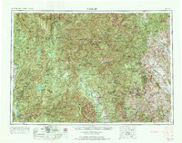
USGS Historical Quadrangle in GeoPDF.
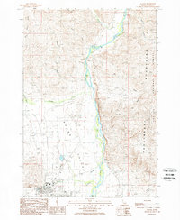
USGS Historical Quadrangle in GeoPDF.
This data set contains imagery from the National Agriculture Imagery Program (NAIP). The NAIP program is administered by USDA FSA and has been established to support two main FSA strategic goals centered on agricultural production. These are, increase stewardship of America's natural resources while enhancing the environment, and to ensure commodities are procured and distributed effectively and efficiently to increase food security. The NAIP program supports these goals by acquiring and providing ortho imagery that has been collected during the agricultural growing season in the U.S. The NAIP ortho imagery is tailored to meet FSA requirements and is a fundamental tool used to support FSA farm and conservation programs....
This data set contains imagery from the National Agriculture Imagery Program (NAIP). The NAIP program is administered by USDA FSA and has been established to support two main FSA strategic goals centered on agricultural production. These are, increase stewardship of America's natural resources while enhancing the environment, and to ensure commodities are procured and distributed effectively and efficiently to increase food security. The NAIP program supports these goals by acquiring and providing ortho imagery that has been collected during the agricultural growing season in the U.S. The NAIP ortho imagery is tailored to meet FSA requirements and is a fundamental tool used to support FSA farm and conservation programs....
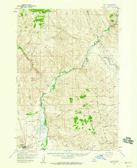
USGS Historical Quadrangle in GeoPDF.

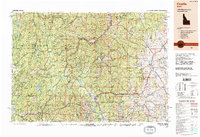
USGS Historical Quadrangle in GeoPDF.

USGS Historical Quadrangle in GeoPDF.
This data release includes laser ablation inductively coupled plasma mass spectrometry (LA-ICPMS) U-Pb zircon geochronology data to determine the ages of Challis igneous rocks in the Thunder Mountain volcanic field and dikes west of the volcanic field, especially in and near the Stibnite-Yellow Pine mining district, ID. These efforts were made to help understand the stratigraphy and lithologic characteristics of the Challis igneous rocks by determining their absolute ages.
Categories: Data;
Tags: Challis,
GGGSC,
Geochronology,
Geology, Geophysics, and Geochemistry Science Center,
Idaho,
USGS Historical Quadrangle in GeoPDF.

USGS Historical Quadrangle in GeoPDF.
This data set contains imagery from the National Agriculture Imagery Program (NAIP). The NAIP program is administered by USDA FSA and has been established to support two main FSA strategic goals centered on agricultural production. These are, increase stewardship of America's natural resources while enhancing the environment, and to ensure commodities are procured and distributed effectively and efficiently to increase food security. The NAIP program supports these goals by acquiring and providing ortho imagery that has been collected during the agricultural growing season in the U.S. The NAIP ortho imagery is tailored to meet FSA requirements and is a fundamental tool used to support FSA farm and conservation programs....
USGS Historical Quadrangle in GeoPDF.
USGS Historical Quadrangle in GeoPDF.
USGS Historical Quadrangle in GeoPDF.
This data set contains imagery from the National Agriculture Imagery Program (NAIP). The NAIP program is administered by USDA FSA and has been established to support two main FSA strategic goals centered on agricultural production. These are, increase stewardship of America's natural resources while enhancing the environment, and to ensure commodities are procured and distributed effectively and efficiently to increase food security. The NAIP program supports these goals by acquiring and providing ortho imagery that has been collected during the agricultural growing season in the U.S. The NAIP ortho imagery is tailored to meet FSA requirements and is a fundamental tool used to support FSA farm and conservation programs....
The data release for the geologic map of the Challis 1 x 2 degrees quadrangle, Idaho, is a Geologic Map Schema (GeMS)-compliant version that updates the GIS files for the geologic map published in U.S. Geological Survey (USGS) Miscellaneous Investigations I-1819 (Fisher and others, 1992). The updated digital data present the attribute tables and geospatial features (points, lines and polygons) in the format that meets GeMS requirements. This data release presents the geologic map as shown on the plates and captured in geospatial data for the published map. Minor errors, such as mistakes in line decoration or differences between the digital data and the map image, are corrected in this version. The database represents...
Categories: Data;
Types: ArcGIS REST Map Service,
ArcGIS Service Definition,
Downloadable,
Map Service;
Tags: Boise County,
Challis,
Custer County,
Economic Geology,
Elmore County,
USGS Historical Quadrangle in GeoPDF.
|

|
