Filters: Tags: Cape Disappointment (X)
21 results (27ms)|
Filters
Date Range
Types (Less) Contacts (Less)
Categories (Less) Tag Types Tag Schemes
|
This portion of the data release presents the locations of the temporary ground control points (GCPs) used for the structure-from-motion (SfM) processing of the imagery collected during the July 2021 unoccupied aerial system (UAS) surveys of the ocean beach at Fort Stevens State Park, OR, and Benson Beach at Cape Disappointment State Park, WA. Eighteen temporary ground control points (GCPs) were distributed throughout the survey area to establish survey control. The GCPs consisted of a combination of small square tarps with black-and-white cross patterns and "X" marks placed on the ground using temporary chalk. The GCP positions were measured using dual-frequency post-processed kinematic (PPK) GPS with corrections...
Categories: Data;
Tags: Bathymetry and Elevation,
Benson Beach,
CHMRP,
Cape Disappointment,
Clatsop County,
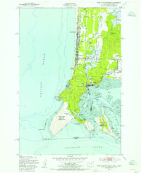
USGS Historical Quadrangle in GeoPDF.
This portion of the data release presents the raw aerial imagery collected during the uncrewed aerial system (UAS) survey conducted on the ocean beaches adjacent to the Columbia River Mouth at the Oregon-Washington border in August 2017. The imagery was acquired using a Department of Interior-owned 3DR Solo quadcopter fitted with a Ricoh GR II digital camera featuring a global shutter. The camera was mounted using a fixed mount on the bottom of the UAS and oriented in an approximately nadir orientation. The Fort Stevens State Park survey was conducted under Oregon Parks and Recreation Department Scientific Research Permit #024-17. Five flights were conducted at Fort Stevens State Park on 7 August 2017, between 16:32...
Categories: Data;
Tags: Bathymetry and Elevation,
Benson Beach,
CHMRP,
Cape Disappointment,
Clatsop County,
This data set contains imagery from the National Agriculture Imagery Program (NAIP). The NAIP program is administered by USDA FSA and has been established to support two main FSA strategic goals centered on agricultural production. These are, increase stewardship of America's natural resources while enhancing the environment, and to ensure commodities are procured and distributed effectively and efficiently to increase food security. The NAIP program supports these goals by acquiring and providing ortho imagery that has been collected during the agricultural growing season in the U.S. The NAIP ortho imagery is tailored to meet FSA requirements and is a fundamental tool used to support FSA farm and conservation programs....
This data set contains imagery from the National Agriculture Imagery Program (NAIP). The NAIP program is administered by USDA FSA and has been established to support two main FSA strategic goals centered on agricultural production. These are, increase stewardship of America's natural resources while enhancing the environment, and to ensure commodities are procured and distributed effectively and efficiently to increase food security. The NAIP program supports these goals by acquiring and providing ortho imagery that has been collected during the agricultural growing season in the U.S. The NAIP ortho imagery is tailored to meet FSA requirements and is a fundamental tool used to support FSA farm and conservation programs....
This portion of the data release presents the locations of the temporary ground control points (GCPs) used for the structure-from-motion (SfM) processing of the imagery collected during the August 2017 unoccupied aerial system (UAS) surveys of the ocean beach at Fort Stevens State Park, OR, and Benson Beach at Cape Disappointment State Park, WA. Eighteen temporary ground control points (GCPs) were distributed throughout the survey area to establish survey control. The GCPs consisted of a combination of small square tarps with black-and-white cross patterns and "X" marks placed on the ground using temporary chalk. The GCP positions were measured using dual-frequency real-time kinematic (RTK) or post-processed kinematic...
Categories: Data;
Tags: Bathymetry and Elevation,
Benson Beach,
CHMRP,
Cape Disappointment,
Clatsop County,
This data set contains imagery from the National Agriculture Imagery Program (NAIP). The NAIP program is administered by USDA FSA and has been established to support two main FSA strategic goals centered on agricultural production. These are, increase stewardship of America's natural resources while enhancing the environment, and to ensure commodities are procured and distributed effectively and efficiently to increase food security. The NAIP program supports these goals by acquiring and providing ortho imagery that has been collected during the agricultural growing season in the U.S. The NAIP ortho imagery is tailored to meet FSA requirements and is a fundamental tool used to support FSA farm and conservation programs....
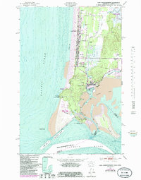
USGS Historical Quadrangle in GeoPDF.
This portion of the data release presents high-resolution orthomosaic images of the ocean beach at Fort Stevens State Park, OR, and Benson Beach at Cape Disappointment State Park, WA. The orthomosaics have resolutions of 5 centimeters per pixel and were derived from structure-from-motion (SfM) processing of aerial imagery collected with unoccupied aerial systems (UAS) during low tide surveys on 22 and 23 July 2021. The raw imagery used to create the orthomosaics was acquired with a UAS fitted with a Ricoh GR II digital camera featuring a global shutter. The UAS was flown on pre-programmed autonomous flight lines spaced to provide approximately 70 percent overlap between images from adjacent lines. The camera was...
Categories: Data;
Tags: Bathymetry and Elevation,
Benson Beach,
CHMRP,
Cape Disappointment,
Clatsop County,
This data set contains imagery from the National Agriculture Imagery Program (NAIP). The NAIP program is administered by USDA FSA and has been established to support two main FSA strategic goals centered on agricultural production. These are, increase stewardship of America's natural resources while enhancing the environment, and to ensure commodities are procured and distributed effectively and efficiently to increase food security. The NAIP program supports these goals by acquiring and providing ortho imagery that has been collected during the agricultural growing season in the U.S. The NAIP ortho imagery is tailored to meet FSA requirements and is a fundamental tool used to support FSA farm and conservation programs....
Alliance-based vegetation map for Lewis and Clark National Historical Park produced by the Institute for Natural Resources at Portland State University. Part of the Vegetation Mapping Program of the Inventory and Monitoring program at NPS. Several imagery sources were used to construct the vegetation map. LiDAR, SPOT 4, NAIP, and LANDSAT were available for the majority of the project area, with only a few places in Washington lacking LiDAR data. The eCognition software package and Berkley Imaging Segmentation was used to create the initial image segments and polygon map used to aid in collection of field training data. The mean values of various variable inputs were summarized by each of the image segments in addition...
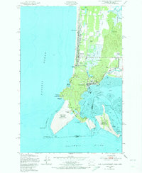
USGS Historical Quadrangle in GeoPDF.
This portion of the data release presents topographic point clouds of the ocean beach at Fort Stevens State Park, OR, and Benson Beach at Cape Disappointment State Park, WA. The point clouds were derived from structure-from-motion (SfM) processing of aerial imagery collected with unoccupied aerial systems (UAS) on during low tide surveys on 7 and 8 August 2017. The point clouds from each survey are tiled into 1000 by 1000 meter tiles to reduce individual file sizes. The Fort Stevens point clouds have a total of 271,915,544 points, with an average point density of 407 points per-square meter and an average point spacing of 5 centimeters. The Benson Beach point clouds have a total of 301,569,130 points, with an average...
Categories: Data;
Tags: Bathymetry and Elevation,
Benson Beach,
CHMRP,
Cape Disappointment,
Clatsop County,

USGS Historical Quadrangle in GeoPDF.
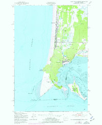
USGS Historical Quadrangle in GeoPDF.
This portion of the data release presents digital surface models (DSM) of the ocean beach at Fort Stevens State Park, OR, and Benson Beach at Cape Disappointment State Park, WA. The DSMs have resolutions of 10 centimeters per pixel and were derived from structure-from-motion (SfM) processing of aerial imagery collected with unoccupied aerial systems (UAS) during low tides on 22 and 23 July 2021. Unlike a digital elevation model (DEM), the DSMs represent the elevation of the highest object within the bounds of a cell. Vegetation, buildings, and other objects have not been removed from the data. The raw imagery used to create the DSMs was acquired with a UAS fitted with a Ricoh GR II digital camera featuring a global...
Categories: Data;
Tags: Bathymetry and Elevation,
Benson Beach,
CHMRP,
Cape Disappointment,
Clatsop County,
This portion of the data release presents topographic point clouds of the ocean beach at Fort Stevens State Park, OR, and Benson Beach at Cape Disappointment State Park, WA. The point clouds were derived from structure-from-motion (SfM) processing of aerial imagery collected with unoccupied aerial systems (UAS) on 2017-11-01 during low tide surveys on 22 and 23 July 2021. The point clouds from each survey are tiled into 500 by 500 meter tiles to reduce individual file sizes. The Fort Stevens point clouds have a total of approximately 496 million points, with an average point density of 386 points per-square meter and an average point spacing of 5 centimeters. The Benson Beach point clouds have a total of approximately...
Categories: Data;
Tags: Bathymetry and Elevation,
Benson Beach,
CHMRP,
Cape Disappointment,
Clatsop County,
This portion of the data release presents high-resolution orthomosaic images of the ocean beach at Fort Stevens State Park, OR, and Benson Beach at Cape Disappointment State Park, WA. The orthomosaics have resolutions of 5 centimeters per pixel and were derived from structure-from-motion (SfM) processing of aerial imagery collected with unoccupied aerial systems (UAS) during low tide surveys on 7 and 8 August 2017. The raw imagery used to create the orthomosaics was acquired with a UAS fitted with a Ricoh GR II digital camera featuring a global shutter. The UAS was flown on pre-programmed autonomous flight lines spaced to provide approximately 70 percent overlap between images from adjacent lines. The camera was...
Categories: Data;
Tags: Bathymetry and Elevation,
Benson Beach,
CHMRP,
Cape Disappointment,
Clatsop County,
This data set contains imagery from the National Agriculture Imagery Program (NAIP). The NAIP program is administered by USDA FSA and has been established to support two main FSA strategic goals centered on agricultural production. These are, increase stewardship of America's natural resources while enhancing the environment, and to ensure commodities are procured and distributed effectively and efficiently to increase food security. The NAIP program supports these goals by acquiring and providing ortho imagery that has been collected during the agricultural growing season in the U.S. The NAIP ortho imagery is tailored to meet FSA requirements and is a fundamental tool used to support FSA farm and conservation programs....
This portion of the data release presents digital surface models (DSM) of the ocean beach at Fort Stevens State Park, OR, and Benson Beach at Cape Disappointment State Park, WA. The DSMs have resolutions of 10 centimeters per pixel and were derived from structure-from-motion (SfM) processing of aerial imagery collected with unoccupied aerial systems (UAS) during low tides on 7 and 8 August 2017. Unlike a digital elevation model (DEM), the DSMs represent the elevation of the highest object within the bounds of a cell. Vegetation, buildings, and other objects have not been removed from the data. The raw imagery used to create the DSMs was acquired with a UAS fitted with a Ricoh GR II digital camera featuring a global...
Categories: Data;
Tags: Bathymetry and Elevation,
Benson Beach,
CHMRP,
Cape Disappointment,
Clatsop County,
|

|
