Filters: Tags: CUTLER (X)
47 results (34ms)|
Filters
Contacts
(Less)
|
This data set contains imagery from the National Agriculture Imagery Program (NAIP). The NAIP program is administered by USDA FSA and has been established to support two main FSA strategic goals centered on agricultural production. These are, increase stewardship of America's natural resources while enhancing the environment, and to ensure commodities are procured and distributed effectively and efficiently to increase food security. The NAIP program supports these goals by acquiring and providing ortho imagery that has been collected during the agricultural growing season in the U.S. The NAIP ortho imagery is tailored to meet FSA requirements and is a fundamental tool used to support FSA farm and conservation programs....
Core Research Center, core D729, from well operated by KERR MCGEE CORPRaw Properties from download, web scrape, MapServer, and Macrostrat API{"Lib Num": "D729", "API Num": null, "Operator": "KERR MCGEE CORP", "Well Name": "29-24-26-2 LISBON", "Field": "LISBON VALLEY", "State": "UT", "County": "SAN JUAN", "Type": "SLABBED", "Photos": "T", "Thin Sec": "F", "Analysis": "T", "Latitude": "38.24661", "Longitude": "-109.24328", "coordinates_geohash": "9wf3d4e6xhf7", "Source": "CENTER OF QUARTER SECTION", "Security Flag": "NO SPECIAL RESTRICTIONS", "crc_collection_name": "core", "sb_parent_id": "4f4e49dae4b07f02db5e0486", "intervals": [{"Formation": "CHINLE", "Age": "TRIASSIC", "Min Depth": "2685", "Max Depth": "2768"},...
Categories: Physical Item;
Tags: Burro Canyon Formation,
Burro Canyon Formation,
CHINLE,
CUTLER,
Lower Cretaceous - Albian,
Core Research Center, core D713, from well operated by GULF MINERALS INCRaw Properties from download, web scrape, MapServer, and Macrostrat API{"Lib Num": "D713", "API Num": null, "Operator": "GULF MINERALS INC", "Well Name": "4 LISBON", "Field": "LISBON VALLEY", "State": "UT", "County": "SAN JUAN", "Type": "SLABBED", "Photos": "F", "Thin Sec": "F", "Analysis": "F", "Latitude": "38.28228", "Longitude": "-109.27731", "coordinates_geohash": "9wf3c34dqn5z", "Source": "CENTER OF QUARTER SECTION", "Security Flag": "NO SPECIAL RESTRICTIONS", "crc_collection_name": "core", "sb_parent_id": "4f4e49dae4b07f02db5e0486", "intervals": [{"Formation": "MOSS BACK", "Age": "TRIA", "Min Depth": "2685", "Max Depth": "2710"}, {"Formation":...
Categories: Physical Item;
Tags: CUTLER,
Holocene to middle Pleistocene,
MOSS BACK,
Mixed eolian and alluvial deposits,
PERM,
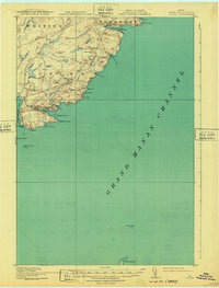
USGS Historical Quadrangle in GeoPDF.
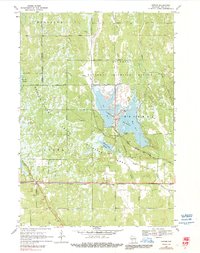
USGS Historical Quadrangle in GeoPDF.
Core Research Center, core T106, from well operated by CITIES SERVICERaw Properties from download, web scrape, MapServer, and Macrostrat API{"Lib Num": "T106", "API Num": "4301930647", "Operator": "CITIES SERVICE", "Well Name": "1 FEDERAL-DE", "Field": "WILDCAT", "State": "UT", "County": "GRAND", "Type": "SLABBED", "Photos": "F", "Thin Sec": "F", "Analysis": "T", "Latitude": "38.78995", "Longitude": "-109.9549", "coordinates_geohash": "9wcu9vmrc4u0", "Source": "FROM STATE RECORDS", "Security Flag": "NO SPECIAL RESTRICTIONS", "crc_collection_name": "core", "sb_parent_id": "4f4e49dae4b07f02db5e0486", "intervals": [{"Formation": "CUTLER", "Age": null, "Min Depth": "2775", "Max Depth": "2801"}], "crcwc_url": "https://my.usgs.gov/crcwc/core/report/16327",...
Categories: Physical Item;
Tags: CUTLER,
Salt Wash Member,
Salt Wash Member of Morrison Formation,
Upper Jurassic,
mudstone,
This data set contains imagery from the National Agriculture Imagery Program (NAIP). The NAIP program is administered by USDA FSA and has been established to support two main FSA strategic goals centered on agricultural production. These are, increase stewardship of America's natural resources while enhancing the environment, and to ensure commodities are procured and distributed effectively and efficiently to increase food security. The NAIP program supports these goals by acquiring and providing ortho imagery that has been collected during the agricultural growing season in the U.S. The NAIP ortho imagery is tailored to meet FSA requirements and is a fundamental tool used to support FSA farm and conservation programs....
This data set contains imagery from the National Agriculture Imagery Program (NAIP). The NAIP program is administered by USDA FSA and has been established to support two main FSA strategic goals centered on agricultural production. These are, increase stewardship of America's natural resources while enhancing the environment, and to ensure commodities are procured and distributed effectively and efficiently to increase food security. The NAIP program supports these goals by acquiring and providing ortho imagery that has been collected during the agricultural growing season in the U.S. The NAIP ortho imagery is tailored to meet FSA requirements and is a fundamental tool used to support FSA farm and conservation programs....
This data set contains imagery from the National Agriculture Imagery Program (NAIP). The NAIP program is administered by USDA FSA and has been established to support two main FSA strategic goals centered on agricultural production. These are, increase stewardship of America's natural resources while enhancing the environment, and to ensure commodities are procured and distributed effectively and efficiently to increase food security. The NAIP program supports these goals by acquiring and providing ortho imagery that has been collected during the agricultural growing season in the U.S. The NAIP ortho imagery is tailored to meet FSA requirements and is a fundamental tool used to support FSA farm and conservation programs....
This data set contains imagery from the National Agriculture Imagery Program (NAIP). The NAIP program is administered by USDA FSA and has been established to support two main FSA strategic goals centered on agricultural production. These are, increase stewardship of America's natural resources while enhancing the environment, and to ensure commodities are procured and distributed effectively and efficiently to increase food security. The NAIP program supports these goals by acquiring and providing ortho imagery that has been collected during the agricultural growing season in the U.S. The NAIP ortho imagery is tailored to meet FSA requirements and is a fundamental tool used to support FSA farm and conservation programs....

USGS Historical Quadrangle in GeoPDF.
Core Research Center, core D742, from well operated by GULF MINERALS INCRaw Properties from download, web scrape, MapServer, and Macrostrat API{"Lib Num": "D742", "API Num": null, "Operator": "GULF MINERALS INC", "Well Name": "9 LISBON", "Field": "LISBON VALLEY", "State": "UT", "County": "SAN JUAN", "Type": "SLABBED", "Photos": "F", "Thin Sec": "F", "Analysis": "T", "Latitude": "38.28228", "Longitude": "-109.27731", "coordinates_geohash": "9wf3c34dqn5z", "Source": "CENTER OF QUARTER SECTION", "Security Flag": "NO SPECIAL RESTRICTIONS", "crc_collection_name": "core", "sb_parent_id": "4f4e49dae4b07f02db5e0486", "intervals": [{"Formation": "CHINLE", "Age": "TRIA", "Min Depth": "2710", "Max Depth": "2760"}, {"Formation":...
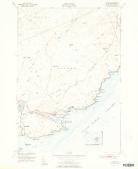
USGS Historical Quadrangle in GeoPDF.

USGS Historical Quadrangle in GeoPDF.
Core Research Center, core U229, from well operated by GULF MINERALS INCRaw Properties from download, web scrape, MapServer, and Macrostrat API{"Lib Num": "U229", "API Num": null, "Operator": "GULF MINERALS INC", "Well Name": "7 LISBON", "Field": "LISBON VALLEY", "State": "UT", "County": "SAN JUAN", "Type": "FULL", "Photos": "F", "Thin Sec": "F", "Analysis": "T", "Latitude": "38.11774", "Longitude": "-109.09733", "coordinates_geohash": "9wf2v7jezvwx", "Source": "CENTER OF QUARTER SECTION", "Security Flag": "NO SPECIAL RESTRICTIONS", "crc_collection_name": "core", "sb_parent_id": "4f4e49dae4b07f02db5e0486", "intervals": [{"Formation": "CHINLE", "Age": "TRIA", "Min Depth": "2744", "Max Depth": "2760"}, {"Formation":...
Core Research Center, core R400, from well operated by AMERICAN HUNTER EXPLRaw Properties from download, web scrape, MapServer, and Macrostrat API{"Lib Num": "R400", "API Num": "0508506029", "Operator": "AMERICAN HUNTER EXPL", "Well Name": "1 WRAY MESA", "Field": "WILDCAT", "State": "CO", "County": "MONTROSE", "Type": "SLABBED", "Photos": "F", "Thin Sec": "T", "Analysis": "T", "Latitude": "38.304551", "Longitude": "-108.960881", "coordinates_geohash": "9wf9bt1h5my6", "Source": "FROM STATE RECORDS", "Security Flag": "NO SPECIAL RESTRICTIONS", "crc_collection_name": "core", "sb_parent_id": "4f4e49dae4b07f02db5e0486", "intervals": [{"Formation": "CUTLER", "Age": "PENN", "Min Depth": "4408", "Max Depth": "4500"}, {"Formation":...
Categories: Physical Item;
Tags: CUTLER,
CUTLER,
CUTLER,
Glen Canyon Group and Chinle Fm,
Glen Canyon Group; Chinle Formation,
This data set contains imagery from the National Agriculture Imagery Program (NAIP). The NAIP program is administered by USDA FSA and has been established to support two main FSA strategic goals centered on agricultural production. These are, increase stewardship of America's natural resources while enhancing the environment, and to ensure commodities are procured and distributed effectively and efficiently to increase food security. The NAIP program supports these goals by acquiring and providing ortho imagery that has been collected during the agricultural growing season in the U.S. The NAIP ortho imagery is tailored to meet FSA requirements and is a fundamental tool used to support FSA farm and conservation programs....
This data set contains imagery from the National Agriculture Imagery Program (NAIP). The NAIP program is administered by USDA FSA and has been established to support two main FSA strategic goals centered on agricultural production. These are, increase stewardship of America's natural resources while enhancing the environment, and to ensure commodities are procured and distributed effectively and efficiently to increase food security. The NAIP program supports these goals by acquiring and providing ortho imagery that has been collected during the agricultural growing season in the U.S. The NAIP ortho imagery is tailored to meet FSA requirements and is a fundamental tool used to support FSA farm and conservation programs....

USGS Historical Quadrangle in GeoPDF.
Core Research Center, core U390, from well operated by KERR MCGEE CORPRaw Properties from download, web scrape, MapServer, and Macrostrat API{"Lib Num": "U390", "API Num": null, "Operator": "KERR MCGEE CORP", "Well Name": "30-25-10-1 LISBON", "Field": "LISBON VALLEY", "State": "UT", "County": "SAN JUAN", "Type": "FULL", "Photos": "F", "Thin Sec": "F", "Analysis": "F", "Latitude": "38.19237", "Longitude": "-109.16526", "coordinates_geohash": "9wf37bsq9jf3", "Source": "CENTER OF SECTION", "Security Flag": "NO SPECIAL RESTRICTIONS", "crc_collection_name": "core", "sb_parent_id": "4f4e49dae4b07f02db5e0486", "intervals": [{"Formation": "CUTLER", "Age": "PERM", "Min Depth": "2000", "Max Depth": "2059"}], "crcwc_url":...
Categories: Physical Item;
Tags: Burro Canyon Formation,
Burro Canyon Formation,
CUTLER,
Lower Cretaceous - Albian,
PERM,
|

|
