|
|

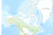
This is one of many datasets generated as part of the cited study. It shows British Columbia percent mortality area (0-100% of the gridcell area containing killed trees) due to Western Balsam Bark Beetle, 2007. Below is a description of the entire study: Abstract. Outbreaks of aggressive bark beetle species cause widespread tree mortality, affecting timber production, wildlife habitat, wildfire, forest composition and structure, biogeochemical cycling, and biogeophysical processes. As a result, agencies responsible for forest management in the United States and British Columbia conduct aerial surveys to map these forest disturbances. Here we combined aerial surveys from British Columbia (2001–2010) and the western...

This is one of many datasets generated as part of the cited study. It shows British Columbia percent killed trees due to Douglas-fir Beetle, 2003. Below is a description of the entire study: Abstract. Outbreaks of aggressive bark beetle species cause widespread tree mortality, affecting timber production, wildlife habitat, wildfire, forest composition and structure, biogeochemical cycling, and biogeophysical processes. As a result, agencies responsible for forest management in the United States and British Columbia conduct aerial surveys to map these forest disturbances. Here we combined aerial surveys from British Columbia (2001–2010) and the western conterminous United States (1997–2010), produced 1-km2 grids...

The 'REA Gold Corporation Corporate Profile and Annual Report 1983' file is part of the A. F. Budge Mining Ltd. Mining collection. A. F. Budge Mining Ltd., a British company owned by Tony Budge, controlled properties across several western U. S. states and northern Mexico. The company was active in Arizona during the 1980s and into the early 1990s. The collection consists of economic geologic information including maps, logs, reports and records. A few properties make up most of the collection: Vulture, United Verde Extension and Korn Kob.
Categories: Data;
Tags: 1980s,
Arizona,
British Columbia,
California,
Canada, All tags...
Dataset,
Idaho,
Nevada,
Oregon,
United States,
Utah,
Washington,
economic geology,
geochemistry,
geophysics,
geoscientificInformation,
maps and atlases,
metallic ores,
natural resource exploration,
news releases, Fewer tags
The National Hydro Network (NHN), for which the standard was officially adopted by the Canadian Council on Geomatics (CCOG) in August 2004, focuses on providing a quality geometric description and a set of basic attributes describing Canada's inland surface waters. It provides geospatial vector data describing hydrographic features such as lakes, reservoirs, rivers, streams, canals, islands, obstacles (e.g. waterfalls, rapids, rocks in water) and constructions (e.g. dams, wharves, dikes), as well as a linear drainage network and the toponymic information (geographical names) associated to hydrography.The NHN forms the hydrographic layer of the GeoBase. The best available federal and provincial/territorial data are...

A nationally compiled dataset containing provincial Forest Tenures/Forest Management Areas and other administrative areas where rights to establish, grow, harvest or remove timber from a particular area of land has been granted. Each province has different boundary definitions and/or harvesting practices which prevents this dataset from having a standard defined tenure unit for all of Canada (See data source below). British Columbia was the only province where tenure boundaries had to be complied from several different sources in order to have a definable tenure unit comparable to other provinces (see NOTES below). This dataset covers Forest Tenures and Management Areas for the province of British Columbia.
This data release comprises a dataset that contains sample collection information and microsatellite genotypes, and another dataset that contains single nucleotide polymorphism (SNP) genotypes with sample collection information for populations of white-tailed ptarmigan across the species' range. There is also an additional file (accession numbers.xlsx) linking samples to accession numbers in Genbank. This data was collected in order to address the following: The delineation of intraspecific units that are evolutionarily and demographically distinct is an important step in the development of species-specific management plans. Neutral genetic variation has served as the primary data source for delineating units for...
Categories: Data;
Tags: Alaska,
Alberta,
British Columbia,
Colorado,
Microsatellites, All tags...
Montana,
Mt. Evans,
New Mexico,
Rocky Mountain National Park,
USGS Science Data Catalog (SDC),
Utah,
Vancouver,
Washington,
Yukon Territory,
biological population management,
biota,
genetic diversity, Fewer tags

These data represent simulated soil temperature and moisture conditions for current climate, and for future climate represented by all available climate models at two time periods during the 21st century. These data were used to: 1) quantify the direction and magnitude of expected changes in several measures of soil temperature and soil moisture, including the key variables used to distinguish the regimes used in the R and R categories; 2) assess how these changes will impact the geographic distribution of soil temperature and moisture regimes; and 3) explore the implications for using R and R categories for estimating future ecosystem resilience and resistance.
Tags: Alberta,
Arizona,
British Columbia,
California,
Canada, All tags...
Climatology,
Colorado,
Ecology,
Geography,
Idaho,
Information Sciences,
Kansas,
Manitoba,
Minnesota,
Montana,
Nebraska,
Nevada,
New Mexico,
North Dakota,
Oklahoma,
Oregon,
Saskatchewan,
Soil Sciences,
South Dakota,
Texas,
USGS Science Data Catalog (SDC),
United States,
Utah,
Washington,
Wyoming,
aridification,
aridity,
big sagebrush ecosystems,
biota,
cheatgrass,
clay loam,
climate,
climate change,
climate models,
concentration pathways,
drought resistance,
droughts,
ecological model,
ecological transformation,
ecosystem resilience,
future time periods,
historical conditions,
resilience,
sandy loam,
silt loam,
soil temperature,
soil types,
vulnerability, Fewer tags
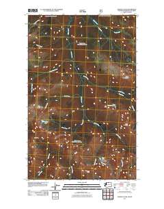
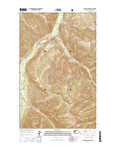
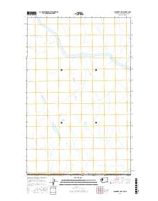
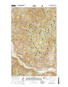
Layered GeoPDF 7.5 Minute Quadrangle Map. Layers of geospatial data include orthoimagery, roads, grids, geographic names, elevation contours, hydrography, and other selected map features.
Tags: 7.5 x 7.5 minute,
Ashnola Pass, WA-BC,
British Columbia,
Downloadable Data,
EarthCover, All tags...
GeoPDF,
Imagery and Base Maps,
Map,
Okanogan,
U.S. National Grid,
US,
US Topo,
US Topo Historical,
United States,
Washington,
contour,
geographic names,
hydrography,
imageryBaseMapsEarthCover,
orthoimage,
topographic,
transportation, Fewer tags
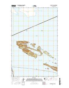
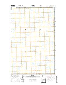
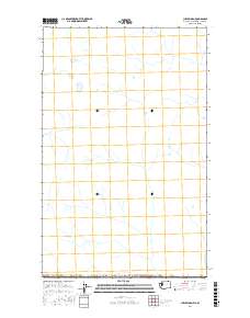
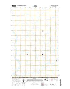
Layered geospatial PDF Map. Layers of geospatial data include orthoimagery, roads, grids, geographic names, elevation contours, hydrography, and other selected map features.
Tags: 7.5 x 7.5 minute,
British Columbia,
Downloadable Data,
EarthCover,
GeoPDF, All tags...
Imagery and Base Maps,
Map,
Public Land Survey System,
San Juan,
Stuart Island, WA-BC,
U.S. National Grid,
US,
US Topo,
US Topo Historical,
United States,
Washington,
boundary,
contour,
geographic names,
hydrography,
imageryBaseMapsEarthCover,
orthoimage,
structures,
topographic,
transportation,
woodland, Fewer tags
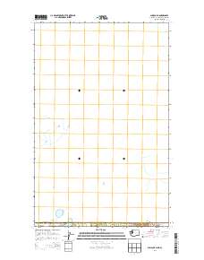
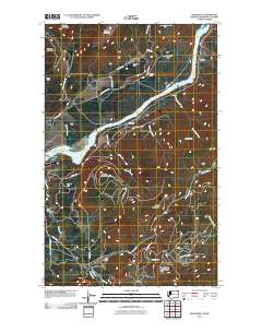
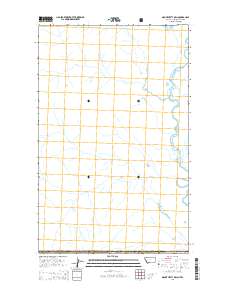
Layered GeoPDF 7.5 Minute Quadrangle Map. Layers of geospatial data include orthoimagery, roads, grids, geographic names, elevation contours, hydrography, and other selected map features.
Tags: 7.5 x 7.5 minute,
British Columbia,
Downloadable Data,
EarthCover,
GeoPDF, All tags...
Imagery and Base Maps,
Map,
Public Land Survey System,
Sumas OE N, WA-BC,
U.S. National Grid,
US,
US Topo,
US Topo Historical,
United States,
Washington,
Whatcom,
boundary,
contour,
geographic names,
hydrography,
imageryBaseMapsEarthCover,
orthoimage,
structures,
topographic,
transportation,
woodland, Fewer tags
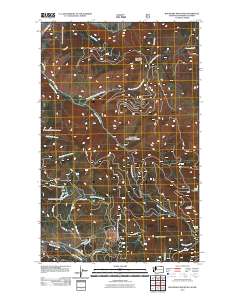
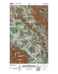
Layered geospatial PDF Map. Layers of geospatial data include orthoimagery, roads, grids, geographic names, elevation contours, hydrography, and other selected map features.
Tags: 7.5 x 7.5 minute,
British Columbia,
Downloadable Data,
EarthCover,
GeoPDF, All tags...
Imagery and Base Maps,
Map,
Okanogan,
Public Land Survey System,
Tatoosh Buttes, WA-BC,
U.S. National Grid,
US,
US Topo,
US Topo Historical,
United States,
Washington,
boundary,
contour,
geographic names,
hydrography,
imageryBaseMapsEarthCover,
orthoimage,
structures,
topographic,
transportation,
woodland, Fewer tags
Layered GeoPDF 7.5 Minute Quadrangle Map. Layers of geospatial data include orthoimagery, roads, grids, geographic names, elevation contours, hydrography, and other selected map features.
Tags: 7.5 x 7.5 minute,
British Columbia,
Downloadable Data,
EarthCover,
GeoPDF, All tags...
Hurley Peak OE N, WA-BC,
Imagery and Base Maps,
Map,
Okanogan,
Public Land Survey System,
U.S. National Grid,
US,
US Topo,
US Topo Historical,
United States,
Washington,
boundary,
contour,
geographic names,
hydrography,
imageryBaseMapsEarthCover,
orthoimage,
structures,
topographic,
transportation,
woodland, Fewer tags
Layered GeoPDF 7.5 Minute Quadrangle Map. Layers of geospatial data include orthoimagery, roads, grids, geographic names, elevation contours, hydrography, and other selected map features.
Tags: 7.5 x 7.5 minute,
Boundary, WA-BC,
British Columbia,
Downloadable Data,
EarthCover, All tags...
GeoPDF,
Imagery and Base Maps,
Map,
Stevens,
U.S. National Grid,
US,
US Topo,
US Topo Historical,
United States,
Washington,
contour,
geographic names,
hydrography,
imageryBaseMapsEarthCover,
orthoimage,
topographic,
transportation, Fewer tags
Layered GeoPDF 7.5 Minute Quadrangle Map. Layers of geospatial data include orthoimagery, roads, grids, geographic names, elevation contours, hydrography, and other selected map features.
Tags: 7.5 x 7.5 minute,
Boundary Mountain, WA-BC,
British Columbia,
Downloadable Data,
EarthCover, All tags...
Ferry,
GeoPDF,
Imagery and Base Maps,
Map,
U.S. National Grid,
US,
US Topo,
US Topo Historical,
United States,
Washington,
contour,
geographic names,
hydrography,
imageryBaseMapsEarthCover,
orthoimage,
topographic,
transportation, Fewer tags
Layered geospatial PDF Map. Layers of geospatial data include orthoimagery, roads, grids, geographic names, elevation contours, hydrography, and other selected map features.
Tags: 7.5 x 7.5 minute,
Boundary OE N, WA-BC,
British Columbia,
Downloadable Data,
EarthCover, All tags...
GeoPDF,
Imagery and Base Maps,
Map,
Public Land Survey System,
Stevens,
U.S. National Grid,
US,
US Topo,
US Topo Historical,
United States,
Washington,
boundary,
contour,
geographic names,
hydrography,
imageryBaseMapsEarthCover,
orthoimage,
structures,
topographic,
transportation,
woodland, Fewer tags
Layered geospatial PDF Map. Layers of geospatial data include orthoimagery, roads, grids, geographic names, elevation contours, hydrography, and other selected map features.
Tags: 7.5 x 7.5 minute,
British Columbia,
Curlew OE N, WA-BC,
Downloadable Data,
EarthCover, All tags...
Ferry,
GeoPDF,
Imagery and Base Maps,
Map,
Public Land Survey System,
U.S. National Grid,
US,
US Topo,
US Topo Historical,
United States,
Washington,
boundary,
contour,
geographic names,
hydrography,
imageryBaseMapsEarthCover,
orthoimage,
structures,
topographic,
transportation,
woodland, Fewer tags
Layered GeoPDF 7.5 Minute Quadrangle Map. Layers of geospatial data include orthoimagery, roads, grids, geographic names, elevation contours, hydrography, and other selected map features.
Tags: 7.5 x 7.5 minute,
British Columbia,
Downloadable Data,
EarthCover,
Flathead, All tags...
GeoPDF,
Imagery and Base Maps,
Map,
Montana,
Mount Hefty OE N, MT-BC,
Public Land Survey System,
U.S. National Grid,
US,
US Topo,
US Topo Historical,
United States,
boundary,
contour,
geographic names,
hydrography,
imageryBaseMapsEarthCover,
orthoimage,
structures,
topographic,
transportation,
woodland, Fewer tags
Layered GeoPDF 7.5 Minute Quadrangle Map. Layers of geospatial data include orthoimagery, roads, grids, geographic names, elevation contours, hydrography, and other selected map features.
Tags: 7.5 x 7.5 minute,
Boundary,
British Columbia,
Copeland, ID-BC,
Downloadable Data, All tags...
EarthCover,
GeoPDF,
Idaho,
Imagery and Base Maps,
Map,
U.S. National Grid,
US,
US Topo,
US Topo Historical,
United States,
contour,
geographic names,
hydrography,
imageryBaseMapsEarthCover,
orthoimage,
topographic,
transportation, Fewer tags
Layered geospatial PDF Map. Layers of geospatial data include orthoimagery, roads, grids, geographic names, elevation contours, hydrography, and other selected map features.
Tags: 7.5 x 7.5 minute,
British Columbia,
Downloadable Data,
EarthCover,
Ferry, All tags...
GeoPDF,
Imagery and Base Maps,
Map,
Public Land Survey System,
U.S. National Grid,
US,
US Topo,
US Topo Historical,
United States,
Vulcan Mountain, WA-BC,
Washington,
boundary,
contour,
geographic names,
hydrography,
imageryBaseMapsEarthCover,
orthoimage,
structures,
topographic,
transportation,
woodland, Fewer tags
Layered geospatial PDF Map. Layers of geospatial data include orthoimagery, roads, grids, geographic names, elevation contours, hydrography, and other selected map features.
Tags: 7.5 x 7.5 minute,
British Columbia,
Downloadable Data,
EarthCover,
GeoPDF, All tags...
Imagery and Base Maps,
Leadpoint OE N, WA-BC,
Map,
Public Land Survey System,
Stevens,
U.S. National Grid,
US,
US Topo,
US Topo Historical,
United States,
Washington,
boundary,
contour,
geographic names,
hydrography,
imageryBaseMapsEarthCover,
orthoimage,
structures,
topographic,
transportation,
woodland, Fewer tags
|
|

