Filters: Tags: Aleutian Arc (X) > partyWithName: State of Alaska, Department of Natural Resources, Division of Geological & Geophysical Surveys (X)
5 results (8ms)|
Filters
Date Range
Contacts
Tag Types Tag Schemes |
Between 1979 and 1982, the Alaska Division of Geological & Geophysical Surveys (DGGS) and the Geophysical Institute, University of Alaska Fairbanks, undertook an assessment of the states geothermal resources under a program jointly sponsored by the U.S. Department of Energy and the State of Alaska. During this period, reconnaissance investigations of more than 100 thermal spring sites and fumarole fields located in Alaska were conducted by DGGS.
This dataset consists of the vector digital GIS files that were used to create sheet 1 of the "Preliminary volcano-hazard assessment for Okmok Volcano, Umnak Island, Alaska" (DGGS RI 2004-3). The map area is centered around Okmok Volcano, on eastern Umnak Island. The data includes volcano-hazard zones for ballistics, ash accumulation, pyroclastic flows, floods and lahars, and debris avalanches. Also included in the dataset are roads, trails, seismic station locations, continuous GPS station locations, creeks, and the location of the Fort Glenn airstrip.
This data lists the historically active volcanoes of Alaska, their location in latitude/longitude decimal degrees, and the year of the last major eruptive event. The 52 volcanoes listed meet at least one of the following criteria since 1700 CE: (1) documented, unquestioned eruption, or (2) a strongly suspected eruption, often an eruption documented in the historical account with very little information (current geologic knowledge must not contradict the eruption account), or (3) persistent (usually on the order of decades, but certainly longer than several months) fumaroles, with temperatures (where measured) within ~10°C of the boiling point, or (4) significant, measured, volcanic-related, non-eruptive deformation,...

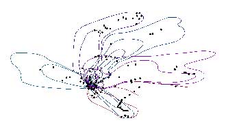
The 2009 eruption of Redoubt Volcano included 19 major tephra-producing explosions. Mass per unit area (MPUA) ash fall sampling of the resulting deposits allowed us to create isomass contours of the ash fall. This dataset contains the vector digital shapefiles of the ash fall contours for the explosive events. In addition, a point digital shapefile is included that describes more than 400 ash fall samples that were collected. For a detailed account of the 2009 eruption of Redoubt Volcano, see Schaefer, J.R., ed., 2012, The 2009 eruption of Redoubt Volcano, Alaska, with contributions by Bull, Katharine, Cameron, Cheryl, Coombs, Michelle, Diefenbach, Angie, Lopez, Taryn, McNutt, Steve, Neal, Christina, Payne, Allison,...
This shaded relief image of Okmok Volcano serves as the basemap for sheet 1 of the "Preliminary volcano-hazard assessment for Okmok Volcano, Umnak Island, Alaska" (DGGS RI 2004-3). The map area is centered around Okmok Volcano, on eastern Umnak Island. SRTM and AirSAR DEM datasets were combined in ArcGIS to produce a georeferenced shaded relief TIFF image of Okmok Volcano.
|

|